Paris Mountain State Park: New Year’s Day Hike - 1/1/23 – 8.5 Miles
“First Day Hikes” at state parks on New Year’s Day are a tradition that has taken hold across the U.S. January 1 can be a day of resolutions, reflections, regrets and/or resets, and for me it’s another good reason to get out in nature. If you don’t know where to go or who to go with, check the website of any state park for First Day guided hikes. Grab your coat and a water bottle and go on a hike (and maybe jump in the lake too)!
Hiking on New Year’s Day isn’t confined to groups, guides and state parks, of course. The important thing is getting outside. This year Jim and I crossed the border into South Carolina to visit new-to-us Paris Mountain State Park. [Note: if you’re going, remember to bring your wallet, especially if you’re used to NC’s free state parks. SC’s parks charge admission fees.]
Paris Mountain SP was developed by the Civilian Conservation Corps (CCC) in the 1930’s as part of the New Deal Program by President Franklin D. Roosevelt and several buildings are still in use. There are several lakes and a campsite area to enjoy. Read more here about the park’s history, education programs, and tours and look here for a map of trails in the park.
A big ol’ shout-out to SC’s amazingly informative and user-friendly state parks websites. NC should take lessons! Or maybe that’s what an admission fee helps pay for…
On my GAIA GPS app, I worked out a loop hike with options for shortening or lengthening the route as time permitted. We skipped the Visitor Center (note to check it out on our next visit) and went straight to the Sulphur Springs Trail parking area.
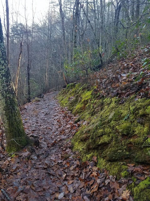
The morning was damp with a wispy fog drifting through the dense forest. The white rectangle blaze looked familiar (but the Appalachian Trail doesn’t pass through SC). Sulphur Springs Trail crosses Mountain Creek several times on footbridges.
Past the lake, we started climbing, crossing Mountain Creek a few more times. No more bridges. What is the criteria for a bridge versus no bridge? Seems like the further away from the parking lot, the more likely a hiker is to encounter unbridged crossings.
At about 1.75 miles, we turned left from Sulphur Springs Trail onto Firetower Trail and hiked about .3 miles out to the site of a former fire tower (of course). We saw remnants of a residence, a partial chimney and a bit of stone foundation.
Beyond this were ground level stone slabs, all that remains of the tower. This is the high point of the park, but no views other than the backyards of homes very close through the trees.
An unmaintained but obvious trail closely paralleled Firetower Trail, and we followed it to where it intersected Kanuga Trail.
We followed Kanuga Trail to North Lake Trail. Do we have enough time to walk around the outer edge of the lake? Glad we did! We saw primitive campsites scattered amongst the trees. The light and leaves were lovely.
one of my favorite flower names!
Another decision point at the intersection of Brissy Ridge Trail: right or left? It’s a loop trail, so either way is about the same distance, so we opted left to get onto the hiker-only portion. This section of Brissy Ridge was 1.5 miles, a steep downhill and then a bigger climb back up.
For the whole route, the only flat parts were on Firetower Trail and around North Lake – otherwise, ups and downs – not a “walk in the park.”
At the Brissy Ridge parking area, it took a couple of minutes to determine where to pick up the Sulphur Springs Trail to complete our big loop. Once we got oriented, Sulphur Springs Trail crossed the park road and stayed within sight/sound of it on its steep downhill trend back to our car.
For those out there like me who are better with pictures than with words, a screenshot of my GAIA track may be helpful. We started in the bottom right-hand corner and hiked clockwise, 8.5 miles and 1,338 miles of ascent. Grateful for another beautiful “first day” in the woods!
“In the new year, never forget to thank
your past years because they enabled you
to reach today!”
~Mehmet Murat Ildan


No comments:
Post a Comment