South Mountains State Park: Wintertime Ramble – 1/16/21 – 12.8 miles

Hiking buddy Carol had been trying for years to entice me to do some winter backpacking in the South Carolina Low Country, but I didn’t have much interest. However, when we booked our plans for a Tahoe Rim Trail thru-hike for the summer of 2021, the notion of training in January made sense. A winter thru-hike of the Swamp Fox Passage section of the Palmetto Trail (South Carolina’s state trail) features lots of pros and very few cons.
Pro: Cold enough to avoid snakes and alligators; no snow; located roughly halfway between our homes; easy, flat hiking; better chance of low water/no flooded areas; gear testing; COVID friendly, backcountry camping; easy bailout points; Carol was into doing all the planning
Cons: Cold rain anywhere is yucky
What does this have to do with South Mountains State Park in North Carolina?
Well, I could use a little training for the training hike. Also, I was just itching to get out for a dayhike meeting my parameters of 12-14 miles, drive time 2 hours or less, not in Pisgah NF because accessibility of forest roads can change with little warning in winter. South Mountains SP is a 90-minute drive from Charlotte, and it’s the largest NC state park with 40 miles of trail. If I could get there early enough I’d beat the Saturday crowds.
I found an old paper map of the park marked with trails I’ve done. There are many combinations of intersecting loops and the idea of new miles was motivating. I roughed out a 15+ mile route with decision points for shortening it if needed.

The visitor center was closed due to COVID but the bathrooms are accessible via outside doors. There’s a kiosk and message board with info for campers, and I picked up an excellent new paper trail map (ok, maybe two, one to draw on and one to keep nice).
The thermometer read 31 degrees, a cold start and precipitation expected in the afternoon, so I must keep an eye on the sky. Clothing was a primary focus of the day, dialing in the right combination of layers to be prepared for four days on the Swamp Fox Passage. I carried a pack full of stuff to see what I would and wouldn’t use: 2 pairs of gloves, puffy jacket, zip-off pants, short sleeved shirt, black lightweight long sleeved shirt, black lightweight fleece, new Lightheart Gear rain jacket, rain pants, and of course my fleece Liberty hat.
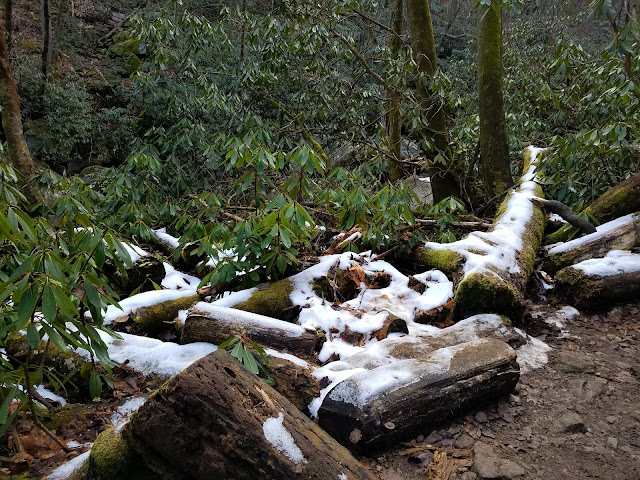
I started my hike on the High Shoals Falls Loop from the Jacob Fork parking area at 9:15 a.m. Traces of snow surprised me – will there be more at higher elevation?
Seems that every hike at South Mountains must include High Shoal Falls. Why would you come this close and not check it out?
Extensive wooden steps and walkways crossing Jacob Fork
These cascades are a prelude in anticipation of the main attraction
High Shoals Falls
Near the top of the falls
Crossing Jacob Fork again above High Shoals Falls
Like most state parks, South Mountains packs a lot of trails into its acreage and the trail blazes can easily confuse me (
read here about the last time I showed my lack of navigation skills at SMSP.) Past the bridge, High Shoals Falls Loop and Upper Falls Trail run concurrently for a while, and at the intersection I turned left to stay on Upper Falls Trail.
At the intersection with Headquarters (H.Q.) Trail, I met a massive group of teenagers (40+) sprawled alongside the trail taking a rest break. They all wore black tee shirts that said “U.S. Marines.” Well, you don’t just walk past a group that large without saying hello and asking, “What’s up?” The four leaders (college age?) explained that they were ROTC students from a high school in Hickory, taking a long dayhike. We agreed that Saturdays in January were made for long dayhikes.
I continued on Upper Falls Trail up to the Shinny Creek Trail turnoff (western end) and then backtracked to the H.Q. junction. Along the way I met up with the ROTC group now on the move. I took advantage of a patch of sun at the junction to eat part of my lunch.


Next, I hiked HQ Trail over to the Shinny Creek Trail intersection (eastern end), the location of the Shinny Creek backcountry campsite. I sat down at a picnic table for a break, but it was too cold in the shade to sit for long.
Winter hiking reveals the true power of the sun. My layering test showed a few surprises: my legs were not cold (I had forgotten to wear leggings under my hiking pants and I didn’t need the rain pants for warmth). My black fleece jacket was a bad choice, too cold without it, too hot with it. My heavy Smartwool quarter-zip shirt would have been better. I wore both pairs of gloves at different times. The rain jacket was a good wind barrier, but probably not heavy enough for rain plus low temperatures.
Dear reader, these details may be dull, but practicing preparedness is THE KEY to a good cold weather experience. Just sayin’.
I headed up Shinny Creek Trail, and at the Shinny Creek crossing (or is it Kathy Creek?) I was surprised to meet the ROTC crew coming down. Next I turned right to ascend Possum Trail, steep, narrow, rough, and recovering from the Chestnut Knob fire in 2016 that burned 6,400 acres (cause undertermined).


After fighting my way up Possum Trail, I needed a breather and gentler terrain. I turned right onto Horseridge Trail, and it was less demanding, but I couldn’t ignore the piles of sawed up trees lining both sides of the trail - maybe blowdowns caused by a high wind event? It was distressing to see so much destruction, so much debris. Still traces of snow at the high elevations even with the strong sun.
South Mountains has had a tough time with Mother Nature and it's not a pretty park in the dead of winter. [Please visit in the springtime too!] Yet its staff continues to excel in stewardship, forest management, and programming. It was named 2017 State Park of the Year.
At the next junction I met three folks on horseback, looking more relaxed than I felt. We exchanged hellos and comments on the weather (notice how warmly they’re dressed) and I turned right onto Sawtooth Trail.

Sawtooth apparently refers to the ups-and-downs on this strenuous high ridge trail. About a mile in, a horse hitching post and a picnic table appeared, inviting travelers to stop and take in the view. The horse people came along and Gary (who looked like Santa Claus) shared with me a little history of equestrian friends who, back in the day, had group rides and weekend events. Eventually they disbanded and used group funds to install picnic tables and hitching posts in several locations in the park. Hearing the story from the folks who did the work was a real treat.


At the intersection of Chestnut Knob Trail and Sawtooth Trail, I had a decision to make. Time felt like it was getting short. The air had changed, and although there were glimpses of blue sky, the clouds were thickening and spitting a little bit of snow (still cold!) I opted to cut a few miles off my route and follow Chestnut Knob Trail back to High Shoals Falls Loop to the parking area.
Along the way, I took the side trail to the Knob Overlook – just like High Shoals Falls, when you’re this close, why would you not?

The last bit of trail down to the Overlook is rutted and steep. I was surprised to see only one person there taking in the view, an Asian man who looked a little bit younger than me. He was very enthusiastic about hiking, and we chatted for more than a few minutes. He said that hiking was his favorite thing to do and he goes every weekend, sometimes with friends or family, but mostly alone because, like me, he doesn’t want to wait for others to be available and “I like to be free.”
I hung around a few minutes more after he departed. I realized that, like many casual hiker encounters, we didn’t feel the need to introduce ourselves but immediately jumped into the hiker vernacular of naming trails we had done or would like to do, and so on. But maybe I should have introduced myself and offered to meet up as a hiking partner sometime…
Recently I mentioned to my daughter that I need blog business cards for when I meet folks out in the woods. This was one of those times!

Remnants of fire on Chestnut Knob Trail
Chestnut Knob Trail has been extensively rehabbed since the 2016 fire, easy tread, not much deadfall (well, maybe a little), winter views into the coves, a pleasant way to end my trek. I passed plenty of people climbing up to the Knob, and I was happy to give the park over to them at 3:00 p.m. and head home.
A full day on the trails, not much wildlife, but a wide variety of humans! One thing that the pandemic has revealed is that being outside is always better. I’m grateful for North Carolina’s public lands.
I feel like I’ve now mastered GAIA enough to get stats, to stay on track, make decisions along the way, and feel secure in what I’m doing. My layering system is more refined and I’ve got more miles on my hiking legs. Ready for what’s next!
“You can walk the same trail twice but
you’ll never take the same hike.”
~Anonymous



.jpg)