Showing posts with label Neusiok Trail. Show all posts

Monday, July 18, 2011

Outer Banks At Last

MST - Day 57 – 4-20-11 – Neusiok Trail from Blackjack Lodge Shelter to Oyster Point – 2.4 miles

After a peaceful, slightly warm night in our little tents, everyone was up early.  We had agreed on a start time – I don’t know, 7:30?  My morning routine is minimal since I do nearly all of my preparation before going to sleep, getting out clothes, packing up as much as I can, so I can linger in my tent as long as possible.  This sometimes makes my hiking friends worry that I am oversleeping (Danny knows better, though).  I may be the last one out of the tent, but I am seldom the last one ready to leave camp.  This morning we hit the trail before 7:00 a.m.
Even though we didn’t have far to hike, I was feeling pretty worn out from yesterday’s marathon and the couple of miles felt like a long distance.  My legs and feet were weary and I was glad to see the cars.
Dawn’s early light
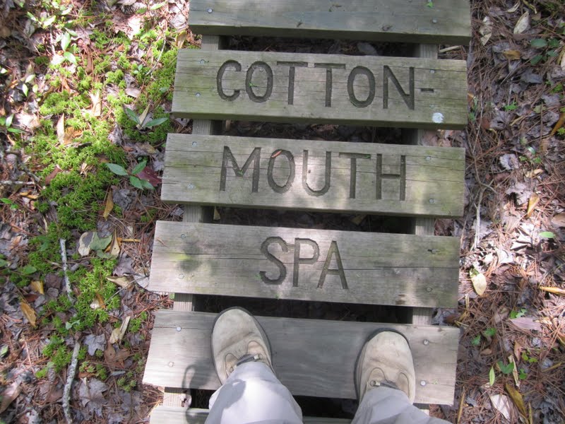
“Turnpike” type trail, built up in the center for water runoff in swampy areas
Danny and I said our goodbyes to Terry and John and we pointed our cars toward the Cedar Point Ferry.  We had reservations for 3:30 p.m. but since we finished the Neusiok so early we wanted to make the 12:30 p.m. ferry.  We drove the route that Jim and I had previously biked and that Danny will walk after our Outer Banks stint is completed.  We stopped for refreshments at Davis Shore Provisions in Davis and the owner there remembered me from last month.

On the drive to the ferry
We also took a detour following signs to Cedar Island National Wildlife Refuge and met its sole employee, Kevin K, a fantastic ambassador for the refuge.  His memory is long, as are his answers to questions, and we were reluctant to interrupt the flow of his narrative.  Eventually we had to thank him and continue on to the ferry.  Someone really needs to interview Kevin K. and capture his knowledge before it’s too late.

We made the earlier ferry and relaxed during the 2+ hours cruise over to the town of Ocracoke.  This fellow’s pickup bed was filled with an impressive collection of shark’s teeth.


Outer Banks, here we come!
First view of Ocracoke
Ocracoke is a very cute town but not fun to drive in.  Everyone is on bikes (no helmets) or walking in the streets (sidewalks are very narrow).  Everything is walking distance so a car is not really necessary during your stay.  Cute shops and restaurants abound and everything is very casual.  We enjoyed the first of many seafood dinners.  

Interestingly, the Ocracoke Lighthouse is on a back street, not on the shore.  It is closed to the public but still worth a photo for the scrapbook.
Danny’s research led us to a British cemetery on another back street, the resting place of four WW II British naval servicemen who died when their patrolling vessel was attacked by a German submarine in waters off the Outer Banks.  Every year a memorial service is held to honor them.


Our home for the night was at Edwards of Ocracoke, very quiet on a side street, the type of place where guests hang out on Adirondack chairs in the courtyard and grill out on little Hibachis.  Danny arranged with the owner to set up our shuttle for tomorrow’s hike, saving us some valuable time as we learn what hiking on the Outer Banks is all about.  Tomorrow:  SAND!
For whatever we lose (like a you or a me),
It's always our self we find in the sea.
~e.e. cummings

Wednesday, July 13, 2011

Neusiok Trail

MST - Day 56 – 4-19-11 – Neusiok Trail from Pine Bluff to Blackjack Lodge Shelter – 19.3 Miles
It always starts innocently, doesn’t it?  A 22-mile trail, an overnight backpack trip stopping at a shelter halfway, eastern North Carolina so no climbing – a simple walk in the woods, no?  Well…no.  (Don’t panic or skip to the end, nothing tragic happens, just an observation that every hike turns out to be different than expected.)
Danny and I met Terry and John at Oyster Point to leave cars and shuttled to Pine Cliff for our walk on the Neusiok Trail.  I was pretty excited to be hiking with these fellows whose reputations preceded them as avid trail builders, maintainers and all-around outdoor enthusiasts who could educate us about all things Neusiok.  John is 81 and Terry is 66 and both are military veterans (Korea and Vietnam).  I may have been the young’un of the group but I was not the fittest, believe me. 


We set out on the trail at 8:00 a.m., outfitted in long pants, long sleeves, hats and a layer of bug spray as a line of defense against the insects famous in the area.  It was humid and uncomfortable and I was coated in sweat in about five minutes but kept the outfit on all day. 
The sun was shining and almost immediately we were walking along the sandy beach of the Neuse River.  What a great beginning!
As the trail skirted the river’s edge we saw decaying cypress stumps.  An osprey flew overhead, trying to divert us from her nest and wanting us to leave. 
Cypress knees look like fantasy forest creatures, don’t you think?
Terry and John were walking Google guides, answering questions and volunteering information about absolutely everything along the trail, pointing out reroutes, bridges they’ve constructed (and reconstructed after flooding), and anchoring methods to keep bridges from floating away.  They also took mental notes of tasks for their never-ending to-do list. 
Old barrels and paraphernalia from old moonshine stills are plentiful
Terry explains Spanish moss
Terry at one of the many boardwalks
The first of three shelters along the Neusiok Trail is called Copperhead Landing – but we didn’t see any of its namesakes today.  Here we stopped for a rest and a quick snack.

Each of the three shelters has a water source but the pump has to be primed.  It is considerate to leave water in these jugs for the next person to get it started.  There is no other reliable water along the trail, so careful planning is essential.
One of many enormous cypress trees along the trail
Getting a hand back up onto the boardwalk – the number and lengths of the boardwalks is incredible and a testament to how much the local maintainers love and care for this trail.  They walk it in all seasons, noting swampy problem areas, and in dry weather they help the US Forest Service install these incredible boardwalks.  I had been forewarned that wet feet were unavoidable on the Neusiok, but I never even stepped in a puddle. 

We also had been cautioned about snakes on the trail, but this is the only fellow we spotted today, looking like a bright green shoelace.
Trail builder humor
Cinnamon ferns
We spotted a letterbox semi-hidden alongside the trail, a waterproof plastic box hidden by someone that can be found by clues listed on a website (although I did not find this particular one listed, so it may have been for a more local purpose).  The more high tech version of letterboxing is geocaching using a GPS.  Letterboxes sometimes contain trinkets and “finders” can take a trinket and deposit one for the next person.  Letterboxes may also contain a log book to record your name and date that you found it.  Find out more here (warning:  fun may ensue!).

The day heated up but we were making good progress – so good, in fact, that we reached our overnight stop, Dogwood Camp Shelter, at about 1:30 p.m.  Decision time!  The next (and only) shelter was 9 more miles.  But if we stopped at Dogwood, what would we do the rest of the day except slap mosquitoes?  And who’s tired yet?  (Nobody).  The real debate was what our options were between the two shelters, if at some point we decided Blackjack Lodge Shelter was not doable.  Since there were no water sources in between, we all filled up containers at Dogwood and then pressed on. 
Foot check at Dogwood Camp – I felt a couple of hot spots so the duct tape came in handy

And that’s the point where mileages became very important… and we began to notice that mileages posted were a little fluid.  This two-mile gravel road stretched on into oblivion and seemed to take a hundred years to walk. 

When I saw this sign I had a moment of despair – I thought we were much closer than this.  My pack was starting to rub and my hip bones were sore.  John, at 81, kept moving like an 18-year-old as I shuffled along behind.
  
Hallelujah - Blackjack Lodge Shelter!  I floated the idea of walking the remaining 3 miles to our cars and going to sleep in a comfy bed back at Terry’s house, but no one was having any of my jazz about that.  I believe the comment was, “I carried all this stuff this far so I’m going to use it.”  So we set up camp, cooked and ate, and I soon crawled into my tent.  I was feeling every one of those 19 miles and was glad no one called my bluff.

Read Danny's entry about the Neusiok Trail here 
I don't go into the woods to "rough it"; I go into the woods to "smooth it". I get it rough enough in the city. ~Horace Kephart, 'Camping and Woodcraft'; 1917