Friday, June 28, 2019

Boone Fork Trail & Hebron Falls


Boone Fork Trail & Hebron Falls – 10/13/18 – 6.2 Miles

 
North Carolina has had a difficult four weeks, two hurricanes devastating the eastern part of the state and wringing themselves out over the mountainous western counties. Hurricane Florence pounded for September 12-15, and Hurricane Michael came up via Florida to punch again on October 10-12. Michael was the fourth strongest storm ever to strike the U.S.

We’re not storm chasers, but Jim and I were interested to see how the water flow was affected in the NC mountains. Hebron Falls was on my waterfalls list. It’s off the Blue Ridge Parkway at Julian Price Park near Blowing Rock. We made plans for a nice full day in the High Country, a quick out-and-back hike to the falls and then a hike up Snake Mountain (northeast of Boone).

We left Charlotte at 7:30 a.m., fixated on the increasingly threatening black clouds as we drove toward the mountains. We were going to the falls first to beat any crowds. I suspected that Snake Mountain might be a bust if the clouds stayed. As we gained altitude up to the BRP, the thermometer dropped steadily.

At the Price Park picnic area the temperature was 42 degrees, windy and spitting rain. Do we have enough clothing layers to do the hike? We both long pants, short sleeves underneath long sleeved shirts and rain jackets.  Jim wore a thin fleece jacket and a ball cap, but nothing for his ears, no gloves. In my backpack I always carry gloves and my Liberty hat, but otherwise I had only a nylon jacket that isn’t intended for hiking.  We donned everything, started walking and warmed up nicely.


Hebron Falls is on the Boone Fork Trail, a five-mile loop of big water thrills and chills. It’s a signature hike along the Blue Ridge Parkway, the right amount of challenge, interest and distance for experienced hikers to take novice friends along.  I’ve hiked the part of the loop that runs concurrently with the Mountains-To-Sea Trail, and together Jim and I hiked the whole loop many years ago going clockwise, but I haven’t taken the detour to Hebron Falls. Today we tackled the loop counterclockwise.


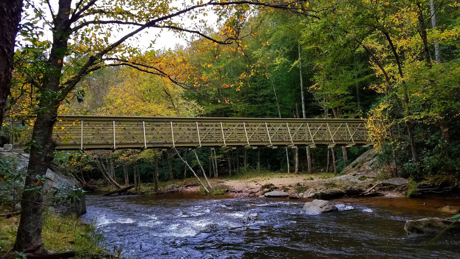
After the first mile the trail intersects with my old friend the MST.  When Danny and I appeared at the river’s edge here in 2010 we were challenged by a wide expanse of flowing water.  I successfully rock hopped across while Danny waded through. Today there’s a beautiful bridge that I symbolically strolled across and back.
 

The trail stays close by the river to the right, enticing hikers to go to the water’s edge for a closer look at white water tumbling over boulders. Having never seen Hebron Falls before, at several places we wondered, is this it? Cascade after cascade after cascade.  

Never fear, friends, you will not miss it

Hebron Falls is at a short switchback side trail down to a giant’s bowling alley of boulders and water tumbling and crashing everywhere.  On this cold and inhospitable-looking Saturday we saw just four like-minded waterfall chasers; on many Saturdays it’s crawling with people, Appalachian State students and coolers of beer. (My friends and I did the same on the New River when we were Virginia Tech students!)

We followed the rough scramble up the righthand side to get to the main falls, but every crevice had its own impressive mesmerizing flow.

 
Checking the time, we decided we were already in a great place and should postpone Snake Mountain ‘til another day.  We continued the Boone Fork Loop counterclockwise, still sticking alongside Boone Fork River.


 At about the 2.5 mile mark, the trail leaves the larger stream and curves left to follow Bee Tree Creek upstream. The water flow narrows but is just as robust – and no more bridges. The trail crossed Bee Tree at least 8 times (at one point 3 times within sight of each other), crossings that are probably inconsequential rock hops in the summer but today required contemplation and a plan before stepping off. All were precarious rock hops and log balancing acts.  A couple of times Jim had to help by pulling me across wide expanses. No mishaps, so I can say it was a whole lot of fun.

Let Jim go first

Finally turning away from the water, the trail left the woods for a nice meadow stroll and the final mile cutting through Price Park Campground to return to the picnic parking area. The weather brightened, and the further we went around the loop, the more people we encountered. Folks were setting up tent compounds, lighting campfires, kids riding bikes. We were a tiny bit envious and wondered if they were prepared for the coming cold night. (Two years ago, in October 2016, we camped in this campground with friends right after Hurricane Matthew!)

Including side trips to viewpoints, the total hike was 6.2 miles. With time for a little something spontaneous now, we drove into Boone to find Howard’s Knob, which I’d heard about but not seen. Howard’s Knob is a Watauga County Park featuring a prominent point overlooking the town and Appalachian State University.  We drove to the top (there might be a hiking trail but we didn’t have info for it) and enjoyed the clear long distance views all the way out to the hallmarks of Linville Gorge.  

Table Rock and Hawksbill on the far right (western) horizon. Spotting these two icons never fails to thrill me!

A midafternoon meal at Wild Craft Eatery in downtown Boone, picking up goodies at Insomnia Cookies for the drive home – cheers to a chilly adventure exploring with my better half!


“Bad weather always looks worse through a window.”  ~Author Unknown


Sunday, June 16, 2019

Carolina Thread Trail: South Fork Trail


Carolina Thread Trail: South Fork Trail – 9/24/18 – 4 Miles


Has this ever happened to you: itching for a walk in some new woods but unwilling to drive 4+ hours roundtrip from Charlotte, NC to the mountains on a Monday? Me too. Solution: the Carolina Thread Trail.

I’ve marked trails of interest on the CTT website but have been holding out until colder weather when mountain trails are inaccessible or dangerous to hike alone. But that itch wouldn’t let me wait and I pored over the list to see what would suit my time frame. South Fork Trail caught my interest, a short drive away, a two-mile one-way walk along the South Fork River connecting McAdenville and Lowell. [Note: not to be confused with South Fork Rail Trail in Lincolnton, NC.]

Parking and trailhead access are right off Exit 23 of I-85 in North Carolina, adjacent to the R.Y. McAden River Access.  There are great signs telling the history of the area and practical info like the street address. The entire trail has distance markers at .5, 1.0 and 1.5 miles and section designations for 911 location. At 2 miles, the trail ends at a residential neighborhood cul-de-sac, so no public parking, but there is an access path for the locals.

Only me at the trailhead on a Monday morning, so safety first. I had left my hike plan with Jim, but I also texted him photos of the signage along with my start time and estimated end time.

 
Bring your mountain bike and leave your road bike at home for this natural surface trail. It is wide as greenways typically are, with plenty of room for cyclists and walkers/runners to pass each other. The trail runs alongside the South Fork of the Catawba River on land owned by Pharr Yarns Preserve, a 94.8-acre preserve protected by Catawba Lands Conservancy (a partner with CTT).

I was on the lookout for snakes (none). On most hikes I just tolerate spiderwebs because I use trekking poles, but for the flat walk today I was empty handed. After running into a H-U-G-E web (do they seem bigger near a river?) I carried a branch in front of me to ward off the big creepy-crawlies, until I got tired of the vigilance and surrendered to the silky spiderweb facials.

The trail immediately passes underneath I-85, giant pylons painted with Carolina Thread Trail (CTT) and Catawba Lands Conservancy (CLC) logos. The water was high and muddy from recent rains and the far-reaching remnants of Hurricane Florence.


My walk began with noise from the highway and planes at nearby Charlotte-Douglas airport, but quickly all that faded away to sounds of crickets, cicadas, birds and flowing water. What I expected to be a pleasant but simple walk turned into an extraordinary experience, just by looking closely at what was right in front of me.  I took over 100 photos today!


Water was nearly always in sight through a screen of trees. Whenever I saw a side trail, I followed it to the river’s edge. At one short access I saw what appeared to be a very old “trail tree” with a 90-degree elbow.

 
At about one mile is Cable Point, a viewpoint of the river dedicated to a former Catawba Lands Conservancy Executive Director, Dave Cable, honoring his years of service. Foundation remains of buildings and stone pillars of a bridge that once crossed the river are reminders of Gaston County history.

From the website: This is a historic trail that was originally used by the Native Americans and then utilized by settlers for textile mills. There were two mills in the woods along the trail. One was the Ferguson Mill and the other one was nicknamed Pinhook. Opened in August 1852, the Pinhook Mill was the second mill to operate along the South Fork River. According to Gaston County historian Robert Ragan, the mill received its name because mill workers would use bent textile pins to fish for lunch outside the building’s windows. During the Civil War, a small detachment of Union soldiers was sent to burn down Pinhook Mill, which was producing cloth for the Confederacy. Upon hearing the soldiers coming, mill superintendent William Sahms ran out to meet the Union troop, only to find them led by his Pennsylvanian childhood neighbor. Sahms convinced the soldiers to spare the mill and the soldiers burnt the bridge instead. The stone pillars of the bridge are still in the river.”


The river was split in several places by small islands and rock outcroppings. In low water (not today) easy wading could access these nice little spots to feel like you are “in the river.” From the side paths that I saw, I’m sure I’m not the first person to think of this but…disclaimer: please use caution when wading in any water!

 
Shortly after the 1.5-mile mark is a very small beach where someone has placed a simple wooden bench to sit and contemplate the water and time and life’s questions - or to eat lunch - or both. This is a natural turnaround point.

My first thought: a chiminea?

I walked the remaining half-mile to the neighborhood access point, a little surprised I didn’t encounter any residents out enjoying this trail at the end of their street, or at least dog walking.

On the return hike, I was no longer concentrating on the water and turned my attention to plant life. I noticed several huge silvery leaves scattered on the ground, looked up to see where they came from: a lovely stand of Fraser magnolias. On the tall mature trees and even on the short saplings, they were largest Fraser magnolia leaves I’ve ever seen.


Very late fading summer flowers, some in-your-face and others easy to miss:

White wood aster

Horse nettle

Hearts a-burstin’

Wingstem

Does anybody know this one?

Orange jewelweed aka spotted touch-me-not

Goldenrod

 
Mushrooms, grapevines and walnuts, oh my!

 
Who would have thought there was so much beauty on a little strip of riverbank accessed underneath power lines and a highway overpass?  Who do you know who would enjoy this little walk in the woods? South Fork Trail is a four-season trail, easily accessible in any weather or temperature, and something new can be discovered every day of the year.

 
“Everything has beauty, but not everyone sees it.” ~Confucius