
Pisgah 400: Loose Ends Hike
Pressley Cove Trail/Bennett Gap Trail/Sycamore Cove Trail
2/22/20 – 9 Miles

My hiking buddy Carol and I have scored permits to hike half of the John Muir Trail in August 2020 and so far I have done very little to physically prepare – time to get after it!
Pisgah National Forest Ranger District in Western NC is just a couple of hours’ drive from Charlotte. The forest roads there can deliver you deep into the backwoods playground of waterfalls, shady trails, rock faces and vistas.
When all weather conditions say “Green Light!” for a great winter day hike in Pisgah or any national forest, first check the website for the status of the forest road access you want, and then talk to a real live ranger to confirm. Sometimes what you think it says is not what it says! And as good as websites are for seasonal information and for other closures, in my experience they are not always up-to-the-minute for re-openings. An unexpected closed gate can be a great disappointment. On the flip side, a ranger may tell you of an unexpected opening that can at least get you closer to where you want to be.
Do this homework ahead of time. Some ranger stations aren’t open on weekends and you can’t pop in to ask questions. And why would you drive all that way without knowing? Yeah, some people are fine with deciding on the fly, but best hiker practice is to leave your hike plan with someone back home in case of emergencies. You DO leave a hike plan, right? Just checking.
Perpetually working on the Pisgah 400 Challenge, I wanted to tie up several loose trail ends off of FR 477, which I verified was open up to the horse stables, right where I wanted to go – yay!
As I bumped along FR 477 to my first trailhead, I saw that nearly all its free roadside campsites were occupied. I’ve never stayed at one of these – will the neighbors be loud, up all night partying? Probably not, but I have endured late-night drinking songs more than twice. On the plus side, staying at one of these sites makes for an easy early start to the day. All sites are beside the creek with campfire rings. Occupants this morning were enjoying their morning campfire coffee.
My day was replete with human encounters, as I wasn’t far away from forest roads.

One car was ahead of me at the Pressley Cove trailhead. The temperature was 24 degrees with a very strong sun, and I layered up for the 1.1-mile steep out-and-back hike. My start time was 9:30 a.m. so I left my lunch in the car. Practicing with the GAIA app was my secondary goal for the day, with no pressure to get it right.


The trail climbs steadily up through the cove to intersect an old forest road that continues to Pressley Gap (I didn’t go that far). I wonder who Pressley was? GAIA recorded it is 1.8 miles up, not 1.1 miles as my paper map says - quite a difference. The hike back down was not knee-friendly.
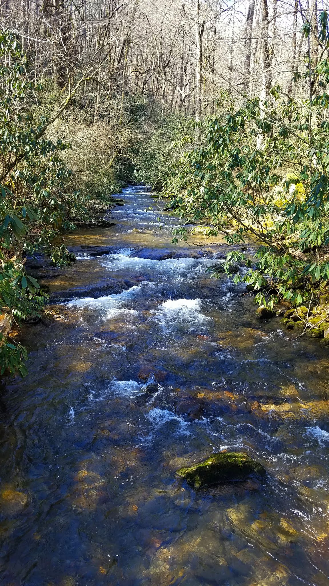
A small but lively creek bubbled noisily down the cove, fed by numerous tiny tributaries that I easily stepped over. I made one footlog crossing, then a bigger one raised high to cross near the top of an impressive slide flowing as far as I could see.
A small but lively creek bubbled noisily down the cove, fed by numerous tiny tributaries that I easily stepped over. I made one footlog crossing, then a bigger one raised high to cross near the top of an impressive slide flowing as far as I could see.


Avery Creek
Back at my car, I ditched my puffy jacket and was eating “first lunch” when two young women with two friendly dogs returned to the car parked beside me. They had hiked a loop up Pressley Cove, up to Black Mountain – six inches of snow at the top, they said - then back down Avery Creek Trail.
Next up for me was Bennett Gap Trail to the first intersection at Coontree Gap, connecting the dots with my birthday hike in 2016. At the trailhead I met two trail maintainers getting set up to do some work, and on the way up I met a third coming down with three energetic unleashed dogs. Leash laws apply in national forests so it was a little disappointing to see this (most people obey the laws) but I’ve learned to expect the unexpected.
Next up for me was Bennett Gap Trail to the first intersection at Coontree Gap, connecting the dots with my birthday hike in 2016. At the trailhead I met two trail maintainers getting set up to do some work, and on the way up I met a third coming down with three energetic unleashed dogs. Leash laws apply in national forests so it was a little disappointing to see this (most people obey the laws) but I’ve learned to expect the unexpected.


Hoarfrost heaving up chunks of earth

Beautiful open forest, low morning sun making shadows across a dusting of snow
At Coontree Gap there stood a puzzled man in running shorts and a tee shirt (nothing else, no backpack, no water). He asked if Coontree Gap Trail goes “back to the road”. I couldn’t resist asking if he had a map (no). Would he like to see mine? I pulled up the map on GAIA (hey, it worked!) and asked where he started (he was not sure.) Jeez. After a quick impatient look at my phone, he asked which way I had come and then headed off in that direction. All trails lead to “the road” eventually. The encounter felt a little White-Rabbit-Alice-In-Wonderland-esque. I hiked back down to my car but never saw the puzzled man again.
Making good time, so I decided to hike Sycamore Cove Trail (on my hike plan as an add-on), but neither the paper map nor the GAIA map was detailed enough to show clear intersections – let's see if it's more obvious in real life. Making my track with GAIA, it’s easy to just turn around and retrace steps.
Making good time, so I decided to hike Sycamore Cove Trail (on my hike plan as an add-on), but neither the paper map nor the GAIA map was detailed enough to show clear intersections – let's see if it's more obvious in real life. Making my track with GAIA, it’s easy to just turn around and retrace steps.
Move to Davidson River parking area, more wardrobe editing, second lunch, find Sycamore Cove Trail (across Hwy 276), and once again I was on a steep climb. Why did I think this was an easy “family friendly” hike? Maybe I was just a little tired? My right knee was beginning to ache. The little voice in the back of my mind was telling me that the John Muir trip will be a problem if this level of exertion is having this effect.


A mountain biker careened around a sharp turn downhill and I had to jump out of the way, yelling at him to give a warning. What was that about expecting the unexpected? Over his shoulder he hollered back - sorry! The person behind him was slower and said thank you when I stood aside.


I stayed on the Sycamore Cove loop back to Hwy 276, finished 9 miles in 4.5 hours, congratulated myself on tying up loose ends and learning more about GAIA navigation. As I gain more confidence, I’m really enjoying Pisgah NF Ranger District.
And I’ve got a lot of hikin’ to do before I get on that JMT.

“How we spend our days is, of course, how we spend our lives.” ~Annie Dillard