Linville Gorge Loop Hike – Conley Cove/Rock Jock/Linville
Gorge/Babel Tower Trails - 6/2/17 – 9 miles

In a moment of
weakness I agreed to join a group hiking trip on the AT in New Hampshire and
southern Maine later this summer, under the heading of “that sounds like fun
while I am sitting here on the couch.” Those miles are considered the most
difficult of the AT and I will suffer greatly if I don’t get off that
couch! Time for some training work. I’ve been curious to explore Linville Gorge
but have heard many cautions not to go alone unless very skilled at navigation
(I’m not). I’ve hiked along the eastern
edge of the gorge a few times and have followed the Mountains-To-Sea Trail from the western edge down to the river and up the eastern side, but always with other
hikers.
My trail buddy Cathy joined me on a loop from Danny
Bernstein’s Hiking North Carolina's Blue Ridge Mountains guidebook. I trust Danny’s maps and narratives, but she
would say that hikers should have other maps, a compass, and brains for any
hike. This is especially true in Linville Gorge, designated a wilderness area with
no blazes and minimal signage. It is
rough, rugged and…well, wild. I chose to
hike the loop in reverse because the last 2.7 miles is on the gravel road, and
I figured we would want to trend downhill rather than uphill for the boring
part. My logic had good and bad
consequences.
I christened my new-to-me Honda CR-V on Kistler Highway - not
as much clearance as my good ole Pilot, but it’s got to do the job or
else. (It did.) Don’t tell Jim how eroded the “highway” was
in some places.
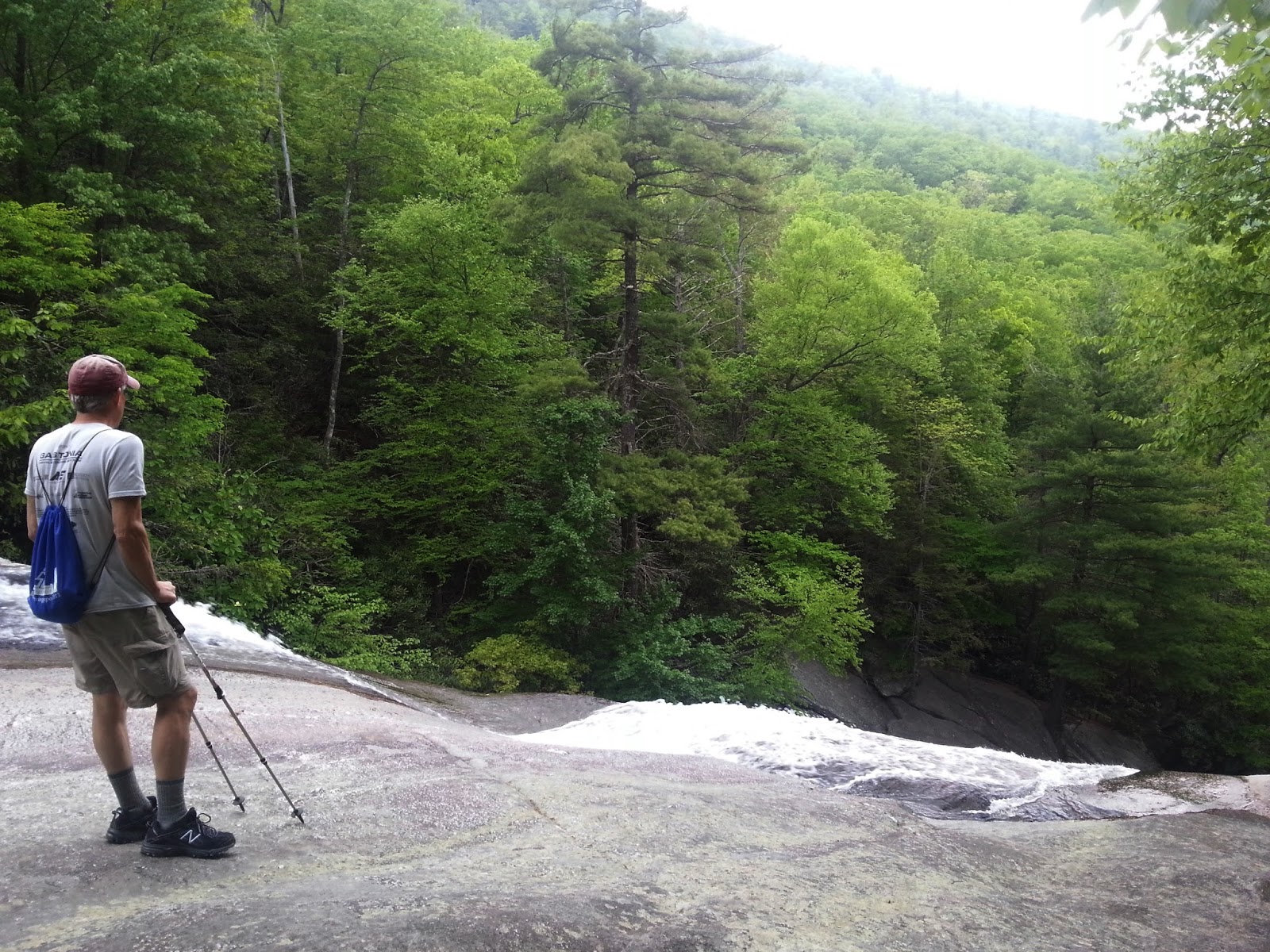
We parked at the Conley Cove trailhead. A half-mile in, we took
a right onto Rock Jock Trail, which
leads to rock outcroppings with outstanding views. We investigated several small paths on the left side of the main trail before turning back.


Shortoff Mountain across the Gorge. The MST climbs up Shortoff and then traces
along about two-thirds of the eastern edge before turning east away from the
Gorge and continuing into Wilson Creek Wilderness.


Table Rock

Hawksbill

Put ‘em together
There are a number of viewpoints of these two iconic points
from the western rim of Linville Gorge, all worth checking out. Rock Jock is
worth the bumpy ride and a two-mile round trip hike, a little work to get the
flavor of the Gorge.
We backtracked to Conley Cove Trail, turned right and took
the plunge down to the Linville River. Late
spring flowers peeked out at every turn.

Mountain laurel

Beard tongue

Spiderwort

Fire pinks

Galax
At the river’s edge we found a large campsite area and a
sign for Linville Gorge Trail, but no signage for Conley Cove. Score one point
for hiking the loop in this direction or we might not have known that Conley
Cove Trail intersected here.


Lunch by the riverside
After our break, we began walking upstream, i.e. steadily
uphill, our pace slowed down by stepping over/around big rocks and numerous
blowdowns that required thinking. The
trail narrowed and dropped off sharply on the right (riverside) with vegetation
crowding on the left. I joked that I would
suffer a lopsided neck strain from bending to the right to avoid getting hit in
the face by branches.

What’s in there, Cathy?


Okay, where is the Spence Ridge Trail? It should be coming in on the right, leading
to the water – a brief detour for us because we wanted to see the Spence Ridge
Bridge. This is a point against hiking in the opposite direction: I am terrible at interpreting narratives in
reverse. Even with Danny’s map, the turn
to the bridge looked to be very close to the Conley Cove intersection, but it
seemed to take forever to get to it. Did
we miss it? Nope, here it is – and the
bridge is gone.

More trail practice with blowdowns and rough footing. The river was loud and often we caught glimpses
of whitewater through the trees, but very few clear lookouts. Several times we took steep side trails to
the water’s edge to check out waterfalls and cascades – all beautiful. If only the trail more closely followed the
edge, but judging by the car-sized and house-sized boulders, it would be hard
to do.

Trail?


Hawksbill again

Is there a view from there?

Yes!

Trail conditions slowed us down to the point where time wasn’t
an accurate indicator of where we are on the trail. Danny’s narrative is not so detailed as to
mention every campsite, etc. and we (I) continued to have trouble interpreting
backwards. Which switchback does she
mean? Which rock overhang?
Apparently we missed where Devil’s Hole Trail comes in from
the right – but, hey, there’s Babel Tower! We are still in the Gorge.

At the base of a steep section of short switchbacks, we felt
that we had located ourselves on the trail.
At the top of the section was a trail junction – no signage at all, but
we interpreted this as the Babel Tower Trail crossing the Linville Gorge
Trail.
We walked a short distance to see Babel Tower’s base, but
time was getting late so we turned around to continue up Babel Tower Trail
toward the parking lot – yes, More.UP. This 1.3 miles seemed especially arduous. We were keeping a good pace, no longer slowed
down by obstacles, but my energy level was depleted. A lot of self-talk that
this was excellence practice for the AT in Maine next month, and that although
it was difficult right this minute, once we finished and I sat down, I would
feel better.
We met a couple walking down, carrying only a bottle of
water, and asked how far to the parking area (after all, we still have 2.7
miles past that to walk on Kistler Highway to get back to our car). They had no idea how far it is or how long
they’ve been walking. Next we saw a
couple carrying loaded backpacks. They had been out for a couple of nights and
were also heading to the parking lot.
An eternity later (15 minutes) we reached the lot and started
off down the gravel road, a relief to be walking a gentle downhill with no
obstacles (my brilliant plan). About half
a mile later, the backpacking couple passed by in their car (driving to Conley
Cove to get their second car) and gave us a ride – saved us two miles of
walking. (Better than my brilliant plan!)
I share all these details to emphasize that no hike goes exactly
as planned. Sometimes it’s easier, but don’t
count on it. More often it’s harder in
some way. Research routes before you go, read guidebooks, trail journals and
descriptions (there are a lot of them out there) but don’t stop there because
the information may not be up to date (ex. missing bridges). Look at the official websites for where you’re
going, see what their current trail conditions and cautions are. (Wikipedia is
not enough!) Take more than one type of map if possible. Orientation, map and compass skills are important
– I should practice these. I’m glad I didn’t
attempt this hike alone, as I would have gotten rattled at missing trail
intersections, the lack of signage, and not being oriented in time and place.
The U.S. Forest Service website for Linville Gorge is here. (It notes the washed out Spence
Ridge bridge and the necessity of a “wet crossing.” The water is often much too high for me to
feel safe crossing there.)
"The
wise man knows that it is better to sit on the banks of a remote mountain
stream than to be emperor of the whole world." ~Zhuangzi