
Tour du Mont Blanc Day 1:
Les Houches to Les Contamines – 7/11/16 – 11.7 Miles
Key notes:
* Guidebook The Tour of Mont Blanc divides the route into 11 stages, several featuring two alternate routes, low and high – wisdom is to go high if weather permits
* we’re hiking anti-clockwise, the more traditional route
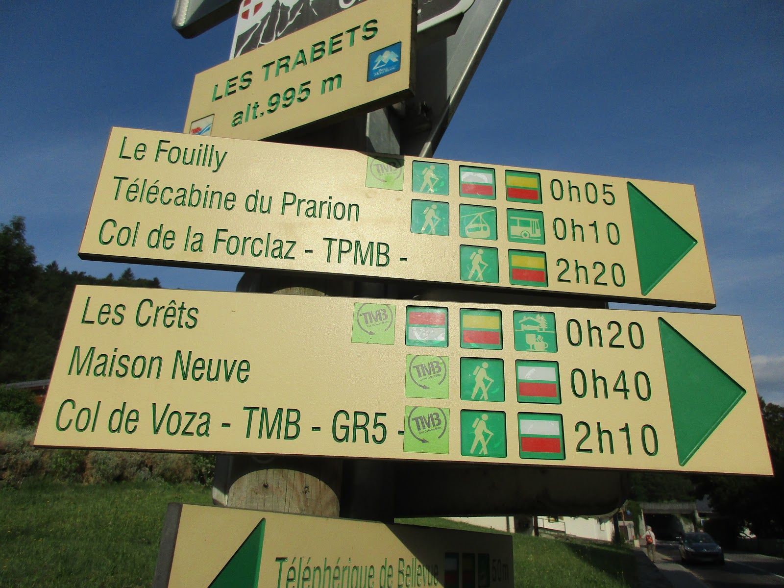
* signs are great but know your next waypoint, not just your ultimate destination for the day
* between signs at junctions, look for red/white bands or yellow diamonds with a black “TMB” painted on trees, rocks and buildings
* a “col” is a gap, a pass, a low point between mountain ridges and they are WINDY
* Guidebook The Tour of Mont Blanc divides the route into 11 stages, several featuring two alternate routes, low and high – wisdom is to go high if weather permits
* we’re hiking anti-clockwise, the more traditional route
* signs are great but know your next waypoint, not just your ultimate destination for the day
* between signs at junctions, look for red/white bands or yellow diamonds with a black “TMB” painted on trees, rocks and buildings
* a “col” is a gap, a pass, a low point between mountain ridges and they are WINDY

Today we’re hiking from Les Houches to the town of
Les Contamines and we’re taking the alternate high route over the Col de
Tricot.
What a lovely breakfast of granola, fruit, yogurt, hard
boiled eggs, meats, cheeses and croissants!
Jim said the coffee was rich (I’m abstaining until after the trek). Two fellow lodgers just off the trek said the
forecast looks especially ominous for tomorrow. Let’s just stay here…

We made our final pack edits. Electronics accounted for a significant
amount of weight but were necessary to maintain phones and cameras, including
adapters, chargers, extra batteries, and a portable battery charger. Although
the guidebook was heavy (because it’s chock-full of useful information in
addition to navigation notes), I opted to carry it and tear out the pages for
each day to keep handy in my pocket. I
referred to them incessantly throughout the trek as a sort of talisman to
reassure me that we were on course (and more than once to confirm that we were
not). At the fromagerie we bought
sandwiches and fruit, not yet trusting that food would be plentiful along the
route as the guidebooks claim. We each carried a stash of candy and Clif bars.

Beginning 8:45 a.m. Our starting point on the TMB just
across the street from Hotel Slalom.
Thanks, Stacey! We’ll see you in
10 days!
First lesson: follow the guidebook precisely through
the twists and turns of leaving or entering a town even if you feel confident
in recognizing markers and signs. This morning we’re headed to Col de Voza.

Follow them, they look like they know the way! After five minutes of this little track, the
first kilometers followed pavement and then gravel roads winding past ski
lodges, hazy snow-covered mountains, probably exquisite in wintertime but
pretty darn steep, and I was soon sweating with heat and effort. Not a good beginning. I regretted filling up on that breakfast
buffet, a little queasy, and of course that’s how I’m going to feel for the
entire trek, right? Jim was ahead of me
as I plodded along at a (hopefully) sustainable pace.

At the Col de Voza sits a large hotel and a station for
the Tramway du Mont Blanc (bathrooms!).
[The tracks in the photo are old, no longer used.] Across the tracks is a small bar-restaurant. Jim and I sat down on a
little bench to contemplate our madness and were joined by a British fellow
hiking the TMB in the clockwise direction, meaning this was his final day. He good-naturedly encouraged us and gave a
few tips. We asked about the high routes
and he confessed he hadn’t taken many of them, but another hiker reported that
the Col des Fours has an unusual amount of snow and it’s not advisable to try
it.
Note: Tomorrow we are
supposed to go over the Col des Fours.

From the Col de Voza the TMB climbs alongside the cable
car tracks

The Hotel Bellevue’s “nice view” of Mont Blanc

From here the trail angles to the right and undulates
gently across a steep wooded mountainside looking into the Bionnassay Valley,
opening up to a rocky moraine created by the Bionnassay Glacier.

We heard the thunder of a whole lot of water as we
scrambled across the moraine.

A wobbly suspension bridge
over the glacier melt flow – my kind of excitement!

Torrent de Bionnassay
cascading toward the valley
Exhileration from the bridge
crossing burned off in short order as I realized the steepness of the next
challenge: 1,200 feet elevation gain to
the Col de Tricot. My legs were exhausted and several times I stopped to rest
for a count of 30. The trail rose above
tree line into grassy meadows filled with alpenrose (similar to azalea),
wandering sheep, and cows wearing enormous bells around their necks – take a
deep breath and turn around and LOOK. These were the views we’d imagined – only
bigger.

Glacier de Bionnassay


Alpenrose and Glacier de
Bionnassay

Jim is still ahead of me

Col de Tricot is a broad gap
or saddle between mountains that separates the Bionnassay Valley and the Miage
Valley, each carved by glaciers flowing down from the Mont Blanc massif. Sheep
wandered among remains of a building and a stone wall. Famished, Jim and I
unpacked to eat our lunch in this 360-degree masterpiece.

The sheep were ready for
lunch, too. Like pigeons at the park or squirrels at the campground (only much
bigger), they approached looking for a handout and wouldn’t take no for an
answer. We shooed them away with our
hands, pushed them away with our boots, but when one fellow began vigorously
licking my knees it was time to abandon lunch and move on.
From the Col we could see our
next waypoint, the Chalets de Miage, down in the Miage Valley. We could see them for the next 90 minutes of
descent (1800 feet), each step a punishment even though mitigated by switchbacks. The guidebook urges caution to hikers on
their first or second day, as going too fast down steep grade with a loaded
backpack can cause knee damage requiring a lengthy recovery. Besides, going
slow allows for savoring the view.

Jim is a speck on the
mountainside

Descending to Miage Valley

Lupines at the Refuge de
Miage
Note to TMB dreamers: Refuge de
Miage would be a great place to end your first day. But we didn’t.

Jim and I had come to the
realization that this trek was going to be a serious challenge. These were not the mountains we’re used to on
the East Coast, and even though the heights don’t equal the mountains of the
American West, the average grade of the TMB was proving to be steeper than I
remembered back home. At the Refuge
(bathrooms again!) we bought Cokes at an exorbitant price, establishing a new
habit to get us through the tough times.
And it worked – we were revived and ready to face the next climb.

Which is over that little
ridge there known as Mount Truc.

A look back over the
shoulder at the Refuge de Miage and the Col de Tricot. Looks pretty simple from here, doesn’t it?

On top of the ridge of Mount
Truc the majesty of the mountains spreads out unobstructed, the Dômes de Miage. (There was a trailside site map display
naming the features.) The green arrow indicates Miage Glacier (which we'll see again on Day 3 in a BIG way). The yellow arrow indicates Pan Glacier, the
grayish flow separating from Miage Glacier.
The blue arrow indicates Mont Blanc peeking out from a wispy cloud. There
is nothing in the photo to indicate scale.
I remember feeling a little emotional at the vastness: this is real, we
are standing here on this ridge, in this meadow, and this is laid out before
us, this is nature’s magnificence. Then we turned and continued on our
way.

Next we passed by Auberge de Truc, another great spot to end the day. But we didn’t.

Our ambitious first day
ended in the town of Les Contamines, another couple of kilometers of steep descent. A charming place that we might have enjoyed
if we weren’t so tired.

We got cell phone service,
checked in with our son back home…

…and walked all the way
through town to our accommodations at Chalet CAF, featuring bunk beds and hot
showers. Bed and full board (supper and
breakfast) was 45€ per person. We knew that supper was served at 7:00 p.m. and
we learned quickly that seating was assigned by the hosts, no hiding in a
corner alone. Over courses of soup,
salad and chicken curry we attempted to talk with a Spanish family of four and
a young Spanish couple (the woman spoke English and translated cheerfully for
everyone). Jim seemed to enjoy practicing Spanish and French with a New Jersey
accent. Sharing our bunk room was a handsome young Australian fellow named
Adrian taking a three-week holiday. He
heard about the TMB last week and decided to just do it. We discussed tomorrow’s dismal weather
forecast and whether to attempt going over the Col des Fours.
In our single-minded focus to
find the Chalet, we had forgotten to pick up food for tomorrow’s hike, but the
hostess had bag lunches on offer. With a
bit of daylight left, Jim retrieved some more cash from an ATM (insurance)
while I tried to get organized, feeling overwhelmed, difficult to think things
through. Fatigue dragged me to bed, but
I didn’t sleep well, thinking about what tomorrow would bring. Are we having fun yet?
Jim carried his Garmon GPS to
record our mileage, elevation gain and loss each day. [Sometimes he forgot to turn it on right away.]
Miles: 11.7 Elevation Gain: 5,007 feet
Elevation Loss: 4,314 feet
“When
you’re safe at home you wish you were having an adventure; when you’re having
an adventure you wish you were safe at home.”
~Thornton Wilder


