Monday, April 18, 2016

Iceland Adventures - Hiking the Laugavegurinn: Álftavatn to Emstrur


Iceland Adventures – Laugavegurinn Day 3 – Álftavatn to Emstrur – 8/31/15 - 15km


Where has Cathy been on the Laugavegurinn? Leading the way ahead of me.  But today Cathy and I stayed together so she is the star of my photos as we walked from Álftavatn to Emstrur-Botnar.  New terrain and fresh challenges were on tap today. 

All packed up
And we think we’re ready to go
The Laugavegurinn passes to the rear of Álftavatn, crosses a little tributary and climbs up over the shoulder of Brattháls Mountain. 
Although forward movement is the main objective in hiking (as in life), I find that occasionally turning to look back gives an additional perspective and enriches the experience.   Leaving Álftavatn, pausing for one last breath, makes me resolve to return someday.
Our first significant water crossing is immediately before us:  Bratthálskvísl 
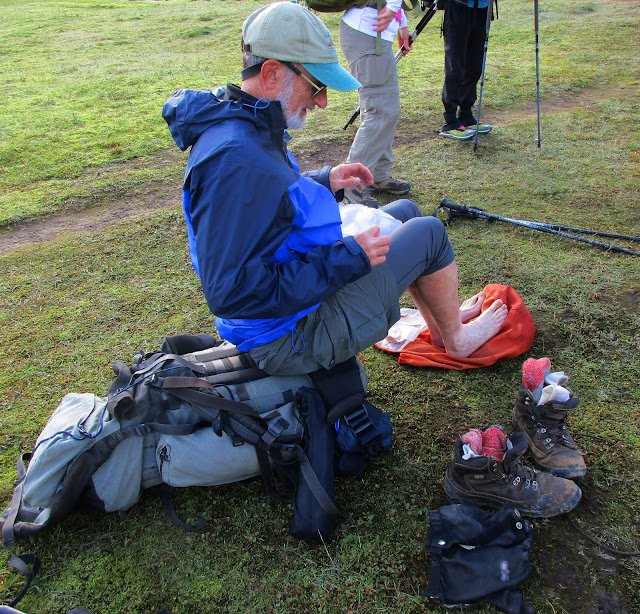
Mike prepares to get wet.  We all carried alternative footwear for the crossings so we wouldn’t have to walk in squishy wet boots. 

Bratthálskvísl (pronounced b-r-r-r-r because it is bone-chilling cold) seemed to take forever as we crossed two sections with a gravel bar in between. 
Paul and Kim entering Hvanngil “Angelic Valley”
I felt I was drifting through the valley, my feet moving along the track without conscious thought, my brain working to translate what my eyes were seeing.  Such a different landscape/world from what we walked through yesterday, yet equally magnificent!  Wispy clouds floated around Stórasúla Volcano, giving the appearance of steam puffing from its top.  Is a flying dragon about to emerge?
Stórasúla Volcano
At Hvanngil Hut there are accommodations for 60 people and plenty of space for tenting.  This is a good option if hikers want to get a few kilometers past Álftavatn (like our Czech Republic friends).  We took advantage of the bathrooms. 

From Hvanngil we walked through a series of lava fields.  Rocks are really lava “bombs” of different shapes, their names derived from the amount of cooling prior to impacting the ground after exploding out of a volcanic vent.  Yes, one type is a “cowpie bomb.”  Technical term.  Look it up.
Cathy
River Kaldaklofskvísl, which we definitely do not want to attempt to cross. 
Iceland has thoughtfully provided a bridge
Barely a kilometer later Kaldaklofskvísl’s flow is less treacherous but no less frigid, and the only way across it is through it.  Each hiker that arrives at the riverside takes time to watch those who go before, sussing out the most advantageous crossing.  Not too deep here.

Past this bridge the Laugavegurinn merges with 4WD track F261, a rather boring flat walk across the basalt desert after the thrill of green mountains and lava flow.  But…what’s this? (Click on photo to see full screen)

Cathy:  In the middle left horizon is our first glimpse of Mýrdalsjökull, the monster ice cap that covers Katla, an active volcano that erupts every 40 to 80 years.  The last eruption was in 1918 so she’s overdue.  Is today the day? 

Stórkonufell is the mountain on the right, Mýrdalsjökull Glacier glistening in the sunlight.
The river Innrí-Emstruá flows down from Mýrdalsjökull, cutting through the basalt lava rock.  (Yes, there was a bridge here.) 
The river Innrí-Emstruá and Stórkonufell Mountain
We are getting closer
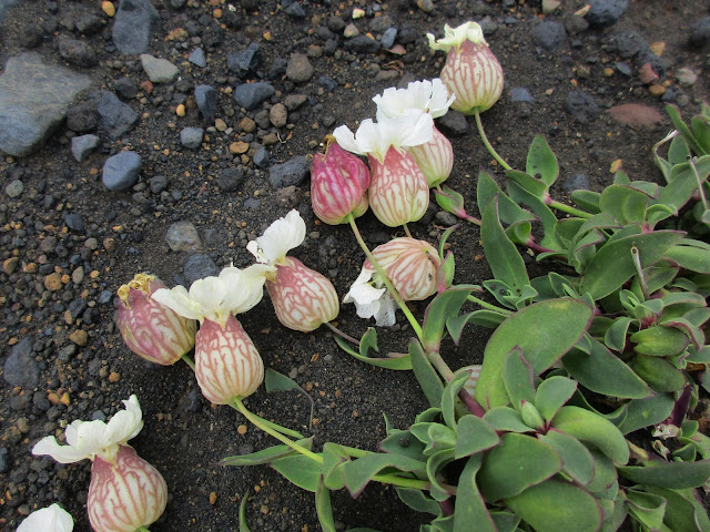
You have to bend down to inspect them, but the plant world of Iceland thrives:  sea campion
Thrift

The big green mountain is Hatfell.  The funky rock formation in front of it – who knows?

Suggestions?
Just as we were beginning to tire of the flat lava dust walk, around the bend the world changed yet again.

And there is Emstrur-Botnar, our red-roofed refuge, with Entujökull, an arm of Mýrdalsjökull, reaching towards it.

Emstrur-Botnar

Every accommodation along the Laugavegurinn is unique and Emstrur was my favorite, three cabins, each with 10 double bunks to sleep 20 people, quite cozy, with picnic type tables in the middle of the room, kitchen facilities and supplies on one end, and a grand view.  Cathy and I arrived first and met the hut warden, a woman of ambiguous age dressed in Icelandic costume complete with a tunic, knit cowl wrap and a necklace of gigantic gemstones.  We were assigned to Hut #3, and since our group was an odd number the warden informed us that one of us would have to sleep with a stranger.  We cheerfully volunteered Mike.

Mid-afternoon, energized by what we had glimpsed on the final descent to Emstrur, Cathy and I got the scoop from the hut warden about nearby trails and went exploring.  We followed the wooden posts marking a trail to Markarfljótgljúfur Canyon, which I had skimmed briefly in my geology book, The Laugavegur Trail, but I was unprepared and overjoyed for the experience.  The author describes, “Every river you crossed since coming down from Hrafntinnusker eventually feeds into the Markarfljót.”  The power of all that water has sliced through 600 feet of lava rock, exposing vent areas of red rock from preexisting volcanoes.  The color palette of rocks and plants was spectacular.
We walked along the Markarfljót plateau for half an hour catching glimpses of the river from many viewpoints.  We parted ways as Cathy chose to continue on and I opted to cross the plateau to explore what the hut warden had called the “Lion King Rock.”  Aptly named, don’t you think?

Sitting on top of the world looking at that big ol’ Mýrdalsjökull glacier

Looking at Emstrur

I stayed alone on Lion King Rock for a long while, chilly but comfortable, reflecting a bit on gratitude for the opportunity and ability to be there, but mostly I didn’t think about anything, just sat and looked and breathed in and out. 

When I returned to Cabin 3, Mike had arrived and gotten his bunk arrangements worked out (a top bunk which he ended up not having to share).  He was preparing to settle in for the evening, but I insisted that he walk out to Lion King Rock and carry his camera.  He was glad he did.  If you are considering hiking the Laugavegurinn, I highly recommend spending half a day or even an extra day in Emstrur so you can explore around Markarfljótgljúfur Canyon. 

By now some new faces and many familiar hikers had rolled in, including the four women we met the previous night, the German couples, and a single young American fellow, a former Boy Scout, whom we had encountered each day. Around the dinner table were multiple languages and similar smiles. Kim told me she’d found a book written in English in another cabin so I went in search of reading material for myself.  In Cabin 1 I found the bookshelf, as well as a party of French hikers who had set up an impressive bar and were just getting the party started.  Our Boy Scout friend was the lone American in that cabin.  (The next morning he said that he hadn’t gotten much sleep but the French fed him well and shared their liquor generously.)

Three days, three very different experiences. Good night, sleep tight.


In the middle of the night
I go walking in my sleep
Through the desert of truth
To the river so deep
We all end in the ocean
We all start in the streams
We're all carried along
By the river of dreams  ~ Billy Joel


Saturday, April 2, 2016

Iceland Adventures - Hiking the Laugavegurinn: Hrafntinnusker to Álftavatn


Iceland Adventures – Laugavegurinn Day 2 – Hrafntinnusker to Álftavatn – 8/30/15 – 12km

Icelandic name challenges for today:  Álftavatn  Háskerðingur  Torfajökull  Jökultungur  Grashagakvísl  Torfatindur  Torfatindar Brattháls Reykjafjöll  Hattfell  Torfamýrar

In anticipation of cold nights I packed my 15-degree sleeping bag, but the hut was uncomfortably hot (geothermal steam) and I slept on top of the bag in my upper bunk.  My earplugs worked very well for the inevitable snoring in a roomful of people.  Also inevitable was a visit to the toilet - at 4:30 a.m. the sun was coming up. 

A hiking breakfast for me is usually an energy bar, but every morning on this trip I forced myself to eat instant oatmeal with walnuts, which I did get used to.  Cathy and Kim brought Skyr for breakfast, heavier than I was willing to carry, but they really enjoyed it.  At 8:15 a.m. our gang of five departed for our 12-kilometer hike to Álftavatn (Swan Lake). 

We stayed within sight of each other most of the day, with Mike and me bringing up the rear and playing photographer for each other.  The full impact of the landscape could not be captured or contained, but we sure tried.  Most of the following scenes include humans for scale.  See how many you can spot.  Be sure to click directly on the photos to see full screen.

Sketchy low clouds at the start that touched the ground at times (light fog) and blanketed the peaks all day, but no precipitation
The double bump on the left is Reykjafjöll
Many snow fields to cross during the morning
Looking back, blue skies struggle to appear behind Mike and Hrafntinnusker
Looking under an ice bridge.  One time Cathy unknowingly crossed a precarious bridge.  A larger person would surely have broken it. 
Ice bridge.  As we lost elevation the melting snow uncovered a bit of green.
Photo op for Mike.  Háskerðingur is the tall peak in the upper right and the small glacier called Kaldaklofsjökull.  It’s hard to distinguish the glacier from the seasonal snow pack.  There is a side trail going up the mountain but we didn’t take it.  Next time.
Rhyolite mountains on the right.  Cathy and Kim and Paul are teeny-tiny in the upper left, standing on the rim of the Torfajökull caldera. Zimmer's The Laugavegur Trail explains the change in geology.
Minerals make the orange colors, similar to what I saw in Yellowstone National Park in July.  We also saw many saucer-sized puddles of clear percolating hot water. 
 
Kim and Paul

The ascents and descents were short but steep. Some were covered in snow with nice kicked-in steps.  Others were piles of black ash, like coarse sand, and descending them was most unnerving.  On one particularly disturbing slope (seriously? we’re supposed to go that way?) Cathy, Mike and Paul made it down with relatively little trouble.  There was not one single blade of grass to hold onto and I just didn’t feel like my hiking poles offered enough stability, so I practiced glissading, starting on my heels and ending up on my butt.  At least if I fell over I would already be close to the ground. Kim went for the extremely cautious step-down with Mike patiently coaching her. 

Kim

Mike
Side view of a stunning cascade.  Do you see Mike?  Yes, we had to cross this upstream, but it was a moderate rock hop.  We didn’t realize the drop until we reached this view after the crossing.
Waterfall and steam vents, tiny specks of humans on the horizon

Looking at Álftavatn (Swan Lake) and the Álftavatn Valley.  The pointy mountain on the center horizon beyond the lake is Hattfell.  The dark brooding mountain flanking the valley on the right side is Torfatindur and the mountain flanking it on the left is Brattháls.  We walked into this landscape painting for over two hours as we descended into the valley.

Lunch view
If our minds weren’t already blown with the landscape… two mountain bikers pedaled cheerfully up the trail.
What hovering cloud?
Álftavatn Valley, the lake as calm as a mirror in the upper left.  The sliver of glass beyond it is Torfavatn, a smaller lake.
Starting the descent down Jökultungur required great concentration and quad strength.  Loose palm-sized rocks and smaller pebbles on the steep slope made for slippery footing.  I skidded many times but only hit the ground once. 
Mike walking towards Tortafindar, the brooding dark mountain, and the braided river Grashagakvísl.  We spent some time scouting out the best route to cross, and Paul was able to rock hop it with his longer legs, but the rest of us put on water shoes and waded across the channels.  Glacier melt = numbing cold, a prelude to upcoming crossings over the next two days.

 Cathy and me walking on the valley floor toward Álftavatn 
Álftavatn accommodates 52 people in sleeping bags and is equipped with gas stoves, crockery, utensils and running cold water.  Bonus for those who have limits for a rustic experience:  flushing toilets and real showers. 
 Kitchen and dining area
Our bunk room for five, a very tight space.  On the main floor are two more similar rooms and the upper floor is an open dorm, all full tonight. I chatted with Sigrid, one of the hut wardens on-site, and learned that the second bunk house was empty and we could move into it to spread out, but there was no heat.  I peeked in the window and the place looked rather gloomy.  After thinking about it for a while, I decided to stick with the crowded-but-friendly main building.
 Bath house
 Lakeside camping area

Early afternoon, still feeling energized from our morning hike and now unencumbered by backpacks, Cathy and I went exploring across the meadow to the lake. 
 
 One of the creeks that feeds into Álftavatn, Brattháls Mountain in the upper left
 Lakeside 
 Looking back at the huts
We scrambled around on the toe of Torfatindur (not to be confused with Torfatindar right beside it), great rocks for walking, very rough with a good grip.  Here’s looking down at the lake, Brattháls Mountain on the far side. 
A troll cave on Torfatindur 
 
Looking down onto the plains of Torfamýrar 
The road through Torfamýrar is part of the Middle Route, so you don’t have to hike to stay and play in the Álftavatn Valley.

We scrambled back down and Cathy continued exploring along the base of the mountain as I headed back to the hut.  There I ran into the two young women from the Czech Republic that we had met on the boat at Hornstrandir.  They were cooking a little supper on the deck before continuing on to spend the night at Hvanngil (which we’ll pass tomorrow).  The ease and confidence of these 20-somethings and other solo women I met hiking in Iceland made quite an impression on me.  Without exception, they were skilled and comfortable and fearless.  When I asked if they ever felt vulnerable as females, a common question I get asked in the U.S., they were perplexed.  Why should they?  Indeed. 

The day ended sitting around the kitchen tables talking with fellow hikers.  A group of four women (three of them were friends from UVA grad school) had a lot to share about their adventures.  I was suffering a little regret for not carrying a book and one of them loaned me her National Geographic magazine to read myself to sleep.  I think I got through one paragraph…Fell asleep with colorful rocks swirling in my head

"I do not bring back from a journey quite the same self that I took." - W. Somerset Maugham