Sunday, May 26, 2019

Pisgah 400: Turkeypen Gap Hike


Pisgah 400: Lollipop Hike At Turkeypen Gap– 8/24/18 – 6 Miles

South Mills River Trail/Pounding Mill Trail/Squirrel Gap Trail/Mullinax Gap Trail/South Mills River Trail


The orthopedist said the cartilage in my right knee is now just a memory and my running days (pain free) are over.  Hiking and backpacking, however, are still thumbs up.  Fresh from a cortisone shot, I tried a short hike in Pisgah National Forest on a hot August Friday morning. 

I chose the short route out of caution for not overdoing my knee, but also because I still don’t trust Pisgah – hiking there is wonky sometimes when my map doesn’t match real life.  Yadda yadda yadda, I’ve said it many times before.  Going anyway.

Turkeypen Gap trailhead was new to me and I’m glad to make its acquaintance because many loops start from that point. I met an older guy in the parking lot also getting ready to hike. He expressed mild surprise that I was hiking alone, but when I asked him if he was alone he said yes. I did not express surprise.  Two questions: why the difference? And should I have told him?  He may have been up to no good. Which answers question #1.

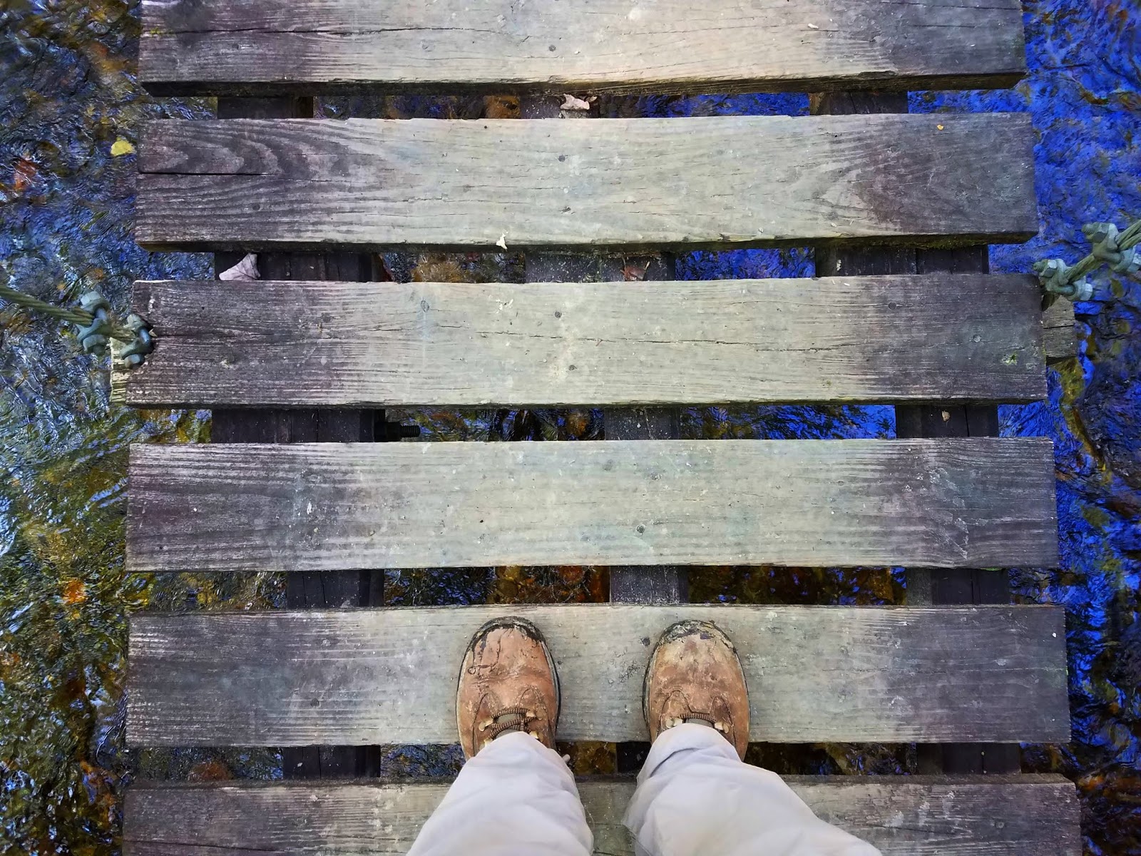
I started out on wide South Mills River Trail (hiking/biking/horses), which drops down to a large swinging bridge across the South Fork. [Note: "drops down" means "uphill" on the return.] On the far side of the bridge I encountered the first confusing intersection of the day. I quickly figured out that there is a horse option to crossing South Fork, then a sharp elbow left turn to continue on the SMR Trail (directed by an old wooden sign). I also noted the T-intersection with Mullinax Trail where my clockwise loop begins/ends.

  
Still on the South Mills River Trail, another intersection and a horse camp, no signage.  My first instinct was to turn left to stay close to the river, but the trail to the right looked significant too, so I followed it and saw a faint blaze. The trail eventually swings left and back to following upriver, now flowing deep in a gorge. It eventually becomes level with the water again at a rock outcrop that invited me to pause.

 
Intersection with Poundingmill Trail, hikers-only, and I see by the topo that it goes straight up a draingage to Poundingstone Mountain. The trail was slim and surprisingly not too overgrown, very enjoyable, orange blazes in all the right places.  I crossed Poundingstone Branch 13 times, all rock hops but not one-steps.  The last quarter mile was quite steep.
  
Doll's-eye

I felt energized and not yet in need of a break, but the junction with Squirrel Gap Trail invited hikers to stop. (Question: what happened to the "S" in Squirrel on the signpost?) As I ate my apple, a lone hiker came through with a fishing pole sticking up out of his backpack.

 
Squirrel Gap Trail (hiking/biking/horses) followed the ridge, another enjoyable trail, signage at the next intersection. My wariness of Pisgah was fading as I skipped merrily along. Then I came upon two large campsites at Mullinax Gap and was reminded: stay on the trail, don’t go through the campsites, or you will get confused and miss the intersection. By now I knew to nose around all the options for a few minutes. I found my correct turn onto Mullinax Gap Trail.

Running cedar, aka fan clubmoss, reproduces by spores

Mullinax Gap Trail (hiking/biking/horses, emphasis on mountain bikers) descends to the river

Thumbnail size pieces of mica rock caught my eye in the dappled sunshine, then I noticed flecks of mica in the sandy soil like diamonds, silver glitter, a long stretch of mica dust. A year or so ago on Spencer Branch Trail in Pisgah NF I discovered an enormous hunk of mica rock. A reminder that when you’re hiking, be sure to look up, down and all around – you’ll be amazed!


At the intersection of Mullinax Gap Trail and South Mills River my loop was completed and I was back in familiar territory. I turned left, crossed the swinging bridge again, and began the moderate uphill.

 
About a hundred yards from the parking lot, I came upon a mother carrying a very tiny infant in a Snuglie and two little girls (3 or 4 years old) walking in the same direction, so obviously they had ventured a little ways out. One of the girls was fussy. I shouted hello from a distance so as not to startle them as I approached. Mom said they are discussing their favorite desserts (cupcakes) to distract them from the difficulty of the walk and the heat. Kudos to Mom!

All in all, a long drive for a short hike, but a triumph on two fronts: my knee felt fine and I chipped away at my intimidation of hiking in Pisgah.  I’ll take the win!  If only returning to Charlotte was easy…


“I have two doctors, my left leg and my right.”  ~G.M. Trevelyan

Wednesday, May 22, 2019

Mount Mitchell to Montreat


Mount Mitchell to Montreat – 8/11/18 – 15.4 Miles


Months in advance, Danny Bernstein put out an invitation for a rare opportunity. With enough willing participants, she offered to arrange a shuttle bus and driver to take us from Montreat College up to Mount Mitchell so that we could walk one way, mostly downhill, via the Mountains-to-Sea Trail and the Old Mitchell Toll Road. My hand went up immediately – yes, please! 

I left my home in Charlotte at 5:30 a.m. to be on time for the 8:00 a.m. departure from Montreat. I drove under overcast skies with some wispy fog, a little bit of rain – not to worry, often the tops of the Black Mountains are above the clouds. And yes, we’ll hike in the rain anyway.

Members of Carolina Mountain Club and other hiking friends from all over western North Carolina - Weaverville, Maggie Valley, Asheville, Hendersonville, Arden, Charlotte – gathered eager to meet the challenge.  Every seat filled, all (14) present and accounted for, we left Montreat five minutes early! Lots of chatty people on the ride, running commentary mostly on health and hiking – does everyone have enough Ibuprofen for this downhill trek?

When the bus reached the Blue Ridge Parkway, we popped out above the clouds. No stopping for the view – we had a hike to get to – but I grabbed a couple of photos from my window seat.

At the summit of Mount Mitchell for our “before” photo

And we’re off on the Mountains-to-Sea Trail westbound, immediately starting a steep descent on wet, slippery roots and rocks. This demanded my full concentration, but the chatty folks kept up their conversations. We were clumped together, hiking too close to one another for my comfort (if I stopped suddenly I would surely get bumped from behind). I perceived this was the culture of the group and I was a guest, so I kept quiet and hoped this regimentation would loosen up as we went along.


On the plus side, this group was fit and well suited to the demands of the day, representing a myriad of experiences, including SB6K completers, AT section hikers and completers, Smokies 900, Pisgah 400, and several Camino de Santiago pilgrims. There really WAS a lot to talk about!

After one mile and 800 feet downhill, the trail moderated to a mercifully flat grade as the MST passed Camp Alice and made its way to Highway 128. We crossed streams and cascades, and late summer wildflowers like love pink turtleheads, love vine, St. John’s wort and goldenglow cheered us on. Debate topic: milkweed or Joe Pye weed? 
 

At Highway 128 our attention was captured by six-foot-tall blooming swamp-thistles topped with graceful butterflies. Paparazzi!


Here we left the MST behind and walked on the shoulder of Hwy 128 to its intersection with the Parkway, where we turned left/northbound for a lunch break at Ridge Junction Overlook. Notice the brooding clouds moving in again.


We continued a short distance on the Parkway as Danny kept an eye out on the right-hand side for a gated road that begins the Old Mitchell Toll Road (originally a tourist railroad access to the mountain and Camp Alice around 1915-1919, later paved as a tourist car toll road in the 1920’s, until the BRP was completed in 1939, providing free access). Great article here.

No signage at the gate.  One more group photo to prove that we made it this far.

One minute later we heard the rain coming, quickly put on pack covers and hustled into rain gear as a downpour ensued. Within 20 minutes we had walked through it, but I kept my rain jacket on for quite a while.  Level walking on the old toll road, almost imperceptible downhill, taking in the rain-filled puddles, the green of late summer and continued abundance of flowers: Michaux’s saxifrage, yellow coneflower, wood aster, white bee balm, spiderwort, and gorgeous yellow fringed orchids.

 
We passed some signed intersections, some unsigned, which was cause for discussion and verification. Danny had scouted most of today’s hike and felt secure in her information, and she was the only hiker who carried a map of the route. I was under the (mistaken) impression that it was advertised as an 11-mile hike, but it clocked in at more than 15 miles. I rarely hike without my own map and I’m not sure why I didn’t have one today. Preparedness lesson re-learned. 

The group stretched out on level ground and I stayed in the middle with some distance for solitude. Conversations still floated within earshot and I could tune in or out.  Hearing about Camino experiences was interesting, viewpoints for walking it solo or walking with a group of friends. I haven’t been particularly interested in being away from home for a long stretch, but maybe I need to think about this some more. 

Folks once lived along the old toll road. We passed a stretch of abandoned campers and makeshift cabins. No communal buildings, no church. Where did the residents work? How did they get food? Was the surrounding land once clear for livestock and gardens? Where was the school for the children? 

Mountain bikers out for a great ride

Below Pot Cove Gap we passed a hunting camp that is still actively used. Its owners/members and the town of Montreat share the gravel road for access.


The majority of miles were behind us but we knew there was a significant drop in elevation still to come. At Sourwood Gap, the rain returned.  We geared up again and turned off Old Mitchell Toll Road onto Appalachian Way, a steep gravel road that turns to pavement as it enters the Montreat community.  No rocks or roots, no steps, just a steep grade of loose gravel – ugh! Teeth were gritted and thighs were burning, putting on the brakes and grimacing with each step. The last mile was over 1,300 feet elevation loss. Ouch.

Smiles in the parking lot, though, and congratulations all around for our accomplishment.  Most of the group met for a pizza supper, but I headed back to Charlotte with some daylight. In my driveway, I could barely unfold myself out of the car. A hard cider, a kitty cat, ice bags on both knees, and Netflix – yes, please!

   
Stats from a fellow hiker:  15.4 Miles  Total ascent: 302 feet   Total descent: 4,276 feet  7.5 hours

“When you have worn out your shoes, the strength of the shoe leather has passed into the fiber of your body. I measure your health by the number of shoes and hats and clothes you have worn out.” ~Ralph Waldo Emerson