Monday, July 25, 2022

Maine Adventures 2021: Acadia National Park - Schoodic Peninsula

Maine 2021: Acadia National Park – Schoodic Mountain Loop – 7/13/21 – 3 Miles

Wake-up coffee leaning back in Adirondack chairs facing the woods and the water of the Sound.

Today’s focus is Schoodic Peninsula (pronounced like “scoop” not like “shoe”), a secluded part of Acadia National Park that sees a fraction of visitors compared to Mount Desert Island. It’s the only part of the park that is on the mainland. Jim and I drove through the tiny village of Winter Harbor, making a note to spend time there later in the day.

Another way to visit Winter Harbor is via the seasonal ferry that operates from Bar Harbor – a boat ride across Frenchman’s Bay between two charming destinations!

Past the village we turned right onto Schoodic Loop Road, a simple scenic drive to most points of interest on the peninsula. In addition to the main attractions of Frazier Point, Schoodic Point and hiking trailheads, there are many turnouts to stop for photos, rest awhile, put your toes in the water and squint at islands on the horizon.

Note: If you’re going, be aware that this road is one way counterclockwise on the lower half of the peninsula, from Frazier Point on the west side to Wonsqueak Bike Path on the east side. Be sure you know where you want to go. If you miss your turnout or parking area, it’s a long way back around. Bikes are allowed but must follow the one-way guidelines. One advantage of biking is that there are paved trails crisscrossing the peninsula in addition to the Loop Road.

At Schoodic Woods Campground ranger station we consulted with the ranger about the hike we were looking at (it’s a loop and there’s a difference between hiking clockwise or counterclockwise). I enjoy talking with park rangers, getting up-to-the-minute information and hearing their enthusiasm for their parks. Always remember to say thank you!

Onward to Schoodic Point, the southernmost tip of the peninsula (via a two-way spur road). The broad expanse of granite headlands exudes drama, enticing you to walk around and explore, but keep in mind that rocks are always slippery.

Schoodic Point (Mount Desert Island on the horizon)

On the horizon, Cadillac Mountain poking her head up through the clouds

Tidal pools brimming with marine life

We walked far out onto the granite shoreline, as close to the water’s edge as we could safely venture. The rocks don’t slope gently down, they “cliff out.” Waves crashed and receded at deep cuts in the shoreline similar to Thunder Hole on MDI. The spray was unpredictable and spectacular.

The human history of Schoodic Point is also fascinating. The Schoodic Institute is located just up the road. With little knowledge of its origins, Jim and I stopped for a visit. Boy, did we learn a LOT! 

On its website the Institute acknowledges Schoodic Point as the homeland of the Wabanaki, People of the Dawn, and the Institute’s pledge to support the Wabanaki Nations.

The 20th century history includes a “land swap” moving a naval security base from Otter Point on Mount Desert Island to Schoodic Point. Why? To appease President Franklin D. Roosevelt’s desire to build out the Park Loop Road on MDI. What was the significance of this part of Maine's coastline? In World War I, Otter Point was an ideal location for a “strategic listening station” receiving radio signals from Europe. After its move to Schoodic Point, the naval base grew and when World War II commenced it operated to locate foreign warships (German submarines). Read more here.

Today the Schoodic Institute partners with Acadia National Park and is dedicated to collaborating with scientists, educators and citizen scientists in understanding the biodiversity and national and global environmental issues, with a focus on youth programming.

Rockefeller Hall at Schoodic Institute

How about a hike now, y’all? Let’s check out the high point of the peninsula: Schoodic Head.

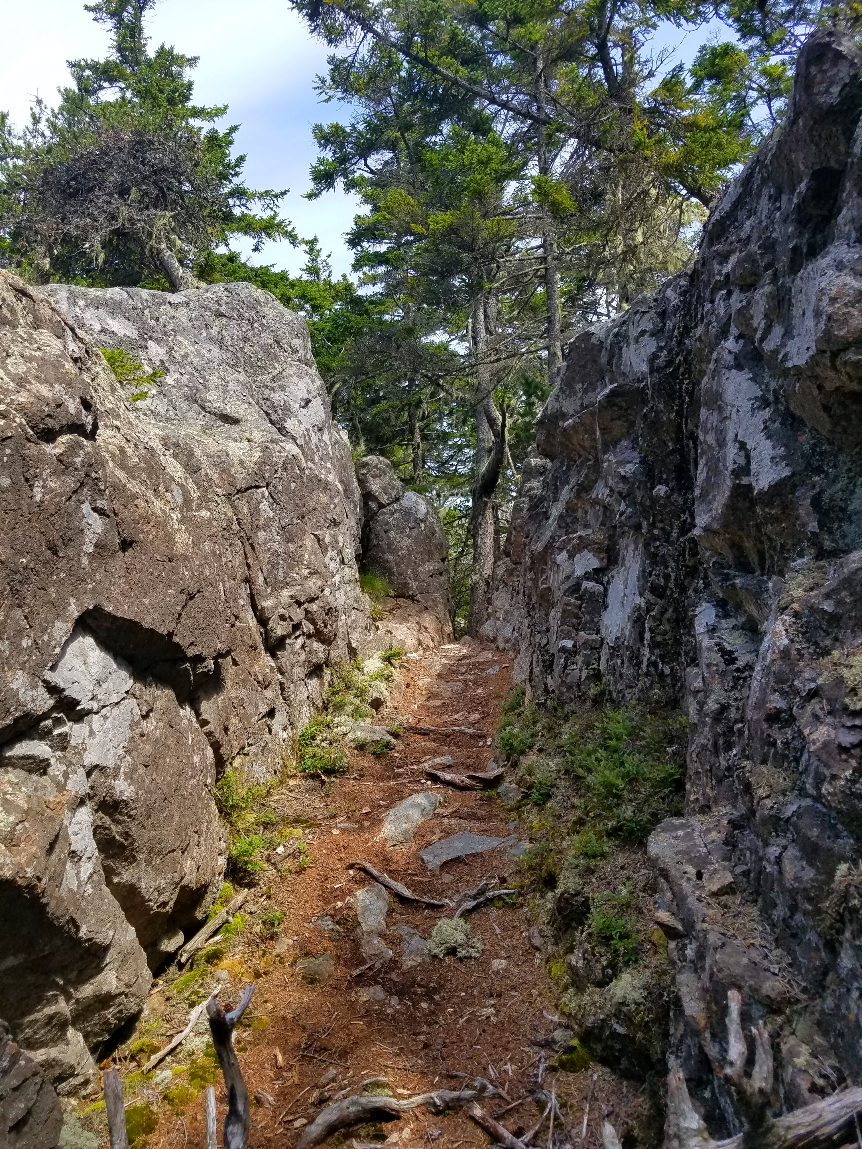
There are several trailheads to start from. From Blueberry Hill parking we walked a short distance on the Loop Road to the Anvil Trail. Our route included the Anvil Trail, Schoodic Head Trail, and Alder Trail back to our car. Yes, we’re doing it CCW – the hard way.

These trails were shorter than those we’d hiked on Mount Desert Island but every bit as rugged, non-stop rock steps and boulders. The climb from the trailhead to the summit was just 1.4 miles and 442 feet elevation gain but, jeez Louise, what a workout!

And great training for our big hike coming up later this week (stay tuned)!

The start of the Anvil Trail – say what??

A rocky quarter mile uphill to the Anvil

View of Mount Desert Island from the Anvil lookout point (also known as “catch my breath
 and question my sanity Point”)

Come on now…more steps

We watched a mama grouse and four chicks

Can a grouse scratch her ear?

A tangle of trails comes together near the summit; pay attention to the signs.
The summit is not at the intersection (there is a surveyor’s marker). 

The viewpoint is a short distance past the summit.
 This is looking eastward across Schoodic Harbor to Spruce Point and beyond.

Our loop continued on Schoodic Head Trail, a steep descent to Ranger Cabin Road (oh, look, we could have driven up here on a gravel road), then a short walk on the forest road to the beginning of Alder Trail.


At the sign we met a man and woman who were hiking the loop clockwise. They asked about directions, and we all checked our maps and pointed them the way we had come. [We would see them again another day.]

Alder Trail was an understatement after all the boulder drama. We were glad we chose the counterclockwise route and the easy stroll back to Blueberry Hill parking.

We continued on Schoodic Loop Road as it hugged the coastline
 (looking back here at Schoodic Head)

It was now 1:00 p.m., later than we had expected, and we were tired, dirty and hungry (not necessarily in that order). En route to our little cottage, we stopped at the lobster tent in front of Fisherman’s Galley to alleviate the “hungry” factor. Again, very pricey but the timing was right.

After a hot shower and clean clothes, we were ready to ramble in Winter Harbor. We’d come to accept that businesses and restaurants don't operate 7 days a week here in Maine, even in the height of summer. Restaurants were closed either Monday-Tuesday or Tuesday-Wednesday, as are some shops and galleries (was this culture or COVID?) Even the library, housed in an old church with stained glass windows, was closed today. 

I'd love to go to a party in this person's front yard

But the Winter Harbor 5&10 was open! They are very proud of this original store. It is stuffed to the gills with things you didn't know you needed. I swore off souvenir tee shirts years ago but couldn’t resist a long-sleeved collegiate style Winter Harbor shirt. More predictably, I picked up a wonderful book In Maine: Essays of Life’s Seasons by John N. Cole.

On our host’s advice, Jim and I joined the long line for ice cream at a shack called Me & Ben's. Why do people love an ice cream line? It’s part of summertime, the anticipation as you see what the people in front of you are getting. Blueberry soft serve piled high, a tasty treat!

We drove through other villages on the peninsula – Birch Harbor, Prospect Harbor and Corea - sleepy little places, picturesque with a capital “P”, and ended with dinner at a local Winter Harbor hangout called Chase’s Restaurant. I was introduced to “lazy lobster” that they crack and extract for you. Delicious!

Tomorrow’s inland destination: Millocket. 

Twilight at Winter Harbor

“Smell the sea and feel the sky,
 let your soul and spirits fly.”
 ~Van Morrison


Saturday, July 16, 2022

Maine Adventures 2021: Acadia National Park - Hiking Up the Beehive & Beyond

Maine 2021: Acadia National Park – Ocean Path/Bowl Trail/Beehive Trail/ 
Gorham Mountain Trail/Cadillac Cliffs Trail/Otter Cove Trail
7/12/21 – 5.6 Miles

Daylight in our little basement grotto woke us at 5:00 a.m. It was a luxury to drift in and out for an hour before getting started on the day. First things first: an al fresco cup of coffee to remind us we’re on vacation.


Jim and I could have stayed for a week or more and really dug deep getting to know Mount Desert Island. We are active travelers, though, and we want to see and do all the things - impossible, yes, but we do try! [I see most visitors to the Great Smoky Mountains working on the same premise and I know that they miss some great stuff.] Two nights is not very long to stay in one location, but it made sense to pack up and move to another part of the park.

What, you thought we were done with MDI after only one hike? Nope. I found a popular hike route that hits some highlights [kinda like those once-in-a-lifetime Smokies visitors] and we happily joined the human flow on a scenic, varied, heart-stopping trek. 

[Note: we didn’t follow this exact plan but it was a good base. We followed recommendations from our Airbnb host to alter/add to it.]

From the Fabbri Picnic Area, we followed a path alongside Park Loop Road to Otter Point, where Otter Cove opens to the Atlantic Ocean. The overcast skies lent a feeling of seriousness to the landscape like, hey, y’all, this might look like fun under a blue sky, but the rocks mean business so watch your step!


Ocean Path officially begins at Otter Point and follows two miles of shoreline to Sand Beach. There are some short steep sections on rocks, but it’s mostly a gravel path closely paralleling the Loop Road with multiple side trails through a screen of trees to reach the monster-sized boulders and cliffs jutting out into the sea. Because of its accessibility, evidence of erosion caused by humans is significant. Yet here we were, adding our footsteps to the path.

The path goes up the left side of Otter Cliffs

The dark peninsula in the middle horizon is Great Head; the faint stretch of land on
 the far horizon is Schoodic Head, where we’ll be exploring tomorrow.

As we drew closer to Thunder Hole, the throngs, masses, droves of people appeared in every shape and size and age, many of them children. We passed on by with just a cursory look because of the line of people queuing to peer down into the narrow inlet carved into the rocks. Steps and railings serve the purpose of protecting people from themselves, (i.e. slipping into the chasm and drowning as waves crash and “thunder” in the narrow space), but seeing the infrastructure made me lose interest. 

[Hypocritical of me, I admit, because I was right there in line to climb stairs to see Niagara Falls and Yellowstone Falls back in the day, and about an hour from now I would be hanging onto infrastructure for dear life as we climbed the Beehive with lots of company.] 

The Ocean Path took us through a large parking area (restrooms!) and down a set of wooden stairs to Sand Beach. The setting brought to mind the coast of Wales with sandy stretches between rocky cliffs rising on either end. We were not tempted to wade in the water, but kids were romping in the surf as kids do, living in the moment rather than worrying about the temperature.

Sand Beach

[Here is another description of the Ocean Path in reverse, from Sand Beach to Otter Point.] 

From the Sand Beach parking lot, we crossed the Loop Road and stepped onto the Bowl Trail.

Here comes the heart-stopping part [Note: if you don’t like iron rung ladders and handrails, don’t do this hike – read a great description here.] At .3 miles, we turned right onto the Beehive Trail and the strength and endurance challenge commenced. Jim and I scrambled our way through an obstacle course like this one on the Tour du Mont Blanc in 2016, but I was now five years older and a teensy bit less confident with heights and balance. 

From a distance, the mountain looks like layers of flattened rock with a gently rounded summit.
 Hiking poles were useless so we strapped them to our daypacks.

Although the climb was very steep, we really didn’t get out of breath making our way up the rocks. In fact, much of the challenge was waiting in vulnerable, precarious spaces as the ant-people ahead of us crept upward handhold by handhold. I was in no hurry to pass any of my ant-friends.

[Note: While patience is required to follow fellow hikers going up the Beehive, going down the Beehive against this flow would be even slower and no fun AT ALL.]

Up close to the rocks (I mean 6 inches from my face) it took all my concentration not to think about the narrowness of the ledge I was standing on.

Taking a break at the first “safe” spot near the top, looking down at Sand Beach

The real summit of the Beehive is further along on a broad rock facing towards Frenchman’s Bay (there are no easily distinguished pointy summits in Acadia NP). Several large groups of people were spread out there so Jim and I kept moving. 

Champlain Mountain and Frenchman’s Bay

We continued on the Beehive Trail as it parallels the Bowl Trail up to its namesake lake. There are a few connector trails between the two (be careful or you’ll get off track) so we decided to skip the lake and head to Gorham Mountain. We descended about half a mile further down the Bowl Trail back towards the Loop Road, then turned right onto Gorham Mountain Trail and climbed half a mile right back up.

At the summit of Gorham Mountain – keep going, the big ocean views are further along

A front row seat to Schoodic Peninsula

Many trail guides follow Gorham Mountain Trail along the ridge all the way down to the Loop Road, but we took our host’s advice to take Cadillac Cliffs Trail as it drops steeply below the ridge and rejoins Gorham Mountain Trail after .3 miles. If you haven’t had enough rock scrambling fun yet, this is your trail.

We rejoined Gorham Mountain Trail, then turned right onto Otter Cove Trail to make our way back to the parking area at Fabbri Picnic Area.

Whew! This hike affirmed what we learned yesterday, that Acadia National Park is small but mighty, challenging and unique.

It’s only noon. What’s the plan for the rest of the day? Jim rented a bike to cruise the Park Loop Road while I rode the shuttle bus from Acadia Visitor Center into Bar Harbor and played tourist. 

Dinner and adult beverages at Blaze Brewing Company in Bar Harbor

With Mount Desert Island in the rearview mirror, we moved on to our next Airbnb on Jones Cove near the Schoodic Peninsula area of Acadia National Park. A cute guest cottage on a private estate, an engaging host sharing a wealth of information about her part of the world, a walk on the private path down to the cove at sunset – what will tomorrow bring?

“Enjoy the beauty of a sunset,
 nature’s farewell kiss for the night.”
 ~Sharon Rene