Monday, April 25, 2022

Adventures In Utah: Bryce Canyon National Park - Fairyland Loop

Adventures In Utah: Bryce Canyon National Park - Fairyland Loop – 4/13/21 – 8.6 miles

How many hoodoos does it take to make Bryce Canyon National Park? A whole lot! You’ve seen two-dimensional photos, but they don’t prepare you for the reality in 3D. And you get to walk all around in it!

Hikers generally don’t sleep in because we know that morning is the best time to experience the natural world before those pesky (other) humans show up – and in a desert setting it’s best to hike before the temperatures rise. We had our sights set on the Fairyland Loop and its trailhead one mile north of the park’s official entrance. We’d heard that the parking lot fills up quickly in the morning, and if you miss out then you have to park elsewhere and catch a shuttle, making a later start on the trail. 

Note: You can also start this hike from Sunset Point, which has a larger parking area, but you have to pass through the Park entrance where everyone else is trying to enter.

So our foursome was out the door very early and circling for a spot. Most folks park, walk out to Fairyland Point, take that selfie, and go back to their cars. Don’t roll your eyes, we’ve all done that in some places and probably will again. Everyone has priorities. All we needed to do was wait just a few minutes. A car departed, we happily parked, grabbed our packs and poles and hit the trail.

But first…we stood at Fairyland Point and took that selfie

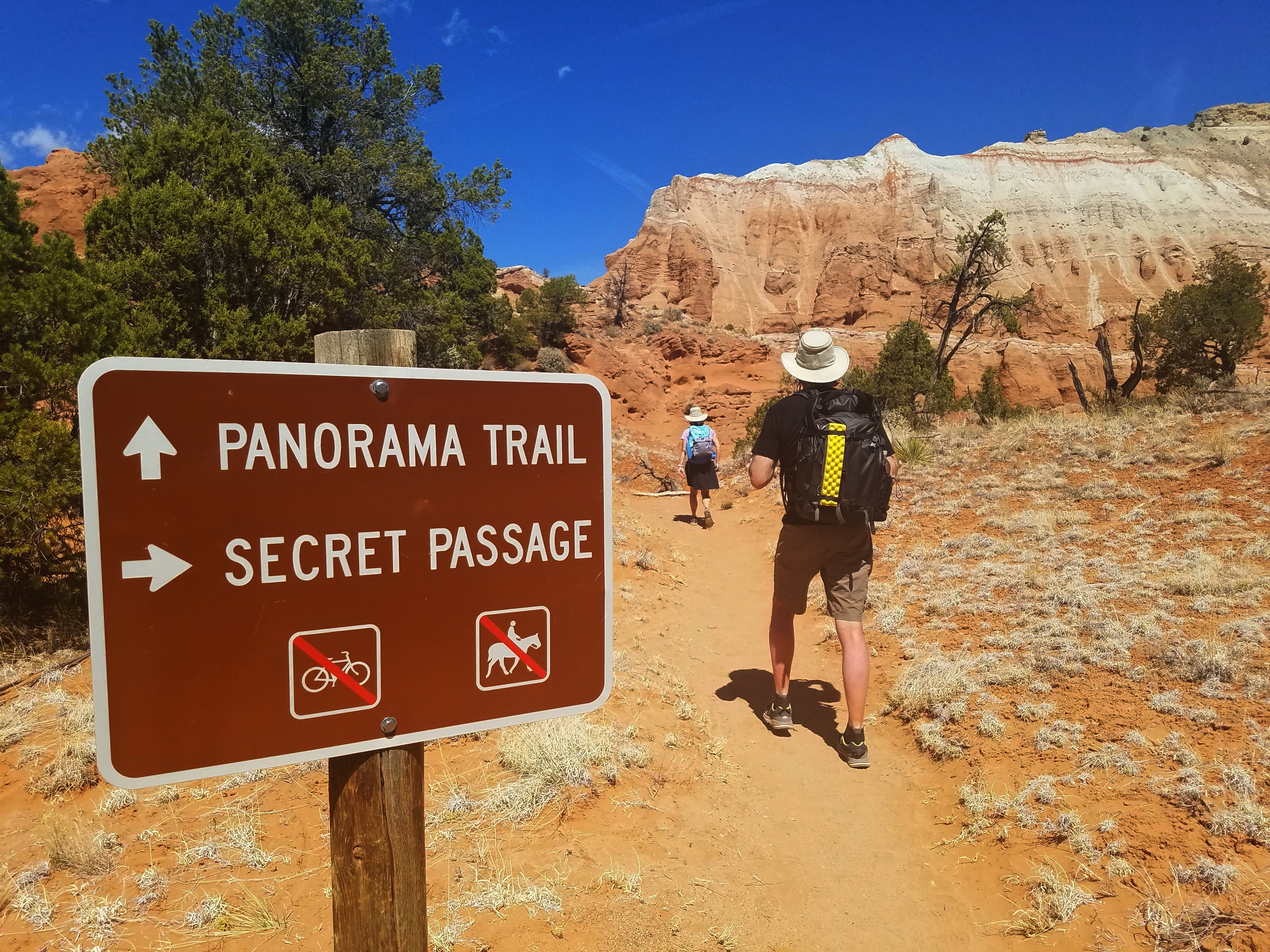
Note: The Fairyland Loop Trail starts on the rim of Fairyland Canyon. Hiking clockwise, it goes about 5.5 miles and intersects with the Rim Trail at Sunset Point, which continues another 2.5 miles to complete the loop. The entire hike is about 8 miles, longer if you add on the spur trail to Tower Bridge.

The tilted mesa in the center top of the photo is called the Sinking Ship

Cathy and Mike ahead of us

Boat Mesa dominates as the trail winds around and down

Every turn revealed a surreal landscape. It took us 5 hours to complete the loop as we gawked and exclaimed and turned around in circles to take it all in. For us flatlanders, going at a slow pace made the high elevation feel less taxing. [Starting elevation was 7,700 feet, down to 7,180 feet at Tower Bridge, up to the highest elevation (at Sunset Point) at 8,100 feet.]

What is a hoodoo? A tall, thin spire of soft rock protruding from the bottom of an arid drainage basin, usually topped by a cap of harder rock.

How does Mother Nature make a hoodoo? Weathering and erosion caused by ice and rain. Elevation in Bryce Canyon varies from 6,600 to 9,100 feet and gets above freezing temperatures and below freezing temperatures more than 170 nights during a year.

Boat Mesa from a different angle: head-on

Somewhere in the first couple of miles we met a group of women about my age, all smiles, on an annual group trip. One saw Jim’s VT hat and said GO HOKIES, demonstrating once again that Virginia Tech folks are everywhere.

Around the same time we passed a young man wearing only shorts and cowboy boots, carrying a very large wooden hiking stick. He had one prosthetic leg and his gait was awkward, but his face bore an expression of intense focus. I had the sense of a profound challenge being met. A young woman accompanied him, neither of them speaking as we passed going in the opposite direction. 

Boat Mesa

The trail descends into Campbell Canyon. At about 4 miles, we turned left onto a .2-mile spur trail to Tower Bridge [a bit of a stretch to imagine a resemblance to the iconic bridge in London, England, but, IMHO, so was Fred Flintstone yesterday at Kodachrome Basin]. 


Cathy and I found a patch of snow in the shadows of the canyon

Clouds were moving in as we returned to the Fairyland Loop Trail and began a significant (hard) climb back up to the canyon rim (nearly 1,000 feet elevation gain in 1.5 miles).  This required increasing our pace, breathing harder, and continuing to marvel at the unfolding scenery.

Yeah, we did that!

Break time near the intersection with the Rim Trail

The China Wall is another uh-MAZ-ing feature on the Fairyland Loop Trail that photos fail to capture. The name refers to its ridges that remind viewers of the Great Wall of China.
Notice snow in the crevices at the base of the hoodoos.

A window in the China Wall

As we passed the short spur trail to the North Campground on the canyon rim, we crossed paths again with the young man in cowboy boots, looking as though walking was now painful but no less determined to reach the goal he envisioned. I hope he was successful in whatever way was meaningful for him.

The Rim Trail was overflowing with people checking out Sunset Point, and we skirted through as quickly as we could. Still more than two miles to go from there as the Rim Trail passed along the top edge of the Pink Cliffs (remember we saw these from Panorama Point in Kodachrome Basin yesterday?

After the hike we entered the Park to check out the Visitor Center and store.  Staff members were doing their best to limit the number of patrons inside and enforce social distancing. I felt empathetic and appreciative of people whose jobs required them to work with the public during the uncertainties of the pandemic. Was I putting them at risk or helping them to maintain a paycheck? As I write this a year later, very few conclusions.


As I efficiently stamped my National Parks Passport and bought my souvenir patches, I wondered…
will my kids throw my patch collection away when I’m gone?

We headed back to our Airbnb, cleaned ourselves up, and drove further up Highway 14 to Duck Creek Village for dinner. There wasn’t much open at this time of year. I’d thought the Village would be a more sophisticated resort than it was but, nonetheless, Aunt Sue’s Chalet welcomed us as its only customers. They had red and white house wines and beer, including Polygamy Porter by Utah’s own Wasatch Brewery. “When you want more than one!”

The service was fantastic, of course, and the food was very good, especially the blueberry pie.

Jim’s hot roast beef sandwich supper

“Water, water, water....There is no shortage of water in the desert but exactly the right amount, a perfect ratio of water to rock, water to sand, insuring that wide, free, open, generous spacing among plants and animals, homes and towns and cities, which makes the arid West so different from any other part of the nation. There is no lack of water here unless you try to establish a city where no city should be.” ~Edward Abbey


Tuesday, April 19, 2022

Adventures In Utah: Escalante Petrified Forest State Park & Kodachrome Basin State Park

Adventures In Utah:
 Escalante Petrified Forest State Park & Kodachrome Basin State Park
 8.5 Miles – 4/12/21

This morning we packed up, waved goodbye to our Escalante house, and headed west on (you guessed it) Byway 12. We arrived at our first stop in about five minutes.

Escalante Petrified Forest State Park sits right by the road with no excuse for not checking out remnants of petrified wood that are hundreds of millions of years old – wow! The Visitor Center was closed for COVID-19, but we picked up a brochure and took a little one-mile warmup hike on the Petrified Forest Trail.

This little park packs a lot of good stuff into its 1,350 acres, including grand vistas and
 layered sandstone cliffs

Petrified tree stumps and limbs are scattered alongside the trail.

The park borders Wide Hollow Reservoir, water source for the town of Escalante. With a campground and water recreation opportunities, if you are the camping or RV type, this would be a fantastic place to base for exploring the many wonders along Byway 12.

Jim and I stayed on the one-mile loop while Cathy and Mike explored the Trail of Sleeping Rainbows. The Eagles View Trail (mountain biking) also passes through the park.

Part of a series of demonstrations of Jim’s amazing strength on our Utah trip

Teased by the unique features and views at Petrified Forest SP, we were excited to visit Kodachrome Basin State Park, known for its unique sandstone spires and features bearing quirky names.

From the park’s brochure: “Kodachrome Basin is a spectacle of towering sandstone chimneys, changing in color and shadow with the day’s mood – from red-tinged spires against a blue sky to soft evening light settling over the desert. This color and contrast prompted the National Geographic Society in 1949, with the consent of Kodak Film Corp., to name the park Kodachrome.”

Most of the park’s trails are short, but we had plenty of time to explore and we hiked the combination Panorama Trail & Big Bear Geyser Trail, what I call an “eyeglasses” hike, two loops linked by a trail in between. Our guidebook describes the hike as a 5.5-mile double loop, but we included some wandering on spur trails and the Secret Passage Loop, for a total of nearly 7 miles.

A great detailed hike report of this hike at Kodachrome Basin is here

Here we go!


The first feature you see along the Panorama Trail is the Fred Flintstone Spire. Once you know
the name, you can squint from different angles and find the resemblance.

A very short side loop leads to Old Indian Cave, an indentation or alcove in the red sandstone with odd markings as though someone dragged fingers through soft clay. I haven’t found a theory for what caused them, either humans or geology.

Orange-red Entrada sandstone has eroded away, leaving this solitary white sand pipe called the Ballerina Spire. It reaches 30 feet straight up like a ballerina’s leg with a very defined calf and pointed toe. It appears much taller as it stands alone against the backdrop of blue sky and white mountaintops.

The Hat Shop is a collection of hoodoo spires, some capped by sandstone slabs

The trail is generally well marked until you get on the Secret Passage Loop (I guess that’s part of what keeps it secret?) and we lost Jim near there. I kept going around the boulders and he missed a turn. (In his defense, it was unmarked and I had no idea he would turn left where he did, and footprints go in every direction on the sandy trails. I should have waited for him).

It was a little bit scary trying to determine where to find Jim. I spoke to another hiker who had seen him, so I stopped at a big intersection and waited until he came around, not smiling.

When the dust settled, we continued on the hike, turning right onto Big Bear Geyser Trail (the connector between the two loops) and walked along the base of the red rocks. We glimpsed side canyons along the way but stuck to the trail.


A dry wash


Another Ballerina Spire in the making?

At the end of the connector section, we turned to follow the loop counterclockwise to a short spur to Cool Cave, which is pretty cool! Also chilly. The opening at the top of this feature makes it resemble a slot canyon, with natural light emphasizing shades of orange and red.

Cathy at Cool Cave

We completed the Big Bear Geyser loop and retraced our steps on the connector back to the Panorama Loop. Mammoth Geyser loomed large in the distance and we took the side spur to check it out. Like Ballerina Spire, Mammoth Geyser is also a white sand pipe, the largest one in Kodachrome Basin SP.

The elevation gain during the nearly 7-mile hike was a mere 554 feet, and most of that effort was via switchbacks to reach Panorama Point. A moderate breeze whistled in my ears. The views are impossible to capture with a little phone camera, but I tried.

On the horizon, the Pink Cliffs of Bryce Canyon National Park

The Grey Cliffs

From Panorama Point we had a short walk along the valley floor to complete the loop and return to the parking lot. Today’s hike was great fun, continuing to build the anticipation of the “big parks” coming up.

Our next Airbnb stay was between towns (really small towns!) and the host advised us to visit the grocery store in Panguitch before check-in. We bid farewell (and hope to see you again) to Byway 12 and said howdy to Highway 89.

Utah didn’t have a mask mandate and it seemed that only tourists were wearing masks – not store employees or local folks. We stocked up for the coming four days/nights, food for breakfasts and lunches and a couple of suppers, and headed to our cozy cabin tucked up in the mountains near the junction of Highway 89 and Highway 14 (a convenient and surprisingly quiet and secluded location).

While Cathy prepared a spaghetti dinner, we looked a few days ahead to our plans in Zion National Park. Zion is a hard park to visit! Because of the pandemic and the configuration of the narrow canyon, timed reservations were required for shuttles within the park (a limited number of time slots as well as seats) and many trails were closed due to rockslides. We decided to skip hiking the Narrows due to the cool temps forecast.

But before we get to Zion NP…

Preview for tomorrow: Bryce Canyon National Park on Byway 12

“The desert wears… a veil of mystery. Motionless and silent it evokes in us an elusive hint of something unknown, unknowable, about to be revealed. Since the desert does not act it seems to be waiting — but waiting for what?”
 ~Edward Abbey