Friday, June 24, 2011

Pedaling the Piedmont

MST - Day 52 – 4-9-11 – Sam’s Stop & Shop, Hicone Road to Little River Presby Church – 41 Miles
Danny and I have made plans for hiking the Outer Banks section of the Mountains-To-Sea Trail and I felt a push to get the interim road miles completed.  Jim agreed to sacrifice another weekend for me on the back roads of the North Carolina piedmont (call it a birthday present – nothing better than the gift of time). 
I mapped out the miles between where Danny and I left off east of Greensboro and where we started the Falls Lake trails near Durham, about  70 miles.  Ian Fraher, a recent MST thru-hiker, took a slightly different route than outlined in Scot Ward’s book to include 8 miles of a recently designated route through Eno River State Park and West Point On the Eno Park in Durham, NC.  My crazy optimistic plan was to bike and then hike this in two days (again:  did not happen).
Driving a long distance and setting up a shuttle hike is nothing new.  It takes time and makes for hiking later into the day, but if it’s no more than a couple of hours of driving I prefer it to arriving the night before, setting up and then sleeping somewhere besides my own bed (i.e. a hotel room).  However, setting up a bike shuttle takes substantially longer because the end points are three times farther apart.  Nevertheless, because we are cheap so we drove two cars on Saturday morning to set up and bike 41 miles.  The weather forecast was threatening afternoon storms, adding to the urgency to get the ride done. 
Driving from Point B back to Point A, we followed our route on the lookout for convenience stores (i.e. fine dining for cyclists) and rest stops.  There were rolling hills, but I was confident after my 40-mile days near the coast (hint:  NOT the same). 
Our bikes took us through classic rural North Carolina dotted with small farms, country stores and buildings from times past, reminiscent of my childhood home in Brunswick County, Virginia. 
Storage for hay bales
A volunteer fire department building with awesome azaleas blooming out front
This barn painting demands stopping for a better look - check out their website
We took a short break at the Haw River Paddle Trail access at Altamahaw

Also in the community of Altamahaw sits this extraordinary brick building – the word “office” is part of the brick work.  It is currently owned by Glen Raven, a fabric technology company.
We passed a tiny white church with a tent set up in its gravel parking lot and what looked suspiciously like the beginnings of an outdoor pot luck meal.  We quickly turned around and went back to investigate.  Yes, it was a fundraiser fish fry (yay!) but they were not cooking yet (boo!).   We made a pact to stop there when we came back to retrieve our car.  

Lunch today was catered by Shak’s Gas, Grocery & Grill.  We parked our bikes and headed inside to see what was on the menu.  A mental picture:  Jim in his skinny black bike shorts, stylish colorful bike jersey, clackety-clack bike shoes, helmet still on his head, strolls into the joint.  As the bell tinkles over the door, five guys in full hunting camouflage turn to look at him.  I had to turn around and go back outside to compose myself.
From the looks of the long line, Shak’s is the hub of the community with the best (only?) food around.  We placed our order for a hot dog and a tuna sandwich and stood aside to wait.  A steady stream of people came to pick up take-out orders, and after 20 minutes I sweetly asked the gal behind the counter how our order was coming.  She looked me over with humorless eyes and said, “I’m workin’ on it.”  We waited another eternity before receiving our food.  Lesson learned:  don’t question Bertha when she’s making your lunch.
A utility building cleverly decorated with birdhouses
This place is probably a lot of fun when it’s open (not today)
Alas, today’s 40 miles were not as easy as our last outing and I struggled for the last 10 miles, stopping often to whine (which did not help at all).  But Little River Presbyterian Church finally came into view, and as we packed up the bikes inside the car (taking off the front wheels and securing the frames upright with bungee cords) we noticed the darkening sky.  We had been in the car no more than five minutes when giant raindrops plopped onto the windshield, and then the proverbial bottom fell out.  With crossed fingers we sped back to the fish fry, but by now the rain was washing across the road and the church tent was deserted.  No choice but to retrieve our first car and look for supper elsewhere before going to our hotel to rest up for tomorrow.
Though we travel the world over to find the beautiful, we must carry it with us or we find it not. ~ Ralph Waldo Emerson

Thursday, June 23, 2011

That's A Big Bridge

MST - Day 51 - 3-13-11 - Highway 55, Pleasant Hill AME Zion Church to Minnesott Ferry - 33 Miles
Despite a good workout yesterday, I spent a restless night worrying if we would get an early enough start for today’s ride.  Why so concerned?  Today takes us through the town of New Bern and across the Neuse River Bridge.  It’s a Sunday morning and we are hoping for the lightest possible traffic.  (Note:  We took very few photos today.)
The morning was pleasantly warm for March, surely good karma.  We started off west of New Bern on Highway 55 (four lanes) and made it about six miles into town before traffic increased.  The architecture of some of the old downtown buildings is amazing.  I wish we had had time for more photos – one of the few drawbacks of biking instead of walking.  It feels so good pedaling that you don't want to stop.
Craven County Courthouse
Tryon Palace is the big historic attraction for New Bern but we passed by too early in the morning to check it out.  Danny visited it when she passed through on her MST hike. 

Front Street was deserted, but still ahead was the Neuse River Bridge.  We drove across it yesterday and it seemed a little insane, but we determined it was doable.  Scot Ward’s directions are written for hikers to walk up the off-ramp, on the left-hand side facing traffic, but as cyclists we had to find and then follow the correct on-ramp.  (I pedaled like a demon up that ramp.)  Once we got onto the bridge there was no stopping, but our wishes for no cars and no wind were granted and it was actually a fun experience.  At the end our route deviated again from Scot’s directions for hikers – we simply got off at the exit and continued on Highway 55. 
We are going over that bridge!

Aerial view of the bridge – we approached from the middle left, across the short horizontal bridge, around the spaghetti loop and up over the wide bridge on the right
Highway 55 is nothing to write home about, a four-lane divided highway with a very wide shoulder.  I was glad not to walk those eight miles.  A highlight:  we stopped at an ABC store for a rest and snack break.
Turning onto SR 1005, we entered the countryside once again, passing swampy areas.  These are cypress knees but it’s hard to tell because of the reflections.
In this rural area on a Sunday morning there was so little traffic that we could relax and ride side by side, checking out homes and yards.  We saw abandoned houses peeking through overgrowth.  At one pasture a horse stood up and lazily walked over to the fence to greet us.  We passed several white churches, one in particular on SR 1005 at five minutes to 11:00 a.m. as people were going in.  Should we have stopped?  Hopefully they would have welcomed visitors, although perhaps not smelly ones in cycling clothes. 

Like I said, roadside cemeteries yield some interesting pieces of information.

We biked 33 miles in 3 hours and 10 minutes, ending at the north parking area for the Minnesott Ferry where we had left a car the previous night.  The key to a fabulous bike ride:  flat, flat and more flat road.
But our day was far from over.  We drove back into New Bern, strolled around the downtown historic area and had a lovely lunch al fresco, returned the rental car…and then began that long, long, long drive back home.  BUT I had completed 80 miles of the MST – not bad for a weekend’s work.

A bicycle does get you there and more.... And there is always the thin edge of danger to keep you alert and comfortably apprehensive.  Dogs become dogs again and snap at your raincoat. Potholes become personal.  And getting there is all the fun.  ~Bill Emerson

Wednesday, June 22, 2011

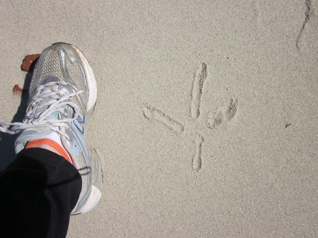
That's A Big Bird

MST - Day 50 - 3-11-11 – Newport River Parking Area to Monroe Gaskill Memorial Bridge – 38.6 miles


“It’s gotta be around here somewhere.” Using a not-very-detailed road map and Scot Ward’s MST book, Jim and I were searching for the start of today’s bike ride. Trouble was, I was following Scot’s directions in reverse (I am terrible at this) and searching for the southern terminus of the Neusiok Trail, a 22-mile trail through Croatan National Forest that I had not yet hiked. By the time I finished my mini-ride last night and we drove back towards New Bern, darkness had fallen and we couldn’t look for this starting point…so here we were early on Saturday morning. Jim drove as I peered out the window looking for Scot’s direction: “pass Alligator Tram Road on left (gravel road) no sign.” The “no sign” part had me a little concerned. How would I know…?

Up ahead on the right there’s a gravel road where a pickup truck is parked and people are standing around. Perhaps they would be helpful?

And that’s how we met Terry Smith and John Jaskolka, members of the Friends of the MST and trail builders/maintainers for this neck of the woods. As on most Saturdays, these “retired” guys were getting ready for a day of hard work on the trail. They gave us directions to our trailhead (I don’t know how else we would have found it) and Jim and I geared up for the day.

Today’s ride through the countryside called for watchful eyes and attention to details. After all, the point was not merely to cover the distance but to appreciate this part of North Carolina. Bridges span marshes and waterways and big birds are out there if you pay attention.  We crossed the Intracoastal Waterway.  

View from the bridge

Small roadside family cemeteries are worth a short but respectful visit. The Wilkinses are laid to rest here with their infant daughter.

Houses of worship abound, many with adjacent cemeteries. This one was unusual with its above ground graves, but I imagine they become more common as we get closer to the sea.

We stopped often today because of the variety of things to explore (and the key to my going the distance – resting a lot). We saw that we were not the first morning visitors at this “beach.”

These sweet ladies are mother and daughter, the proprietors of the Simpson farm stand and bakery. We got to enjoy a giant chocolate chip muffin just in time because the next day they were closing down for six weeks for mom’s knee replacement surgery.

Bikes taking a rest at the Finz Grill

An entrepreneur selling decorative gourds outside his home

My view for most of the day


At Davis Shore Provisions you can enjoy a cup of coffee and awesome homemade desserts (key lime pie is a must). If you want a cyclist style lunch, the Handy House convenience store across the road has hot dogs and chicken. The owners of Davis Shore Provisions let us eat lunch on their lawn, throw away our trash, and catch our breath before the last push.


I am still upright on the bike. Along this stretch we watched a great blue heron rise from the grasses and float for a long time above the water.

Bridge over Salters Creek


At the end of the ride I felt tired but my thighs were not aching – a good thing since I have tomorrow to go. This was a very enjoyable bike day, little traffic, breathtaking scenery and blue skies.

Somewhere over the rainbow, skies are blue, and the dreams that you dare to dream really do come true. ~ E. Y. Harburg

Monday, June 20, 2011

Biking Eastward

MST - Day 49 - 3-11-11 – Monroe Gaskill Memorial Bridge to Cedar Island Ferry – 9.3 miles
With my recent success (i.e. survival) with road biking I felt brave enough to tackle a multi-day trip.  Jim agreed to devote a weekend to my Mountains-To-Sea Trail project, so I chose to go as far away from home as possible to maximize his generosity.  New Bern, here we come! 
Ever-increasing gas prices made driving two cars from Charlotte a little hard to swallow, so we reserved a rental car at the New Bern airport.  The long, long, long drive from Charlotte was eased a bit by stopping for barbecue at Wilber’s in Goldsboro (excellent!).  We picked up the rental and headed towards the Cedar Island Ferry, following the route per Scot Ward’s book that we would bike tomorrow. 
Did I mention that it’s also a long, long, long way from New Bern to Cedar Island?  I wanted to bike the last ten miles to the end today in order to keep tomorrow under 40 miles (remember, just six days ago 28 miles was difficult).  But it was getting windy and colder, clouds were threatening and it was after 5 p.m.  We arrived at the Cedar Island Ferry and I was nervous and indecisive, ready to bail out and face the consequences with a long day tomorrow.  Then Jim suggested that rather than taking the time to get both bikes ready, he could drop me off to ride alone and he would shadow me for support.

I really didn’t want to do this, but Jim is a good coach and I trust him, so we went back to the Monroe Gaskill Memorial Bridge.  (That bridge was pretty intimidating.)  But there was almost no traffic and here we were, so off I went.

Still upright!
Jim drove a little ahead and parked to take photos of me coming down off the bridge.  I look like such a dork on the bike, but at least I was moving!  I was dressed right for the temperature and after the bridge everything was flat as a pancake and it was a fun ride.  The marshes in the late afternoon light were lovely and I realized that tomorrow we were in for a treat going through the wildlife refuge.


Again Jim drove on, meeting me at intervals to see if I was okay (yes, it was only 9 miles but it was nice to have the support).  I cruised through the little community of Cedar Island.  Such a sense of accomplishment to arrive at the ferry!  I felt so much more confident that tomorrow is doable.  Now all we needed was pizza and sleep.

The bicycle is a curious vehicle.  Its passenger is its engine.  ~John Howard

Sunday, June 19, 2011

East Or West, A Trail Is Best

MST – Day 48 - 3-8-11 - Hanging Rock State Park to Family Dollar Highway 8 – 8.6 miles
I wanted to clean up what was left over from Sunday’s outing.  My daughter Laura was home from Virginia Tech for spring break with not much to do so I enlisted her to be my shuttle driver.  (For Christmas she had given me a sweet “coupon” good for one day of hiking, so I cashed it in for helping me today.)  In addition to the road miles, there were a couple of trail miles from the Hanging Rock State Park visitor center where Danny and I ended almost a year ago to Hanging Rock Park Road that I needed to cover.  Only 8.6 miles all together, doing it alone meant doubling to 17.2, not viable since adding a four-hour round trip drive already made for a full day.  (Confession:  I mainly wanted to spend time with my baby girl.) 
I wanted to do the road miles first and save the trail for last.  Laura dropped me off with my bike at the entrance to HRSP and the road immediately started steeply uphill.  This first climb was very surprising – why was I breathing so hard?  This was going to be a rough six miles.  My mind ran over options:  call Laura, tell her to come get the bike, and start walking.  But each succeeding climb was a little less intense, and the one I had dreaded most, the 1.5 miles leading up to Highway 8, was quite gentle .  The song Dog Days Are Over” with its fast-then-slow-then-fast tune reverberated in my head all day.  I finished the ride in about 45 minutes, including time to stop for a couple of photos en route.
The courthouse in the charming little town of Danbury, NC
Laura met me at Family Dollar, we loaded up the bike, and then drove to the Hanging Rock VC where I changed into hiking clothes.  Even though the trail was less than 2 miles, I was fully outfitted, and I felt a swell of anticipation, a lightness in my spirit as my feet went from pavement to dirt.
From the visitor center parking lot, Indian Creek Trail runs concurrently with the MST and passes a lovely stonework shelter built by the CCC
A gentle downhill took me past Hidden Falls and then Window Falls. 
The trail follows Indian Creek most of the way to the park’s edge and Hanging Rock Park Road where Laura was waiting. 
The walk in the woods was wonderful, reminding me that this is truly what I love.  Road walking is better than sitting on the couch, road biking is tough and exhilerating, but hiking on a trail is just this side of heaven.

"Everybody needs beauty as well as bread, places to play in and pray in, where nature may heal and give strength to body and soul." ~ John Muir


Friday, June 17, 2011

We Be Bikin' Now, Honey

Day 47 – 3-5-11 - MST – Highway 8 Family Dollar to Lake Brandt Greenway – 27.5 miles

So my newest challenge on the Mountains-To-Sea Trail – road biking.  Both of my most loyal readers remember that my husband, Jim, is an avid cyclist and biked the length of the Blue Ridge Parkway a couple of years ago with me driving his support vehicle.  Jim also participates in bike challenge rides with charming names like Blue Ridge Brutal and Blood, Sweat & Gears.  More importantly, he knows how to fix a flat tire.  But most of all, Jim is extremely patient and a great cheerleader.

How much am I geared up for this new adventure?  My bike is a hybrid Fuji Crosstown 4.0 because I like to ride rails-to-trails and I want to stay versatile and ease into road biking.  The MST may be all I ever do on pavement.  Cars make me very nervous.  So I’m just wearing sneakers, no special bike shoes, but the padded black Spandex bike shorts are a must, as is a snazzy jersey with pockets across the back to hold all my stuff.  Helmet, fingerless gloves (to keep my hands from getting scraped when I fall) and my rain jacket and I’m ready to go. 
Our first leg was to close the distance from Hanging Rock State Park to the Lake Brandt Greenway in Greensboro, a little over 36 miles.  How hard can that be?  We did a few training rides in advance, up to about 20 miles, good enough, right?  Let’s just see how it goes… I know my legs are good for hiking – does that translate to biking?  It sure will be nice to cover three times the distance in one day.  We set a date for Sunday, March 6, and I began to get mentally psyched.
But biking in the rain is no good and suddenly Sunday’s forecast was all rain.  We decided to change to Saturday.  I had been building up my nerve and now I had one day less to get ready.  Now I was dreading it – 36 miles??
Saturday morning Jim and I headed out in two cars (because shuttling is still part of the MST section hiking mantra) and drove to Greensboro.  Jim had mapped out notes of the route to carry with us.  He was excited to be biking in the Belews Creek area because he worked on a big project at the power plant there during his career with Duke Energy.   We dropped off the end car quickly and followed the route backwards, making and correcting a few wrong turns.  The nearer we got to Hanging Rock SP, the bigger the hills grew and the more nervous I got about my ability to do the climbs.  The clock was ticking too.  Did we have enough time to do the 36 miles before late afternoon and darkness and/or rain fell?  We ultimately decided to cut the first five miles off and start from the Family Dollar on Highway 8.  If we finished with plenty of time, we would come back and pick up that five miles (surprise:  that did not happen).  
The skies were overcast and a little misty but it did not get any worse.  The temp was chilly enough that I never took off my rain jacket.  I followed my hubby’s rear end all day and he never worked up a sweat.  He looked like he was going so slow that he could hardly stay upright.  Me?  I was pedaling and panting for all I was worth.  There were plenty of rolling hills but I took the climbs slow in first gear on my little hybrid and…actually enjoyed myself.  The downhills were exhilarating.  Once I learned that every downhill has an uphill waiting, I let it go and flew down those mini-mountains. 
There was more traffic than I had ever ridden with but I got used to it.  We had to work to stay together so that cars could pass us easily at once rather than passing me and then catching up to and passing Jim.  Only once did I pull over because a car was afraid to pass and there was a line built up behind her.  I’m glad I have a rear view mirror on my left handlebar – it gives me a sense of security to see what’s coming up behind me.  I retained my habit of waving to cars, not quite as cool as the one-finger-salute that cyclists give to each other. 

Readers of my last post know my views of dogs on hiking trails.  Dogs encountered while walking or biking the roads are a different issue and Jim has schooled me to always be on the lookout for the seemingly docile mongrel that can leap to life and cover the distance between in a few seconds.  BUT…today we had no adrenaline encounters, only saw a few man’s-best-friends chained in their yards.  Some barked as if to dare us to come closer while others merely lifted an eyebrow before going back to sleep.

Hikers carry snacks and lunch and eat sitting beside babbling brooks, but cyclists are connoisseurs of roadside joints.  We ate lunch midway at BJ's, a fine establishment next to the Stokesdale post office.  

The rusty ice cream cone beacon is what sucked us in.   A hot dog and French Fries and soda, a good reward for hard work - I could get used to this as opposed to eating a homemade sandwich.

After lunch, though, my thighs were really burning and throbbing.  I expected that to continue until the end of the ride, but after a half hour or so my fuel must have kicked in because I recovered.  Make no mistake, though, this bike ride was hard and I needed to be in better shape and take training more seriously. 

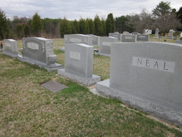
Roadside cemetery for lots of Neals
A patriotic roadside barn

Our last mile was on Highway 220, a major route into Greensboro, that in hindsight we probably should have walked.  A screaming 18-wheeler passed us with inches to spare – don’t want to do that too often.  But I learned the lesson of staying steady upright while praying hard. 
End of the ride – lots of details to take care of
Jim decided he is not a fan of car shuttling, so his reward was eating BBQ at Fuzzy’s in Madison, NC, out of our way, but he had a dim memory of it from his days at the Belews Creek plant.  Memory is usually better than real life, though, and I’d give the place a B-minus.  At least now I can say I’ve eaten at Fuzzy’s.  I have a feeling that with Jim helping me, there will be more BBQ joints in my future.
Aaaannnddd…we still had to drive two cars home.   

"Experience is what you get by not having it when you need it." Unknown


Leashes

MST – Day 46 – 2/12/11  - Greensboro - Church Street to Sam’s Stop & Shop, Hicone Road – 15.8 Miles

Danny and I had just 6.8 trail miles remaining as part of the Greensboro watershed system, not enough to call it a hike, so today’s effort included a little more than 8 miles of road walking.  Although this will not be my last hike on pavement, it cemented the fact that I don’t like it and will scheme to avoid it in the future. 

We followed the Osprey Trail and then the Townsend Trail along the southern edge of Lake Townsend, another sunny day but still quite cold.  Local residents were enjoying their trails, too, trail running and walking their beloved dogs.  Danny and I have discussed dogs in public spaces many times.  She has never lived with a pet, but my family had dogs when I was young (we lived in the country and they ran all over the place).  My kids had a cat (Nicholas) that was greatly mourned when he died.  Pets add a wonderful dimension of enrichment and love to human life.  But…

This is where I may lose friends.  Dogs in public places should be restrained because they are not human.  They disturb wildlife, can dart in front of walkers/runners and trip them, and can bite a human or another dog if they feel threatened.  I don’t care how well trained you think your darling is.  Several times I have seen Danny address dog owners who are not following the prevailing leash laws and I’ve questioned people myself a time or two.  In national parks they are not allowed at all and in other public places there is always a leash law posted.  On this particular day in Greensboro we saw a dozen dogs, only two of them on leashes.  One of them was a very large fellow pooping on the trail, after which his owner whistled and the dog followed…but the poop remained.  
At one point we met a jogger with his unleashed dog.  Actually we met the dog first when it zoomed past us going in the same direction.  As the owner passed by I asked if he had a leash for his dog.  He snarked, “No, do YOU have a leash?” and did not slow down.  I suspected that we might see him again on his return – and we did.  But this time he had his dog leashed and he stopped to apologize to us.  We had a very nice conversation, told him that we were visitors to the area and had noticed the culture of letting dogs go off leash and how off-putting it could be.  I very much appreciated him taking the time to talk with us and hopefully he keeps his dog leashed now.  But the culture of a place is hard to change with no enforcement of the rules – and what municipality has the money for dog patrol these days?  Humans will do whatever they can get away with and…dogs will be dogs.
Back to the hike: 

Greensboro trailhead signs are very detailed and helpful. 
An icy creek crossing
This homesite would have had a grand lake view
Trash or antique?
The eastern terminus of the Townsend Trail brought us to Southshore Road and the Jim Batten Soccer Complex.  From here the road walking carried us past the Bryan Park golf course, over the bridge across U.S. Highway 29 and on a zigzag route of side streets to Hicone Road.  Walking on pavement and/or the sloped grassy edge seems simple, but it is different than a woodsy trail and the leg muscles are used differently.  For a couple of days afterwards my calves ached.  Danny worked out plans with other folks to keep on walking the roads, a good choice for her, but I’m looking forward to two wheels.

Properly trained, a man can be dog's best friend. ~Corey Ford 
A dog is one of the remaining reasons why some people can be persuaded to go for a walk.  ~O.A. Battista