Smokies 900 Round 2: Barnes Cemetery, Cat Stairs & Greenbrier Pinnacle
3/20/21 - 13.3 Miles, 3539 feel elev. gain, 10.5 hours

For all those people who like longer evenings…I hate losing my early mornings. Daylight savings time was last Sunday, meaning that “rise and shine” is still oh-dark-thirty for hikers, especially looking at an arduous route and an uncertain time frame. Yes, Jeff and I are going up the Cat Stairs, but first we’ll stop by the Barnes homesite.
The Smokies (like many mountains in TN and NC) are crisscrossed with old roadbeds of long-ago pre-Park homesites and logging operations. No signage, no maintenance, and most see little foot traffic. (Like the Plemmons Cemetery, there is little or no “official” information with the National Park Service.) For the curious researcher, though, there is always a blog post somewhere to tell the story. While I dug up narratives about the Barnes family, Jeff found two GPS tracks for us to follow, made by two different hikers (we called them the “red” track and the “green” track).
Links for more reading about these places are at the end of this blog post.
From the beginning of Ramsey Cascades Road, we crossed the bridges and looked for an old roadbed curving innocuously into the woods on the left. There was no signage indicating where it goes, but the GPS tracks confirmed that this must be the place.
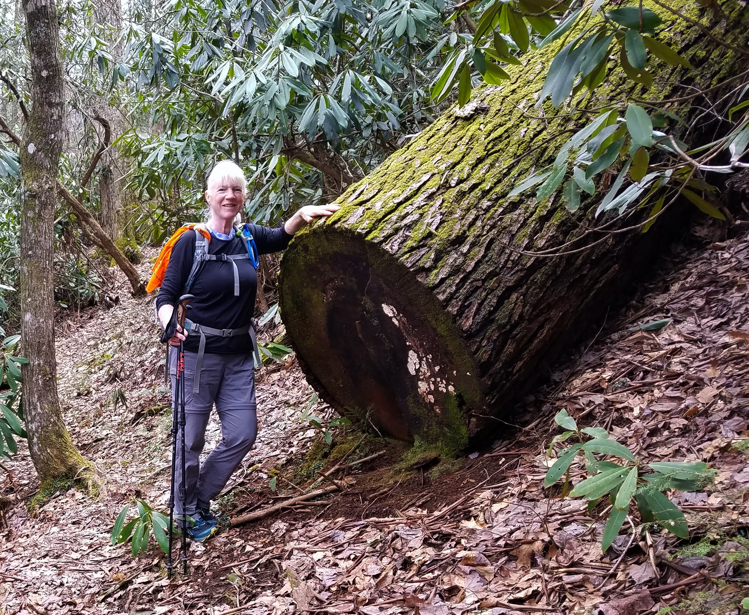
Rock walls defined the old roadway with a sense of permanence, running continuously for hundreds of yards. I admired the perseverance and determination that they represent, marveling that this is the way ordinary (extraordinary) people once lived in this rugged place.


Did I mention that the old road goes up the mountain? Of course it does. The temperature was quite cold and I started the day bundled up as though I would be spending the night (who knows?) but with the uphill effort I soon began removing layers.
The rock walls tapered away into the earth and the roadbed narrowed first to a distinct path, then a faint one. Still early spring with little new undergrowth, we relied on the red and green GPS tracks that ran mostly together (but sometimes not). Jeff is NOT a fan of following too closely, preferring to pick his way without stopping often to look at a screen. I was along for the ride and at his mercy, but I understood his method.
The path grew steeper, followed a creek bed that I think is Bird Branch, then the creek narrowed and we picked up another branch (Little Bird Branch?) Frequently the path would disappear and reappear, barely discernible.
After about two miles we arrived at the family homesite of John and Isabella Maples Barnes and the graves of three of their children.


Rosey Barnes Aug 18, 1915 – Sept 17, 1922
Delia Lenora Barnes Oct 25, 1897 – Dec 25, 1898
Julies Barnes Dec 25, 1899 – Feb 7, 1901
I could summarize what I’ve learned about this place, but instead I encourage you to read this beautifully written blog post about the hike to the homesite, some history of the Barnes family, the children, and thoughts on the heartbreaks of life in the mountains. Fair warning: you may find yourself going down a rabbit hole of old cemeteries and igniting a new obsession.
Go ahead and read it, you'll be glad you did. I’ll wait.
Wow.
At the chimney, we paused for something to eat and I tried to get myself mentally ready for what was coming (but I couldn’t really be ready, because if I had known what was coming I would not have done it). Jeff DID know what was coming, and he said later that he was really surprised that I wanted to do it.
Behind the chimney, we picked up a trail that crossed a tiny stream (probably used by the Barnes family) and both saw and heard a splashing, looked like a gurgling or bubbling. I had the irrational thought that it was a flopping fish, but it was a huge toad swimming in a circle in a tiny pool. He flipped over onto his back to show a lily-white underside, then onto his belly to show his mottled toady spots - and then he disappeared. A memorable moment in nature.
Both the red and green GPS tracks followed an old level roadbed, nearly disintegrated and melted off of the slope. Jeff pulled out a pair of garden snips and began to cut small low hanging branches and green briars. This amused me, and I came to appreciate the pruning detail because it slowed him down a bit and it did make the way easier for me.

Eventually we faced the base of Greenbrier Pinnacle. The “red” track turned sharply right and just climbed the ridiculously steep mountain, but we stayed on the “green” track as it curved around the slope to intersect the ridgeline and then began to climb – which was not as steep, but still pretty difficult. The visible trail disappeared and we had to sidehill with little to hold onto. The leaf litter was deep and I leaned into the mountain. Did not enjoy this part very much. It went on forever.
Since my nose is this close to the ground, I might as well take a photo of
rattlesnake plantain foliage on the mountainside.
But forever had only just begun. We at last reached the Cat Stairs – a boulder pile probably a million feet high, not a single rock face, but a series of boulder outcrops with cracks and patches of soil. At first it seemed impossible, until we got up close and could see, well, someone stepped up here, then here, then here, and so on. Jeff reminded me about three points of contact. I put my hiking poles into my daypack and here we go.
I now understood the name Cat Stairs. The only way to do this was to move on hands and feet (not hands and knees) and lean into the rock. Jeff went first and we both talked our way up. I did have thoughts that if one of us fell, it would be an unimaginable task for the other person to get out and get help. I don’t remember how I got through this part because I really wasn’t thinking beyond the next handhold and foot placement.
About halfway up, a few yards out onto a boulder for a view to Mt LeConte.
Jeff stepped out farther but I would not risk it (unusual for me).
The top of the Cat Stairs was not the end of our ascent of Greenbriar Pinnacle, though. There was more steep sidehilling and walking stooped over through rhododendron tunnels to get to flatter ground. THEN we had to find the old jeep road (aka old Greenbrier Pinnacle Trail) and follow it half a mile to the summit trail to the location of the Pinnacle fire tower – one of the main goals of most people doing this crazy-ass hike.
View from a safer angle: Mt LeConte wearing a dusting of snow
Fire lookout towers were once a vital part of forest management. Several remain in the Smokies but all were decommissioned and most were removed with the development of technology to detect fires.
(Note: Mt. Sterling serves a new purpose: Duke Energy installed a microgrid consisting of solar panels and batteries at the tower and removed power lines.)
In their heyday, the lookout towers were staffed seasonally by caretakers, some of whom lived locally. Somewhere I read a story about a caretaker at the Pinnacle tower whose family lived within sight of the tower. He and his wife would signal back and forth by hanging laundry in different colors on a clothesline. One color meant the baby hadn’t come yet, and another color indicated the baby’s birth. I may be misremembering (or making it up altogether) but it’s a charming story.
The four corners of the Pinnacle tower block remain
All that remains of the caretaker’s cabin is a pile of rocks
and the cistern that was inside the building.
We ate lunch by the tower block. So peaceful – if only we could get in a car and drive down.


I was relieved to have the Cat Stairs behind me, but Jeff’s goal was still ahead: the summit of Greenbrier Pinnacle. His research said that the summit was .7 miles further along the ridge (UP!) and that the bushwhack was “ugly”. And here we go again.
At first there was a discernible trail, but it deteriorated and this became the roughest part of the entire day. Jeff snipped away at branches and blackberry briars, since we would be hiking back the same way. Lots of rhododendron twigs hit the ground, lots of briars, and I began to bend and break off ends of branches at face level. The path was dangerous, covered with sticks and roots, and once I fell face flat – for a second I thought I was going to get a broken nose - but I didn’t suffer any harm.
S-l-o-w going. We had to stop every few yards and assess which way to go. The ridge was narrow, there were not many choices, and none of them good ones. Snip, snip, snip! Steep sidehilling again.
There was no open summit, of course, relying on Jeff’s GPS to tell him when we were at the highest inch of ground. Then he very unceremoniously said, “Looks like this is it,” and turned around to go back. I forgot to snap a photo at that moment, so did it a couple minutes later and called it good.

Pinnacle summit (?)
For the record, it took 1 hour 40 minutes to battle our way from the fire tower location to the summit of Greenbrier Pinnacle. It took 35 minutes to return because it was easier (though not easy!) to retrace our steps, finding snipped branches and leaves, and recognizing the way we had come.
Are.We.Done.Yet.
Well, the hard(est) part was done, but there were still miles to go to complete our adventure. We returned to the old jeep road (Old Greenbrier Pinnacle Trail, remember?) and started the three-mile hike down to the junction with Ramsey Cascades Trail.
For the first half mile or more the trail was steep and hard to discern, narrowly closed-in mountain laurel and numerous large blowdowns to navigate over and around. We reached a fantastic viewpoint, a rock ledge as wide as a double doorway, where someone had placed a log for a seat with a view. We could see the ridgeline that is both the NC/TN state line and the path of the AT through the Smokies. Jeff pointed out Woolly Tops.


The trail improved as it descended on long, long switchbacks. Occasionally there was a view if I stood on tippy-toes. Jeff kept up a steady stream of conversation, mostly him talking and me listening, and it kept me moving along without agonizing about the time getting late. We were looking at a 7:30pm finish.
At the Ramsey Cascades Trail, 3.5 miles of level walking awaited, a relief to my quads, although at this point I couldn’t really walk any faster. We finished the hike with a whimper and an elated sense of satisfaction. WE DID IT! AND I’LL NEVER DO IT AGAIN!
Middle Prong
For further reading, (not for hiking routes or mapping or recommendations), links to related blog posts are here, here, and here.
In case you missed it, the blog post about the Barnes homesite is here. “You cannot stay on the summit forever. You have to come down again…
One climbs and one sees; one descends and one can see no longer, but one has seen.
There is an art in conducting oneself…
In the memory of what one saw higher up.
When one can no longer see, one can at least
still know.”
~Rene Daumal