Showing posts with label Black Canyon of the Gunnison National Park. Show all posts

Wednesday, September 27, 2023

Colorado 2022: Black Canyon of the Gunnison National Park - North Rim

Colorado 2022: Black Canyon of the Gunnison National Park – North Rim
8/12/22 - 4 miles

Coffee and calm on the south patio as the sun rises

Jim and I felt conflicted: stay and enjoy this early morning serenity or get out and meet the day? Beating the heat on the North Rim prompted us to get moving.

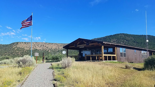
Yes, BLCA’s North Rim is remote, but don’t skip it – in my opinion, the most dramatic views of the Gunnison River are from the north side and getting there is a worthwhile experience. Pavement ended and gravel took over at the Park boundary as we approached the ranger station on Mesa Inclinado (great name, right?) 

[Note: There are no maintained or marked trails into the inner canyon. However, there are several unmarked scramble routes from the North Rim and a wilderness permit is required to go into the canyon. Be aware that what goes down must come back up! Read more here about this undertaking and please act responsibly.]

The temperature was 70 degrees, very comfortable, so before the heat took over we hiked the North Vista Trail from the ranger station to Exclamation Point, about 3 miles round trip, staying on top of the mesa. The trail continues to Green Mountain, 7 miles round trip.

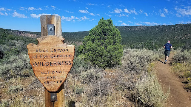
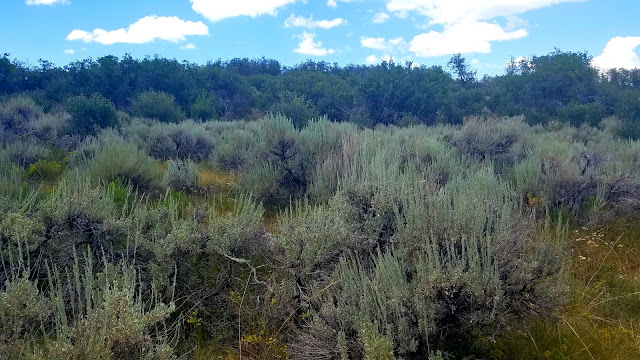
The trail passes through sagebrush, oak scrub, pinyon pine and juniper, with one good viewpoint to the South Rim where the Gunnison River makes its 90-degree elbow turn to the right. The canyon’s walls are so steep and close together that we couldn’t see down to the water.

Something has been a-scratchin’

So far we’re the first humans out this morning (rabbits were active but hard to photograph)

Exclamation Point (7,702 feet elevation)

This is directly across from the Painted Wall View where we stood yesterday. It’s difficult to get depth perception with the shadows of the morning sun.

Stillness, no breeze – wait, do you hear the susurration of water flowing 2,000 feet below? The power of nature. Breathe in, breathe out.

After backtracking to the trailhead, we drove to the North Rim Campground to walk the half-mile Chasm View Trail, which is directly across the canyon from the South Rim’s Chasm View Trail. Between these two “chasm views” is the narrowest point of the canyon at river level – 40 feet! That’s about the width of a city street in Manhattan, with skyscrapers on both sides.

A jaw-dropping vantage point of the turn in the river as it flows downstream
 past the Painted Wall

Painted Wall as seen from Chasm View North Rim

Have you made your plans to visit BLCA yet?

We made our way along the rest of the North Rim Road, stopping at all viewpoints including the Narrows, Balanced Rock, Big Island, Island Peaks & Kneeling Camel. [Some were less photogenic than others.]

Balanced Rock

Do you see the Kneeling Camel?

Getting a closer look

Island Peaks

Looking downstream again – the rim looks flat as a board

Jim and I left the North Rim satisfied that we had seen and done all we wanted, an unhurried day that was much needed. Bonus: as we were heading out of the Park, Jim saw a bobcat cross the road! I caught a glimpse of its tawny-colored hind end as it disappeared into the brush.

What to do next? A much-anticipated visit to Big B’s Delicious Orchards! Y’all know I love cider. Not only can pick your own apples and buy produce from the farm stand, you can sample flights of ciders made on the premises (or drink a whole lot of your favorite one), swing on the rope swings, and listen to live music. You could plan an entire vacation based around their concert schedule. 

A Porsche car rally made a pit stop at Big B’s

We were a little early for the music, but we chilled out with cider and sweet potato fries and people watched until I needed a nap.

We returned to our tower room, turned on the A/C and enjoyed a little siesta before cleaning up for a special dinner at nearby Mesa Winds Winery (arranged by our Airbnb host). We sat out on the veranda of this small farm-to-table restaurant and enjoyed small plates fresh from their gardens and, of course, wines from their vineyards. 

Friends, it doesn’t get any better than this

Oh, wait a minute...

“Write it on your heart that every day
 is the best day in the year.“
 ~Ralph Waldo Emerson


Thursday, September 21, 2023

Colorado 2022: Black Canyon of the Gunnison National Park - South Rim

Black Canyon of the Gunnison National Park: South Rim – 8/11/22 – 4.5 miles

Reluctantly Jim and I waved goodbye to Cortez, knowing we were leaving many stones unturned in the southwest corner of Colorado (including Four Corners…)

New adventures awaited 150 miles north: Black Canyon of the Gunnison National Park. Is it weird that I’d never heard of this park until a couple of years ago? BLCA was established as a national monument in 1933 but it took until 1999 to elevate it to national park status. Its geologic story is fascinating. Read here about “grow, blow and flow.”

We took the scenic route starting on Highway 145, a two-lane black top following alongside the Dolores River. The tiny town of Rico showed up at the right time for a coffee refill. Main Street (the only street?) looks like a movie set of Wild West storefronts. Fireweed Café & Mercantile has something for everyone, handmade jewelry and crafts, organic artisanal treats and a hot breakfast. We sat on the patio to enjoy this unexpected pleasure.

As we drove on through narrow mountain passes and wide open spaces, we couldn’t resist frequent stops to gawk at rows of high peaks. I didn’t record most of the names, but who can forget Lizard Head Peak (13,113 feet)?

And here we are!

The gorge formed by the Gunnison River is so deep and narrow that the near-vertical walls are darkened by shadows most of the day, thus the name Black Canyon. The bottom of the gorge is so inaccessible that no evidence of human occupation has been found. [There is evidence of Ute people occupying the canyon rims.] 

The South Rim features 12 overlooks and a few short hiking trails, but there are no maintained or marked trails into the inner canyon. However, there are several unmarked scramble routes and a wilderness permit is required to go into the canyon. Read more here about this undertaking and please act responsibly.

Jim and I decided to stick with the viewpoints along the rim. The first one, Tomichi Point, is where everyone jumps out of the car to gaze in amazement (and bathrooms!)

BLCA is a great park to explore with children and folks with limited mobility, with short walks to platform overlooks, sometimes right beside the road. Parking was never crowded. The South Rim Visitor Center was busy but not overwhelmed. Read more here and here about activities for a half-day visit or longer. 

We hiked the Rim Rock Trail from the VC to the campground, a balcony trail with closeup views into the deep, narrow canyon. Stretching our legs after a few hours in the car – yes, please.

I’ll tell you right now, the heat got to me, 90 degrees of intense direct sun. At the campground, I was ready to turn back to the VC, but Jim wanted to make it a loop via the Uplands Trail. This added a couple of miles to our hike (whine, whine) but it was a worthwhile variation through the grasslands and a total of about 3 miles.

South Rim Road winds for 7 miles from Tomichi Point to its ending at High Point. We took our time, stopping at just about every pullout: Pulpit Rock, Cross Fissures, Devil’s Lookout, Painted Wall View, Dragon Point and so on. The views are the same but different, slight variations in the rocks and the water. Near Painted Wall View, the Gunnison River makes a nearly 90-degree left turn. We saw teeny people on the North Rim across the canyon, which we’ll explore tomorrow. 

View from Pulpit Rock

Painted Wall

View from Dragon Point

As we left the South Rim, we took East Portal Road down to an access point for the river near the Gunnison River Diversion Dam. [This area is part of the Curecanti National Recreation Area, accessed via US 50 east of BCLA.. If you’re going, check it out. There are 11 campgrounds and a variety of hiking trails.]

The paved road is crazy steep with hairpin turns, closed in winter. I’m used to such roads on public lands, but I hung on to my seat as we descended.

On an unmarked but obvious trail beside the river, we passed a picnic area and some walk-in campsites. The only people we saw were fly fishing. I was thrilled to put my feet in the water.

When I planned this trip, there were no accommodations in Montrose, the closest town to the South Rim of BLCA, so we had a couple of hours of drive time still ahead of us to our Airbnb near the North Rim. After a few mishaps, lack of cell service, and one closed brewery (what, no celebrating today??) we stopped at a Wal-Mart to buy Subway sandwiches and supplies for the next couple of days.

I was nervous about what our place would be like (aren’t I always?) and it was quite a drive up to the top of a mesa miles from any town. The property was amazing, remote, just what we needed to exhale after another full day of adventures. The single level adobe house was situated at the end of a gravel road, opening up to an expansive view. 

The owner lives in the main house and our space was the “tower room” on top, a large space with windows on three sides accessible by an external staircase.

The owner’s attention to Southwest style decorative details and love of flowers brought surprises around every corner. We were offered free range of all the outdoor spaces and felt right at home. 

We slept that night with the windows open for cross breezes until it was chilly enough to crawl under the comforters. Ahhhh…

"The world is big and I want to have a good look
 at it before it gets dark."
~John Muir