Showing posts with label Black Mountains. Show all posts

Tuesday, January 2, 2024

Green Knob Trail: Black Mountain Campground to Green Knob Lookout Tower

Green Knob Trail: Black Mountain Campground to Green Knob Lookout Tower
1/30/23 – 6 miles

When my mother passed away at age 72, a wise friend told me there would be a time each year that she would be on my mind and it might not be when I would expect it. Truth: while Mother’s Day and her birthday bring a tinge of remembrance, it’s the anniversary of her passing that carries significance for me. It has become a tradition to take the last few days of January to retreat alone and reflect, look back and look forward.

This year I stayed in a cabin on the South Toe River in North Carolina, equipped with coffee, my journals, and my yoga mat. On my way to the cabin I took a walk in the mountains.

Green Knob Lookout Tower, 5 miles north of Mount Mitchell on the Blue Ridge Parkway in NC, was built in 1931 as a live-in tower. It was occupied until the late 1970’s, rehabbed in 1996, and restored in 2013.

On a clear day back in 2010 I hiked to Green Knob as part of Carolina Mountain Club’s Lookout Tower Challenge. The route I took then was a one-mile round trip accessed from the Blue Ridge Parkway. I didn’t see anyone that day and I walked on the tower’s catwalk (not accessible since the 2013 restoration).

Today I tackled the big climb to the tower from the South Toe Trailhead, where many trailheads converge at a large parking area at the entrance to Black Mountain Campground. The Mountain Mitchell Trail and the Mountains-To-Sea Trail pass through here. No restroom facilities, though.

Start out on Green Knob/River Loop/Mountains-to-Sea Trails running together. [Note: this section of the MST didn’t exist when Danny and I hiked it, we took the road for a couple of miles.]

Trail signage and blazes were better than I expected. Within the first half-mile the two trails turn off and the rest of the way was just the long haul following the white diamond blazes up Green Knob Trail. I referred to my GAIA app for distance but didn’t need it for navigation.

Not far from the trailhead I noticed a man off-trail in the woods to the left, carrying a blue tarp. He didn’t acknowledge seeing me, although he couldn’t have missed my orange shirt. Stay tuned.

Whew! As the trail follows Lost Cove Ridge, the grade is moderately steep, flat for 50 yards, then very steep – repeat, repeat, repeat. I love the winter forest, tangles of high bare branches making room to exist together and allowing views of neighboring slopes. Dead of winter, no flowers, gray sky, stillness, no breeze at all. That description sounds unappealing to some, but I find beauty in the winter woods, glimpses of birds, the pick-up-stix placement of fallen trees and upended root balls.

Who was here?

Twisted tree trunk

Duck!

I let my breathing dictate my pace, sometimes counting steps and then resting while I checked my position on GAIA. As I slowly plodded upward, I worried about how I would get back down those slopes without falling – a little bit of mud and a lot of wet leaves. My legs grew tired, emphasizing a lack of training.

Did I mention that I’m planning to hike the Centennial Trail in South Dakota in June? Training!

A little sprinkle almost gave me a reason to turn around – I don’t want to get drenched out here all alone – but it fizzled to nothing and I kept going, fighting the inclination to quit because it’s hard.  Isn’t that a life lesson that we are continually learning?

The ridge narrowed for the last push, tall trees gone, now scraggly mountain laurel, vegetation changed to galax leaves in profusion. 

There were more rocks, small boulders, a couple of places where I had to choose footholds carefully. The higher the trail rose, the slower I went. For those of you who calculate such things, this 3-mile hike gains about 1,000 feet in the first 2 miles, then 1,000 feet more in the final mile.

The Black Mountains

Close to the base of the lookout tower, a trail came in on the left. This is the unmarked trail from the Blue Ridge Parkway that I hiked up over a dozen years ago. Or was it just yesterday? 

Green Knob Lookout Tower (elevation 5,090 feet)

From the steps of the lookout tower, the Black Mountain Crest is shrouded in clouds
 as blue sky breaks out above

I ate my lunch sitting at the base of the tower with the intermittent sun on my back. The temperature today ranged from 45 to 55, paired with overcast skies, perfect hiking weather.

The hike back – is this the same route? Now that I was not looking at my footing and laboring for breath, I soaked in my surroundings and enjoyed the quiet stillness, the color of decaying wet leaves and lichen.

View from Lost Cove Overlook 

And…do I remember navigating this blowdown on the way up?

The return hike took 1.5 hours, side-hilling carefully on the precarious downhills with numerous “oopsies” when I’d slip a short ways. Feeling the decreasing range of motion of this aging body, I descended boulders carefully, sitting down and lowering myself rather than hyper-extending my knees. Of course some movements are more limited as I age, but that doesn’t limit my brain. I remind myself, “Just be more careful and you’ll get there.”

Near the trailhead again I saw the same man in the woods, and on the trail was a big pile of twigs tied into bundles. Around the bend, another fellow walked up and said hi, very friendly, hastily explaining that they were harvesting birch whips, which they have a permit to do every year to sell in bundles to florists. 

My personality of crossing things off lists, tallying miles, making “progress” and relishing a sense of accomplishment is a paradox to my feelings at the end of the hike: breathing the cold air, working my body, I felt both depleted and renewed, an indescribable feeling of connection and just being.

Retreat time.

“And into the forest I go,
 to lose my mind and find my soul.”
 ~John Muir


Monday, June 21, 2021

Mount Mitchell State Park: Maple Camp Bald Loop

Mount Mitchell State Park – Maple Camp Bald Loop – 7/17/20 – 8.3 miles


Browsing my shelf of hiking guidebooks for a training hike for my upcoming John Muir Trail adventure, Danny Bernstein's stellar Hiking North Carolina's Blue Ridge Mountains offered up a loop hike in Mount Mitchell State Park. I wanted something interesting, physically challenging, and within a reasonable distance from home. As Meatloaf famously sang, "Two out of three ain't bad."

Jim tagged along, good sport that he is, to help me with the six-hour roundtrip drive and for safety on the hike. The terrain in Mount Mitchell NP is no joke, and weather can change rapidly and more severely than in many places that I'm comfortable hiking solo. Plus I enjoy having him around.

We opted to tackle the loop going clockwise, in the opposite direction of Danny’s narrative, to hike on the ridgeline first and avoid two things: more people later in the day and exposure to possible afternoon thunderstorms.


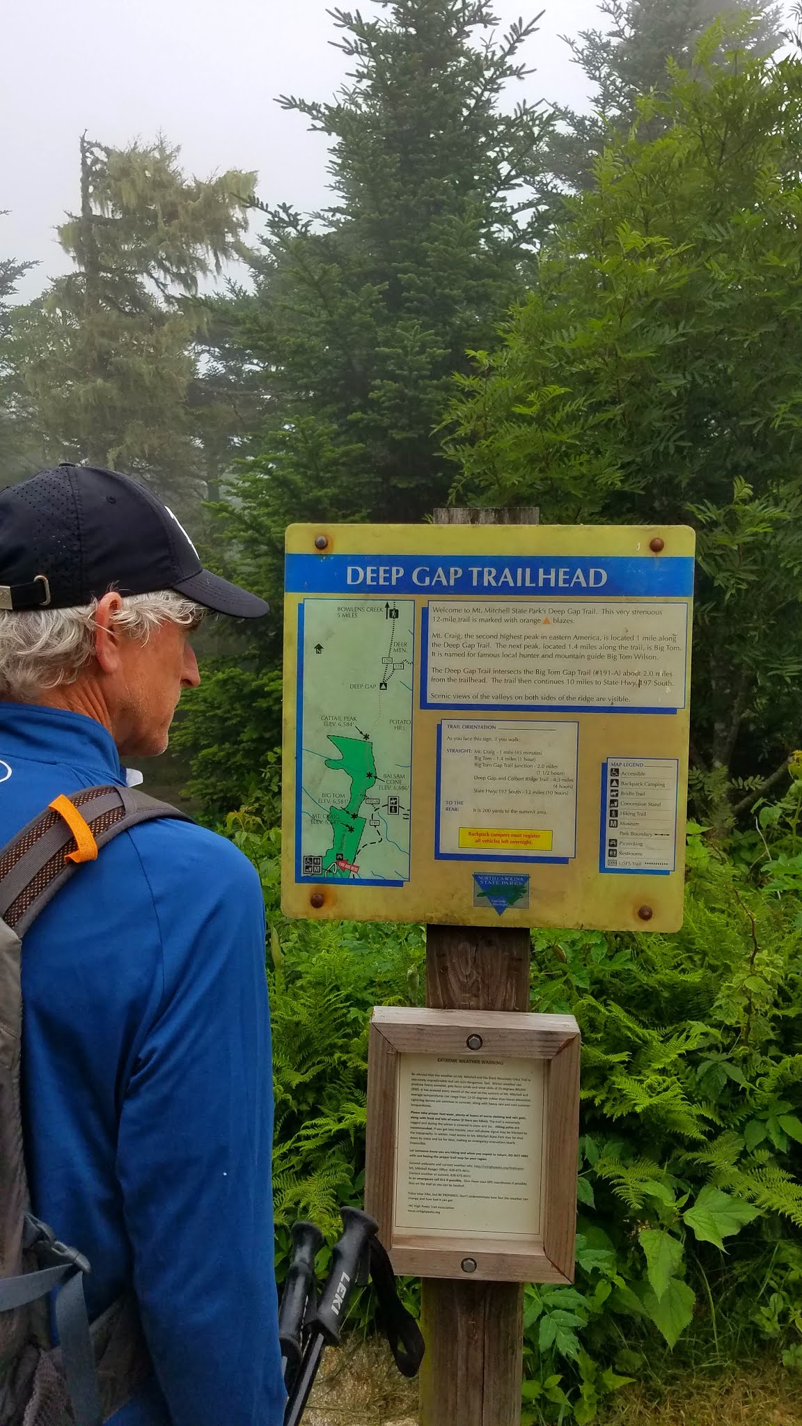
From the parking lot, Deep Gap Trail leads through the picnic area and into a Hansel and Gretel alpine forest, misty and cool, with secret moss-covered places for storybook creatures to hide. I’m sure we added an hour to this hike just by taking photos.

The view from the top of Mount Craig - 6,650 feet

Deep Gap Trail continues its ramble eastward along the ridgeline, an ever-so-slight downhill to the summit of Big Tom at 6,580 feet. These two peaks and several more 6,000 footers are lined up along the Black Mountain Crest. I’ve hiked them before as part of the South Beyond 6000 Challenge.


Michaux’s saxifrage growing in mossy spots

I remembered that the trail was rugged, yet I was still surprised by the big boulders and roots and intimidated by the ropes set in place for ascending and descending Big Tom’s slippery rock faces. 


Looking back up at what we just scrambled down

We turned right off of Deep Gap Trail, plunging steeply downhill on Big Tom Gap Trail (#191-A), which sees far less foot traffic. It was narrow, poorly marked, and alternated between piles of rocks and overgrown tall grass such that we couldn’t see our footing.  Jim was especially good at stepping into holes and yelping. This trail wasn’t long but it was ornery.

At the intersection with Buncombe Horse Trail we paused for a snack break, then turned left to follow Danny's directions to Maple Camp Bald. This trail was even less traveled, and since we were following the route in a different direction and weren’t checking mileage, it was challenging to determine when we had reached our destination. The vegetation was nearly chest high, which afforded the opportunity to enjoy the profusion of yellow flowers.

St. John’s Wort

Whorled loosestrife

Southern bush honeysuckle


Looking across the South Toe River valley towards the Blacks – are they on fire?
No, but those gathering clouds got our attention.


We arrived at a campsite with a nice view – could this be Maple Camp Bald? The “bald” is very broad and we couldn’t find a summit marker. We kept going for a bit, then turned back,
figuring we had done our best.

Buncombe Horse Trail was wide and very flat, rocky as to be expected, and required paying attention to navigate muddy spots. At this level of alpine elevation, the temperature was cool and comfortable (unlike our home in Charlotte, sweltering in the 90-plus degree heat).  Those dark clouds were concerning, and persistent thunder rumbled for the couple of hours we were on this trail, but they didn’t produce any wind or rain. (On our drive home we saw evidence of lots of rain in the valley.)

Galax

Surprise of the day – one purple fringed orchid

We stopped for a quick lunch at a campsite near the junction of the Buncombe Horse Trail and the Mountains-To-Sea Trail. With less than two miles to go, it was tempting to just keep pushing, but I’m glad we stopped to eat and rest. We had a big job ahead of us climbing up Mount Mitchell.

The MST runs concurrently with Mount Mitchell Trail and I’ve hiked this section several times, both up and down. It is seriously steep, unforgiving terrain, with encouraging (or discouraging) signposts of elevation progress (ex. 5900, 6250, etc.) It is a mental challenge as well as a physical one. The best advice I have is to go at your own pace. In total, the trail is about an 800-foot elevation gain in 1.6 miles, and Jim and I completed it in exactly one hour.

As we neared the parking area, we met the flow of people just getting onto the trails. It was a good decision to hike clockwise for more solitude. [We saw only five hikers on Deep Gap Trail and no one else until those folks near the end of the loop.] It was just good luck that thunderstorms never developed while we on the trail.

We stopped at a little brewery in the town of Marion to see if they were COVID-friendly (yes). Jim loves trying local beers and I’m happy that most places now offer ciders too. Mica Brewing had one of my favorites from Wisconsin on tap: Ciderboys Peach County! We toasted Danny’s contributions to the hiking world and another safe, magical day in the North Carolina mountains.

“The world is big and I want to have
a good look at it before it gets dark.”
~John Muir