Pisgah 400: Buck Spring, Barnett Branch, Black Mountain & Club Gap Trails
5/29/21 – 8.8 Miles
This hike brought to you by Green Day
Plugging away at the Pisgah 400 Challenge and now it’s getting complicated. Most of the trails I have left to tackle require a shuttle drop-off or a car at both ends of the hike. I’ve got a few sample routes in my back pocket in case anyone asks…like Jim, for instance.
Today we were both itching to do something outside. I pulled one of these “sample” plans up to see if it dovetailed with a Blue Ridge Parkway bike ride for him. My route began off of Highway 276 near the Parkway and ended on Forest Road 477 about a mile from the Cradle of Forestry. We can make this work.
First we located my exit trailhead on FR 477, to make sure it was there and that the walk was reasonable – half a mile to Hwy 276 and then about a quarter of a mile to the Cradle of Forestry – check!

Second, we scouted the Cradle of Forestry parking lot where Jim would leave the car and we would rendezvous – check! [We agreed on “what-ifs” and contingency plans, as always, since there is no cell service in this neck of the woods.]
Third, he drove me to my start trailhead on Hwy 276 – check! As I sauntered off into the green, he returned the car to the Cradle and started his bike ride up to the BRP and beyond.
Today I experimented with typing trip notes into an app on my phone throughout the day. Verdict: I have great details and an enhanced memory of the experience, but I didn’t like the time and attention it took away from being “in the moment.” I probably won’t make it a habit on the go, but I’ll try harder to make notes at the end of each hike day rather than a day/week/month/year later.
Starting out on Buck Spring Trail. The dirt was spongy from last night’s rain, vegetation was dripping wet, and my pants legs were quickly drenched. After arid Utah, it felt great to be immersed in Pisgah NF in all its green saturated glory!

Throughout the day I recognized the fading foliage of early spring ephemerals and some stars of late spring, including brook meadow rue, mountain laurel, robin’s plantain, trillium, white wood aster, bear corn, galax foliage, Clinton’s lily, and sweet shrub.
Stepping over the trickling beginning of Bearwallow Brook at a curve in the trail
Recent trail work cutting/defining the bank
Buck Spring Trail intersects my old friend, the Mountains-to-Sea Trail

I crossed several log bridges over small tributaries draining down the steep mountainside
to join South Fork Mills River
Tulip tree blossom
Brook meadow rue aka mountain meadow rue
Mountain laurel was abundant overhead throughout the day
My reunion with the MST lasted only a short minute before I turned right onto Barnett Branch Trail. This trail changes personalities many times in its 3.1 miles, starting with a steep descent on slippery wet ground. Steep plus wet means “take your time.”
Spiderwebs were thick on Barnett Branch, so I must have been the first person
passing through this morning. This is called “silk blazing.
I enjoy playing “how did that happen” nature forensics detective: see this splintered tree, for example. Was it wrenched apart by some weather event or did it simply succumb in its final rot stage? Must have made quite a racket when it took the fall.
Splinter fingers
From another angle
A hollow base – a bear condo?
Through the thick green foliage I caught a glimpse of a small free-flowing waterfall and cascades from one of the unnamed creeks I had crossed up on Buck Spring Trail. A series of short, steep switchbacks descend close by its edge, and at the bottom of the last switchback was another sweet cascade flowing down broad rock ledges.
The photo isn’t great, and the flow isn’t spectacular given the amount of rain in the preceding 48 hours, but a nice interlude nonetheless. Both of these cascades are unnamed as far as I can tell. They are easy to reach via Yellow Gap Road when it’s open. Driving in from Hwy 276, the Barnett Branch trailhead is on your left and the lower cascade is a few minutes’ walk.
A very nice campsite below the waterfall, easy for beginners with access from Yellow Gap Road, probably first-come-first-served. I was pleased to see that it was spotlessly clean.
Barnett Branch Trail crosses Yellow Gap Road where a riot of fern waving was taking place, followed by mud puddles and a mountain laurel tunnel.
Barnett Branch Trail cuts across Pink Beds Loop, meaning it intersects once, goes half a mile, then crosses again. It’s easy to get mixed up in the Pink Beds area. If you’re going, check the directional arrows on the signs or you may take a wrong turn.
Reminds me of the old saying, “When God closes a door, he opens a window,
but sometimes it’s hell in the hallway!”
There was a lot going on in that little half-mile through the Pink Beds.
Soon after I crossed the Loop the first time, I reached an unsigned intersection that triggered some head-scratching – Pisgah, you are up to your old tricks! My GAIA GPS told me to stay left…maybe the trail to the right is a shortcut for roadside campers.


A lone trillium, late to the spring party


Another campsite


At another unexpected junction, a Barnett Branch sign to the right
but nothing identifying the intersecting trails


The most informative sign in the Pink Beds


Cinnamon ferns
I crossed the Pink Beds Loop for the second (and last) time with more than half of Barnett Branch Trail still ahead of me, now a steady but gentle climb on a narrow path ascending Soapstone Ridge with a right turn to Black Mountain Trail. This was my favorite part of the day, solitude, no intersections, the trail weaving in and out of coves filled with green everything.
I ate lunch sitting on a big log, surrounded by green green green on all sides. Through the trees I spotted one spectacular mountain laurel on the hillside, smothered in signature pinkish white blooms. I was delighted to find that the trail passed right by it as I continued on my way up.
Bear corn
A fellow traveler: a red eft (Eastern newt)
The trail made a 90-degree hairpin type turn at a grassy flat spot, and I wondered
if camping is allowed everywhere? This would be a cushy spot.
But there was no water source and no signs of use here.
For the last two switchbacks, the trail’s character changed to on old road bed before reluctantly depositing me onto Black Mountain Trail. My solitude bubble disintegrated as I met two mountain bikers right there at the intersection.
For a short while I enjoyed the half-mile ridge walk to the summit of Rich Mountain, feeling the breeze and listening to birdsong (I heard birdsong all day long, a little unusual – the most active time of year?)
From the top of Rich Mountain, though, the trail slams downhill in what must be a mountain biker's dream, banked curves and rock cliffs and red dirt. All I could think was, “I hope I hear ‘em coming!” The vast majority of bikers are courteous trail rule followers, but there always seems to be one who is in his own zone…
I was happy to turn off of Black Mountain Trail onto Club Gap Trail for my final descent, sad to see that it was also a rutted and muddy mess (although shaded with gorgeous rhododendrons!) And still there were warriors pushing bikes up the very steep trail. It’s gotta be fun to put yourself through that.


A literal bright spot – shiny flakes of mica on the trail

I arrived at the Cradle of Forestry within our estimated time frame, grateful for bathrooms and hot water for cleanup. Jim arrived soon after me, a successful bike ride for him today, and we decided we deserved two celebratory stops on the way home.
Next we checked out
Iron Key Brewing Company in Columbus NC, new to us and perfectly timed for a beer and a meal on the laid back patio. Iron Key occupies a former jail where the original key is still needed to unlock the door. The restrooms are labeled Bonnie and Clyde. Five stars for atmosphere!
“It’s something unpredictable,
but in the end is right
I hope you had the time of your life.”
~Green Day, “Good Riddance”



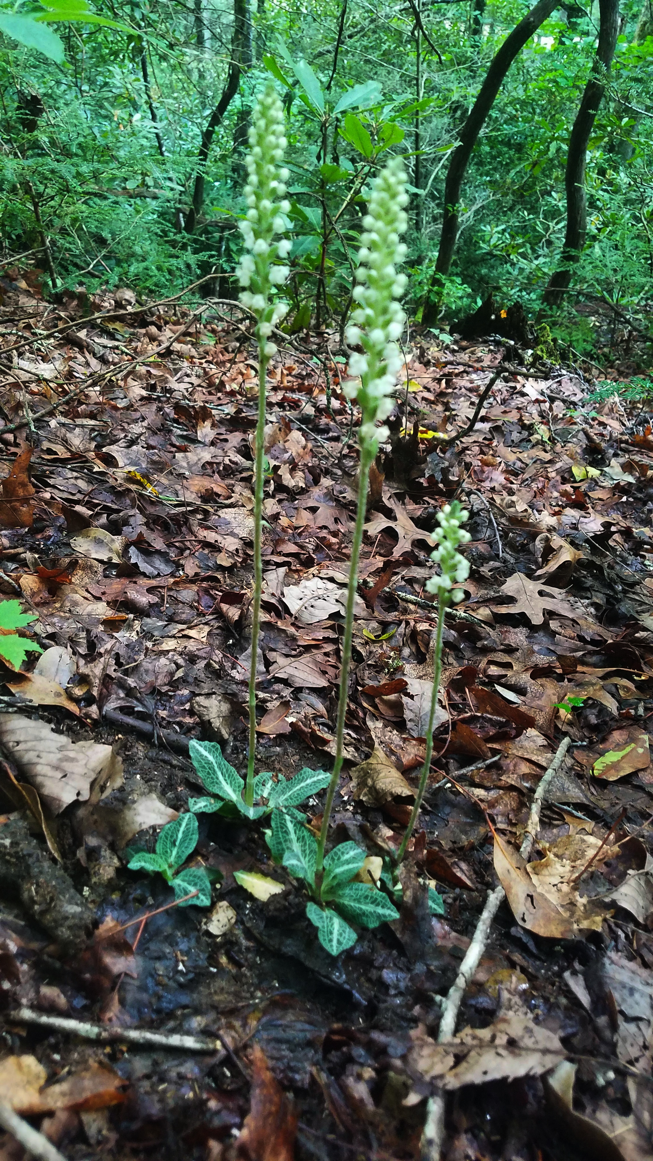


 At least there are pretty flowers


