
Smokies 900 Round 2: Noland Creek Trail Campsite 64 to Lake View Drive &
A Change of Plans - 6/5/21 – 14.2 Miles

Today’s plan on paper:
(1) hike the remaining 4.1 miles on Noland Creek Trail back to the car
(2) dump trash and anything we haven’t needed
(3) move the car to Tunnel to Nowhere parking at Lakeshore Trail
(4) add food for our second overnight hike out-and-back on Lakeshore/Bear Creek Trails
(5) get going!
We got up at first light, packed, ate monster donuts that Carol had carefully carried all day yesterday. The rest of Noland Creek Trail was a very gentle descent on a wide roadbed, enjoying the sounds of rushing water as we walked.


I continued to mull over any possible variation on the plan for the overnight trip ahead of us but couldn’t come up with an easier version in our time frame that included Bear Creek Trail. It’s a very remote trail, 6 miles long (12 RT), and a dayhike from the Tunnel that includes it is a minimum 18.5-mile round trip. Add the 4.1 miles we’re hiking on Noland Creek Trail back to the car and that’s…too many miles.

The parking lot was filled with horse trailers unloading and preparing for trail riding. Maybe hitch a ride? (Just kidding.)
I spontaneously said to Carol, “You know, we don’t have to do this!” I truly had not been thinking along those lines, but we were at a decision point. We were both dreading the fully loaded haul halfway up Bear Creek Trail to Campsite 75 (Poplar Flats) and more miles after that. If our biggest goal of the trip was to test gear, well, we had already done that.
Just go home? Nope. Our secondary goal, covering some new miles of the Smokies 900 map, was still in play. Options: dayhike most of our plan, leaving out Bear Creek Trail? Camp somewhere and do another dayhike tomorrow? Finding a campsite on a Saturday night would be hard, and there was nowhere else in the Deep Creek area that we wanted to hike – we’ve actually done it all.
Ultimately we crafted a respectable 10-mile dayhike route combining trail sections that Carol needed to cover and ones that I needed, with a side trip to Woody Cemetery for good measure.
New plan: Loop hike of Tunnel Bypass/Lakeshore Trail/Forney Creek Trail/Whiteoak Branch Trail/Lakeshore Trail through Tunnel back to Carol’s car.
Even with very light packs, the uphills took some effort after our big day yesterday. I was glad we had chosen this option.

Carol spotted another black bear rear end in retreat.

Tunnel Bypass intersects Lakeshore Trail, where we turned left and dropped into the groove of the wide, deeply worn path. Mountain laurel arched overhead and sprinkled petals at our feet.

We passed Whiteoak Branch Trail, then crossed Gray Wolf Creek on a footbridge and looked for an unnamed trail on the right that leads to the Woody Cemetery. An extended picnic table sits in a clearing, welcoming family members and visitors to the cemetery on Decoration Day.

Cemeteries are usually located on high ground near a homesite or community. Woody Cemetery is a steep third of a mile beyond the clearing. As we approached, a doe watched us from the edge of the woods.

Most of the site seems stark, red dirt that at first appears barren until you understand that the woods have not overtaken it because of human caretaking. Artificial flowers have been placed on some graves.
There are rows of stone markers of differing sizes, some rough fieldstones and some newer granite ones placed long after the families left their homes when the park was formed. In all, about 65 loved ones rest on this hillside.

Eight markers say simply “Infant Freeman,” which brought tears at the realization of what that family endured. I try to be mindful that these places are not tourist attractions; they are sacred and special to the families who lived and worked here and to their descendants.

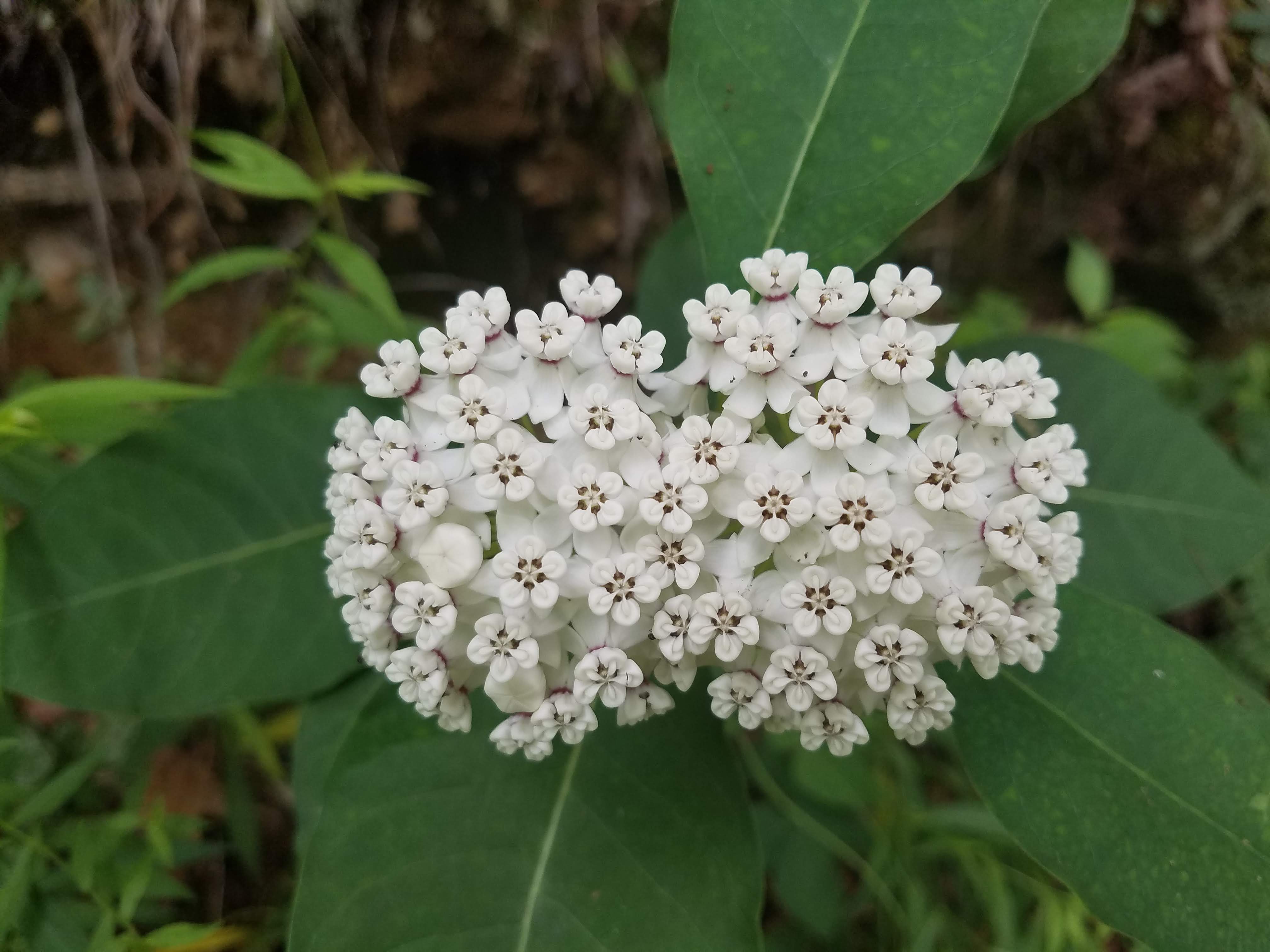 A beautiful redring milkweed
Carol and I returned to the Lakeshore Trail and continued to Campsite 74 (Lower Forney) at the intersection with Bear Creek Trail. The site is very large, with several campfire rings and sets of bear cables, a great basecamp for the area. Forney Creek flows swiftly along one side. Tents were set up and several backpacks were hung on cables but no people were around. We took a lunch break here.

We ate half the can right there on the spot.

After lunch, we hiked on Bear Creek Trail for .4 miles to the intersection with Forney Creek Trail. This is also the point where Bear Creek joins Forney Creek and the flow widens and continues past Campsite 74 on its way to Fontana Lake. We cheerfully said goodbye to Bear Creek Trail (we’ll be back!) and turned right onto Forney Creek Trail.
One mile up Forney Creek Trail, a right turn onto Whiteoak Branch, which is a short little trail that connects back to Lakeshore Trail. At that point we turned left and followed the Lakeshore two miles to its trailhead at the Tunnel.


If you haven’t walked through the Tunnel, it is a worthwhile unique experience. I’ve done it a dozen times – it never fails to give me chills. Alone? With a friend? Go for the darkness or use a flashlight? [Hint: a flashlight helps to see and appreciate the artwork.]

 Safe on the other side
Another Smokies backpacking trip in the books. I’m sure Carol would have gone all in for the second overnight, and I shortchanged our endurance training, but overall the trip accomplished our gear testing goals. I’m still nervous about this Tahoe Rim Trail thru-hike business…

“You need special shoes for hiking -
and a bit of a special soul as well.”
~Terri Guillemets
No comments:
Post a Comment