
Wolf Creek Falls/Upper Sols Creek Falls/Rhapsodie Falls/Lower Rhapsodie Falls/
Dismal Falls/Aunt Sallys Falls – 6 miles - 2/27/21

[Note: Directions to trailheads for all the waterfalls we visited today are from Kevin Adams’ book North Carolina Waterfalls, Third Edition, and are updated instructions from previous editions.]
Wolf Creek Falls Hike – 1 mile round trip
From the junction of NC 281 and US 64, Jim and I drove north on NC 281 for 12.7 miles, crossing Wolf Creek Lake Dam (the falls are downstream from the lake). About half a mile after the dam, we found a pull-off on the left, heeding instructions not to park at the nearby church. There were no other cars around and we didn’t see or hear anyone at the falls during our hike.
After reading some blog posts describing steep descents with ropes and slipping on rocks while crossing the creek above the falls, and photos of people sitting in a pool within arm’s reach of the big drop, I opted to follow Adams’ more moderate route to a different viewpoint. Even so, it was an adventure following the faint path, a brief scramble descent, and a precarious-enough-for-me viewpoint – but no threat of swinging from ropes or breaking bones. (That would come later in the day.)


Upper Sols Creek Falls Hike – 1 mile round trip
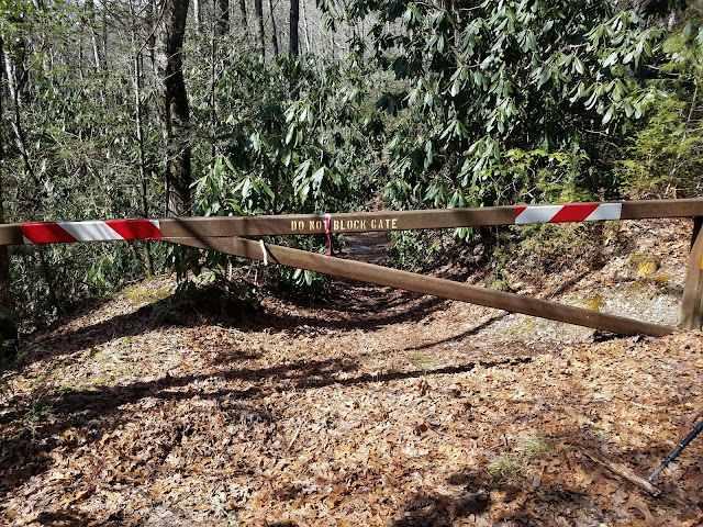
We drove 4 miles further north on NC 281. Paying attention to Adams’ new directions in the Third Edition, we knew there was no access to the driveway on the west side of the Sols Creek.
Finding the right-hand pull-off just before crossing Sols Creek wasn’t easy because you don’t see it (the creek goes under the road via concrete pipes). We used our GPS to zero in. As for the parking, it’s really only space for a car or two “between the private drive and the guardrail.”
 Maybe there’s a trail down there
Descending to the creek, the trail follows an old roadbed that was the original NC 281. Within a few hundred feet, we reached the remains of a long-gone bridge and our first wading opportunity. The water was swift, cold, and deep.

There wasn’t much elevation change on this hike and sporadic flagging tape helped keep us on course. (Although you know not to count on flagging tape, right?) The challenge was the cold water, wading several times on the way to the falls and repeating on the way back.


Along one stretch, the narrow trail hugged the creek bank so tightly that I felt off balance.
It’s hard to see here, but the surface is about 8 feet below. One slip and we’re in the creek
with a broken something.

This spectacular waterfall was gorgeous, all to ourselves. Even though we were wet and chilled, we retreated to a flat rock and sat down for a snack and listened to the water’s powerful roar. This was my favorite moment and our only rest break all day.

Now, Jim and I could have (should have?) called it a good day and gone back to our Airbnb for hot showers, clean clothes, and a nice dinner. But since we were already out here…
Lower Rhapsodie Falls/Rhapsodie Falls/Dismal Falls/Aunt Sallys Falls – 4 Miles Round Trip
We backtracked south about 10 miles on NC 281 and turned right onto Winding Gap Road. Our next four waterfalls were all accessed from the same parking area described in Adams’ book. (In fact, Adams devotes nearly a page-and-a-half to his writeup of Dismal Falls, what to do and what not to do, turn by turn.) Rather than making a beeline straight for Dismal Falls (the farthest), Jim and I checked out Lower Rhapsodie and Rhapsodie Falls on the way out and then…but I get ahead of myself.
As I wrote this, I found myself making numerous side notes, so let's put them together:
There are no signposts for any of these waterfalls. Wayfinding skills are necessary for this hike… and we still got a little confused. This is not for novice hikers.
This 4-mile hike took us 3.5 hours.
Here is a very good blog post about this hike, including photos in summer with leaves on the trees. The writer emphasizes the same difficulties that we encountered at Dismal Falls, so you know I’m not exaggerating!
I’ve been working from the Waterfalls 100 list dated 2011 and didn’t realize that the list was revised in November 2019. Shame on me for not keeping current. Dismal Falls is no longer on the Waterfalls 100 Challenge list but it is definitely on my list of accomplishments!
The trail started out reasonably enough on an old forest road, crossing several small branches. At about 1.3 miles we rock hopped across West Branch and the climbing fest began. We heard Lower Rhapsodie Falls on our right and walked a short distance to its base.

Back to the main “trail” that was barely discernible, the grade grew steeper and a bit muddy with precarious footing. We continued through an area of large boulders, staying to the right. This would get us into some trouble on the return.


a delicate beauty 70 feet tall.

Back on the main trail again, we were 1.5 miles in with just half a mile to go – how hard can it be? “Well,” said Dismal Falls, “Hold my beer.”
Our GAIA GPS helped us keep on track as we climbed over a shoulder to a fork in the trail. Although unsigned, we knew that the left trail headed downward to Lower Dismal Falls and the right trail headed straight up the ridge in the direction of Dismal Falls. Jim and I started out stair stepping, then sidehilling, then tippy toeing a quarter mile up a ridiculously steep grade.
Are we there yet? No, we are not. What goes up must then go down. Adams’ description says, “then descend for over .1 mile on an even steeper grade to the base of the falls. This section is as steep as you can get on a trail. If it were any steeper, you’d be climbing up and down a tree.”
Hmmmm…
On this day, we found that some thoughtful folks had set up a series of ropes down to the water’s edge. Were they safe? Would they break? See any dead bodies down there? We took a few minutes to discuss trying to get to the bottom, then we did it, but we questioned our sanity with each step. How do people convince themselves to do such risky things? I guess we think, “This step is the hardest one and the next one will be easier,” over and over and over.


Dismal Falls – 125 feet from the top of the free fall to where we’re standing

At the top of the ropes course, we tackled the crazy steep descent back to the fork. We weren’t too particular about staying on the trail as we made our own switchbacks down.
Not out of the woods yet – haha! Remember the big rocks that we should have gone around on the left side? We inadvertently went straight and cliffed out on top of the rocks, had to backtrack and work our way around. I attribute some of this confusion to the winter forest making the trail harder to discern. Yeah, that’s it, blame it on wintertime.
Tired and triumphant, on the return hike we took the short side trail to a sweet little old lady waterfall.


Sapphire National golf course as the sun sank behind the mountains. Cheers!

“Just let go – and fall like a little waterfall.”
~Bob Ross
No comments:
Post a Comment