AT in GA: Consolation Hiking During A Pandemic – Unicoi Gap to Deep Gap Shelter
7/24/20 – 13.1 Miles
Carol and I have been planning a section hike on the John Muir Trail for 7+ months and I’ve been nervous every day since we got the permits. Nearly 115 miles on the southwestern half of the trail ending at Mount Whitney, the highest elevations and the most remote miles with very little resupply (only once on Day 8) - what’s not to be afraid of? But we’ve been planning and plotting and negotiating with each other to the nth degree.
Then COVID-19 came. Well, surely it will be over by then? Hmmm…can we do it safely? Flying with layovers, shuttle buses, hotel rooms before we even see the trail. We could wear masks and cross our fingers! In the end, we realized we could plan for most anything except for contracting the virus en route and getting sick on the trail. With few bailout points, that was too much risk for us.
So with regret and relief, we pulled the plug. When we saw news reports of the terrible wildfires, our hearts ached for the hikers who had to be evacuated from the trail and those who never got started.
We already had a training backpacking trip planned, and we decided that the risks of a weekend outside close to home were reasonable - so here we go! Carol is an AT thru-hiker (2015) and I have hiked it from North Georgia through Virginia. Time to get after finishing the AT in GA.
7/23/20 – Thursday
Carol and I met at Dick’s Creek Gap. We had two cars to set up our own shuttle for an overnight hike from Unicoi Gap to Blue Ridge Gap. Now, Blue Ridge Gap is not as accessible as it looks on paper. I heard advice that the road where the trail crosses the gap (Charlie’s Creek Road) is for 4WD and ATV’s, not little ol’ cars like mine. Still, it’s possible to park a car within a mile of the trail crossing. So we did.
Following Upper Hightower Road to Charlie’s Creek Road where it turns to gravel, we left my car at a small pull-off, hoping it was the one we had info about (plus my vague memory of being here previously when I hiked the AT southbound from NC to Blue Ridge Gap.) We walked up the road a bit to confirm that it was indeed terrible, very deeply rutted, truly only for crazy thrill-seekers. [I’m including these boring details in case it helps someone else planning a hike here.]
After transferring all my gear to Carol's car, we headed to Andrews Cove Campground near Helen, GA. It’s a teeny little spot, part of the U.S. Forest Service, close to the road so a little noisy, nicely spaced wooded sites, first come first served. (FYI, a two-mile trail from the campground leads up to the AT, but not at the point we needed to be.) We settled in for a good night’s sleep before we hit the trail in the morning.
7/24/20 – Friday
We took care packing for the overnight, editing out clothes and food up to the last minute to be as light as possible (do I need that shirt and those Clif bars?) We had no rain during the night, a dry tent and a dry footprint (rare!) but the forecast said we probably will have rain sometime in the next two days.
We parked Carol’s car at Unicoi Gap trailhead, where I realized I didn’t have my usual paper copy of the AWOL guidebook pages for the hike. Those pages are like a talisman in my pocket, a vital part of my mental process to know the elevation ups and downs of the trail. I took photos of the pages from Carol’s book and we stepped onto the trail about 8:30 a.m. Our destination at Deep Gap Shelter was 13 miles away.
Up, up, 1,100 feet up in the first 1.4 miles to the top of Rocky Mountain, and we’re in a good mood because it’s the beginning of our adventure.
Then we plunged 900 feet right back down to Indian Grave Gap at a forest road crossing. This is the intersection where blue-blazed Andrews Cove Trail descends to our campsite last night. We had a bathroom break, a quick snack, and a check of our good attitude (still there) before tackling the bigger climb up Tray Mountain.
It was a flower kind of day. We saw Turk’s cap lily, rattlesnake plantain, White Bergamot-Basil bee balm (looks like red bee balm only white), false foxglove (yellow), Solomon’s Seal fruit, St. John’s wort, yellow star grass, coreopsis, Black-eyed Susan, foamflower, starry campion, ghost pipe, wild hydrangea, summer-sweet or mountain sweet pepperbush, wingstem, mountain mint and black cohosh. A few photos:
What the heck is the cheese factory site? Well, it’s a big camping area part way up Tray Mountain with room for lots of tents and a spring nearby. There was a dairy located there from the 1800’s, but nothing remains today except the fun name. Carol and I considered hiking up to this site last night but opted for car camping instead.
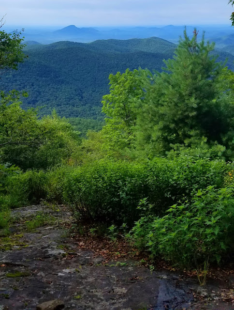
Tray Gap provided a brief level respite on the way up Tray Mountain. The elevation gain from Indian Grave Gap to the summit of Tray Mountain is 1,100 feet over three miles, so not as steep as the push up Rocky Mountain, but it took some oomph out of us. The air was hot and humid, sweating until we were drenched. We ate lunch on the summit’s narrow, rocky outcrop as the valley filled in with clouds that quickly passed.
The next five miles were short ups and downs that got harder and harder – carrying 28 pounds is just not something you run out and do. Gaps are noted on the AWOL pages but some were signed, some were not, so there was guesswork about where we were. Did we pass Steeltrap Gap yet? What about Young Lick Knob, wouldn’t want to miss that. Thunder began rumbling in the distance.
Somewhere in there (Sassafrass Gap?) I was leading when Carol yelled. As I turned around, she pointed at a snake, a black-colored snake, but not a “black snake.” Now, all day long I’d been scanning for snakes in the thick vegetation at the trail’s edges, yet I walked right past this guy maybe a foot away. This magnificent creature was not long and thin like a black snake, but thick and velvety black like an Elvis painting, with dark brown and wispy thin white markings. It was neither tightly coiled nor stretched out its full length, but it was very, very still.
So let’s take some photos and examine them for details later. The head was so black it was hard to define the shape from my angle, but Carol’s photo clearly showed a triangle-shaped head. Although we didn’t hear rattles, I thought I could see them, and photos confirmed this. So this new friend was a black phase timber rattlesnake (read more here).
Ready to resume our hike, Carol stepped off the opposite side of the trail to give Elvis a wide berth. She tripped over a vine and fell headlong – thankfully, away from the snake! She unclipped her pack in order to get up, said she was fine, but I suspected she banged up her hip.
Continuing on with a little adrenaline buzz, we were hypersensitive to everything around us. No more snakes, but plenty of wildflowers.

Thunder rumbled closer, wind began to sway the treetops, so we stopped for another break at Addis Gap to prepare for rain. We put covers on our backpacks but skipped our rain jackets because we were already drenched from the 98% humidity. What’s another 2%?
Getting up and over Kelly Knob was the last big obstacle between us and the shelter, a one-mile, 800-foot gain to the top and a half-mile, 600-foot drop to Deep Gap. As soon as we started up, the rain came down.
Carol is stronger than me on the uphills, so I put my head down and followed her, one foot in front of the other, as the rain poured like a fire hose. I glanced up occasionally to keep her in sight and she glanced back at me for the same, but there was no chance of us getting far apart. Thunder clapped louder and louder, several times very close. Two times a simultaneous boom and flash of lighting made us stop and look around – but stopping felt like a bad option so we kept slogging. We reached the top in 50 minutes as the rain was beginning to ease.
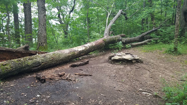
At Deep Gap, we turned right and hiked .3 miles on a side trail to the shelter. That’s a long way off of the AT, but the shelters are built on level ground near water sources. Because of COVID, shelters were closed, but in our soaked state we wanted to use it to get sorted.
Three women from Florida with the same idea had set their tents up inside the shelter. They were a bit hesitant when we appeared, but we worked out them moving their tents to one side to allow Carol and me to use the other side. (Carol and I didn’t set up our tents, but we had already agreed to share close proximity while driving.)
We fetched water (I am getting better at transferring from one vessel to another and estimating how much I need) and started on camp chores. The rain stopped but the 98% humidity didn’t. We were getting chilled in our wet clothes, and I kicked myself because I hadn’t brought any other shorts. But…wait, what’s this? There's a pair of yoga pants in my backpack, which I normally would never carry…hurray! Dry clothes, settling in, cooking supper.
About 7:30 p.m., three young guys showed up, full of life and pumped to thru-hike the AT. Although clueless about many things, they were affable and conversational and paid close attention as Carol talked about her own thru-hike experience.
One of the guys hung a hammock and the other two climbed the ladder to the shelter’s two tiny sleeping loft spaces. Will the world judge us for being in the shelter during COVID? Practicality won out. I thought the guys were going to be rowdy, but we women got quieted down and lights out by 9:00 p.m. and they did the same.
Not much sleep because of all the rustling and squeaking of sleeping pads, but at least I was dry and wouldn’t have to pack a wet tent in the morning.
“A few minutes ago every tree was excited, bowing to the roaring storm, waving, swirling, tossing their branches in glorious enthusiasm like worship. But though to the outer ear these trees are now silent, their songs never cease.”
~John Muir


1 comment:
This is a great post thhanks
Post a Comment