Pisgah National Forest Waterfalls: Eastatoe Falls,
Courthouse Falls and Upper Falls on Courthouse Creek – 8/31/18 – 3.5 Miles
[As of September 2019, Eastatoe Falls near Rosman, NC is no longer open to the public.]
Jim and I kicked off Labor Day Weekend in our usual style, combining hiking and biking in western North Carolina. Today’s agenda is three waterfalls in/near Pisgah National Forest on the Carolina Mountain Club Waterfalls Challenge (WC100), followed by a bike ride for Jim on the Blue Ridge Parkway, ending the day at a hideaway cabin near Bryson City.
Jim and I kicked off Labor Day Weekend in our usual style, combining hiking and biking in western North Carolina. Today’s agenda is three waterfalls in/near Pisgah National Forest on the Carolina Mountain Club Waterfalls Challenge (WC100), followed by a bike ride for Jim on the Blue Ridge Parkway, ending the day at a hideaway cabin near Bryson City.
Hoping to hike a few new trail miles in Pisgah, we stopped
at the Pisgah Ranger Station to get up-to-date info on forest road and trail access.
It’s easy to ask questions by phone, but I like chatting with the volunteers
and rangers in person as we put heads together over maps, and these folks are
very friendly and eager to help. The volunteer confirmed that Summey Cove Trail
(the one I wanted to hike) has been decommissioned because its lower trailhead
is at an unsafe place on Highway 215. I’ve got a feeling that the trail is
still heavily used, but I didn’t want to try it solo without knowing conditions
(decommissioning means no maintenance and it could be overgrown or covered in
blowdowns).
I used the 2nd edition (2006) of Kevin Adams’ North Carolina Waterfalls for my research for today’s waterfall hikes, but while at the Pisgah gift shop I purchased the new 3rd edition (2016). If you’ve never seen this book, you must buy the 3rd edition immediately. If you own an earlier version, you must buy the 3rd edition immediately. [Foreshadowing: some things have changed.]
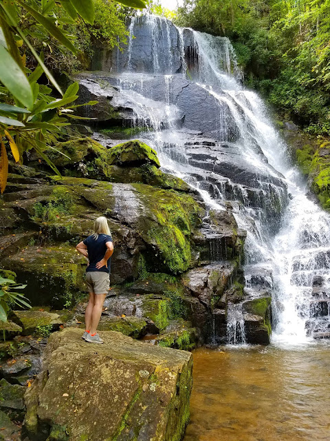
Eastatoe Falls is on private property near Rosman, NC. Fortunately for all of us, the owners are
extremely generous in sharing this treasure. Adams gives details on location
and background. On this Friday at noon we were the only car in the parking
area. It’s a very short walk and would be worth a 10-mile hike. Simply
stunning.
The Summey Cove Trail closing canceled our hike/bike scheme,
so Jim joined me for the next two waterfalls of the day. We drove up Highway
215 as it rises up to the Blue Ridge Parkway and turned onto FR 140, snaking
along three miles of hairpin turns on slippery gravel. The pulloff for
Courthouse Falls was easy to find right after the bridge over Courthouse Creek
(again, no other cars there). The trail starts on the other opposite side of the
road. It runs concurrently with Summey
Cove Trail and I felt disappointed not to be hiking it.
The trail descended about a quarter of a mile when we could
see and hear the waterfall. We spotted a super steep side trail and skidded
down it to the bottom before realizing that this was not necessary - the true
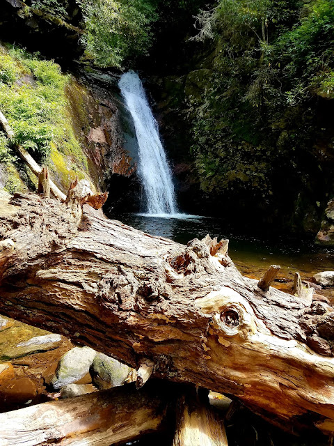
side trail was a tad farther away and gently graded as a long switchback. Courthouse Falls is a steep slide, flowing
over a ledge in a narrow, powerful 35-foot chute down into a dark pool. The rock
cirque partially surrounding it makes a dramatic backstop and we could see how
the water was eroding the rock.
The large plunge pool is an invitation to cool off, but I
avoid busy swimming holes because humans do risky things that I don’t want to
be a witness to. The churning water
looked like fun but can be dangerous. I was content at the pool’s edge, which
was very clear with golden light and the rocks on the bottom looked like gold
nuggets.
A big beautiful tree trunk lies alongside the pool’s
edge, intricately swirled bark. How old
is it? How long has it been lying there? Did it make a sound when it fell?
Back to the car and a short drive further to the
gated end of FR 140. We hoisted our daypacks for our hike to the Upper Waterfall
on Courthouse Creek.
The first .7 miles followed the old road to its end; then
things got sketchy trying to follow Adams’ directions (2006 edition). His
details were specific but didn’t give cumulative mileage, i.e. cross the creek,
go .2 miles, past the big rock, go .14 from that, etc. The trail was skimpy at
best and skirted right to the edge of the steep bank of Courthouse Creek.
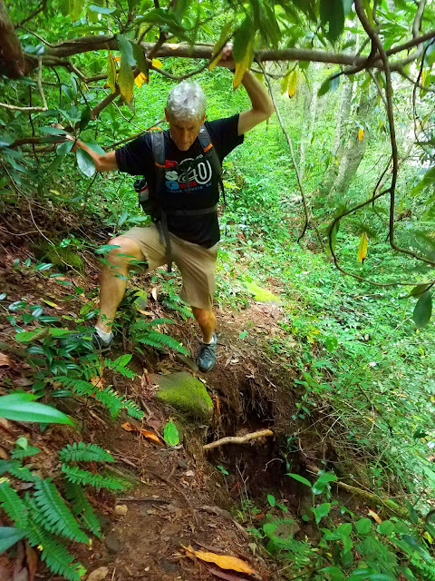
At one point where the trail was washed out, I grabbed an
overhead rhododendron branch to help me step across. My feet slipped and I
dangled by my arms until I could get my feet back on the far edge. Jeez Louise!
At the (fourth? fifth?) creek crossing we lost the trail. A
GPS seemed essential for finding this waterfall. I felt conflicted – technology makes it
easier, but do I want to do hikes that absolutely require it? Losing interest
in deciphering the instructions and mindful of the time, we agreed to turn back.
That meant crossing that washout again – better luck this time.
On the return we saw a sweet little unnamed waterfall
– is this Upper Waterfall?
We took a few minutes to explore two other side trails that
we had ignored earlier – maybe we were wrong to do that? One led us across the creek
and down to a broad slide that was sparse with low water but is probably
impressive after big rain. At the bottom of the slide the creek takes a
sharp turn left – is this the Upper Waterfall?
Note: Back at home in my easy chair, comparing the
hike narratives from the two editions of Adams’ book, the description for the
Upper Waterfall hike in the 2nd edition is now contained in the
description for the hike to Red Rock Falls in the 3rd edition. I believe that what the 3rd
edition calls “Upper Courthouse Falls” is along the way to Red Rock Falls and
is the broad slide pictured above.
We returned to our car, drove back out to Highway 215, and Jim
began his bike ride up to the BRP. The plan was to touch base at
Richland Balsam Overlook and ride southbound to Balsam Gap. I drove ahead, saw
that the BRP was being repaved in that section, and checked in with him. Fine,
no problem, keep going. I continued on
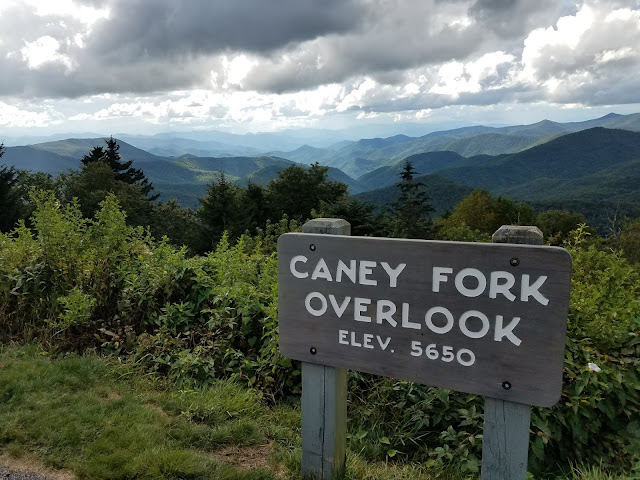
to Richland Balsam, stopping to ooh and ahh along the way (and notice the gathering clouds).
Jim at Richland Balsam, the high point of the Parkway
Still doing well at our check-in, I headed towards Balsam
Gap to wait for Jim’s finish. Three minutes later a hard rain began, a little
hail, then more hard rain. I turned around and went back, asked if he wanted to
stop, but he stubbornly kept going. I don’t think cycling in the rain is at all
safe, especially careening downhill, especially braking. One of Jim’s many famous sayings is, “There’s
no backslapping until it’s all over,” and all ended well, but I felt (and still
feel) that it was an unnecessary risk.
Sopping wet and still alive
We got to the cabin much later than originally planned (but still
daylight), prepared a simple supper and sat on the porch as the stars came out.
Tomorrow is another day.
“May your trails be crooked, winding, lonesome, dangerous, leading to
the most amazing view. May your mountains rise into and above the clouds.” ~Edward
Abbey


No comments:
Post a Comment