Appalachian Trail in TN – 11/13/15 – FR 253 Southbound to
19E – 14.1 miles
It seems that three weeks is the longest time period I can
stand without a massive injection of Vitamin “N”ature. Fortunately, my part-time work schedule allows
me Fridays off and overnight escapes allow me to be back home for church on
Sundays. All that’s left to contend with
is the weather forecast.
This time out I chose an obscure portion of the AT in
Tennessee, closing a 26-mile gap between 19E and Dennis Cove Road. I arranged a shuttle ride with Mary of
Mountain Harbour Hostel. My plan was to hike
southbound from the midpoint, tent overnight at Mountain Harbor, then shuttle with
Bob Peoples of Kincora at the other end back to the midpoint and hike
northbound. Sounds complicated, but not
really, and I’d save a little money and a lot of time. Plus it’s fun to figure
out these logistical puzzles.
The forecast for overnight temps in the 20’s got me to
rethinking my options as I drove to Mary’s in the early morning light.
Mountain Harbour Hostel
The trailhead was one of the most remote I’ve ever seen –
thank goodness I wasn’t trying to find it on my own. At 10:30 a.m. I began my southbound day under
a stellar blue sky, crisp 40’s, hearing the wind high and light in the trees
but not really feeling it.
Upper Laurel Fork
A good reminder of south versus north. It’s easy to get turned around especially
when you camp by a pretty stream.
The first seven miles ticked off quickly, very flat, moving
along at a good clip. Suddenly there was Mountaineer Shelter looking very new,
built in 2006.
Sleeps 14 on two levels
Mountaineer Falls may be significant sometimes, but it was a mere dribble
today
I lost track of mileage referencing AWOL’s guide, still
moving faster than my normal pace, and passed numerous campsites not mentioned. I kept looking up!
I got my bearings straight again at the Elk River as the
trail followed an oxbow bend going upstream, passing through a skinny open
meadow. Why wasn’t this noted in the guide?
A methodical and determined woodpecker dined here
Looking for Jones Falls, I tried one side trail that led
instead to a really nice secluded campsite beside the river. After retracing my steps back up to the AT, I
encountered two hikers who told me that Jones Falls was a little bit further,
indicated by a wooden sign.
The rock wall of Jones Falls is impressive in height
even with low water like today. I can
imagine this after significant rain fall.
I wonder how it ices up during a cold winter?
With ten miles on my legs now, I slowed down a bit for
the only significant climb (which wouldn’t have been even an eye blink at the beginning
of the day). At least the pine needle
carpet was easy on me.
The trail crosses Buck Mountain Road near the church of
the same name and winds behind Isaacs Cemetery.
After another short uphill beyond the cemetery, the
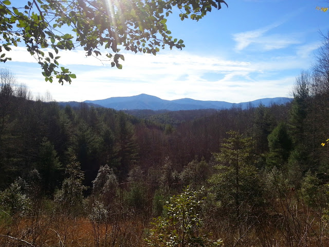
trail reaches an open ridge with some sunbeam views
Tiny bumps on the
horizon are Grandfather Mountain!
Thrilling to spot the old guy from this vantage point.
A fuzzy closeup
Shall we call this Grandfather Tree?
The remainder of my hike followed jeep paths through more
open meadows, over road crossings and piney woods before popping out onto 19E
for the short walk back to Mountain Harbour.
Including my side detours, I had walked 15 miles in 6 hours and was filled with the peace and restoration of a day in the woods. I made the decision not to camp overnight, but
to go home to a warm bed.
During the drive I turned on the radio and learned of the
suicide bombing attacks in Paris. Peace shattered.
“Lose yourself in nature and find peace.” ~Ralph Waldo Emerson


No comments:
Post a Comment