Appalachian Trail in NC/TN: Hump
Mountain – 8/28/17 – 8 Miles
A few Carolina Berg Wanderers went hiking on a Monday –
because we could. At this stage in life,
you arrange things to do what you want. Ignoring
the ominous weather forecast, Mike, Brian, Ann and I escaped the muggy late-summer
Piedmont heat to enjoy Hump Mountain, a prominent bald along the Appalachian
Trail straddling the state line of North Carolina and Tennessee. A cloudy day plus high elevation plus a
little wind equals long sleeves.
We started from an access point that I hadn’t used before,
driving up gravel FR 5545 to an old road access to Overmountain Shelter (now
gated). This is a common parking area
for people overnighting at the shelter who want to avoid the long hike from
Carvers Gap. Heck, you could carry your coolers
and Dutch ovens and tailgate chairs (but please don’t!)
We hiked up the old road to Yellow Mountain Gap, where six
paths appear, so pay close attention to signage. The AT and the Overmountain Victory Trail
intersect there, plus the old road, and then a side trail leads down to the
shelter. A visit to the shelter is
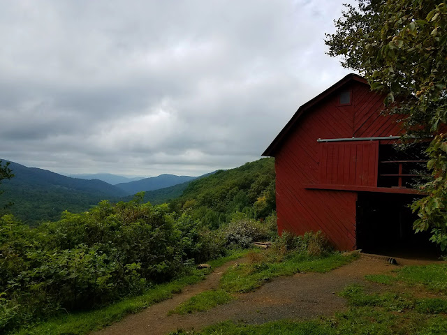
mandatory whether you plan to stay there or not. A big old red barn that sleeps 20, its
picturesque setting and romantic view out across the valley, it’s an iconic feature
of the NC/TN trail. [Update September 2019 - Overmountain Shelter is now closed due to instability - do not enter the shelter!]
Hiking northbound, the AT ascends, weaving in and out of trees along the edge of an open field.
Looking down at Overmountain Shelter
Looking northwest into Tennessee – I see those clouds
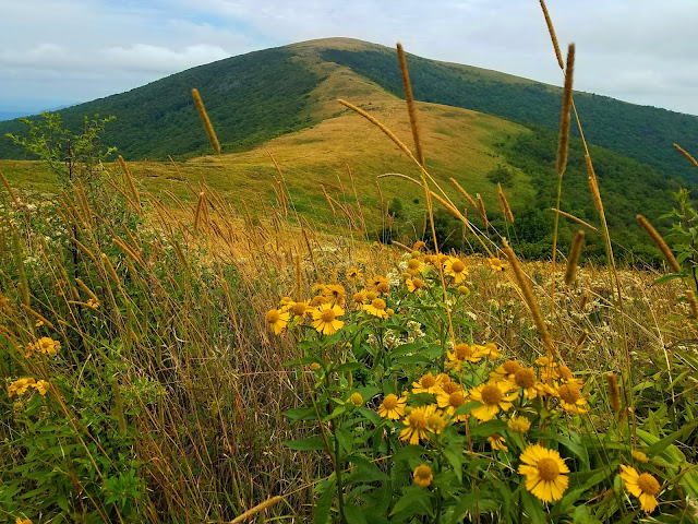
Looking east across a carpet of yellow
About 1.5 miles north of Yellow Mountain Gap a large rock
formation sits on a rise, a good place to pause, rest, regroup, or just be still.
Little Hump Mountain (elev. 5,459 feet) is not so very
little, but the climb is so gradual and the views so extensive that you (hardly)
notice the exertion.
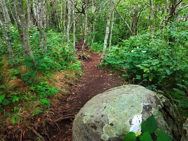
Near the top the AT passes through a forested area of
Tolkien-inspired trees, twisted trunks and a thick canopy.
On the other side of the trees, the trail descends the north
slope of Little Hump, in and out of trees and knee high scrub. The trail is a deeply worn trench. Near the base
it passes through a scattering of trees in a small gap with a maze of side
trails and campsites.
A little further along we crossed Bradley Gap, a wide saddle
with more campsites, very inviting IF you don’t expect any bad weather. Pretty awesome view of the big guy.
Hump Mountain (elev. 5,587 feet)
The finest view in the Southern Appalachian Highlands:
Grandfather Mountain from the summit of
Hump Mountain
The hike back was just as thrilling, looking at things from
a different viewpoint
Hawksbill and Table Rock on the horizon
On the return, we passed the side trail to the summit of
Yellow Mountain. I skipped it on our
epic Hump Mountain Sherpa Hike back in 2011 and I skipped it again today. Mike and Brian explored some faint old trails
with a GPS track while Ann and I stuck to the script (not interested in
bushwhacking). All ways converged in the
field above Overmountain Shelter at about the same time. New flowers had sprung up after we passed
through!
Back again at Yellow Mountain Gap where the AT bisects the Overmountain
Victory Trail, the OVT goes northbound to Hampton Creek State Natural Area. Southbound, the OVT parallels the old road bed
and beyond. Both directions looked
overgrown and seldom used. Again Ann and
I took the path more traveled, Mike and Brian took the other. Their way was longer, probably more
interesting…
Methinks a hike to Hump Mountain should be an annual summer’s-end
event.
“The
mind can go in a thousand directions, but on this beautiful path, I walk in
peace. With each step, the wind blows. With each step, a flower blooms.” ~Thich
Nhat Hanh


No comments:
Post a Comment