Sunday, May 27, 2018

AT in TN: Walking Across Watauga Dam


AT in TN: Campsite Southbound to Hampton TN at 321 – 6/10/17 – 12.7 Miles


Cathy and I were up and at ‘em at first light, itchy feet on the trail by 6:40 a.m. We opted to skip breakfast and eat at the next shelter, 3.8 miles away.

The tone for the day was familiar, hustling because we knew we were walking out.  Nobody waiting on us, nobody holding the stopwatch, but it’s hard to resist the pull to the end where you can set that backpack down for good.  In hindsight, of course, I shouldn’t have waited two hours to eat because I needed some fuel for the pace.  Cathy doesn’t require stops as frequently as are good for me and she doesn’t like to stop for long periods of time or she gets stiff (me too).  But when she is out ahead, she is considerate to stop for me to catch up, then I rest for maybe 5-10 minutes before starting again with her.  She doesn’t make me go, it’s my own internal push. Someday when I grow up I will better monitor my resting and pacing.

On the uphill to the shelter we met several thru-hikers, cheery from a night’s rest and tackling the trail again today.  Vandeventer Shelter is situated on a bluff looking out across Watauga Lake.  The shelter itself has its back to the lake (to block the wind) but there are boulders to perch on while contemplating the commanding view, inviting hikers to linger over their morning coffee (but not much tent space so I was glad we didn’t push on to it last night).  Three young men were still at the shelter, leisurely considering packing up and planning to hike to Damascus that day, 30+ miles – ah, youth! 


We ate our belated breakfast and talked with these guys.  One said he didn’t have much water and I told him where they would pass our campsite with its piped spring.  Then another mentioned that he had no water at all.  Cathy and I both had extra and filled up his water bottle (also topped off the others).  How far is it northbound to Damascus? As we went our way southbound, Cathy overheard them talking about using Adderall to keep moving on the long days…

We saw a skunk sprinting down the trail today! 

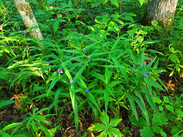
More flowers and green green green:


The AT rolls downhill from the shelter to Watauga Dam, teasing glimpses of the lake along the way.  The last two miles down to the dam are knee-crunchers.
Scars on the mountains

The increasing proximity to mankind triggers the not-unexpected-but-still-a-little-prickly feeling of dismay that the trail must pass through these populated areas.  We navigated on and off of roads, in and out of trees, then a mile road walk to the top of the dam. There is a necessary balance to maintain for the privilege of hiking through the forest and respecting those who choose to live in the mountains.  For example, we enjoy the goodwill of the Tennessee Valley Authority, which limits access to the road crossing the dam only to AT hikers, barring other visitors. 

Watauga Dam creates power for the community and the beautiful lake, a popular draw for summer fun, swimming and boating.

Watauga Lake Shelter was closed for bear activity. Not surprising - it is heavily used because it is so close to a major road.  I didn’t even go down the short side path to check it out.  Besides, there was this slithery snake right on the main path.  A snake and a skunk – a higher wildlife count than yesterday.


The trail closely followed the lakeshore in and out of tiny coves and we could see Shook Branch Recreation Area across the way, a beach filled with people on a hot day.  A mere minute as the crow flies, but we were not crows so we took the long route, another mile. 

I see the beach...

...and the beach sees me

Another day, another section, another state completed on the Appalachian Trail.  Thanks, Cathy!  Amen and pass the milkshake!

“For in the true nature of things, if we rightly consider, every green tree is far more glorious than if it were made of gold and silver.” ~Martin Luther


Monday, May 14, 2018

AT in TN: Walking Across Cross Mountain


AT In TN: Low Gap to Campsite – 6/10/17 – 14.1 Miles

A promising weather forecast and I’m ready for an overnight backpack trip to finish the Tennessee section of the Appalachian Trail. Cathy was a willing partner even though she’s already hiked these miles.  I found a shuttle driver out of Hampton, TN to take us to our starting point.  On the morning we left Charlotte I couldn’t find the driver’s phone number, so there was some anxiety if I remembered the details correctly.

We connected with our shuttle driver and left my car on US 321 next to Shook Branch Recreation Area.  He was laid back, a little too laid back, not much of a talker, listening to an evangelical preacher radio station.  It was a long ride to Low Gap. 

Starting at Low Gap, as soon as the pavement disappeared from view I forgot the everyday world, fired up to be on the AT again and especially energized to get TN completed.  Spring flowers were gone, but the undergrowth was flush with flourishing ferns and other foliage. The trail word for today was VERDANT. 

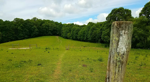
A small open meadow looking over Shady Valley GREEN GREEN GREEN

[And now a word about gear for women hikers:  I tested a urination device called the pStyle (Google it.) Don’t you just get tired of peeing in the woods the old-fashioned way?  Warm weather, dense foliage, a sparsely populated trail section, good conditions for experimentation.  With some practice, I got the hang of it and would recommend it.  Google it.] 

Near the high elevation point of our route sits Double Springs Shelter, tiny and primitive even by basic shelter standards.  Cathy prefers shelters but I don’t much care for them, and this one had nothing to entice me.  There were generous tent sites, though I saw a huge blob of bear scat near one site.  Note: AT shelters in Tennessee don’t have privies (for people or bears) so be prepared to poop in the woods.  


Soon after we passed Double Springs, the trail turned left (east) onto Cross Mountain.  Cross Mountain is a link between the long ridges of Holston Mountain and Iron Mountain – hikers literally cross from one mountain to the other (imagine the cross bar of the letter H).

The AT leads over the crest of Cross Mountain and opens to expansive pastures formerly owned by the Osborne family. In the early days of the AT, the family allowed the trail to pass along the ridgeline. In 2001, the Appalachian Trail Conservancy land trust bought the land from the family and transferred it to the federal government. Cathy and I climbed over stiles and greeted the pasture residents.

Looking back over my shoulder


At the bottom of the field, the trail crosses TN 91.  There is a parking area and a short handicap-accessible trail.  While Cathy and I ate our lunch, a car pulled up and we watched a tender moment unfold.  A man, a woman and a little girl got out, and the man pulled a (very) loaded backpack from the trunk.  He hoisted his pack, big hugs all around, and the man set his feet northbound on the AT.  Wife and daughter waved as he walked up the green slope and out of sight.  Happy trails!


Southbound from TN 91, the AT follows the ridgeline of Iron Mountain all the way to Watauga Dam, steep slopes on the eastern side and gentle gradual slopes to the west, with no dramatic peaks or views. You gotta like walking in the green tunnel because there isn’t much to mark the miles.

The human interest story of this section is represented by the Nick Grindstaff monument, and if you don’t look sharp you’ll walk past it (southbound, it’s on the right).  Nick was a hermit that lived and died on Iron Mountain and was buried at his homesite long before the AT was created in Tennessee. His house is gone, but the chimney remains, with a stone covering the fireplace opening featuring the carved epitaph: “Uncle Nick Grindstaff, lived alone, suffered alone, died alone.”  The ATC’s trail guide tells the story:  “Orphaned at age 3, Grindstaff traveled west at age 26 but was robbed and beaten there.  Disillusioned, he came back east to the mountains and lived the remaining 45 years of his life on Iron Mountain with only a dog as a companion.  When he was found dead in his shanty, the dog reportedly had to be overpowered before the body could be removed; it had kept watch for three or four days.”


We walked past Iron Mountain Shelter, another one not winning any awards (but keeping in mind that the sun was shining but if a storm was coming I would be very grateful for a roof over my head).

Turkeypen Gap – time to start looking for our campsite - I hope it's not like this

About 1.5 miles further south we found it, a nice big campsite area on the east side of the trail, two fire rings, a piped spring (rusty pipe).  It was 5:20 p.m. and we were not tempted to push further to the next shelter.  As we settled, more hikers trickled in.  A section hiker seemed tired and a bit cranky as he set up his tent. When I asked how he was doing, he said not too good. I asked what was his obstacle, and he said he was too old for this. 

Two thru-hikers with a big dog surveyed the site, then found flat spots on the west side of the trail that looked better than what we had.  Tempting for us to relocate (especially away from Grumpy Hiker) but too much trouble and still camp chores to perform, collecting and treating water, cooking supper. We had been very hot and sweaty all day, but when the evening chill rolled in I pulled on the long sleeved shirt that is always part of my regular gear.

Another thru-hiker stopped, nodded hello, hung up his hammock, ate his supper and began watching a movie on his iPad.  Huh.

Hanging bear bags wasn’t as easy as I had hoped, but we get them up there and nothing disturbed them during the night.

Cathy and I sat talking, waiting for the sunlight to fade, but by 8:30 p.m. it was still light and I was tired, so I crawled into my tent. Cathy spent a little time talking with the dog owners, then she turned in too.  

Today wasn’t wildly dramatic, no difficult climbs, no crazy weather, no bears or even snakes.  The most interesting moments involved human touches on the earth, structures, monuments, people crossing paths.  I may never walk on Cross Mountain again, but I will remember it.

Peaceful night

“We may never pass this way again.” ~Seals & Crofts