
Smokemont Weekend – 6/24/16 – Thomas Divide/Kanati Fork
Trails (Plus A Bonus Trail) – 13.9 Miles
I had a very special date for a Saturday hike in Great Smoky
Mountains National Park and decided to make a weekend of it and crank up the
excitement by trying something new. I
pulled into Smokemont Campground on Friday morning, quickly popped up my tent on
one of the last available sites, and drove with a churning stomach to the
Kanati Fork trailhead. All week I had been talking myself into a hike plan that
involved… hitchhiking.

Okay, that’s not a big deal to some, and I’ve asked for
rides at trailheads a couple of times with other hikers, but I had not done it
alone. I wanted to hike part of the
Thomas Divide Trail from Newfound Gap to Sunkota Ridge, then retrace back up
Thomas Divide to the Kanati Fork intersection, then follow Kanati Fork out to
Newfound Gap for a total of about 10 miles. It was just a short distance along
Newfound Gap Road from my beginning point to my exit point, but hiring a
shuttle driver was impractical (and expensive) in the middle of the GSMNP. So…hitchhiking.
At the big Kanati Fork trailhead I parked, put on my boots
and my daypack, brandished my hiking poles, and stood by the road with my thumb
extended, smiling enthusiastically. Many
slowed down (what is that by the road, Marge?) but no one stopped. I was willing to give it 15 minutes or 50
cars, whichever came first, and both limits were reached at about the same
time. I began walking backwards to my
car, still smiling, but already rethinking my plan.
Hold on – is that car’s turn signal on? Yes, a kind soul is going to give me a
ride! In fact, it’s two kind souls, and
they are driving an official park ranger SUV.
Hmmm…

Two newbie rangers,
one two months on the job, the other on his first day. They were very friendly
to this “mature” female hiker, but also very official, asked for my driver’s license
(oops, that’s my library card) radioed in to check me for outstanding warrants (really)
and asked me if I was carrying any weapons (no). I did not remark that firearms are legal in
national parks. Then they gave me a ride
to my trailhead at Thomas Divide. All in
all, the best case scenario for me, because I was able to start my hike at the
desired entry point and the rangers knew who I was for safety purposes.
My steps were lighthearted and I felt very strong as I
skipped along Thomas Divide. In total,
it is one of the longest trails in the GSMNP at 13.6 miles. The end I started from is a delight, gently undulating
along a ridge. (Later it drops steeply to Deeplow Gap and drops again ultimately
to Gailbraith Creek Road).

I walked a mile and stopped for a lunch break, noticing
what I heard – the wind, the birds – and what I didn’t hear – cars/planes/people. (Okay, it’s hard to get away from the
motorcycle noise on Newfound Gap Road.)
Also noticing what I saw – green leaves, moss, leaf litter,
ferns, bark, shadows – and what I didn’t see – power lines, pavement,
billboards.
The breeze made the late June flowers dance and elusive to
photograph:

Flame azalea

Fire pink
Four leaved milkweed

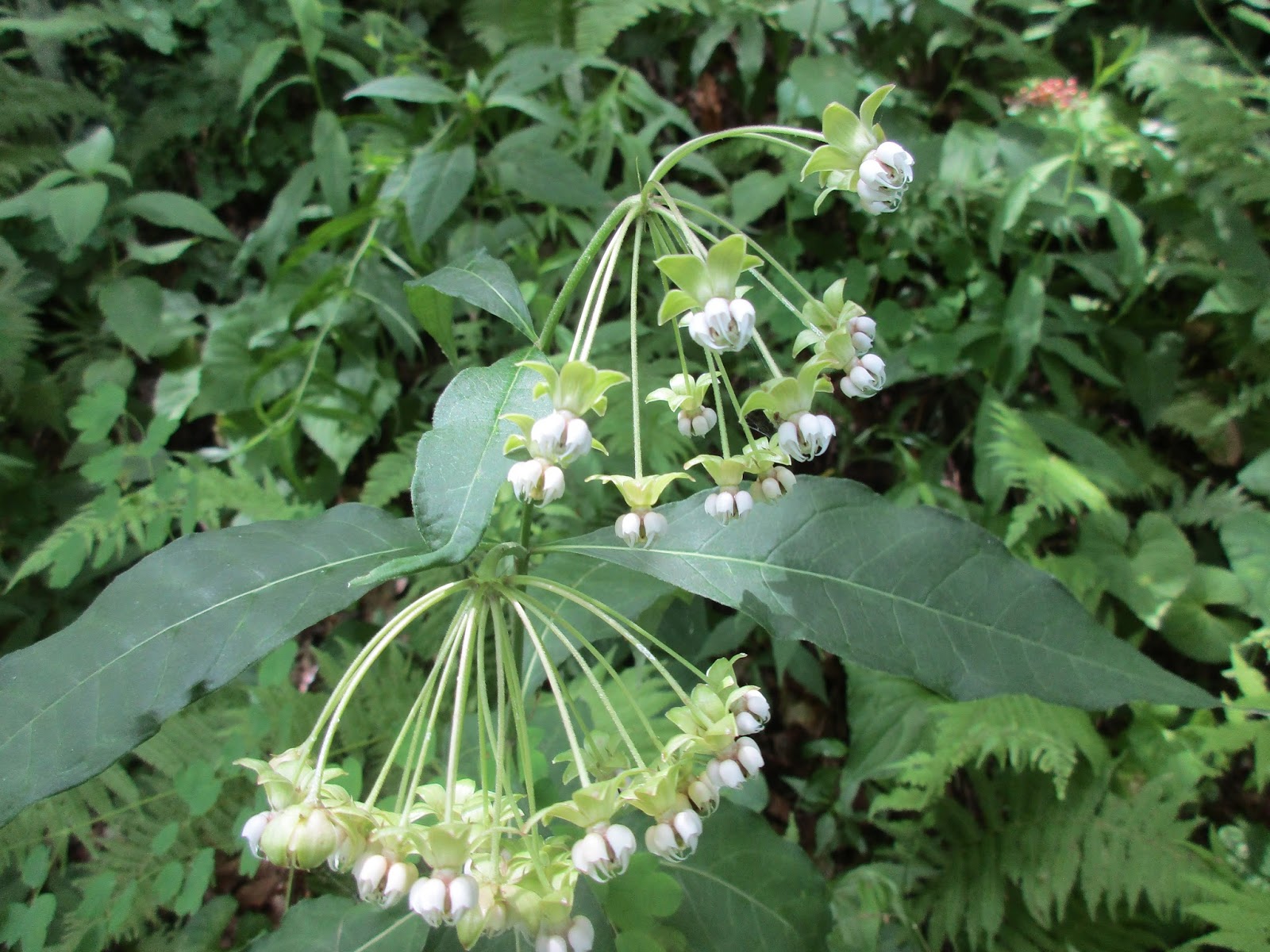
White bee balm

Columbine, a
rare treat. It blooms profusely but for
a very brief period

Galax

Spiderwort

Red bee balm

Squaw-root or squawcorn - a parasitic plant that grows on oak roots, no chlorophyll

As I passed the Kanati Fork intersection I met a
group of out-and-back hikers. I don’t
think they noticed the old wild boar trap about a hundred feet off the
trail.
The next 2.8 miles of Thomas Divide Trail has a different
feel than the first portion, narrower, a
path less traveled. It drops down to
Tuskee Gap and then wakes you back up with a brisk uphill to reach the
intersection with Sunkota Ridge Trail (another ridgeline that is beautiful to
hike). I turned around there and retraced my steps to
the junction with Kanati Fork.
Kanati Fork Trail descends steadily 2,100 feet over 2.9
miles, with nary an upward step, through a cove forest with a couple of small
seeps and more wildflowers. It seems
that the trail is rarely used despite its prominent location, perhaps because
of its steepness – a lot of effort with no featured destination such as a view
or a waterfall or even a sizable creek – or maybe because of its proximity to the popular Kephart
Prong Trail with its gentle elevation gain, stream crossings and CCC artifacts.

But Kanati Fork Trail does have an awesome feature that I
think is worth the effort: stunning
Dutchman’s pipe vines located at a sharp switchback about a mile from the lower
trailhead.

Tree burl

Deeply furrowed bark – black walnut?

In some places the trail was obscured by the lush
vegetation
My hike was over sooner than expected. With hours of daylight left, I looked over my
trail map and saw a little out-and-back trail that I could easily tackle, so I
drove out Straight Fork Road to Hyatt Ridge Trail. Just 1.8 miles up and 1.8 miles back down, no
big deal.
Well, Hyatt Ridge was a steady climb up that kicked my butt.
Maybe I was tired after a long drive, a 10-mile hike and the heat of the day. I’m
sorry to say that this was just to check off a box. I tapped the sign at the intersection, turned
around and marched unceremoniously back to the car.
Tried to get a good night’s sleep before the big day
tomorrow!
"A wildflower blooms for its own joy." ~Oscar Wilde