Showing posts with label Pisgah 400. Show all posts

Tuesday, April 21, 2026

Pisgah 400: Thompson Creek Hike

 Pisgah 400: Thompson Creek Hike – 3/20/24 - 6.4 Miles
457 ft ele. gain, 2,112 ft ele. loss

Today is a special day: the first Wednesday of Jim’s retirement! What better way for him to celebrate than biking the Blue Ridge Parkway on a weekday? Double bonus points for me hiking while he’s biking. Luckily, the BRP runs right through Pisgah National Forest’s Ranger District. I’ll find something to do…

It’s easy to get excited about hikes to thundering waterfalls, towering rock formations, and grand vistas. Anticipation of a payoff for energy exerted pulls many people along the trail.

There are some of those thrills in Pisgah NF, but what appeals to me is trails rambling for miles and miles through deep forest. Solitude. Quiet. If you’re working on the Pisgah 400 Challenge, you’ll find yourself navigating remote trail loops, crossing a creek or two or ten and seeing very few fellow hikers. (Note: Be on alert on mountain biker trails, though.) 

Okay, a nice view from the Blue Ridge Parkway before I get started

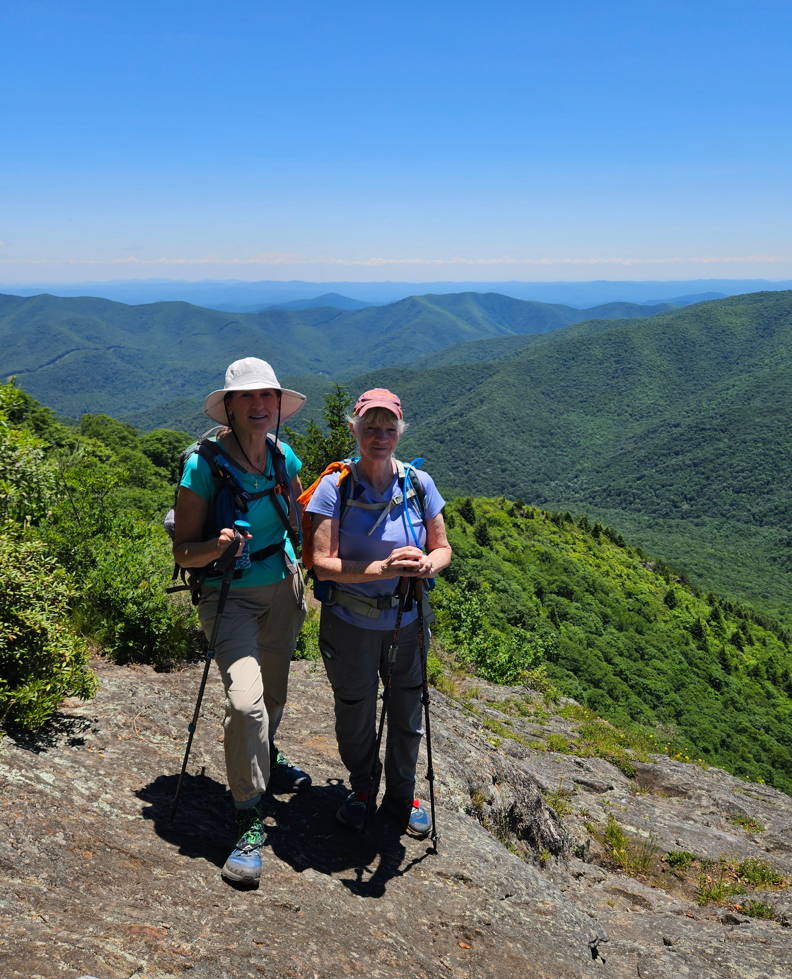
Jim dropped me off at the Pisgah Inn, where the Mountains-to-Sea Trail passes by. We’d made our plan for a meetup point and time frame, since there may be no cell service. My hike route is not a loop, it's point-to-point: half a mile eastbound on the MST #440, right turn onto Laurel Mountain Trail #121, right turn onto Laurel Mountain Trail Connector #110, right onto Pilot Rock Trail #321, left onto Thompson Creek Trail #602 to its terminus at Yellow Gap Road (Forest Road 1206). Then I’ll walk on the gravel road toward paved Hwy 276 until Jim meets me.

GAIA track of my hike

I love following a rugged trail that maybe no one has been on for days, letting my imagination roam and asking myself questions aloud:

That sign – it’s different from the others. Who put that sign there? How long ago?
I don't know!

That foliage – what flower will emerge? What bloom has already faded?
Galax foliage lining the trail above 4,000 feet - it will bloom late May through July

That building – what is it? I thought we were in a wilderness area
It's the Pisgah Inn on the BRP where I started, visible when the leaves are off the trees

That huge tree lying there – when did it fall? During a storm? Day or night?
 Did it make a sound? What happens to it now?
It becomes home for beetles, ants, mosses, fungi, mice and more,
maybe even as a "nurse log" for new growth

That flower – What is it? Ooh, I know this one!
Halberdleaf Yellow Violet

What animal(s) crossed this path 5 minutes ago?
What will cross it behind my back before I am out of sight?

None that I saw today, but I’m sure lots of critters saw me

That stream – how many snakes live there? (quick look around)
Headwaters of Thompson Creek

Thompson Creek Trail sign

Until now the hike has been easy, but now I’m going down, down, down. (Refer again to the GAIA track above.) The trail is one of the straightest lines on the entire Pisgah NF topo map, meaning it is S-T-E-E-P with no switchbacks. It’s also overgrown, eroded in places, hasn’t seen maintenance in a while. I left off asking myself questions and concentrated on not skidding down slopes and busting my @%*.

Maybe one more question - How long is this downhill going to last?
About 2.3 miles, 1,600 feet elevation loss

Quads quaking, blue sky, wind in the treetops, breeze on my face, lungs filled with fresh air, what a great day to be outside!

Thompson Creek grew wider, tumbling over rocks and roots, yet still easy to cross. Imagine a heavy rain on these steep slopes and the entire trail could be part of the creek. 

Upper Thompson Creek Falls (a little bit off-trail) 

The end of the trail connecting to Yellow Gap Road
An alternative hike would be a short out-and-back from here up to the waterfall

I walked about 2 miles on Yellow Gap Road before Jim intercepted me. We were both hot, sweaty, dusty, in need of a change of clothes and an adult beverage. As we kicked back at Ecusta Brewing, he told me about his amazing ride on the BRP, surprised that there were few cars. Welcome to the land of playing on a weekday, Jim!

Cheers to Jim’s retirement!

“Often when you think you’re at the end of something,
you’re at the beginning of something else.”
~Fred Rogers


Wednesday, January 8, 2025

Pisgah 400: Graveyard Fields

Pisgah 400: Graveyard Fields Ramble - 7/13/23 - 4 Miles

Yellowstone Prong at Graveyard Fields

Carol and I are feeling lucky on the last morning of our trip: three blue sky days in a row in the Shining Rock Wilderness area of Pisgah National Forest. How about let’s tiptoe over to Graveyard Fields before the masses arrive?

Graveyard Fields is part of Pisgah National Forest, adjacent to (but not part of) Shining Rock Wilderness. It is one of the most well-known, much-loved and over-used areas along the Blue Ridge Parkway in North Carolina. Southwest of Asheville, with direct accessibility from an overlook at Milepost 418.8 that includes a large parking area and restrooms, it’s just about impossible to drive past without stopping out of curiosity – what is everyone looking at?

Waterfalls are what the casual Blue Ridge Parkway visitor is eager to see. Yellowstone Prong flows through the valley of Graveyard Fields, creating multi-tiered cascades and waterfalls along the way. (A “prong” means a branch of a stream or river.) Add in changing leaf color in autumn and you’ve got good reason for the traffic jam at MP 418.8. And just a short hike will get you to the edge of the flow.

I avoid Graveyard Fields on weekends and most weekday afternoons, but an early weekday morning is just right for a ramble.

Note: Camping is not allowed at Graveyard Fields, so hike on over to Shining Rock to enjoy an overnight experience.

With limited time today before our drive back to Charlotte, Carol and I opted for a short hike on the Graveyard Fields Loop Trail counterclockwise and the spur trails to Second Falls and Upper Falls, about 4 miles total.

Enough preamble! Let’s go hiking.

From the parking lot, a five-minute walk on a paved path and wooden stairs takes you down
 to Yellowstone Prong

Dramatic double bridges crossing the river

On closer inspection, the bridges are a little crookedy

Looking downstream at Yellowstone Prong from the bridge

Descending more steps towards Second Falls

Carol’s view of Second Falls as I wobbled on the boulders to get a closer look

Backtracking up the stairs, where trails continue east towards Yellowstone Falls or west towards Upper Falls. We stayed counterclockwise on the Loop Trail heading west.

A long section of boardwalk - thank you, trail builders!

Trail erosion

A couple of easy rock hops

Leaving the Loop Trail for the side trail to Upper Falls

Upper Falls is a narrow, long slide that was underwhelming after seeing Second Falls, but not a surprise considering it was the middle of summer. Carol and I sat for a snack break and a peaceful moment before we heard folks approaching on the trail.

We backtracked to the Loop Trail and continued counterclockwise towards the parking lot, appreciating summer flowers up close.

Galax blooms

Yellow bush honeysuckle

Carol and a carpet of mountain laurel blossoms

Our Pisgah National Forest escape could not have been better, the synergy of beautiful mountains, flawless weather and great hiking buddies. What’s next?

Looking Glass Rock from the Blue Ridge Parkway

“Never know when you’re making a memory;
they will wish they was here together again someday.”
~ Rickie Lee Jones


Sunday, November 24, 2024

Pisgah 400: Art Loeb Trail & Cold Mountain

Pisgah 400: Art Loeb Trail & Cold Mountain – 7/12/23 – 11.4 miles

After a comfy/chilly night’s rest (54 degrees) at Mount Pisgah Campground, Carol and I woke up to another blue sky day, looking forward to hiking to a famous summit: Cold Mountain.

Heard of it?

Yes, it’s the Cold Mountain that inspired the 1997 book by Charles Frazier (am I dating myself here?)

Yes, it’s the Cold Mountain that every Boy Scout at Camp Daniel Boone has tackled on an 11-mile round trip hike to the summit.

Yes, it’s the Cold Mountain (elevation 6,030 feet) that is part of the South Beyond 6000 Summit Challenge (SB6K).  

Raising the awesomeness factor of today’s hike is the Art Loeb Trail, a challenging route traversing ridgelines of Shining Rock Wilderness and high points of Pisgah National Forest. Camp Daniel Boone is at the northern terminus of the Art Loeb Trail. The southern terminus is 30.1 miles away at Davidson River Campground in Pisgah National Forest.

I’ve hiked all of the Art Loeb Trail except the westernmost four miles starting from the camp. I summitted Cold Mountain in 2009 as part of the SB6K Challenge (that’s 14 years ago, friends). Our trek on that day was a rigorous 18 miles out-and-back from…well, you can read all about it here.

Today’s adventure is all new for Carol, so let’s go!

It’s one heck of a drive from Mount Pisgah Campground to Camp Daniel Boone, and I was taken aback when it appeared we would drive through the middle of the camp while the morning flag ceremony was being conducted. Boy Scouts young and old swarming everywhere – are we in the right place? Yep, just keep going to the gravel parking lot for Art Loeb Trail.

A young woman with a loaded backpack was studying the trailhead sign and she headed up the trail a few minutes ahead of us. We soon caught up with her and she was eager to chat. She was excited to begin a birthday challenge for herself, her first multi-day hike.

Carol and I surreptitiously raised eyebrows. We are both experienced backpacking know-it-alls and Shining Rock Wilderness is quite rugged, a myriad of unmarked animal and social trails with no signage. We suppressed the urge to grill her about gear, instead encouraging her that it was very doable. She said she had paper maps and some info from the AllTrails app, figured she would take 5 days or so. We took a group photo, and Carol and I wished her well and walked on, a little worried – yes, judging her (lack of?) preparedness.

Our superiority complexes were quickly squelched as the steepness of the trail in front of us took our breath away. Let’s slow down and appreciate nature. Lush foliage and midsummer flowers were putting on a show!


I do not know what this is...

Dutchman’s Pipe vines and heart-shaped foliage

Turk’s Cap Lily

Carol crossing one of several little streams

Fire Pinks


Sundrops

At about 4 miles, we reached Deep Gap, where the Art Loeb Trail turns right and Cold Mountain Trail turns left. We took a break to assess our energy levels.

Are we having fun yet? Carol debated whether she wanted to continue to the summit.  Up to this point, the Art Loeb had been challenging but not hard to follow, clear of obstacles. Looking at the head-high foliage pointing towards Cold Mountain, though, I also had doubts. This is where the “let’s start, see what it’s like, maybe turn around” philosophy applies. (Spoiler alert at the top of this post: we both made it to the summit.)

Can you see me?

The steep grade didn’t let up. The closer we got to the top, the more rugged the trail became. The tall undergrowth persisted, broken up occasionally by boulders. No surprise I only took three photos on this section.

A piped spring

Columbine

I see an opening…

The top of Cold Mountain is broad, mostly tree covered, but there is a survey marker

Several expanses of rock facing south, overlooking Shining Rock Wilderness’s green carpeted ridges. Like Goldilocks, we checked out all of them.

The Art Loeb Trail follows the ridgeline in the center of the photo

On the return hike, we stopped at Deep Gap again where a group of high school age Boy Scouts were setting up tents. We chatted with the woman who was guiding them on a 3-day backpack trip in Shining Rock Wilderness. We asked about the young woman on her Art Loeb birthday quest, but this group had not seen her.

Most folks who meet in the middle of the woods are happy to talk: where ya been,
where ya going?

Further down the trail, we met two men and asked if they had seen the young woman. They said yes, she was turning around, decided it was too much for her. She could have modified her plan to a one-nighter out-and-back, but at any rate, Carol and I were very happy to hear she had made a thoughtful decision.

Heck of a long drive back to Mount Pisgah Campground with plans for a simple dehydrated supper. At the neighboring campsite, two guys were cooking something that smelled delicious and they invited us to “sit a spell.” They were old friends who meet several times a year to camp together, cook a lot, smoke cigars, enjoy the peace and quiet of the outdoors. Their setup was elaborate, with a huge tent and canopies, camp cots and a large rug to keep the dirt out – and don’t forget the eternal campfire. We talked about what we’d done that day and they talked about what they might do tomorrow, after sleeping in and cooking breakfast and smoking more cigars.

Camp neighbors keeping their priorities straight

"Live your life by a compass, not a clock."
 ~Stephen Covey