Saturday, May 31, 2014

AT Project in VA: A Stuffed Burrito


Appalachian Trail Project in VA – 3/30/14 - Grayson Highlands Backpack – Dickey Gap to Old Orchard Shelter – 10.2 Miles

The miles on the Appalachian Trail in Virginia are adding up and the gaps are narrowing down.  One 
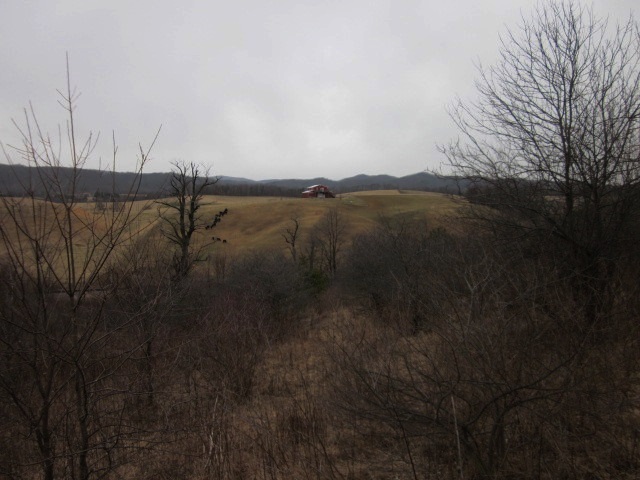
36-mile stretch in the most southwestern section I have been anxious to get to is the Grayson Highlands area.  I’ve backpacked there twice in past years, enjoying the wild ponies and the massive rhododendron bloom in June.  Putting out a couple of invitations yielded no available hiking partners, so I was ready to suck it up and go solo.  In a kitchen table session with maps and mileages I laid out my plan to convince Jim (and myself) that I had a reasonable plan.  The same old drawbacks, possible extreme cold weather, exposed areas and out of cell phone range. 

On Tuesday I got an email from my friend Mike:  his paddling plans in Florida had canceled (too much water) and was I still going to Grayson Highlands?  Yes, yes, yes!

Then the deal got sweeter as Mike (who has hiked the area multiple times) proposed tweaks to my itinerary, making it easier for me.  He was willing to shuttle and let me slackpack some (meaning carry just a daypack) and meet me late in the day.  Very generous – what’s in it for him?  Companionship at the end of the day plus good guy status. 

We had a five-day window for our three-day scenario and we watched the weather forecast worsen and then move around the calendar, ultimately settling on a Sunday-Monday-Tuesday plan.  Sunday’s forecast called for morning rain/snow but clearing quickly and steadily after that.

So imagine my dismay as I’m driving to meet Mike in Virginia, wind gusting and snow starting to blow.  I stopped for gas and I felt just how bone-chilling the wind factor was.  Do I really want to get into this?  Can I just turn around and go get a cup of coffee?  But I knew Mike was waiting for me.  Maybe I can talk him out of it.

Mike’s big grin and “Are you ready for this?” told me that there was no wimping out on this adventure.   I followed his vehicle along windy Highway 58 to the drop-off point for my car.  The snow fell thicker by the minute, definitely more than an inch or two, probably three or four inches and sticking to everything, coating tree trunks and branches and rhododendron leaves.   The plan for today was an 8.5-mile hike southbound from Dickey Gap to VA 603 (Fox Creek) where I would meet Mike, then backpack in about 1.5 miles to Orchard Shelter for the night.  I felt apprehensive but resigned to give it a try and at least do the 8.5 miles.

At Dickey Gap I put on my rain jacket and pants and started down the pristine, footprint- less trail of fresh snow.  Below the ridge the wind was minimal, a muffled hush, magical, everything coated in white. 

The rhodies say b-r-r-r

Slippery bridge

Yeah, that’s the trail

My boots

Soon I met a couple hiking northbound, giving me footprints to follow, which was helpful in places like rock fields.  I couldn’t rely on white blazes today.

At the side trail to Hurricane Mountain Shelter I experienced a few moments of indecision.  The signs were twisted at an angle, there were multiple sets of footprints going to the shelter and then northbound where I had come from, and keeping straight (southbound) looked very narrow, more like a trail to a water source or privy.  The rhododendrons were bent over from the heavy snow, closing in the trail.  I opted for the straight “trail less traveled” and eventually found a white blaze, and now was following two sets of footprints going the same direction as me, plus doggie prints.  I concluded that several hikers stayed at the shelter last night and set out in both directions this morning.

At the junction with Iron Mountain Trail, Mike intercepted me hiking as he was hiking a loop starting from VA 603.  He took a great photo of me in my red rain jacket.  Then he continued his loop and planned to meet me at the Fox Creek parking area.  I had such a great time hiking in the snow that I had decided to continue with the three-day plan.  After all, it was forecast to steadily improve, right?

Sure enough, blue skies peeking through!

At Mike’s van I traded my daypack for my backpack, taking care to think through what I needed for the next two days.  We hiked 1.5 miles to Old Orchard Shelter, which we were disappointed to see was quite uninviting, small and cramped.
And snow had blown in and been packed down.  I don’t think I'll be sleeping here.

We quickly decided to pitch tents in an open area where obviously someone had done the same the night before.

The shelter was pretty bad but the privy sure was nice.

Handicapped accessible with a ramp and railings by the toilet – but how does the wheelchair get there?

Piped spring water source

While it was still daylight we spent time finding the right tree to hang our food bags.  Some folks don’t bother with this, just hang their food on a low branch away from their tent or even keep it in their tent and hope for the best.  I admit I’ve done all of the above, whatever the group is doing.  But Mike is conscientious about best practices and always sets up a bear bag line.

 As the sun went down and we cooked supper I began to get cold.  Mike doesn’t get into his tent too early but I couldn’t keep him company.  Shivering set in and I had to relent and get warm.  Usually the activity of preparing for sleep inside my tent and putting on layers gets me warmed up to slip into my sleeping bag, but this time it didn’t quite do the trick.  During the night I added layers of clothing until the only thing I was not wearing was my rain jacket (using it as a pillow).  I had on two pairs of socks plus two pairs of liner socks, sleeping tights, hiking pants, rain pants, short sleeved shirt, two long sleeved shirts (one Smartwool), my light fleece jacket, my primaloft coat, two hats and a thick pair of wool gloves.  I felt like a stuffed burrito in that 15-degree sleeping bag…plus a silk bag liner!  Still it was hours before I warmed up to a comfortable level.  Not for the first (or last) time I questioned my judgment on carrying a bag of stuff and sleeping outside in the cold.

But I’m glad I didn’t miss it.

“What good is the warmth of summer without the cold of winter to give it sweetness?”  ~John Steinbeck


Tuesday, May 27, 2014

AT Project in VA: Red Sky At Morning


Appalachian Trail Project in VA – 3/16/14 – Partnership Shelter to Hwy 11 – 11.5 Miles

Daylight savings time changes are challenging for those who wake up with the sun.  Deep inside the shelter, which was deep in the mountains, the sunrise didn’t register with us until nearly 7:30 a.m.  I opened one eye and realized I could see the picnic table out front, then sat up and leaned forward to see from whence came the faint light. 


Spectacular sunrise in red/orange/purple.   As we all marveled at the palette, someone said, “red sky at morning, sailors take warning,” and we remembered the 90% forecast for soaking rain coming in.  Time to get moving.

A cold breakfast of hard-boiled eggs and a packet of almond butter went down the hatch as we hurriedly packed up.  A stiff wind was blowing, low 40’s, and beyond the sunrise colors were gray skies.  We were on our way by 8:00 a.m.

Crossing Highway 16, this sign reminded us of our miles to go.  If we were lucky we would put some behind us before the rain began.


One cold night in a shelter does not provide enough rest to start “fresh” again.  As I expected, my legs were still tired and my pack felt very heavy, but by putting one foot in front of the other eventually it got better.  I took the steepest climb over Locust Mountain very slow and steady, not bad at all.  I’ve learned that I am much better on the obvious, anticipated climbs than on the little ones that are not noticeable on the elevation profile and take me by surprise, I guess because I don’t slow down on those like I should.  I was still last in line but usually within a glimpse of the others.

Passing under power lines, we could hear the humming as Chris got “tingly.”

We stopped at Chatfield Shelter for a snack, remarking that the rain was holding off, but we put on pack covers and rain jackets to be prepared.  At this point it was still windy and quite chilly and no more significant uphills on the map…but even the insignificant bumps were taxing as we hurried to finish our hike.

The Lindamood School, circa 1894, part of the Settlers Museum of Southwest Virginia, closed today. 
This red barn was a beacon for miles as we descended through open pastures and an old apple orchard into the Great Valley.

The highlight of the day, especially for Chris, who is an eighth grade science teacher, was a proliferation of carniverous pitcher plants growing in a bog beside railroad tracks.  A set of boards carries hikers through the bog.

Past the bog there was more climbing through open meadows.  We could hear and then see both Highway 11 and I-81 for more than a mile as we switchbacked down.  Cathy and Amy were ahead and Chris and I brought up the rear.  As we caught sight of our car, the rain began to fall. 

“Those who dwell among the beauties and mysteries of the earth are never alone or weary of life.”  ~Rachel Carson


Friday, May 23, 2014

AT Project in VA - Dickey Gap to Partnership Shelter


Appalachian Trail Project in VA – 3/15/14 – Dickey Gap to Partnership Shelter – 14.5 Miles

Testing testing testing, one two, one two – this is a test of the Smoky Scout weight-bearing knee system. 

I’ve done a number of day hikes, short and long, but it was time to try out the knees with a loaded backpack.  What has changed since November?  Well, I’ve rested a lot, I’ve stretched my IT band a lot, and I’ve signed up for a four-day trek to Maccu Pichu in June. 

We decided on a one-night backpack trip with an easy bailout at the end of Day 1.  Who is we?  My AT-obsessed hiking friends Cathy and Chris and Chris’s college age daughter Amy.  This would be Amy’s longest day so far with a backpack.  (Cathy had hiked this section before but was game for a repeat just to be sociable.) 

Our planned overnight stop was Partnership Shelter, so close to civilization that hikers can phone in for pizza delivery (if you can get a cell signal from the parking lot, that is).  We’d be there on a Saturday night and the shelter sleeps 20 people.   How many will show up?  Carry a tent or not carry a tent?   I opted to take one, be a responsible backpacker and be prepared.  The forecast was for a clear day Saturday with cold rain coming in on Sunday.

We met Skip, our shuttle driver, at The Barn Restaurant on Highway 11 and he drove us south to our starting point at Dickey Gap.  Like all shuttle drivers I’ve met, Skip was gregarious and ready to share trail information and stories.  Most famous passenger:  last year he shuttled Robin Williams and his grandson to backpack on the AT.  We arrived at Dickey Gap in the blink of an eye.  Skip snapped a starting photo for us and we were on the trail by 11:15 a.m.

Amy helped set the pace with her 20-years-young long legs and as usual I moved to the back of the line.  Bringing up the rear by choice, I stayed just a few minutes behind the others and could usually see them up ahead.  I settled into a rhythm to concentrate on hauling an extra 25 pounds through the woods. 


Pretty winter view on our first climb up Bobby’s Ridge and continuing up Dickey Ridge.  We skipped the side trail to High Point.  Our first snack stop was at Trimpi Shelter, a little further off the trail than I would have normally been willing to detour, but it was a beautiful day and what else did we have to do besides be out in it?

Chris walking the moss green carpet
                                                                           
The first of several stiles passing through open meadows

Brambles in the meadow

Wide open space

At the next stile Chris and I speculated about the owner of this flurry of fur.  Looks like someone lost a fight.  No carcass in evidence, though.

The trail crossed the South Fork of the Holston River and VA 670 and the day was warming up.  I stopped to zip off my pant legs and remove my long-sleeved shirt in preparation for the gradual climb up yet another Brushy Mountain.  The other three women pulled ahead of me and I walked alone for a few miles, keeping a close eye on the white blazes as the AT frequently slipped onto old road beds and then off again into the woods.  A Taize meditation I hummed as I walked:

In the Lord I’ll be ever thankful
in the Lord I will rejoice
look to God, do not be afraid
lift up your voices, the Lord is near
lift up your voices, the Lord is near.

A creepy section of the trail near a high point (no notations on the map) where grapevines are taking over the vegetation.  Felt a little like a haunted house with big strands of cobwebs hanging from the ceiling.  


This section of the AT doesn’t feature big rocks, spectacular views or gushing waterfalls.  It does offer solitude for a nice walk in the woods, something I’ll take any day.  

We reached Partnership Shelter by 4:45 p.m., making very good time.  We got prime spaces on the bottom floor of the shelter.  The upper room is accessed by a straight-up vertical ladder that I wouldn’t want to use while wearing a backpack, but I’m sure it is a hospitable place to spend a rainy night.  


Note:  a sign on the approach to the shelter says no tent camping within .5 miles.  I wonder how often that is enforced?

A great composting privy is part the accommodations and the nearby Mount Rogers Visitor Center provides a water pump, so treating water is not necessary.  During operating hours (not while we were there) hikers make use of the real bathrooms and…yes, hot showers!   This is a prime stop for an AT backpacker looking for comfort.  Hikers who don’t care for crowds avoid it but to each his own…

Guess what?  No one else showed up and we had the place to ourselves.  We sat at the picnic table cooking and eating supper, watching the sunlight lessen and the feeling the cold increase.  A full moon rose through the tangle of still-bare branches.  Doesn’t look like rain, does it?


A great day, no knee issues (are you tired of hearing about that yet?) so no need to call for a taxi.  8:00 p.m., dark, time to get snuggled in.  And then the barred owl started up:  who-cooks-for-you?

“Every adventure is worthwhile.”  ~Amelia Earheart