Thursday, October 27, 2011

Canyons, Waterfalls and Sand Dunes

Death Valley/Mt Whitney Trip – 9/12/11 – Black Point Canyon/Darwin Falls/Panamint Dunes – 15.5 Miles

So what is your first thought at the mention of “Death Valley”?  (Go ahead, take a minute, I’ll wait…)

Well, there is more to it than that.  Today’s adventures took us from rock canyons to waterfalls to sand dunes, all within the boundaries of Death Valley National Park.  

We “slept in” until 7:00 a.m. because all our treks were located on “our” side of the park.  By now we don’t know how to eat breakfast unless we’re in a moving car, so soon we were on our way to the first hike of the day, Black Point Canyon, another trail-less gem from Jeff’s GPS.  By now I understood canyons a little better.  First you walk gently uphill, then you turn around and walk gently downhill, following the path carved by flowing water.  It is possible to get lost if you take too many side turns, but generally that’s it. 

Close to the road we found artifacts, formerly known as trash.

Rock formations are like clouds, you can see all kinds of figures and shapes.  What do you see here?

Getting interesting

Desert foliage makes intriguing graphic design

A “dry fall” means the end of the hike for us, but not for Jeff.  He climbed up and explored a little further.
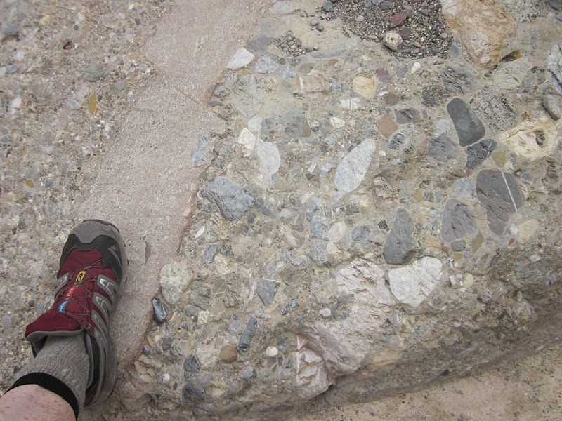
Breccia rock

A ghostlike plant

There is green in the desert – you just have to look for it

Next hike on the list:  Darwin Falls, a unique diversion from all the bare rock and dry dust.  Darwin Stream is the only permanent water source in Death Valley and it supplies water to the little settlement of Panamint Springs via an above-ground pipeline.  Directions to the trailhead say,“drive 1.1 miles past Panamint Springs to the first dirt road on the left.”  Dirt road is an optimistic description for the rutted washboard surface.  Sensitized by our recent tire woes, we crept to the trailhead.  Note to everyone:  it takes a long time to get anywhere in Death Valley. 

Starting out, this looked like any other canyon wash, not the oasis promised in the guide- book.  But very soon green began to appear and we crossed an actual stream of flowing water. 

Vegetation becomes taller and denser

A lizard friend as long as my forearm (just guessing, I didn’t check for real)

Check out the balancing rock in the upper left

We followed the sound of trickling water into the narrowing canyon, hugging the walls, crossing the stream several times on rocks and logs.  Hold up…is that…shade?  After only one mile we reached the lower falls, a 25-foot drop.


At one point on the hike out Dolores gasped and grabbed my arm as a large black/brown snake slithered away past Carolyn’s feet.  I didn’t see it so I could pretend it didn’t exist. 

Pipeline to Panamint Springs

A nice little two-mile hike with green stuff, water and shade.  Cool?  Well, cool is relative.  It was still hot…and about to get hotter.

Hike number 3:  Panamint Dunes.  There are several areas of sand dunes in Death Valley NP and Panamint Dunes are the largest and therefore the biggest challenge for Jeff aka “the peakbagger.”  They rise several hundred feet high, making them appear closer than they are (like lots of things in the desert.) 

There is no real trail to Panamint Dunes, but the closest you can get to them by car is via a dirt road called Lake Hill Road (no sign) off Highway 190.  We missed it the first time we passed it, but I spotted it on the second try.  As soon as I said, “There it is,” I felt a pang of regret.  If we had not been able to locate the road, we could have gone to explore Mesquite Dunes, much more accessible and easier to climb.  But here we were once again, creeping along a six-mile gravel road to “where the road begins to deteriorate” and we could park the car.  We passed Lake Hill (2,030 feet), a small mountain in the middle of the flat desert.  This hump was important as a landmark for our return hike.

The dunes sit at the northern end of the North Panamint Dry Lake bed.  Surround- ed by mountains on three sides like a bowl, they look like little sand piles going up the mountainside.  Here they are four miles from our car. 

At 3:30 p.m. we struck out across the desert floor on our 9-mile out-and-back hike.  After the gurgling waters of Darwin Falls, all I saw ahead of me was a flat hot walk similar to the salt flats. 

Dolores – the bump to the middle right is Lake Hill (Jeff's photo)

But unlike the salt flats, the desert floor here was alive with flora and fauna.  The surface began as hard packed sand, with pockets of softness around scrub brush where animals had dug tunnels near the roots.  Tiny lizards darted constantly in all directions.  Tracks were everywhere in the sand, but I couldn’t identify any.  In some places I saw the wind moving branches back and forth, creating patterns in the sand. 

As we drew closer we realized that there were actually hills before the sand dunes, big hills, softer sand.  I worked hard to get up the first one, then at the top I saw another one.  Did I mention it was HOT?  I was not so enamored of Death Valley on this section of the hike. 

Finally we crested the last hill and saw the dunes – they were enormous.  Jeff’s goal was to summit the tallest one.  My goal was to summit the first one I got to. 

Carolyn and I walked up the first dune and agreed we had a front row seat for everything, including the highest dune.  Dolores joined us and we took the requisite photos of each other. 

Carolyn photographing her footprints

Tiny Jeff

We sat down to watch Jeff as he worked his way up the spines of the dunes towards the highest point.  It was a breath- taking experience to watch his progress – definitely worth the effort to get there.  

Jeff's photo looking down at us - can you see us?

More of Jeff's photos:


The wind kicked up and began to erase our footprints.  I hurried to put my camera away but not soon enough.  Carolyn’s camera slipped from her pocket into the sand too.  We both had camera problems for the rest of the trip. 

We started the long hike back to the car, sighting on Lake Hill and trying to walk a straight line.  Four miles will always be four miles and the heat did not relent.  Carolyn jumped at the sight of a snake, but again I missed seeing it.  Eventually we picked up our earlier footprints and followed them back to the gravel road.  We reached the car around 7:00 p.m. just as dark settled in.

Once again we had to conquer the six-mile gravel road out to pavement, half an hour of tedious bumping, and we needed gas and water.  Who knows how early things shut down in Panamint Springs?  Luck was with us, the gas station was open and so was the one restaurant.  There was a large group of German tourists seated just before us, and Michael the bartender said if I would write down our orders we’d get our food faster.  I played waitress - very surreal.  We were extremely tired, thirsty, a little goofy, and I remember the pizza was delicious. 

Michael told Jeff there were scorpions everywhere on the property, including the bathrooms, so watch our step.  We filled up all our water containers, a now-familiar chore.  We found a shortcut road back to Thorndike Campground, but it was still after 10:00 p.m. when I slipped into my sleeping bag. 

So far I’ve done seven hikes in Death Valley and each one has been amazing.  What’s up tomorrow?  Us!  Heading to Telescope Peak!

It is easier to go down a hill than up, but the view is best from the top.  ~Arnold Bennett


Monday, October 24, 2011

My Kingdom For A Tire

Death Valley/Mt Whitney Trip – 9/11/11 – Badwater Basin & Mormon Point Canyon – 10 miles


This morning the sun rose and so did we, ready for another try at Badwater Basin.  While we were packing up for our epic day, Jeff noticed nails lying around in the parking area by our site.  (Foreshadowing:  a literary device where the author suggests certain plot developments that come later in the story.

Winding our way down the road from our campground, we left gravel and hit pavement, increasing speed from 10 to 25 miles per hour.  The rental car began flashing a low tire pressure warning.  We pulled over, rolled down the window, and heard the hissing of the front left tire.  Hhmmm…nails. We were a long way from anywhere.  Great.

All gear came out of the back so the spare tire and kit could be located.  (This is the third time I’ve been around tire changing in five months and I really need to learn to do this myself).  After a lot of work on Jeff’s part, the pathetically tiny spare tire was in place, not a permanent solution.  We didn’t feel safe driving on it back up to camp.  Nothing else to do but go into town and look for a way to make repairs.  


Stovepipe Wells is another oasis a little closer to our campground, but even smaller than Furnace Creek.  It also has a motel, a restaurant, a general store and a gas station…but no way to repair tires.  At Furnace Creek, still no luck.  Did I mention this was Sunday?  The tire guy comes in between 12:00 and 5:00.  Well, what do you think we should do?  Go hiking.

The hiking guides imply that the boardwalk at Badwater Basin equates to the lowest point of Death Valley, but Jeff’s GPS does not agree.  We parked on the side of the road, put on hats and long-sleeved shirts, took a deep breath.  Looking straight across the valley, it seems that you can walk to the Panamint Mountain range in about five minutes, but it is six miles across and we were going halfway (and back again).  The lowest point of Death Valley is at -282 feet and the only way to tell is by Jeff’s GPS.  I couldn’t detect any elevation loss at all, just a flat walk.  For all I know we started out at minus 281 feet. 

The ground started out as a crusty moon walk, then the salt crystals began to appear.

Carolyn holding some salt – tastes good on French fries

The honeycomb pattern in the salt is formed as a result of repeated freeze-thaw and evaporation cycles.  Walking on it sounded and felt like crunchy snow.  In some patches it was smushy and wet underneath. 

Here we are at the bottom of North America!  BTW, it’s about noon.  And the park rangers were worried! (Jeff's photo)

Looking up at Dante’s Peak where we were yesterday (Jeff's photo)

Turn around the other way, looking up at Telescope Peak (covered in clouds), where we will be two days from now (Jeff's photo)

After a few photos, we didn’t stick around because it was blistering hot and getting hotter.  Once I spied the car I just walked a straight line back to it.  No obstacles, no climbing, no creek crossings, but this was one of the most extreme hikes I’ve ever done.

We stopped at the boardwalk to use the bathrooms, eat some lunch and watch the tourists.  

And since we were in the neighborhood, we checked out another point of interest that Jeff found online (again, no map, just GPS coordinates) called Mormon Point Canyon.  We walked up a huge wash as the heat continued to increase.  After a while I just pretended to be in a sauna.  Dolores and I lagged behind as Jeff and Carolyn moved ahead.  We did reach the point where the walls closed in to form a narrow slot canyon, very surreal (and shadows, a little relief from the heat).  I could see where flash floods would be sudden and deadly. 

Making our way back to the car (Jeff's photo)

Can’t get enough of the expansive landscape

So, about that tire…back in Furnace Creek the tire guy pronounced ours irreparable and he didn’t have one the size we needed.  The rental company in Las Vegas was happy to bring a new car out to us IF we paid to have the “damaged” one towed for a ridiculous amount of money.  No, they would NOT bring us a new tire, only a new car.  Finally we concluded that we had to drive back to the rental company and swap cars.  To make a long story even longer:  at 5:00 p.m. we pointed toward Las Vegas, grabbed fast food, got to the rental place, moved all our gear over to a new car, and then at the checkout point the attendant said we had the wrong car.  (Well, Carolyn said the third time is the charm.)  We moved all our gear over again and drove back through Death Valley and up to our little kingdom at Thorndike Campground.  Arrived at camp at 12:30 a.m. 

We were crazy tired and very dirty (no water, remember?) but we only wanted to sleep.  Because tomorrow we have three hikes to do! 

P.S.  We were all aware that today was the 10th anniversary of 9/11.  Although we didn’t have access to media and we didn’t talk about it much, I think we all felt the solemnity of the day. I felt gratitude at being in an American national park today.

If you don't know where you are going, you will probably end up somewhere else.  ~Lawrence J. Peter

Thursday, October 20, 2011

Peaks and Valleys and Canyons

Death Valley/Mt Whitney Trip – 9/10/11 – Gower Gulch/Golden Canyon Loop and Dante’s Peak – 8.8 Miles

6:00 a.m., rise and shine, no time for sleeping, we’re in Death Valley!  No leisurely mornings of breakfast and a second cup of coffee (wait…where was the first cup?) for the Bergs on an adventure.  Today we’re hiking to the lowest point of North America.  What to wear, what to wear? 

Packs ready, nerves jumping, we crept down the road toward civilization at Furnace Creek, a tiny oasis with a motel, gas station, general store, restaurant, a couple of campgrounds and the Visitor Center for Death Valley.  This is as good as it gets, folks.  Most important, we needed to fill up all our water containers and gas up the car ($5+ per gallon).  Searching for water and gas became a theme for our time in DV. 

Driving towards Badwater Basin, I could hardly believe my eyes.  The sky ahead was dark and lightning flashed.  I looked at Jeff – yes, he had seen it, too.  The landscape was so wide open, it was hard to tell where the storm actually was, could be miles away or right over where we were planning to hike.  And the tallest thing out there besides us would be some dead dragonflies. 

Plans are meant to be changed, so we switched our itinerary, turned around and drove to Zabriskie Point on Highway 190, a popular stop for tourists-in-cars and a trailhead for a nice loop hike through Gower Gulch and Golden Canyon.  We checked out the view from the overlook and then hopped onto the trail.


How to describe Gower Gulch?  This was my first experience with canyon hiking and everything was fascinating.  A canyon is the path made when water washes down from the mountaintops to the valley.   Remember making sand art as a kid, filling a glass bottle with layers of sand in different colors?  The mountains here are layers of all types of rocks, layers of colors, not just yellow and red, but umber, ochre, sage, magenta, bronze, sienna, slate, sand, taupe.  
Signpost
Touching/tasting rock

Colors spilling down

An old mine

A harsh environment

Breccia rock composed of broken fragments of minerals or rock cemented together - remember this when you redo your bathroom

Dolores looking at melted looking lava rock

Hiking babes

After a couple of miles of wandering through this wonderland we exited Gower Gulch near Badwater Road, which the trail paralleled for 1.3 miles up to the entrance to Golden Canyon.  


The first mile of Golden Canyon is an interpretative hike (alas, the fliers were gone from the trailhead.) 

Golden Canyon narrows to a tight fit

And opens up 

  The trail splits and a side trip to the left for an additional .4 miles gets you to the Red Cathedral.  

 Red Cathedral from Manly Peak

Backtracking from the Red Cathedral, we turned left to catch the loop back to Zabriskie Point.  The temperature and the trail climbed steadily and our morning jaunt became a little like work.  This was a rude awakening from the pleasant walk down Gower Gulch.  At 100+ degrees I dismissed everything I’d heard about “dry heat” because I was drenched in sweat.  I was a little worried about the amount of water I was carrying (didn’t run out, though).  

After a couple of miles of wandering through this wonderland we exited Gower Gulch near Badwater Road, which the trail paralleled for 1.3 miles up to the entrance to Golden Canyon.  

With a magnifying glass you can see the trail as it follows the base of Manly Beacon, an imposing feature amongst all the awesomeness.   The panoramic views reminded me of the Grand Tetons without the snow.  (My limited frame of reference is expanding!)

 Fake background?

Getting warmer

A long view (Jeff's photo) 

This section back to the beginning was 2.6 miles, making the hike a bit longer than Jeff’s original estimate.  (Another theme emerging:  distances are fuzzy out here *le shrug*).  Considering that there were two more hikes on the day’s agenda, the wimpy part of me began scheming an escape.

Back at the car, no time for reflection, we can’t let Dante’s View get away!  We ate lunch while Jeff drove with the HVAC at full power.  Part of the Black Mountains, Dante’s Peak is above 5,500 feet and a welcome cool respite from Zabriskie Point.  Jeff whittled down his original hike plan to just the one-mile round trip from the parking lot to the peak.  The cool breeze and the expansive view of Badwater’s salt flats brought me back to my happy place.

From Dante’s Peak looking down into Badwater Basin, the lowest point, and across to the Panamint Mountains and Telescope Peak, the highest point of Death Valley NP.  Yes, we’re going down there AND up there.

 Carolyn and Dolores

What’s that – one more hike today?  Jeff’s research uncovered info for some little-known hikes, including Funeral Canyon.  We drove back to Furnace Creek, filled up with water again, and found the trailhead (term used very loosely) at the Sunset Campground.  Please note the time:  3:30 p.m. to begin an 8-mile hike. 

The canyon began typically as a very wide washout, promising narrow slots and awesome/strange rocks to come.  After about 20 minutes, I decided I’d rather chill/rest for tomorrow, so I bailed.  Jeff gave me the car keys and they walked off into the wild.  I went to the Death Valley Visitor Center. 

At the VC I stood in front of the air conditioner for a (long) time, got my National Parks passport stamped and browsed the hiking books, ultimately buying Hiking Death Valley National Park (very useful in the days ahead).  I had a long chat with the lady ranger, who did not want to give me advice about hiking in Badwater at this time of the year.  She said it was dangerously hot and they steer people away from anything other than exploring the boardwalk there.  I understood that she had to stick to a script, but it was frustrating to be stonewalled.  I guess they get tired of rescuing people. 

At the general store I got a sandwich and a COLD soda, then went back to the campground to wait for my valiant companions.  With lots of time, I repacked my stuff, rinsed out socks in the bathhouse, read my book, and felt no remorse for opting out of the hike.  They got off the trail about 7:10 p.m. and, yes, the hike was longer than they expected.  I was fine with my 8.8-mile day.  Jeff noted that we'd been in Death Valley only 24 hours and I'd already had my "town day."

Dinner at Furnace Creek Restaurant (no need for a fancy name when you’re the only one there) was excellent.  Then we faced the hour-plus drive back to Thorndike Campground.  I crawled into my tent at about 10:00 p.m., and before I could lie down I saw lightning flashes and heard rumbling coming over the mountain range, what turned into the most powerful storm I have ever encountered while in a tent.  Dolores and Carolyn and I were tented close together, and Carolyn yelled that water was flowing swiftly underneath her.  I said, “I’m not looking,” because I couldn’t do anything about it anyway, but I could see that my tent floor was squishing like a waterbed, too.  I sat up with my little headlamp, constantly checking for leaks.  The rain splashed hard enough on one side to plaster the rain fly to the netting, so I got a little wet, but for the most part it held up really well (Big Agnes Seedhouse 2).   [Carolyn’s tent really was swamped and she renamed it “A River Runs Through It.”  We moved it to level ground the next morning.]

Three quick lightning/thunder cracks directly overhead had me saying my prayers that the stunted tree over my tent wouldn’t lose any branches.  There wasn’t much wind, but the rain pounded hard, and then the storm passed.  There was more rain during the night. 

Average annual rainfall in Death Valley:  two inches.  I guess that doesn’t include the mountains surrounding it.

In every walk with nature one receives far more than he seeks. ~ John Muir.