Friday, March 28, 2014

AT Project in VA: Peters Mountain Bailout


Appalachian Trail Project in VA – 11/16/13 - Mountain Lake Road Southbound to Symms Gap Meadow…Or Not – 16.5 Miles

I’ve endured a handful of hikes over the years that I would classify as difficult, not because of the terrain or even the distance but because of physical suffering:  sore feet, sore knees, weary shoulders, bonking because of dehydration or not eating sufficiently.  I’ve often said that the longest mile is the last one.  And yet I’ve felt a sense of enjoyment and accomplishment even through the discomfort (okay, pain) of those days.

Until November 16, 2013. 

I’d planned a 2-day, 28-mile hike on the AT near Pearisburg, VA, a long stretch with few exits.  I had done many long dayhikes since the summer when I wrestled with knee issues, but this would be my first overnight with a loaded backpack in several months.   I was going solo to take advantage of the good weather and I looked forward to challenging myself once again with some alone time.  Jim was going to the Virginia Tech game in Blacksburg, so we would be in the same general area, but he was just up for the day.  I arranged for Don, a shuttle driver that I had used before, to take me to my trailhead at Mountain Island Lake Road and from there I planned to walk southbound into the town of Pearisburg.

As we drove, Don asked me the specifics of my plan and knew well the place where I intended to pitch my tent.  The shelters in this section were not spaced conveniently for me so I was aiming for Symms Gap Meadow.  He told me the last reliable water source was at Pine Swamp Branch Shelter.  Along Mountain Lake Road I took note of all the hunters’ pickup trucks.  [Later I found this excellent section of the ATC website with information on hunting seasons and hiker safety.]

Very foggy driving up the mountain, but we broke above the clouds to a lovely sky and cottony clouds in the valley below. 

I had forgotten to bring my blaze orange vest, so I tied my bright red rain jacket on the outside of my pack and crossed my fingers that it would suffice.  For the first 3.5 miles of my hike the AT runs parallel and close beside Rocky Mountain Road, giving easy access for hunters, but they can venture far from the road and still be in a wilderness area where hunting is allowed.  The protective corridor of the AT can be as narrow as 1,000 feet, so…not much protection.  While hunters are not supposed to use the AT as a route, I guess it’s hard to avoid.  And bullets don’t know anything about boundaries. 

Anyway, the hike started out great, a pretty day, feeling strong.  I met a couple of hunters on the trail, kept hearing gunshots all day, which made me a little nervous, but I 
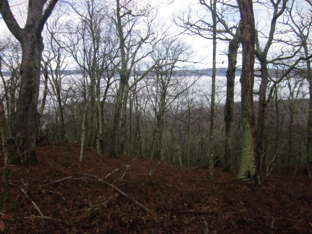
soon was immersed in the glory of  the woods.  

I passed Bailey Gap Shelter with barely a glance and began a swift descent through a rhododendron tunnel…

…to a very fancy bridge spanning Stony Creek.

A lichen-encrusted white blaze

Perhaps I took that downhill too quickly, short, fast steps, almost skipping in some places.  My left knee began to ache along the outer edge; soon my right knee was chiming in.  The problems of last summer coming back?  Slowing down and stepping more deliberately didn’t help.  Hmmmm…

Meanwhile the trail led me over several streams and close by “The Captain’s,” some sort of privately owned place to camp, and from the looks of it hunters were gathered there also.  Then I began to notice places along the trail where the leaf litter was brushed away as though something (big) had been dragged.


Deer hairs on a footbridge – obviously Bambi and I were not alone in the woods.  I made a mental note to tell all my hiking buddies to only hike on Sundays (no hunting) in southwest Virginia. 


At Pine Swamp Branch Shelter I stopped to eat and assess my knee situation.  By now I was feeling painful twinges with nearly every step.  I was looking at a significant climb just ahead of me and about seven more miles to my campsite.  Knees don’t hurt on the uphill, so I hoped to get a break and just take it easy from there.  So I climbed Peters Mountain and turned south to walk the ridge, which is also the state line of Virginia-West Virginia.


Correction:  knees can hurt on the uphill.  

Mid-afternoon and fog was creeping in.  I was trying to be noisy, kicking leaves and striking stones with my hiking poles.  I walked right up to this hunter and his young son sitting quietly on a log beside the trail.  


After 10 miles the knee pain was excruciating.  I was holding my breath, gritting my teeth and exhaling with a whimper at each step.  The fog made for limited visibility on the rocky terrain and I was slipping and falling often because my knees were so shaky.  How did I get into this predicament?  All I wanted to do was get to my little campsite near Mile 15 so I could lie awake all night wondering how I was going to hike out the remaining 13 miles on Sunday.  

Then…at about Mile 14 I passed a blue-blaze side trail to the right with a sign that said 1.9 miles to a road!  Wait, it’s not on my elevation guide…but it is on my ATC trail map.  The Groundhog Trail!  It was now 4:30 p.m., getting dark along with the fog.  Should I try to get off the trail or hole up and hope that tomorrow would be better after some rest?  I got a cell signal (hallelujah) and called Don, my shuttle driver, and told him I wanted to bail out.  He said he would meet me.  (Was he just waiting by the phone?  I think so.)  


The side trail was in rough shape, steep, slippery leaves, and I fell about 10 times in the first 10 minutes.  Was I going from bad to worse?  The trail itself was hard to see, but the blue blazes on the trees were excellent and I just walked for about an hour from one blaze to the next (knees screaming the whole time).  I think my speed was about a mile an hour.

Don, my shuttle-driver-turned-trail-angel, had quite a drive to come find me – after all, I was now walking down into a West Virginia valley.  Then he walked in half a mile through open pasture and part way up the mountain to meet me.  By now it was full dark.  I could see a head lamp bobbing up the mountainside.   Ah, rescue!  My knees were still hurting but I knew I would soon relinquish my backpack and sit down in Don’s car.  As I followed him back through the open pasture, I saw that I would not ever have found my way in the dark through the overgrown grass.  My last best option would have been to camp in the pasture and then figure it out in the morning.  Glad I didn’t have to.

I can’t say enough about how kind Don was during the ride back to my car.  He continually assured me that I had made the right decision and made me feel smart rather than a wimp.   I really do suspect that he was at home “doin’ nothing” because he knew that I was out alone. 


I called Jim (he was still in the area) and he met us in Pearisburg.  He paid Don a huge ransom as a thank-you, gave me a hug, dusted me off, bought me a cheeseburger, and we drove home.  The knees were still hurting on Sunday but by Monday everything was fine.  Time for a doctor visit.

Lesson 1:  Ain’t no shame in bailing out to stay safe.  I didn’t want to fall and get badly injured.

Lesson 2:  Always, always, always carry a trail map and check your location often to stay oriented.

Lesson 3:  Don’t rely on cell phone coverage and be prepared to spend the night (but I sure was glad when I got that signal)

Lesson 4:  Appreciate and become good friends with shuttle drivers.  They are angels.


Monday, March 24, 2014

AT Project in VA: Closing the (Rockfish) Gap


Appalachian Trail Project in VA - Shenandoah National Park – 10/29/13 – Beagle Gap to Rockfish Gap – 5.3 Miles

My ambitious hiking agenda in Shenandoah NP had not worked out, but that’s the hiking life (and the rest of life, too, really).  Make plans but be ready to change.   Over the years I’ve had many mastermind schemes scuttled by rain, snow, extreme cold, high water creeks, closed roads, illness, dead batteries, bailed-out hiking partners.  Some changes happen the day before, some changes happen at the trailhead.  Plans B, C and D should be in your back pocket.  Just make sure someone at home knows about them, too. 

So today we faced the long drive home (5+hours) and there was just a little morning time to enjoy.  By hiking 5.3 miles southbound on the AT from Beagle Gap to Rockfish Gap I completed a stretch of 181 contiguous miles, a big note of satisfaction for the effort.  While I made my short stroll, Jim enjoyed one last bike ride from Rockfish Gap southbound on the Blue Ridge Parkway. 

Through a fence style and into a meadow to climb up Bear Den Mountain

Police communication towers at the summit

Someone with a sense of humor installed some comfy tractor seats for a rest stop here at a west-facing view.  Jim remembered seeing these when he and our son completed a 50-miler hike with their Boy Scout troop in Shenandoah many moons ago. 


The leaf change has largely passed on and my attention turned to exploding seed pods in the open meadows. 

Milkweed


Any clues?

I am always interested in evidence of times gone by, old road beds that now lead nowhere, fence posts and stacked stone indicating where humans attempted to corral the wilderness

Fence post with barbed wire

An old gate


And before I knew it, I was at Rockfish Gap, where I staggered off the trail last May after following Cathy for 40 miles over some of the biggest ups and downs on the AT.  As I was changing out of my boots, Jim appeared, looking happy as he always does when he’s on his bike.  The two of us are very fortunate to have such fulfilling hobbies that we can dovetail to spend time together.  It takes planning, flexibility, perseverance, and the desire to cooperate…kind of like marriage, huh?

“Love does not consist of gazing at each other, but in looking together in the same direction.”  ~Antoine de Saint-Exupery


Thursday, March 20, 2014

AT Project in VA: Shenandoah NP - Oh Deer


Appalachian Trail Project in VA - Shenandoah National Park – 10/28/13 – Beagle Gap to Turk Gap – 6.6 Miles

Shaking off the previous day’s muddled ending, Jim and I got back on track today, driving in the early morning light on Skyline Drive.  No traffic, passing through sideways sunbeams on the twisting two-lane, keeping an eye out for the day’s starting point while catching glimpses of the valleys at overlooks right and left  – BAM!  Didn’t see it until it was too late.

Our car collided with a deer crossing the road from left to right.  Jim kept his cool, didn’t swerve, firmly hit the brakes, but there was no avoiding the young buck as he struck the driver’s side front quarter panel.  When we stopped and looked back, we saw him lying near the edge of the road, rib cage heaving rapidly, still alive but obviously mortally wounded.

Then, in the trees on the right side of the road, I saw a female deer standing and looking, too. 

As we got out of our car, a big Park Service garbage truck came along and stopped.  The driver contacted NPS headquarters, pulled the still-breathing deer off of the roadway, and kindly distracted us with chatter as we waited for the rangers.  When they arrived, he waved goodbye and drove off.

Anyone who has had a car accident knows how long the paperwork takes and it’s no different with the NPS.  While the female officer took photos of our car’s damage, the male officer walked back to check on the injured deer.  He hemmed and hawed, not wanting to say it, until finally I said, “Aren’t you going to shoot him?”  He said, well, yes, he was going to dispatch the animal but didn’t want to be so blunt in case it would upset us.  Knowing that it was suffering upset us more.  The officer put in his earplugs, I got inside my car with the windows rolled up and my fingers in my ears, and still the shot was sudden and booming. 

Meanwhile, the female deer wouldn’t leave.  Twice she circled around through the woods and reappeared.  The officer chased her across the road but she came back to the edge with her silent gaze.  I’m sure she went to see her (companion? son?) lying in the weeds after we all left. 

Gee, who feels like hiking now? 

But what else was there to do with an entire day?  After some debate, we settled on a shorter hike for me (bike ride for Jim) and finding a nice late lunch at Big Meadows Lodge.  I started at Beagle Gap and hiked northbound to tag up with Turk Gap where I began yesterday. 

At Beagle Gap

It was a lovely morning after all, hiking through open meadows up Little Calf Mountain.  A short side trail to the summit gives this view.  Next was Calf Mountain, a little taller but less impressive because the summit is covered with trees.


However, near the top of Calf Mountain the trail passes several majestic grandfatherly (and grandmotherly) trees, giving the impression of an old homesite (haven’t confirmed this, though).  If trees could talk, what would this one say?
Do burls feel like bunions?

Still distracted by the fateful deer encounter, six miles went by without much notice and I was glad to get off the trail.  I met Jim at Turk Gap and we drove (carefully) north on Skyline Drive to check out the Harry F. Byrd, Sr. Visitor Center and its impressive interactive exhibit about the establishment and development of Shenandoah National Park.  We did find a late lunch at the bar at Big Meadows Lodge and an adult beverage was most welcome. 

[Postscript:  My car was driveable for the rest of the trip (couldn't open the passenger front door) but it ended up in the shop for a while, nearly totaled but ultimately repaired.)

"Trees are the Earth's endless effort to speak to the listening heaven."  ~Rabindranath Tagore

Monday, March 10, 2014

AT Project in VA: Shenandoah NP - Blackrock and Black Bears


Appalachian Trail Project in VA - Shenandoah National Park – 10/27/13 – Turk Gap to Loft Mountain Campground - 17 Miles

Good news!  The government got over its hissy fit, America’s public lands reopened and people swarmed in, although the leaves were past their peak in many areas and the revenues lost to local economies were gone forever.  Jim and I attended yet another Virginia Tech football game on Saturday and left B’burg on Sunday morning at dark-thirty to get to Shenandoah National Park.  I had an ambitious 3 days of Appalachian Trail hiking planned, starting with a 17-mile trek from Turk Gap northbound to the Loft Mountain Campground store.

Brief facts about Shenandoah National Park:

·         - Established in 1935, similar to Great Smoky Mountains NP in that hundreds of families were displaced to make way for the park
·         - Over 500 miles of trails, including 101 miles of the AT
·         - Includes 300 square miles of the Blue Ridge Mountains
·         - Total acreage is 196,466 acres
·         - Park website says there are between 300 and 500 black bears – the upper range gives about the same density of black bears as in Great Smoky Mountains NP
·         - Skyline Drive, beginning at the northern end of the Blue Ridge Parkway, runs up the spine of Shenandoah, providing access to all campgrounds, lodges and attractions.

Last-minute check in the parking lot:  water, food, camera, hiking poles, gloves, hat.  I wasn’t too worried, though, because I knew I’d cross Skyline Drive six times and could always hitch a ride if I needed to bail out.  I waved goodbye to Jim as he prepared for his bike ride and then I melted into the woods. 

Five minutes later, I began to hear odd sounds, sort of low moaning like a sick cow, or like a person imitating a sick cow.  Funny, I don’t remember reading about any open pasture land, and anyway, I’m inside the national park boundary.  Is there a person trying to startle me?  I turned 360 degrees, couldn’t see any movement, but the trees were swaying.  Was I hearing two trees rubbing together?  Hey…what is that big black spot…three big black spots…up in the tree over there?

It’s a mama bear and two very large cubs.  I think the cubs were crying (or maybe enjoying themselves) because the trees were swaying precariously with the wind and their weight.  How did they get that far up anyway?  And do they see me?  


Feeling brave at a safe distance, I began snapping pictures with both my camera and my phone.  Suddenly mama bear decided to descend and reached the ground in barely the blink of an eye.  Immediately I turned away and headed up the trail at a quick clip – not running – with my ears primed for any sounds behind me.  I frequently looked back over my shoulder for ten minutes or more as I hiked away from the area, but the bears did not reappear. 

Well, that was the first few minutes of the day.  What else is in store?

The rest of the day was uneventful for wildlife at least.  But how about this enormous leaf?

Red-orange bittersweet berries are the most colorful thing in the woods now

Criss-crossing Skyline Drive

The geological highlight was Blackrock, which the AT loops nearly three-quarters of the way around to make sure you don’t miss it.  It is also easily accessible via a half-mile trail from a parking area on Skyline Drive.  Blackrock is a pile of talus rock – Hampton Sandstone, which someone more knowledgeable than I will have to elaborate on -- just begging to be scrambled (there is no “trail” to the top of the pile).  However, it’s not as easy as it looks.  Some rocks are loose, even the big boulders are wiggly, and an ankle-twisting may await you.


There were people around but somehow no one played “King of the Mountain” while I was up top.  The view is 360 degrees.  Imagine how glorious it would have looked a couple of weeks earlier when the leaves were in full color.
On top of Blackrock

Lichen patterns on the rocks

The waypoints were frequent, the miles churned out, and by the time I reached the first sign for Loft Mountain Campground I was ready to call it a day.  But…although there were several connector trails going through the campground, if you want to pass every white blaze, the AT circumvents it and winds all the way around the south, the east and up to the northern end.  There is where I found the connector trail to the camp store.  Swiftly I hiked up this little path a bit ahead of schedule, ready to buy a soft drink and check off the day’s progress.

No cars.  Not mine or anyone else’s.  The place was shut up tight. 

My sad conclusion was that the campground was closed for the season and the access road was gated so Jim couldn’t get in to leave the car.  I didn’t have the guidebook or larger maps with me, just my elevation profile notes, so I tried to remember details of the brochure we had picked up when we entered the park.  Seems like the paved road goes down just a mile or so to join Skyline Drive.  Hopefully Jim parked as close to that road junction as possible.  Nothing for it but to walk a little longer.

Ah, yes!  At the junction with Skyline Drive sits Loft Mountain Wayside, a little gift shop and restaurant, and that’s my car in parking lot!  But Jim is not in it…but his bike is… he must have gone looking for me.

I waited a while as I tried to reason what Jim would do.  He must have thought he could intercept me by hiking up the spur trail that started by the campground access road and goes up to the AT.  But when?  It couldn’t have been too long.  If he took the trail and I took the road, we would have missed each other.  As I puzzled, I saw a car turn onto the campground access road, open the gate and leave it partially open.  Choosing to beg forgiveness rather than permission, I followed in my car back up to the campground store.  Now there was a cleaning crew there and, yes, they had just spoken to Jim and sent him on up the AT to look for me. 

Cut to the chase:  after two hours of me driving to different AT access points along Skyline Drive, leaving notes to tell Jim to stay put and talking to everyone I saw to intercept him, we were reunited at the Wayside.  I was mainly worried that he would go too far south on the trail, worry that he wasn’t finding me, and darkness was descending.  Once we were both accounted for and parsed the sequence of events and Jim’s good intentions, the moral of the story was not to ever come looking for me until I am overdue by an agreed amount of time.  The vast majority of the time I can figure things out for myself.

The happy ending was our lovely secluded cabin at Lydia Mountain Lodge & Cabins called "Just Us." The owners very graciously allowed us to change our reservation for early October without a fee.  A home-cooked meal, a beer, a hot tub and a warm fire made everything all better.


[Footnote:  My hike took place in October 2013, but shortly before this posting in March 2014, this area was devastated by a fire encompassing more than 450 acres, reportedly started by an illegal campfire.  The AT and Skyline Drive remain open but the Wildcat Ridge and Rocks Mountain side trails to the west are closed.)


"I may not be there yet but I'm closer than I was yesterday."  ~Unknown