Showing posts with label Mountains-To-Sea Trail. Show all posts

Sunday, January 12, 2025

MST: Cascades Recreation Area to Benge Gap

Mountains-to-Sea Trail:  Great Day Hikes #11
Cascades Recreation Area to Benge Gap – 7/2/23 – 8.5 miles RT

The Mountains-to-Sea Trail across North Carolina is close to my heart. Over nearly two years, 2009-2011, I hiked the trail in sections from the western terminus atop Kuwohi in the Great Smoky Mountains at the NC/TN state line to the eastern terminus atop the sand dunes at Jockey’s Ridge State Park at NC’s Outer Banks – more than 1,000 miles! Some days I walked with others, some days on my own, and I biked some of the eastern sections. Every mile was an adventure.

The MST can be accessed from many points across the state for a challenging mountain hike, a relaxing half-day walk in the woods or an easy small-town stroll. A book that I highly recommend, Great Day Hikes On North Carolina’s Mountains-to-Sea Trail, highlights 40 adventures across the state. The trail continues to change and grow since I completed it in 2011, and currently it spans 1,175 miles. Great Day Hikes is my inspiration to get out and see what it’s like today.

To escape the broiling heat of a July day in the Carolina Piedmont, Jim and I headed to a higher altitude section of the MST along the Blue Ridge Parkway near Boone, NC – Hike #11. Within the boundary of E.B. Jeffress Park, we hiked from the Cascades Recreation Area eastbound to Benge Gap and back again. (If you’re with friends and two cars, this is a nice shuttle hike.) 

Know before you go: check the BRP website for seasonal or construction closures. 

Our hike started from the north end of the Cascades Recreation Picnic Area on a loop trail. The MST goes left and the Cascades Trail goes right to access the waterfall. Jim and I followed the right fork to check out the waterfall, knowing that we would hike the MST portion of the loop on our return.

Falls Creek

A steep set of steps leads from the top of the Cascades Waterfall down to a rock wall and landing viewpoint of the falls. The steps are very close to the waterfall as it descends. Beyond the landing, the trail was blocked off and we could see severe erosion. I wonder if the trail will ever be rehabbed or if it is better to remain closed. It’s so close to the waterfall, it seems a strong temptation to get dangerously close.

Top of Cascades Waterfall

A rock wall and landing where trail access ends, but the waterfall keeps tumbling out of sight

We walked back up the steps to the loop trail, and at the sign indicating the return to
the parking lot Jim and I turned right onto the MST

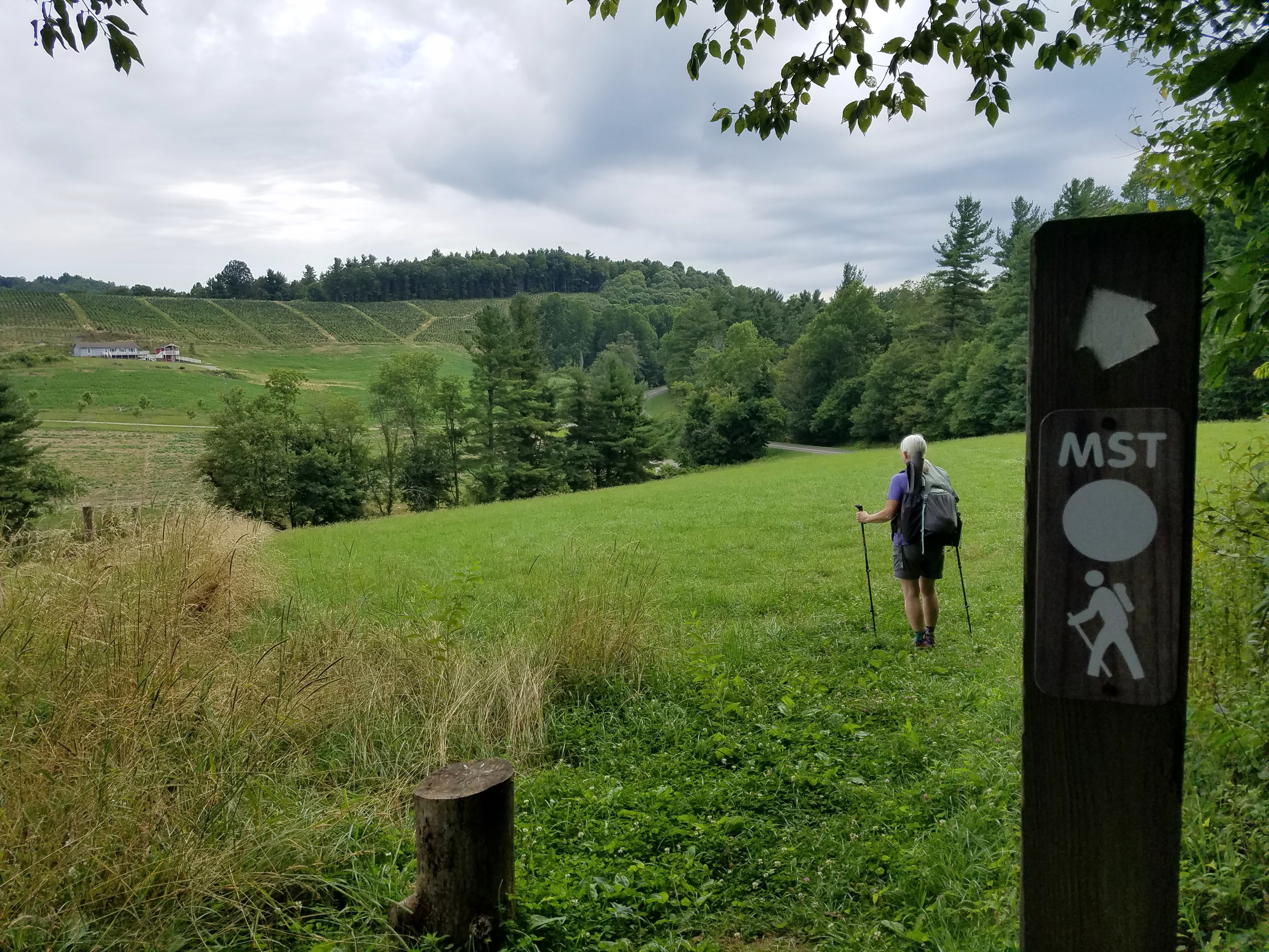
The white circle blazes of the MST indicate the path all the way across North Carolina

This Fowler’s Toad was well camouflaged until I stepped too close.
I jumped higher than he did!

The Mountains-to-Sea Trail follows the Blue Ridge Parkway, crossing the roadway back and forth, sharing its narrow corridor of protected federal land as it passes farms and fields in this area northeast of Boone. Fences and gates are part of the rural scene. Sometimes a sharp eye will discern a hunter's deer stand.

A couple of miles along our route, we popped out into a pasture and followed the well-trodden path downhill, where we walked a short way on the road and turned back into the woods.

Crossing another field, Jim said, “Hey, why don’t you pose with this tractor?”

It’s a two-toad day!

Before we knew it, we’d reached the intersection of country roads called Benge Gap. We turned around and retraced our steps, staying on the MST portion of the Cascades loop trail as it followed Falls Creek. This little loop to the waterfall and back is a great family hike for the summertime, splashing in the creek and looking for toads.

Our reward after an 8.5-mile ramble: lunch with adult beverages in downtown Wilkesboro, NC. If you haven’t taken the backroads to this little country town, you should.

“In Native American cultures, the American toad is considered a symbol of transformation and adaptability due to their dual nature of living both in water and on land.”
~Robert Leonard


Sunday, March 22, 2020

Mountains-To-Sea Trail Training Hike


Mountains-To-Sea Trail: Training Hike – 13 miles – 5/5/19


A training hike, you say? With Danny Bernstein, eh? What is in the works? Read on.

I spent Saturday night at Danny’s home, woke up to a gray and rainy Sunday morning. Forecast was solid rain until 11:00 a.m. A little breakfast, a quick gear check (boots/pack/raingear/poles) and we’re off. A day hike in the rain might be postponed if you’re looking for views and sunshine, but we had on our “big girl panties” and no weather could deter us. We needed to practice hiking in the rain.

On the agenda, an out-and-back hike on the Mountains-To-Sea Trail starting at the Blue Ridge ParkwayVisitor Center near Asheville, destination Lunch Rocks. I had never stepped onto the MST from this point, and we had a bit of confusion on the blue blaze trail from the parking lot to connect with the MST, probably added a half-mile to the day: more training! We needed to practice being confused.


We hiked northbound 2.5 miles to the Folk Art Center, encountering stone steps, log bridges, a concrete tunnel, a railroad crossing, walking under the BRP and through a field of wet cows, crossing a bridge over US 70. (No photos, cameras safely stowed.) We needed to practice route-finding through infrastructure.

The relentless rain turned it up a notch to drenching downpour. Everything attached to my body was saturated.  At the Folk Art Center we sloshed into the bathroom. I did my business and wrangled my wet clothes back into some semblance of order.  Back outside, I sat on a bench, removed my boots and wrung out my sopping wet socks. Put them back on my wrinkly feet, still wet but no longer sloshing, and so far no hot spots - it really did help. We needed to practice saturation with a smile.

  
As promised, the rain stopped at 11:00 a.m.(I looked at my watch.) The clouds dispersed and the sun came out. I had resigned myself to a full day of rain, my hood pulled over my face, my vision limited to my boots splashing on the trail, very little conversation as we gutted out the miles. Amazing how cessation of precipitation can change an attitude – and how sunshine can bring on amnesia that it ever rained at all! We needed this day to remember in our adventures to come.

The foliage was still dripping wet, of course, magnifying the intensity of green everywhere. We continued another 2.5 miles on the MST to Lunch Rocks, a popular rock outcropping to take a break, eat and enjoy the view.

  
Rejuvenated by the improved weather, Danny suggested pushing on another half-mile to the next high point, so we did. About ten minutes up the trail, we were rewarded with clumps of pink ladyslippers.


The rest of the day was green and wildflowers and walking blissfully on a gentle downhill back to where we started. Cameras out – let pictures tell the story.

Lyreleaf Sage

Flame Azalea

Putty Root Orchid (Adam and Eve) - a first for me


What are Danny and I training for? The Pembrokeshire Coast Path – 186 miles in Wales!


“The greatest adventure is what lies ahead.”  ~J.R.R. Tolkien


Friday, June 28, 2019

Boone Fork Trail & Hebron Falls


Boone Fork Trail & Hebron Falls – 10/13/18 – 6.2 Miles

 
North Carolina has had a difficult four weeks, two hurricanes devastating the eastern part of the state and wringing themselves out over the mountainous western counties. Hurricane Florence pounded for September 12-15, and Hurricane Michael came up via Florida to punch again on October 10-12. Michael was the fourth strongest storm ever to strike the U.S.

We’re not storm chasers, but Jim and I were interested to see how the water flow was affected in the NC mountains. Hebron Falls was on my waterfalls list. It’s off the Blue Ridge Parkway at Julian Price Park near Blowing Rock. We made plans for a nice full day in the High Country, a quick out-and-back hike to the falls and then a hike up Snake Mountain (northeast of Boone).

We left Charlotte at 7:30 a.m., fixated on the increasingly threatening black clouds as we drove toward the mountains. We were going to the falls first to beat any crowds. I suspected that Snake Mountain might be a bust if the clouds stayed. As we gained altitude up to the BRP, the thermometer dropped steadily.

At the Price Park picnic area the temperature was 42 degrees, windy and spitting rain. Do we have enough clothing layers to do the hike? We both long pants, short sleeves underneath long sleeved shirts and rain jackets.  Jim wore a thin fleece jacket and a ball cap, but nothing for his ears, no gloves. In my backpack I always carry gloves and my Liberty hat, but otherwise I had only a nylon jacket that isn’t intended for hiking.  We donned everything, started walking and warmed up nicely.


Hebron Falls is on the Boone Fork Trail, a five-mile loop of big water thrills and chills. It’s a signature hike along the Blue Ridge Parkway, the right amount of challenge, interest and distance for experienced hikers to take novice friends along.  I’ve hiked the part of the loop that runs concurrently with the Mountains-To-Sea Trail, and together Jim and I hiked the whole loop many years ago going clockwise, but I haven’t taken the detour to Hebron Falls. Today we tackled the loop counterclockwise.


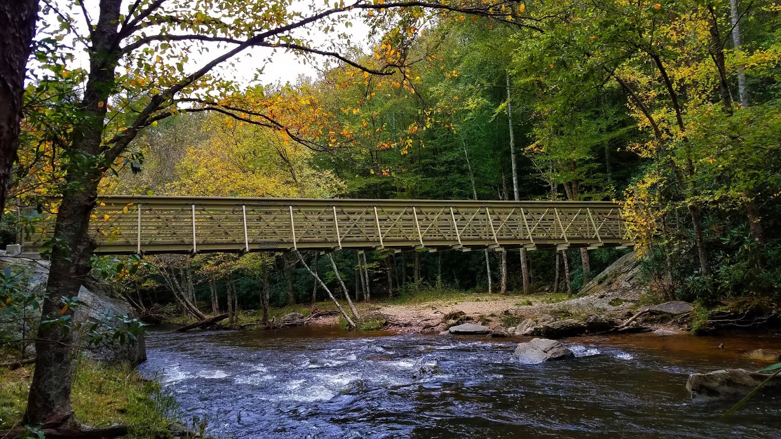
After the first mile the trail intersects with my old friend the MST.  When Danny and I appeared at the river’s edge here in 2010 we were challenged by a wide expanse of flowing water.  I successfully rock hopped across while Danny waded through. Today there’s a beautiful bridge that I symbolically strolled across and back.
 

The trail stays close by the river to the right, enticing hikers to go to the water’s edge for a closer look at white water tumbling over boulders. Having never seen Hebron Falls before, at several places we wondered, is this it? Cascade after cascade after cascade.  

Never fear, friends, you will not miss it

Hebron Falls is at a short switchback side trail down to a giant’s bowling alley of boulders and water tumbling and crashing everywhere.  On this cold and inhospitable-looking Saturday we saw just four like-minded waterfall chasers; on many Saturdays it’s crawling with people, Appalachian State students and coolers of beer. (My friends and I did the same on the New River when we were Virginia Tech students!)

We followed the rough scramble up the righthand side to get to the main falls, but every crevice had its own impressive mesmerizing flow.

 
Checking the time, we decided we were already in a great place and should postpone Snake Mountain ‘til another day.  We continued the Boone Fork Loop counterclockwise, still sticking alongside Boone Fork River.


 At about the 2.5 mile mark, the trail leaves the larger stream and curves left to follow Bee Tree Creek upstream. The water flow narrows but is just as robust – and no more bridges. The trail crossed Bee Tree at least 8 times (at one point 3 times within sight of each other), crossings that are probably inconsequential rock hops in the summer but today required contemplation and a plan before stepping off. All were precarious rock hops and log balancing acts.  A couple of times Jim had to help by pulling me across wide expanses. No mishaps, so I can say it was a whole lot of fun.

Let Jim go first

Finally turning away from the water, the trail left the woods for a nice meadow stroll and the final mile cutting through Price Park Campground to return to the picnic parking area. The weather brightened, and the further we went around the loop, the more people we encountered. Folks were setting up tent compounds, lighting campfires, kids riding bikes. We were a tiny bit envious and wondered if they were prepared for the coming cold night. (Two years ago, in October 2016, we camped in this campground with friends right after Hurricane Matthew!)

Including side trips to viewpoints, the total hike was 6.2 miles. With time for a little something spontaneous now, we drove into Boone to find Howard’s Knob, which I’d heard about but not seen. Howard’s Knob is a Watauga County Park featuring a prominent point overlooking the town and Appalachian State University.  We drove to the top (there might be a hiking trail but we didn’t have info for it) and enjoyed the clear long distance views all the way out to the hallmarks of Linville Gorge.  

Table Rock and Hawksbill on the far right (western) horizon. Spotting these two icons never fails to thrill me!

A midafternoon meal at Wild Craft Eatery in downtown Boone, picking up goodies at Insomnia Cookies for the drive home – cheers to a chilly adventure exploring with my better half!


“Bad weather always looks worse through a window.”  ~Author Unknown