Wednesday, July 27, 2011

Summiting Jockey's Ridge

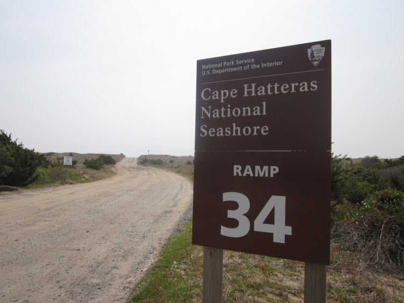
MST – Day 64 – 4-27-11 – ORV #2 to Jockey's Ridge State Park Summit – 12.4 Miles
That feeling of anticipation is often as delicious as the fulfillment of the experience itself:  Christmas morning… 21st birthday…reaching a significant summit in a hiking challenge.  I’ve said before, the only thing better than the beginning of a hike is the end of a hike. 
Although Danny and I both had more to do to complete the MST, climbing the tallest sand dune in the Eastern United States at Jockey's Ridge State Park carried much significance for both of us.    After all, it would be our last day together on this challenge and we had logged lot of miles as a hiking duo.  We had envisioned this day since 10/21/09 when we stood at Clingman’s Dome in the Smokies and pointed our feet east on the MST.
We started out from ORV #2 and walked onto the beach.  I took off my shoes to walk barefoot for a while. 
Before long we reached the edge of civilization, beachfront houses practically standing in the water.  It dawned on me that these houses were damaged in past hurricanes, no longer inhabitable, but still standing at the edge like memories, some tilting forward and some tilting back.
Hurricane remnants

Sand bags on the new first row
Bulldozing sand

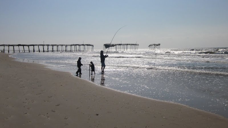
At the Outer Banks pier the usual suspects were fishing and enjoying cold beverages from their coolers.  These boys looked like they were old hands.  Every kid needs to go fishing at least once, don’t you think?
Intense concentration
 
No more solitude for us as casual beach walkers appeared.  A group gathered around a small shark that had washed up on shore, still gasping.  A man threw it back into the water but it washed up again, unable to swim away.

We picked a point to get off the beach, perhaps a little too soon, because all that was left was walking on a sidewalk beside Highway 12, busier now.  We reached our left turn street and found our way to the entrance to Jockey's Ridge State Park.
Danny and I retrieved the sparkling apple juice and chocolate that we had stowed in the car to celebrate on the summit.  I picked up my hiking sticks for the first time since we arrived at the Outer Banks.   Danny was very animated, excited at our impending triumph, and I enjoyed seeing her enthusiasm. 
Signing the Mountains-To-Sea register
The ranger in the office radioed Laura Arrington, who was patrolling in the park, and she agreed to meet us at the summit.  But where is the summit?  Well, it depends on how the wind is blowing.  There is no marker because the high point changes slightly as the sand shifts.  Out the back door of the visitor center the trail to the dunes begins.  The wind was blowing significantly and the sand was deep and soft.  This wasn’t going to be the stroll I thought it would be.  Dozens of people were trekking back and forth as we squished our way up the first sand dune.  And at the top…was the view of the REAL dune.
Now the wind was blowing sand horizontally, so hard it hurt on bare skin, and I was worried about damaging my camera.  And again, thank goodness for my sunglasses.  Every hiker for herself  – I saw Laura and another woman on a golf cart waving wildly at the top, so I aimed myself in their direction.  Wind, sand, beaming sunshine:  and there we were.
On top of Jockey's Ridge
We celebrated quickly with our treats and then hightailed it back to the visitor center to sit down and have a snack, since it was impossible to picnic on top of the dune as we had hoped. 
Danny planned to hang around for a few days until she could meet up with friends to finish her MST road walking, so she would return to Jockey's Ridge when conditions were better.  Me, I had a seven-hour drive to get back home.  I grabbed a quick shower at the hotel and said goodbye for now to my hiking buddy.  I know that Danny and I have many more adventures ahead.  Her story of the day is here.
I sang along with my Glee CD’s all the way home.
You are never too old to set another goal or to dream a new dream. ~C.S. Lewis


Conquering Pea Island

MST – Day 63 – 4-26-11 – Pea Island National Wildlife Refuge – 12.8 Miles
Ahhhh, Pea Island National Wildlife Refuge.  Vehicle access is prohibited and very few people set foot there.  We had driven the length of it on Highway 12 several times, but the idea of 12+ miles of uninterrupted beach walking was still a little intimidating.  No landmarks?  No breaks?  Just 12 miles of sand?  We’d learned that not all sand is friendly.  For most of our Outer Banks walking it was very easy to get off the beach and onto the road, but along Pea Island the terrain between is sometimes wider and thick with scrub vegetation.  Afternoon thunderstorms were in the forecast, so we needed an exit plan.  And the plan was…go, go, go.  We were determined to conquer Pea Island.

Walking under the last house in Rodanthe
Dead shark
Footprints – nobody here but us MST hikers
Or...what’s that flash of blue over by that sand dune?  Is it possible there is someone else here?  I think this artist was as surprised to see us as we were to see him. 
One landmark from Scot’s book – the smoke stack of a shipwreck visible at low tide.  At this point we knew we’d walked about eight miles

A ray or a skate?  There were many of these washed up  on shore.
We watched these clouds roll in for what seemed like hours, but they didn’t get close enough to feel threatening.
At last we saw the beach curving to the left as we approached the Oregon Inlet and the Bonner Bridge.  We picked a sand dune to climb over and then followed an old roadway to the parking area where we’d left our car.  Pea Island:  done!
Herbert C. Bonner Bridge one more time
Tomorrow is our last day and we’ll be hiking to the terminus of the Mountains-To-Sea Trail at Jockeys Ridge State Park.  Before we checked into our hotel in Nags Head we stopped at the park to get an idea of what was in store.   Superintendent Debo Cox and the other folks at the visitor center made a big to-do about us coming through.  One enthusiastic employee, Laura Arrington, agreed to meet us at the summit tomorrow.  My maiden name is Arrington and Laura and I had a nice chat as we tried to determine if we were related (sadly, no). 
After tomorrow Danny has three more days of road walking and I have more than a few days of biking to complete the MST.  Still, summiting Jockeys Ridge is a major milestone in this adventure!
Danny’s blog entry is here.


Tuesday, July 26, 2011

Happy Anniversary Honey

MST – Day 62 – 4-25-11 – ORV #27 to Midgett Realty in Rodanthe – 10 Miles

The routine is set now:  start early, park a car, drive back to where we left off, walk five or so miles of beach, get onto Highway 12, walk through a town…
Early morning shadows
Low tide, just the way we like it

After the requisite few miles we left the beach on a long boardwalk to go to Highway 12, passing through a small neighborhood of very posh recently constructed homes.  We peeked in a few windows.  Most of the homes were unoccupied with hopeful for sale signs in the front yards.

We walked through the tiny town of Salvo with its miniature post office.  I really should have been photographing these post offices from the beginning since we walk by one in nearly every town.  My dad’s career was with the U.S. Postal Service.  He would have gotten a kick out of these little ones.  

In the town of Waves we passed a tattoo parlor and I could not resist texting my husband and kids to tell them I was thinking of getting a “souvenir” of my journey.  They quickly responded with lots of suggestions but I managed to keep on walking.
The Midgett family cemetery holds a prominent spot beside Highway 12.  This family name is connected with lots of businesses in the area.

Finally we entered Rodanthe and stopped at my coffee shop that wasn’t open yesterday – yippee!  And since it was a hot day I celebrated with an iced coffee drink.  Connected to this row of shops is the kiteboarding outfitter that I found earlier and business was booming.  This is the sound side of the island where the water is calmer.  In fact, the water is only about waist deep.  If I wasn’t in the middle of a hike I could have pulled up a seat and watched for hours.

Danny found a new friend to give her the scoop on kite boarding

Close to our end point in the northern end of Rodanthe we saw a curious monument entitled “Exodus From Chamacomico” marking an interesting Civil War event. 
At the Midgett Realty offices we asked if we could leave a car in their parking lot for tomorrow’s hike and they very kindly granted permission.  It was the closest we could get to the beginning of our next big challenge – Pea Island. 
Today was Jim’s and my 30th wedding anniversary and Danny treated me to dinner in celebration.  In our original scheduling I had hoped that Jim could join us for a few days at the Outer Banks.  That didn’t work out but I kept the dates planned because it’s pretty hard for Danny and me to find a 10-day window in our busy schedules.  I was sad not to see Jim on our special day, but we’ve planned a 10-day trip to Ireland later in the summer to make up for it.
Here you will find Danny’s blog entry for today.
Our wedding was many years ago.  The celebration continues to this day.  ~Gene Perret

Bodie Island Lighthouse

MST – Day 61 – 4-24-11 – North End of Bonner Bridge to ORV #2 – 5 Miles
Today was Easter Sunday, a day that Danny and I had agreed to take off from hiking, but we ended up doing a few miles anyway because…we’re hikers.  And even five miles became an adventure.

First, though, I wanted to attend an Easter service at a local church, and there was only one on the island – Fair Haven United Methodist Church.  Currently I belong to Avondale Presbyterian Church in Charlotte, but I was raised as a Baptist.  Well, the Methodists are right next door to the Baptists in terms of their worship style, so memories came flooding back.  Danny went along too.  She grew up in the Jewish faith so this was quite a different experience for her, I’m sure.  The church was very small but the sanctuary was filled with visiting family and friends for this most important day for Christians.  There was much sharing of joys and concerns of the congregation and the hymns were very familiar.  It was comforting to be sharing the story even though I was away from my home church:  “Christ has died, Christ is risen, Christ will come again.”

After church we changed into hiking gear and drove across the Herbert C. Bonner Bridge (no walking!) to Bodie Island and parked at the first ORV ramp.  I was a little nervous about getting my car out of the sand later (but I did, of course).

We strolled along the roadside, talking about this and that, not paying much attention to our next landmark.  The mosquitoes were especially vicious and I stopped to apply some bug spray.  The nozzle got twisted and I inadvertently sprayed myself right in the eyes. 
Crying tears helps in this kind of situation and even yelling helps a little (Danny didn’t take it personally).  My eyes were burning fiercely and I had to bend over to keep from falling down.  I was afraid that I had done real damage.  Danny was thinking fast on her feet to get water, but the tube from my water bladder is designed not to flow freely so that wasn’t enough.  She was carrying only Gatorade.  The fastest course of action was to soak a bandana with Gatorade and apply it to my eyes.  It didn’t make the burning worse and eventually it began to ease. 
What now?  Do we continue on or go back to the car?  The pain was diminishing so we decided to continue on to the Bodie Lighthouse where there were water facilities.  We walked forward until we realized we had missed our landmark.  Again – what now?  Hikers are stubborn, so again we opted to keep going.  But backtracking on a hot day while pressing a Gatorade bandana first to one eye and then the other is something I do not want to repeat in my lifetime.  We found our error, got onto our trail and enjoyed the walk through the marshland.
Now I am spoiled for walking up to lighthouses rather than driving up to them, the anticipation and the first glimpse of these unique structures from the trail.
We found three dollar bills lying on the ground along the trail, probably slipped out of someone’s pocket when they reached for their water bottle.  We carried it to the lighthouse and put it in the donation box.  By the time we reached the lighthouse my eyes were just feeling itchy as though I had been crying (uh, yeah) and I flushed them with water in the bathroom.  No permanent damage done…but, boy, did that hurt.  A lesson to always carry water and a bandana…and maybe use bug wipes or creams instead of sprays…

Bodie Lighthouse and keeper’s quarters

The Bodie Lighthouse is not open for climbing, so after visiting the small museum in the keeper's quarters we walked on to our second car, picked up mine, and then went our separate ways for a little time off in the afternoon.  Danny wanted to get to her writing and I went in search of a coffee shop with wifi.  Alas, there was no such thing on Easter Sunday, but I found an outfitter where kiteboarders were gathered and I stopped to watch for a while. 


What guy with his shirt off?  I’m looking at the kites…
Read Danny’s tale of today’s hike here. 


The happiest man is he who learns from nature the lesson of worship. ~Ralph Waldo Emerson

Sunday, July 24, 2011

Avon & Rodanthe

MST - Day 60 – 4-23-11 – Cape Hatteras Motel to ORV 27 – 14.3 Miles

I felt a little more tired today when I got up, lots to do, including packing up to leave our little cozy spot and setting up our shuttle.  Our first four miles of the day were on the beach.  I was a little apprehensive because of how it ended yesterday, soft sand and swearing to myself, but walking was tolerable.  Danny and I agreed early on in our Outer Banks hiking that if the sand was difficult then the road was an acceptable alternative.  I was glad to get off after four miles, though, and change the scenery.

No vehicles sign + tire tracks = irony

In the town of Avon we stopped at a gas station for a break and it began to rain lightly; however, in the time it took us to don rain gear the rain passed over and the sun came out.  We got wet by putting our packs back down on the ground to put the rain gear away.  The homes in Avon were upscale and very colorful, a favorite vacation destination.  Highway 12 took us past restaurants and supermarkets.

Outside Uglie Mugs Coffee Shop we asked a man to take a photo.  He complied and then offered to buy us a cup of coffee.  We had a very nice visit with him and his wife, explaining the MST and chatting about the Outer Banks – a highlight of the day.

But of course we had miles to go before…well, you know.  We walked on out of Avon and back onto the beach at ORV #34.
The beach walk was not so nice this time, alternating erratically between hard-packed and soft sand, flat terrain and steep slopes.  We passed a few fishing parties.  One fellow cheered, “Go Hokies!” when he saw my hat.  (Virginia Tech attire is a great attention-getter – I always wear Hokie shirts in airports and make new friends.)  We took a nice break on a big log, the only time we’ve actually sat and chilled on the beach during this entire trek.
The outgoing tide leaves patterns on the sand
Finally at ORV #30 we decided to call it quits and head for the road.  Our last 2.4 miles was on nice, hard pavement.  I was very glad to see my car.   Again we enacted the arduous process of retrieving our first car and driving on to our next motel in Rodanthe, a town we had eagerly anticipated that turned out not to be as upscale as Avon.  There were attractive rental houses but few other facilities, no good grocery store, etc.  Our efficiency was one room (we were spoiled at the last place) but I grew to appreciate the quiet and the wireless internet.  The owners were very friendly and even helped us with our shuttle on our second day.  All in all, I give the Sea Sound Motel a thumbs-up.

An upcoming challenge was hiking through Pea Island National Wildlife Refuge, a long stretch with few access points.  Danny and I drove along Highway 12 trying to get a  feel for this section.  How difficult would it be to get off the beach if there is lightning?  Are there any landmarks to see?  How will we know our progress?  Scot's book covers this 12-mile section in about 6 lines, meaning "there ain't much to tell ya."
At one parking area along the drive we met two fish and wildlife refuge officers and we asked their opinion about another challenge we were concerned about:  walking across the Herbert C. Bonner Bridge at the northern end of Pea Island.  The bridge is nearly 3 miles long, two lanes, no walking or biking lanes, and windy all the time.  Other MST hikers have told us how treacherous this bridge feels.  The officers advised us not to walk across (one said he was a cyclist and he would not bike across it).  Good enough for me – we hereby declare ourselves too sane to walk across that bridge.
Over dinner Danny talked about an upcoming first-time camping trip with her granddaughter and asked me how to make ‘smores, something she had never done that I’ve done dozens of times with my kids and with Girl Scouts.  What an interesting conversation, trying to describe that process step by step.  First you take a graham cracker…

Saturday, July 23, 2011

Cape Hatteras Lighthouse

MST - Day 59 – 4-22-11 – Hatteras Ferry to Buxton – 13.75 miles

I woke up this morning with one exciting thought:  Today we are hiking to the Cape Hatteras Lighthouse!  I have lived in North Carolina for 30 years and have never visited this icon.  (In fact, I’ve only visited the Outer Banks once on a rainy weekend in 1988.) 
I loved our little home-away-from-home at Cape Pines Motel – a two-room efficiency so Danny and I both had space to spread out computers, stuff, and some privacy.  She’s an early riser and I’m a stay-in-bed-until-the-last-possible-moment riser, so she had the kitchen to turn on lights, eat breakfast, read, compute, etc. 
Our hike began with an early morning stroll through the town of Hatteras, sleepy now but busy later in the day. 
Land Shark (remember SNL?)
Cemetery in town
On the beach again, less windy than yesterday, hard packed sand and easy walking.  Because of a sunburn on the backs of my legs, it was long pants for me for the next few days.  (You would think I would have learned that lesson after all these years.)  And I felt like most of the time I would just be carrying my hiking poles on the level terrain, so I left them behind.  I missed them a time or two, but for the most part it was liberating to swing my arms as I walked. 
Under the pier
At NPS Frisco Campground we got off the beach and meandered along the paved drive – MST white circle blazes here!  We followed the blazes through onto the Open Ponds Trail, 4.4 miles of maritime forest.  The trail started off as a soft pine needle walk and then transitioned to soft sand, hard to negotiate without my poles.   We passed a beautiful pond, scrub pines, two deer  – I did not expect this type of trail at this point, another one of the delights of the MST. 
Best white blaze yet (do you recognize poison ivy?)

At Buxton Woods picnic area the trail changed to pavement and a short walk to the Cape Hatteras Lighthouse – goosebumps! 
The lighthouse was closed at the moment because of the wind.  We inquired about advance tickets and learned they were not necessary, so we decided to come back after we completed the day’s hike.  We continued on, walking along the track on which the lighthouse was moved back in 1999 from its original site.  Can you see the lighthouse in the distance?
Back at the lighthouse, the top had been opened again, and as we waited for our group’s turn to ascend we listened to the park ranger’s funny speech about no leaning, no spitting, etc.  I whispered to Danny, “Let’s make sure we’re first going up because we’re faster than these folks.”   What an awesome aerial view of the Cape!  The ranger at the top pointed out Diamond Shoals and explained that here the warm Gulf stream and the cold Labrador current meet.   The colliding water masses create large sand bars that are dangerous and sometimes fatal for ships (hence the nickname, “Graveyard of the Atlantic”).  Reading about all this is interesting, but standing on top of the lighthouse and looking out over the waters is breathtaking.


We browsed through the exhibits on the grounds and watched a fascinating video of the monumental endeavor to move the lighthouse, something I remember watching often in the news as it was taking place.  Read about the move here. 
Over the course of our Mountains-To-Sea adventure Danny and I have seen some impressive natural icons of North Carolina:  the Great Smoky Mountains from Clingmans Dome, Grandfather Mountain, Pilot Mountain, to name a few.  Although the Cape Hatteras Lighthouse is manmade, seeing it from the context of the MST was definitely a highlight for me.
Danny’s story of our Hatteras day is here.
In every outthrust headland, in every curving beach, in every grain of sand there is the story of the earth.  ~ Rachel Carson