Even More Waterfalls In Oconee County, SC: Long Creek Falls & Opossum Creek Falls
Long Creek, SC – 6/6/20 – 10.5 Miles
These two waterfalls are in the same neck of the woods on the same forest road. Driving along gravelly Turkey Ridge Road (aka FS 755) we passed the Opossum Creek Falls trailhead, big signs and lots of cars. Since that looks easy, we figured, let’s go to Long Creek Falls first. Ah, hindsight…
Long Creek FallsThis detailed description helped get us to the trailhead. At 2.8 miles on Turkey Ridge Road, we parked in the grassy area described and heeded the caution, “FS 755-I continues on and it looks tempting to continue driving down, but don’t.” There was no signage there about Long Creek Falls. We walked down this 4X4 road of red mud and deep trenches, about half a mile to its end and this still-not-helpful sign.

An overgrown but discernible path began, sometimes on and sometimes off an old logging road. At a couple of decision points we kept to the right, then saw that the left leading path kept connecting back again. For about a mile we followed along, not too steep but clearly descending, in cool deep shade. We could hear big water below, and at an obvious left turn the trail plunged down to the river.
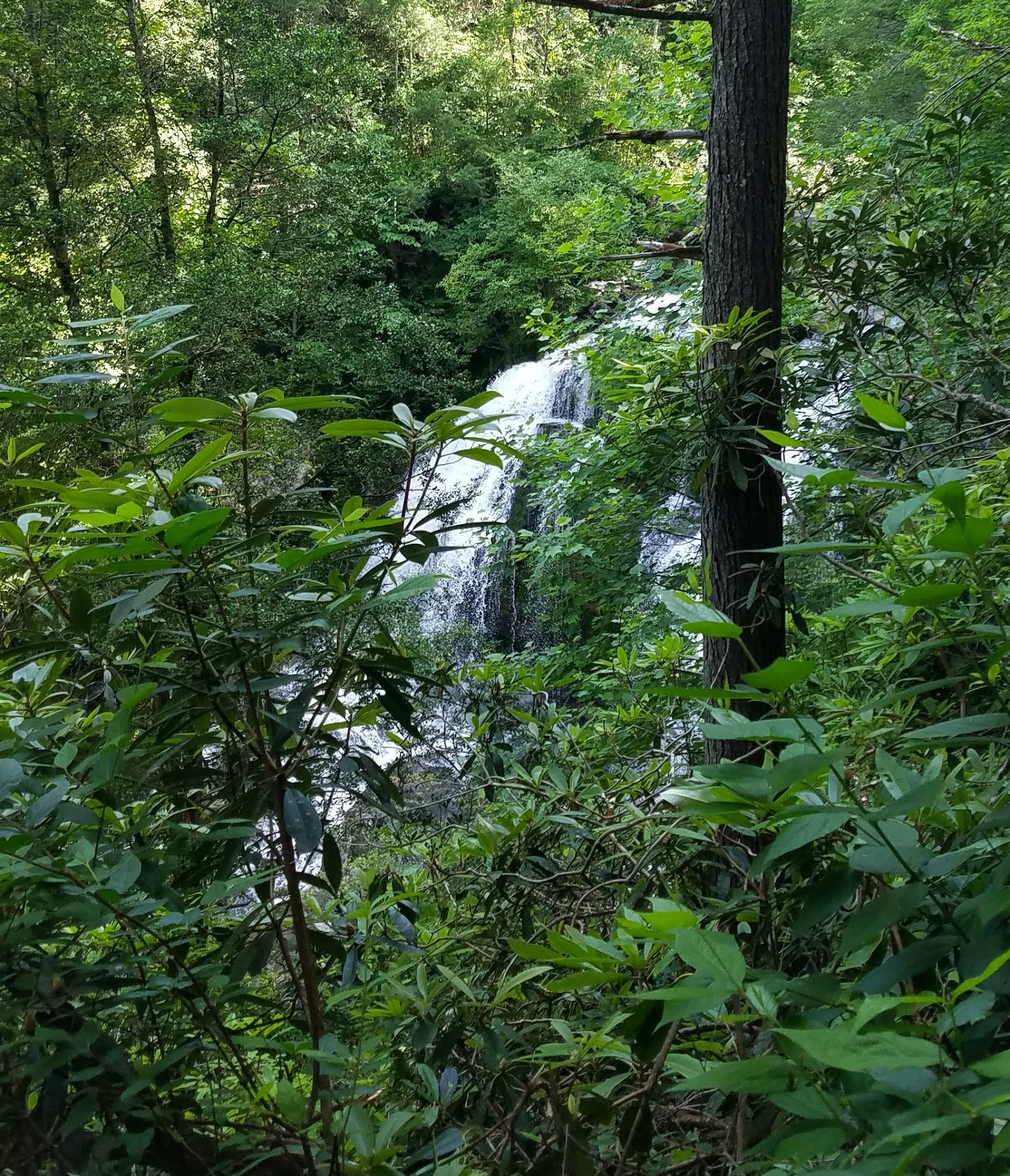
We popped out on the edge of the Chattooga River where Long Creek flows into it from the right. It’s probably not hard to cross Long Creek here in lower flow, but not today. We scrambled over big rocks going up the right side of Long Creek to get a look at the waterfall, but we didn’t try to get right up to the base.
A glimpse of Long Creek Falls as the trail descends to the Chattooga River
The Chattooga River where Long Creek joins
Nobody here but us
The out-and-back hike was 3.5 miles. Adventurous folks who are prepared for wet scrambling would have a blast getting up to the waterfall. This would also be a great hike in colder weather when the path is easier to follow.
When we got back to our car, a family was parked there trying to figure things out, so at least we could give them more information on how to reach the falls.
Opossum Creek Falls
Encouraged by our success with Long Creek Falls, Jim and I backtracked on Turkey Ridge Road to the cars parked for Opossum Creek Falls, where I made a mistake and learned a lesson about Forest Service signage. Between two obvious trailheads was a sign labeled “Opossum Creek Falls” with an arrow pointing to the left, which I interpreted as the trail on the left.
This trail descended but became fainter than I would have expected. It’s a popular trail, so how could that be? We kept going for nearly a mile until I had to admit it couldn’t be right. We hiked back up to the beginning and took the trailhead to the right, which fizzled out in similar fashion (we didn’t go as far).
Back at the sign in the parking lot for the third time, we puzzled that maybe the left arrow means to go further along the gravel road to find the trail. Sure enough, 50 yards away, a nice sign “Opossum Creek Falls” with an arrow indicating straight ahead – damn! Two miles and time wasted. In our defense, parked cars hid the sign and we didn’t see it until we were on top of it.
Here is a great hike description that I wish I’d seen beforehand: “The sign for Opossum Creek Falls Trail is placed directly across from the parking area. There are two trailheads by the sign. Neither are the trails you want. Walk down the road toward the left for about 50 yards. You’ll see two boulders on the side of the road and a trail. That’s the Opossum Creek trailhead.”
With little conversation, Jim and I hurried 2.5 miles down to the Chattooga. My head cleared enough to notice the small wonders at our feet along the way.

Pipsissewa, one of my favorites
Coker's Amanita
Rafting groups were pulled up on the beach of a wide river pool, taking a break on this hot day. We turned left and headed up Opossum Creek, per instructions, prepared for “a heavily vegetated path and a time-consuming half-mile hike to the base of the falls.” To our delight, the path was a good one, nothing to impede us, and the waterfall was stunning.
We claimed a big rock as a front row seat for our late lunch – whew! Thankfully a big enough payoff to erase the two-mile mistake. All was forgiven as we sat mesmerized by the power of the water.
We backtracked to the Chattooga River. The rafting groups were gone, so we walked along the sandy beach. One couple was lounging by the water’s edge like they were waiting for us to leave. The heat and humidity were not enticing us to hike 2.5 miles back up to the road… what if we went swimming first?
Dripping wet from the river rather than from sweat, we conquered the climb
back up to the gravel road.
How far do you have to research to find all pertinent info? Maybe my writeup will help someone. Jim recorded a Strava track that showed the two-mile mistake was a manway that got us almost the whole way to connect with the “real” trail not far from the river – geez! What lessons? Certainly GPS apps and tracks would have been helpful in this instance. Yes, people have walked in the woods for millennia without them…and that’s why there are so many trails!
A little screened porch charcuterie made us thirsty and brave after three days of waterfall hiking. We timidly ventured into Walhalla for a beer on the patio at West & Co. Taproom. All’s well that ends well.
“There’s no better place to find yourself
than sitting by a waterfall
and listening to its music.”
~Roland R. Kemler


 At an intersection, a sign pointed to the right for the Narrows.