Appalachian Trail in NC – Standing Indian - Deep Gap Southbound to Blue Ridge Gap – 9/15/17 –
10.1 miles
Just two gaps now in my miles on the Appalachian Trail in North
Carolina, the larger one a popular stretch called Standing Indian in Nantahala
National Forest, due south of Franklin, NC. I asked my good friend Mike to help
me out a little and he responded in character by helping me out a lot. The goal was tackling 40 miles in three days –
of course, it didn’t work out that way. If
I had hired a shuttle and set out to backpack this section without support, I
would have been in a pickle.
Weather is a major factor in hiking, even weather that has
already happened. Hurricane Irma swept
across the Caribbean and on to Florida on September 10. On September 11, downgraded Tropical Storm
Irma crashed through upstate Georgia and southwestern North Carolina with damaging
high winds and torrential rains. Four
days later, Mike and I arrived in Franklin.
We stopped at the Nantahala Ranger District office to check on the status
of the forest roads we wanted to use:
all clear. Let’s hope the trails
are clear, too.
More know-before-you-go:
The point where the AT crosses the Georgia-North Carolina state line is at
Bly Gap, a lovely place deep in the woods with no road access. The closest access in Georgia is three miles
further south at Blue Ridge Gap. Mike
dropped me off at Deep Gap, NC where I would start southbound, then headed to
Blue Ridge Gap where he would hike northbound to meet me.
With shivers of anticipation, I stepped onto my old friend,
the Appalachian Trail. My brain registered green leaves carpeting the trail –
and everything else. I thought to
myself, I’ll have to pay close attention and keep an eye on the white
blazes. I walked about 50 yards and
stepped over a branch laying across the path.
I walked around a bend and stepped over a skinny tree trunk. Ten minutes after that I confronted a massive
tree crown obliterating the trail. And so it began...Hmmm.
This obstacle course distorted my sense of pacing to the
point that I couldn’t rely on time to tell me how far I’d gone. Fortunately, signs helped me track my
progress, although I was dismayed to see how slow that progress was.
At Water Oak Gap, two miles from my start at Deep Gap
Still enough good humor to chuckle at "Chunky Gal"
Muskrat Creek Shelter looked intact. What is not shown is the fact that I nearly
missed it altogether because there were so many downed trees across the
intersection leading to it. I was very
happy to find this shelter so that I could again determine my location.
At last, a view near Courthouse Bald
I had long ago stopped taking pictures of blowdowns; they
just kept coming. Each new one made my
heart sink a little bit lower, a new problem to solve. Over, under, around, through – or a
combination of techniques. Could I be the first person on the trail since the
storm? Not once did I see a path cleared
by someone who came before me. The upper parts of trees – the crowns – were the
most difficult. First I looked for a way
around; if that didn’t look feasible, I climbed between branches, up over one,
down under the next. Exhausting. I
counted 125 significant blowdowns along the 10 miles I hiked. One thing I
decided for sure: I’m not doing this
again tomorrow.
At Bly Gap, a venerable old tree that every AT hiker
has a photo of.
Even this old fellow lost
a limb to the storm.
About eight miles in, I saw Mike coming up the trail
carrying loppers. He’d been methodically
working on the wreckage as he hiked in to meet me, flipping the smaller limbs
off the trail and cutting paths through the big branches. The photo below makes me smile: David and Goliath. Mike is clipping the poison ivy on this old sentinel
that has laid down its life across the trail.
It wasn’t all misery, of course. What were impediments to my progress were
merely nature’s prunings, part of the process.
Little miracles were still happening.
So 10 miles covered in 7 hours, and I was about as tired as
I’ve ever felt after a hike. In Mike’s volunteer
role as the greatest support person on earth, he had scouted out a comfortable
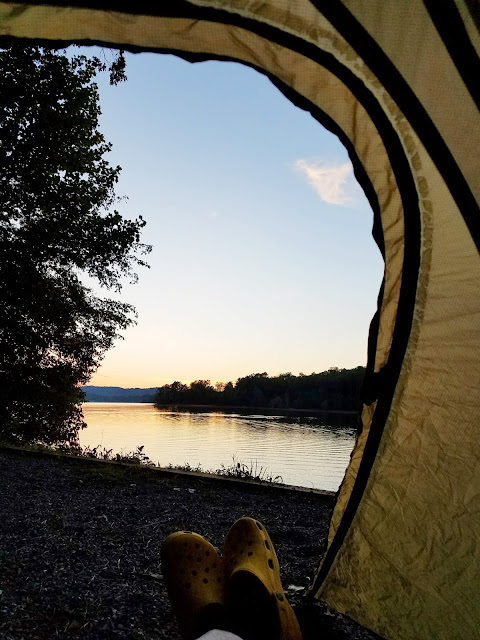
place to camp for the night – Jackrabbit Campground on Lake Chatuge, a couple
of miles north of Hiawassee, GA. A
little supper and an adult beverage at Monte Alban Restaurant, a clear night
sky and crickets by the water.
“Therefore do not worry about tomorrow, for tomorrow will
worry about itself. Each day has enough trouble of its own.”
~Matthew 6:34


No comments:
Post a Comment