

Let’s talk about our stellar hiking day! We’re still in the Dolomites, the sun is shining, the hiking is maybe a teensy degree less hard, and we’re lucky to have the health, wealth and time to be on this adventure.
Jim’s shorts were still wet from last night’s washing so he pinned them to the outside of his backpack to dry in the sun. We set out in deep morning shadows after a cold breakfast and an expensive takeaway lunch. Goodbye, Rifugio Staulanza.
Jim’s in charge of navigation – where is our trail? It began with a few hundred yards’ walk on the curvy mountain road, so staying outside of the guardrail seemed safer.


At a hairpin turn, we left the pavement for a gravel spur road and found ourselves on a collision course with a herd of cows – we “heard” the herd first with the clanging bells around their necks. Do the cows get tired of hearing their bells? A shepherd guided them across the road right in front of us. Jim got a little mixed up in it.

Steve and Emily caught up to us during the cow parade. At a small farm guesthouse called Casera Vescora we passed through the pasture gate and climbed the steep hillside. Past a fence marking the property boundary, the path leveled out, giving us hope that today would maybe be easier than yesterday? (It had its tough moments, but perhaps because we are stronger.)


Where several paths converged, we were joined by walkers seemingly out of nowhere, all heading for Rifugio Coldai. The ascent is a series of steep switchbacks which are obscured by shortcuts. One guidebook says “zigzags of the mule track” – 1,000 feet elevation gain in 1.3 miles.

The river of people flowing upward, scrambling up steep shortcuts, made it difficult to distinguish the “real” track, which would be a moderate grade. It was hard not to just follow everyone else.


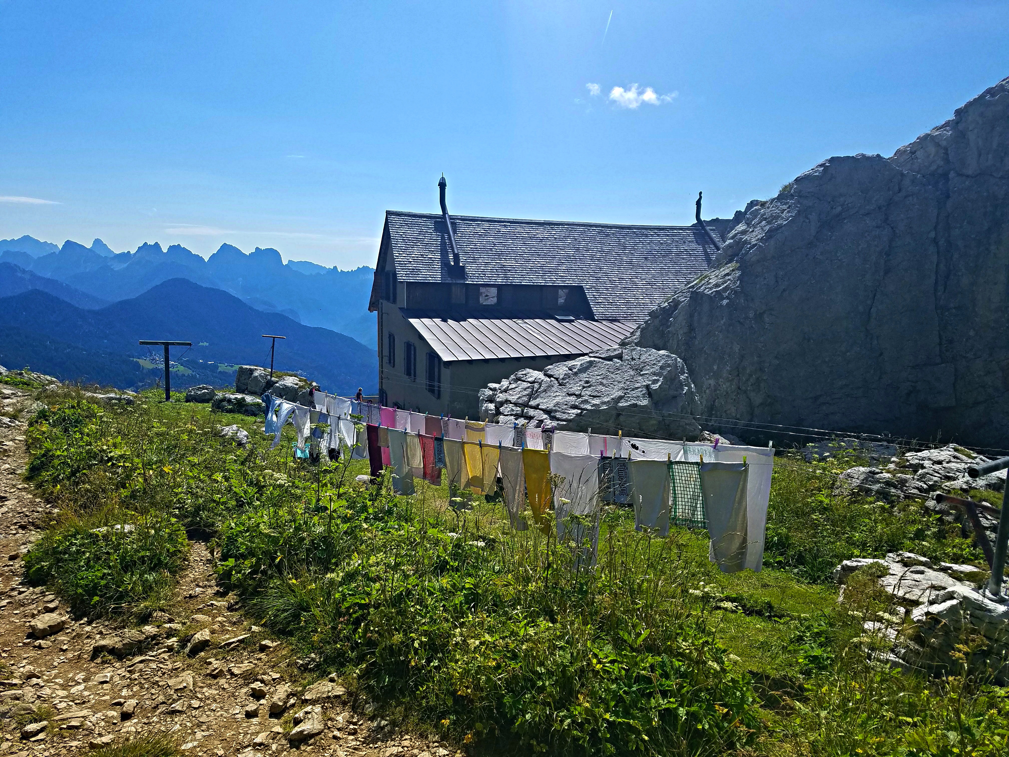
Rifugio Coldai is perched in an amazingly spectacular setting, 7,000 feet high, at the northern end of the Civetta Mountains group. The front of the rifugio faces Monte Pelmo and the back side faces Forcella Coldai and its viewpoint above Lago Coldai (more on that in a minute.)


chugging my celebratory orange Fanta

Jim and I had a bathroom break, slathered on sunscreen for the next stretch, took a deep breath and pointed ourselves to a bit more climbing to Forcella Coldai.


(Come on, you know you’d take a selfie here too, even if you didn’t post it on social media)
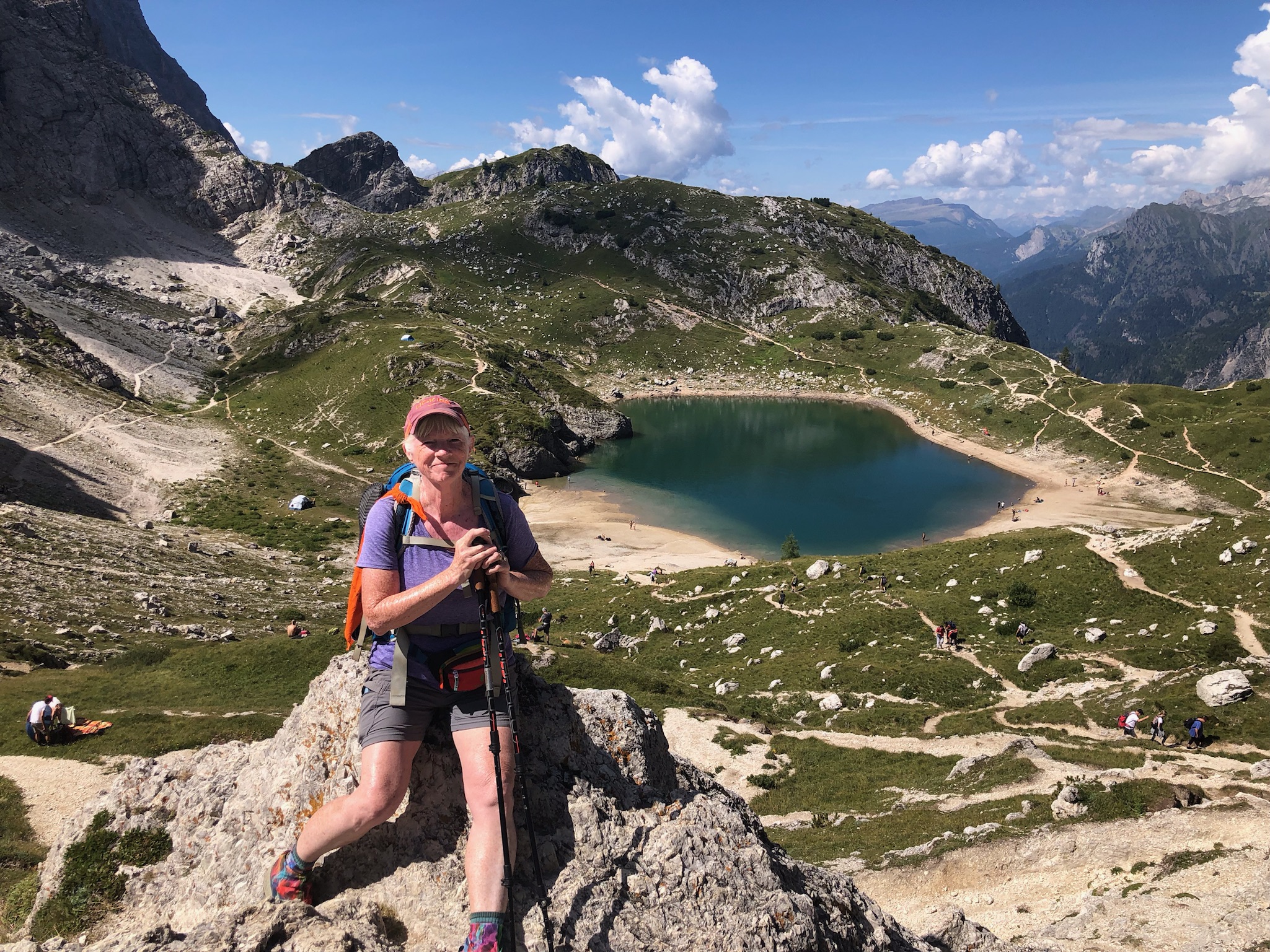
On a little grassy spot above the lake, Jim and I sat to eat our takeaway lunch and watch people swimming and hanging out at the water’s edge. I resisted the urge to take off shoes and socks and put my feet in the water. We had many miles to go.

through the notch near the upper left


(yes, there is a trail down to it)
Back on the AV1 (now #560), we passed through Forcella Col Negro and into another world of boulders and white scree on a balcony path at the base of Civetta (where have we experienced this before? But today the path was more stable.)


Our next waypoint was the side trail to Rifugio Tissi. We could see the pass; however, the distance to it was two hours traversing boulder fields, looking for cairns to guide us, slow going over/under/around all sizes of rocks. Stop often to marvel at the vastness of the landscape you’re in and how small you are in it.

because you may cause avalanches


When the AV1 began its steady climb to the junction with the Rifugio Tissi side trail, I put my head down and slowed to a sustainable pace. I guess Jim thought he could encourage me by pausing and asking how I was doing (and sometimes that felt helpful) but at this point I just wanted to get myself there. One time he stopped directly on the trail, waited until I was within a couple of steps of him, and asked if I wanted to stop.
I was using my breath to walk, not talk, and I lost my temper – “Don’t get in the path of a hiker going steeply uphill!” Poor Jim began to apologize and defend – “I was only trying to help” – but he was impeding me trying to reach a difficult goal. I felt inadequate and incompetent. AND I was yelling at the nicest person on earth. This was my low point of the entire AV1 hike.

Pity party over for now, let’s get our vibe back. Because of the time, we did not detour to Rifugio Tissi. Rifugio Vazzoler, our home for tonight, was our focus now. We were mostly past the Civetta, but it dominated looking back over our left shoulder as the trail dipped into Val Civetta.


Where's the shepherd?


we walked together for the last couple of miles


The south-facing side is tall, straight and flat,
reminding me of the face of Notre-Dame Cathedral with its twin towers.

 On the right side of Torre Venezia, a row of peaks extending beyond it also looked like the cathedral, a long body of spires. For me, this was the most impressive rock formation of our trek.
The last mile passed through dense forest (whew, shade!) Out of nowhere, I slipped and fell hard on my back (just like on Day 2). As I went down I knew my right leg twisted in a weird way – an embarrassing, ungraceful fall. My backpack saved my head, though. No damage done, thank goodness.
Rifugio Vazzoler is a rustic old style rifugio surrounded by thick Hansel-and-Gretel woods, picnic tables outside, a pump to fill water bottles. No hope of wifi working. Classic bar, cash only, glass jugs of fruit-infused grappa lining a shelf along the back wall. A botanical garden that I didn’t get time to explore. Every bed filled every night.


 The bunkhouse

 Good luck charging that iPhone


Jim and I had a bunk room to ourselves, space to spread out and hang sweaty clothes to dry. Unisex bathrooms down the hall, everyone sharing 3 showers, 3 toilets, 3 trough-style sinks – just like summer camp! The showers were minimal, coin operated, hot-enough water (do you really need a shower curtain) but got the job done.

We gathered at a picnic table with our AV1 friends to compare notes and toast the day. We’re staying at different rifugios tomorrow night, but for the final night we are all heading to Rifugio Pian de Fontana, the most remote rifugio of the AV1. I was very nervous about a section on that day featuring “a knife-edge ridge and a scramble up steep rocks” to Forcella de Zita Sud. There is no alternate route around this forcella; if you want to avoid it, the only choice is to exit the AV1, skipping the last two nights/days. How narrow is the “knife edge?” Is it a foot wide or 3 feet wide or…
Our young friends had not heard about this dubious traverse and were unconcerned, a shrug of the shoulders and “I guess we’ll see when we get there.” I really felt my old age, worrying about death and all.
.jpg)
Another old person concern: remember Jim’s insect bite from the day we arrived in Italy? The redness had spread, was swollen and hot to the touch. He consulted with the four hiker/physicians and the diagnosis was… (more shrugs)… gee, it looks like an insect bite, you should get that looked at when you get to a town.
Assigned seating for meals, get to know your fellow travelers. We shared a large booth with a family of four from Oregon and a young couple from San Sebastian, Spain. (One of our daughters lives near Barcelona so Jim and I have a soft spot for everyone Spanish.) Ana & Carlos were delightful and we loved getting to know them. They were also heading to Pian di Fontana so they became part of the bubble.

Today was a roller coaster of “bests” and “worsts” and I wouldn’t trade this experience for anything. I hope Jim doesn’t trade me!
