Friday, January 18, 2013

Hanging Rock State Park


Hanging Rock State Park – 11/10/12 – 7.5 Miles

A week home from Haiti, I was feeling antsy to get out on a trail and planned a hike at Pilot Mountain State Park.  Jim asked to join me, a bit of a surprise since Saturday mornings are his prime cycling time, but I guess he missed me, eh?  A little glitch…on Thursday the state park folks tried a little prescribed burn in Pilot Mountain SP and it got out of control, so the park was closed down while the fire people did their work.  So what’s the next best thing?  Hanging Rock State Park.

I’ve hiked through part of Hanging Rock SP previously – it’s one of the pearls of NC that the string of the Mountains-to-Sea Trail passes through – but I’d never climbed its signature point, Hanging Rock.  Jim and I chose the route in Danny Bernstein’s book, “Hiking North Carolina’s Blue Ridge Heritage,” that includes Hanging Rock, Wolf Rock, House Rock and Cook’s Wall, all massive rock outcroppings from which to gaze out at the North Carolina Piedmont.  Hanging Rock SP is part of the Sauratown Mountains.

I could take up space paraphrasing about the history of the park but their website is the best source for information:  “Many facilities in the park were constructed by the Civilian Conservation Corps (CCC) between 1935 and 1942. A concrete and earthen dam completed in 1938 impounded a 12-acre lake, and a stone bathhouse, diving tower and sandy beach also were built. Other facilities constructed by the CCC include a park road and parking area, a picnic area and shelter, and hiking trails. In 1991, the bathhouse was added to the National Register of Historic Places.”  Admission is free (like most of NC’s state parks) and it is one of only two state parks that has cabins for rent (the other is Morrow Mountain SP).  

From the impressive visitor center Jim and I followed Hanging Rock Trail, very wide and heavily used.  I was a staunch critic of the stone work given my (scant hours of) experience on the Smokies Trails Forever crew a month ago.  

A glimpse of Hanging Rock through the trees.  Why is it so hazy and why is my throat so dry?

And thar she blows.  How will we get up there?  The trail winds around to the back side, of course.

Looking at Moore’s Knob, another awesome viewpoint in the park – and the smoky haze is due to the fire over at Pilot Mountain SP, still not contained.
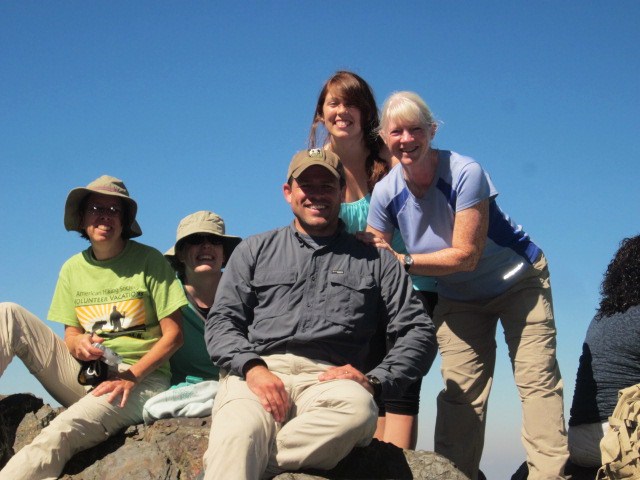
Our perch on Hanging Rock.  This is an easy to moderate hike, less than 1.5 miles from the parking lot to the summit.  A thrilling spot for minimal effort. 

We backtracked down Hanging Rock Trail and turned left onto Wolf Rock Loop Trail.  From here it’s an easy stroll through pines and some hardwoods to Wolf Rock.  Along the way we investigated a couple of side paths to smaller rock outcroppings. 

More haze from Wolf Rock

Great signage everywhere, but always carry your park map too.  Now we headed toward Cook’s Wall, checking out House Rock along the way.

Looking at Hanging Rock from House Rock.  I was surprised that there were only two other people at this expansive rock outcropping on this lovely Saturday, but then again, it does take a little more effort to get there (on the way to Cook’s Wall).  It is not part of a loop and the trail dead ends at Cook’s Wall.  You have to want to go here.  Have you noticed that most people don’t venture very far from the parking lot?  


Next stop, Cook’s Wall, an incredible rock face to stand on.  There was a college age fellow parked there with his lawn chair and his lunch and he talked incessantly to everyone that walked up.  Apparently he had camped in the park and set up court for the day at Cook’s Wall.  I had to walk away after a couple of minutes when I realized that he was not going to stop sharing his voluminous information.  I mean, I like chatting with hikers, but he had a monologue going.  Jim and I found a space (almost) out of earshot to sit and enjoy the view.

View from Cook’s Wall

Looking at Pilot Mountain – white smoke on the horizon.  Before it was brought under control the fire consumed 625 acres.

Jim and I backtracked to Wolf Rock Loop Trail and turned left for our descent.  Here the map is necessary to decipher the way back to the visitor center main parking lot, as the trail runs concurrently with part of the Chestnut Oak Nature Trail and skirts alongside pavement.  Altogether we hiked 7.5 miles.  A nice way to spend a Saturday with my favorite fella.

“It is easier to go down a hill than up, but the view is best from the top.”  ~Arnold Bennett


Thursday, January 10, 2013

Hiking in Haiti - La Citadelle


La Citadelle and Sans-Souci – Milot, Haiti - 10/28/12 – 3 Miles

How did I jump from the Great Smoky Mountains to Haiti?  Kind of a short story.  My church put together a mission trip to Haiti and I joined in.  One of the best leaps of faith I’ve ever taken.

Our group of two women and seven men flew from Charlotte to Cap-Haitien in northern Haiti to spend a week doing light construction work and helping with a food distribution program for the elderly in a remote part of the country.  Life is so different there, each day felt like ten days, as every experience was unlike what happens in the U.S.  Taking a (cold) outside shower meant hoping that the neighbors next door (the U.N.) haven’t accidentally shut off the electricity that pumps the water supply.  Riding into town to buy food meant hopping on the back of an open flat bed truck and hanging on for dear life, exchanging money, negotiating to buy bags of rice or beans in a marketplace filled with sights, sounds, smells you don’t encounter at your local grocery store.  Going for a walk along the road brought us into contact with the family cows being walked home for the night, motorcycles with five people hanging on (including little kids), passing cemeteries with above-ground crypts with burnt chicken parts on top.  There is an order amidst the chaos, much poverty, and abundant grace.

Our group put together a video of our experiences in Haiti that you can see here.  It is worth the 12 minutes.  You should be able to recognize me – the one with the white skin and white hair.  I’m sure some of the Haitians thought I was albino. 

After a rousing worship service on our Sunday there, we spent the afternoon exploring La Citadelle, a mighty fortress high on a mountain outside the remote town of Milot.  After driving several miles up the mountain on a restored stone-and-concrete road, we parked our truck, navigated through the Haitians selling souvenirs and offering to be tour guides, and walked the last couple of miles.

Our trusted transportation for the week

Lush Haitian countryside

Walking up the mountain with lots of enthusiastic “guides” who would not take no for an answer.  Eventually I gave in and chatted with the two who had singled me out, flanking me like bodyguards.  They were very nice teenage boys, this is the only way they have of earning money, and they’ve picked up several languages.  Interestingly, they are not allowed inside the fortress.  It’s not exactly open to the public.

Banana trees everywhere

La Citadelle is the largest fortress in the Americas and is designated as a World Heritage Site. It has become an icon of Haiti and some call it the 8th wonder of the world. It was built by Henri Christophe, a key leader during the Haitian slave rebellion, after Haiti gained independence from France in the early 1800's (somewhere during the time of the construction Christophe helped assassinate the emperor and declare himself king of the northern half of Haiti.) The site could be a tremendous tourism draw if Haiti can ever attract tourists.  It sits on the top of Bonnet a L'Eveque Mountain.

A guard station on the road up to the fortress (I think).  See the sharp mountains in the center back- ground?  On the other side of them is the town of Milot, where we spent most of our time.

Our translator/ guide/ friend Jacqueline (on the left) gave us a personal tour of the interior of La Citadelle.  Don’t know how he got the keys.

La Citadelle was fortified with 350 cannons, never actually used. 

Like I said, it’s technically not open to the public.  A few safety issues need to be addressed. 

Looking 300 feet straight down.

Piles of cannonballs – too heavy to be souvenirs – not like picking up rocks on the trail.

About as high as we could get

Piles of cannonballs in the lower right

After La Citadelle we walked back down to our truck (passing through the vendors again) and drove back down and around the mountains to Milot.  At the edge of town sits the ruins of Sans-Souci Palace, one of nine palaces owned by the same Henri Christophe and built while La Citadelle was being constructed. This sits at the bottom of the mountain right at the end of the street in Milot. It is another tourist gem and in its day was referred to as the equivalent of the Palace of Versailles in France.  Henri committed suicide here in 1820. The palace was largely destroyed by a big earthquake in 1842.  This photo is the back side of the palace.

Walking up the back steps of Sans-Souci Palace

The remains of the front gardens and buildings

Sans-Souci Palace

Looking through a doorway at the town of Milot

A Catholic church and the town of Milot at the bottom of the curved roadway behind the palace

A sculpture of Henry’s wife, Queen Marie-Louise, on the palace grounds. She and her daughters were "escorted" from the palace along with the king's corpse.  They returned to France.

This was one short afternoon in our week-long visit in Haiti.  We met wonderful, friendly, genuine, gentle, gracious people who tolerated our lack of their language and treated us warmly.  I was very glad to return to my physical comforts at the end of our week, and I think about our friends with little shelter and even less food, realizing what I take for granted, and am humbled.  My life is easier mostly because of an accident of birth.  I hope to visit again in the next couple of years.  I fear that little will have changed, because the problems of corrupt governments and generations of poverty are not overcome in so short a time.  But someday wouldn’t it be wonderful if tourism could be ignited in Haiti and you could all go to see La Citadelle?

Never know when you’re making a memory; they will wish they was here together again someday ~ Rickie Lee Jones


Saturday, December 29, 2012

You Never Step In The Same River Twice


AT to Charlie’s Bunion/Sweat Heifer Creek Trail/Kephart Prong Trail – 10/5/12 - 12 Miles


Very excited this morning, anticipating a trifecta of my favorite things:  (1) hiking on a gorgeous fall day in the Great Smoky Mountains (2) with new friends who have never been to Charlie’s Bunion (3) plus a few extra miles on my own.  I must figure out a way to do this for a living. 

After breakfast this morning Christine, our GSMNP ranger-leader-friend for our Trails Forever volunteer week, treated us to a slide presentation she had created from our work week and gave each of us a DVD copy.  A great catalogue of memories of our unique experience!  After that, our group began to dissolve, a couple of people leaving for the long drive home, some hiking in different areas.  Sarah and Helen and I headed to Newfound Gap to check out the Appalachian Trail – Charlie’s Bunion, here we come! 

A beautiful beginning

The AT was busy, of course, because Charlie’s Bunion is one of the most popular and iconic points in the Park.  The hike is moderate, gradually gaining elevation, and in many places you can look down on both sides as though you are straddling a wide fence dividing North Carolina and Tennessee.  For many visitors this is the only place they set foot on the AT and not everyone makes it the four miles out to the Bunion (remember, it’s four miles back).  But every step of the way was a celebration for me.

Dog hobble showing its fall colors was the stand-out of the day

We passed Tina, Frieda and David along the way and caught up with the other Sarah from our work crew at Icewater Spring Shelter.  We had a leisurely lunch, enjoying the sunshine after work days in the rain, and the four of us pushed on to the Bunion.

Charlie’s Bunion is a magnificent rock bluff facing Tennessee, once sleeping underneath the typical Smokies soil and trees and then uncovered by two events:  a fire in 1925 that destroyed the vegetation followed by a particularly vicious cloudburst in 1929 that washed away the exposed soil.  A crew that included Horace Kephart and his friend Charlie Conner took a hike to check out the damage after the storm.  The story goes that when Charlie removed his boots and socks to tend to his sore feet, Kephart likened Charlie’s bunion to the rocky outcropping. 

Helen and I out on the farthest point of the Bunion

Our Trails Forever crew with a random guy from Atlanta.  He took photos of us first and we invited him to join in.  Loads of people at the Bunion today and we had to take turns to get pictures.

Mount LeConte, the second highest point of Tennessee and third highest point in the Smokies.

We left Charlie’s Bunion and began our backtrack on the AT.  My friends were hiking back to our starting point at Newfound Gap and I planned a longer route via Sweat Heifer Creek Trail and Kephart Prong Trail.  At Icewater Spring Shelter we parted ways.

The intersection of Sweat Heifer Creek Trail and the AT.  From here I’ve got about 3,000 feet of descent.  Hope my knees are ready for it!

I’ve hiked Sweat Heifer Creek Trail only once before, in the opposite direction, climbing up from Kephart Prong to the AT, so this excursion was a sweet treat indeed, in a different season and rolling downhill.  The previous hike was solo, cold and crunchy with snow and there was evidence that I had company ahead of me.  Never met them face-to-face, though.


The first quarter mile of trail appeared unloved, narrow and faint, but eventually it grew more distinct.  Purple asters, the last of the fall flowers, were hanging on. 


A very recent blowdown.  I had to suck in my belly to scoot around this one.

“Hiking Trails Of The Smokies,” aka the “brown book” contains descriptions of every trail in the GSMNP, but the write-up of this trail is surprisingly lacking.  At about the halfway point there is a sharp left turn (going downhill)at a gap where there are rusted buckets and other artifacts, perhaps evidence of a work crew from years long past.  There is no mention of this spot in the brown book. 

Soon after this point I heard a rush of water that grew louder and louder.  Funny, I didn’t make much note of water features on my prior hike.  I wonder why not?  The first cascade didn’t photograph well but was really beautiful in person, sparkling in the afternoon sun.  This is a tributary to Sweat Heifer Creek. 

The thick carpet of leaves crunched with each step and I made many attempts to photograph the trail at ground level.  How about if I blow this up to life size and hang it on the inside of my front door?  Then every time I leave home I’ll feel like I’m walking right into the Smokies.

Again, the increasing roar of water and this time it was the real thing, Sweat Heifer Cascades, where the creek tumbles across the trail, spilling from ledges into pools and forming more cascades.  This hike just kept getting better!  My heart was joyful.

Just before the junction with Kephart Prong Trail I reached a footbridge crossing Kephart Prong. 

I didn’t realize at the time how close I was to the intersection and the Kephart Shelter.  I sat on the bridge to have a snack and watch the ever-changing flow of water.  Paraphrasing a saying attributed to Heraclitus, “You can never step in the same river twice,” what does it mean for you?  Many interpretations.

A few steps later, I walked up to Kephart Shelter and chatted with the fellows who were stopping there for the night – oh, how I envied them!

The two-mile walk down Kephart Prong Trail went quickly and soon I was at my car, set to return to base camp for one last night with the trail crew.  This was a rare time when I was not ready to end my hike – I felt I could keep going for miles.  But the sun was going down soon and all good things must come to an end…until next time.

“Climb the mountains and get their good tidings. Nature’s peace will flow into you as sunshine flows into trees. The winds will blow their own freshness into you, and the storms their energy, while cares drop off like autumn leaves.”  ~John Muir