Tuesday, May 15, 2012

What, Another Birthday?


Solo Backpack in the Smokies – 4-11-12 – Mingus Creek Trail/Newton Bald Trail/Thomas Divide Trail/Deeplow Gap Trail – 13.7 Miles

Beginning with my 50th I’ve spent every birthday on a trail for a significant project, the Smokies 900 or the Mountains-to-SeaTrail.  What about this year?  It’s a Wednesday, so it would be a solo hike, but the SB6K project didn’t seem to click.  What about…a solo backpack trip?  Now that’s a phrase I never thought would apply to me.  Certainly a new threshold, a new line to cross.  I’ve hiked alone all day, slept in frontcountry campgrounds alone all night, but never spent the night alone in the deep dark woods.

What better place to try this new challenge than the Great Smoky Mountains?  I’ve been meaning to hike those trails again anyway.  Poring over the map looking for possible overnight loop hikes, I got that tingly feeling that I love.  I chose a figure-eight type route and a backcountry campsite that should be empty on a weeknight.  I left a very detailed hike plan with my husband and left home very early on Wednesday morning. 

The weather had been warmer than normal for a couple of weeks but a cold front was coming through, predicting nighttime temps in the high 20’s.  The drive through the mountains was very windy and I had a few thoughts about branches and trees falling on tents.  The Blue Ridge Parkway was closed near the entrance to the Smokies so I had to drive through the town of Cherokee, normally something I don’t mind but I wasn’t in the mood for it today.  I wanted to get on the trail.  I stopped at the Occonaluftee Visitor Center and self-registered for my campsite.  As I stuffed my form into the box I wondered just how often they check those things.

I parked at the Mingus Mill parking lot and made a last minute check of my gear – anything I can leave out or should add in?  My trail map split apart as I consulted it one more time.  Oh, well, I’ll have to rely on piecing it together.  A good thing I had studied it so much beforehand. 


Before I started on the trail I visited the slave cemetery a short walk from the far corner of the parking lot.  There are six graves evidenced by rough uncarved sandstones.


Oops, forgot my new hiking poles – gotta go back.

Beginning of my adventure – Mingus Mill in the background

Mingus Creek Trail begins as a wide road bed.  Along the first mile there are remnants of many buildings from old homesteads and the CCC camp that operated there.  Flowers bloomed profusely along the path.

Some type of phlox

White erect trillium (distinguished by its dark center)

At 1.25 miles the trail split.  Mingus Creek Trail continued to the left.  The unnamed trail to the right leads .8 miles to another cemetery.  One of my interests in re-hiking the Smokies is to take more time investigating the cemeteries.  Some are harder to find than others.  I had planned to visit this particular one on my return hike the next day, but something told me to go sooner rather than later…so I did.  

Mingus Creek Cemetery seemed a bit forlorn, no flowers on any graves

Mrs. Polly Mathis, born 1888, died 1934

I backtracked to Mingus Creek Trail and began the long climb.  In the first few minutes I met four descending hikers, the only people I saw before returning to the parking lot the next afternoon.  Now it was just me, myself and I. 

Toothwort

Showy orchis

The Mingus Creek Trail actually leaves Mingus Creek very early on and instead follows Madcap Branch up the mountainside, crossing several times (fun name, “Madcap”).  At about the three-mile mark the trail intersects with Deeplow Gap Trail, which I will return to this spot tomorrow.  After a brief quarter-mile respite of near level walking, Mingus Creek Trail resumes its climb – a total of six miles and 3,000 feet of ascent from the beginning.  But going slow and steady, not trying to keep up with anyone, it felt great. 

At 5,080 feet Mingus Creek Trail meets Newton Bald Trail.  While some balds in the Smokies are managed by the Park service to remain open, Newton is Bald no more, just another wooded mountain top.  There is a big old chestnut tree trunk to rest on while you ponder life, though. 

A bear condo on Newton Bald Trail (see the hole near the top?)  Dead trees that are still standing are called snags and are a very important part of a healthy forest ecosystem, providing home for creatures great and small.  Don’t stick your head in one of these holes.


I continued on for .7 miles along Newton Bald Trail, passing through Campsite #52 sprawled across the trail.  It looks like a great place to camp in good weather, but I wouldn’t want to be huddled there in my tent on that ridge during a bad nighttime thunderstorm.  At the intersection with Thomas Divide Trail I turned left, very much looking forward to some downhill.  The walk down Thomas Divide was just lovely with glimpses of the high ridgeline of the AT to the right.  (If I’d had my glasses I could have really seen the Clingmans Dome tower.)  A nice breeze was blowing on the western side of Thomas Divide, while on the eastern side I was more protected.  It was a day for short sleeves and gloves.  As I strolled merrily along I hummed and sang “Agnus Dei”.  Alleluias sound so awesome in the outdoors!

At one point on Thomas Divide, as the trail rounded the side of a mountain and curved onto the next one, I noticed that the first part was completely brown, still in winter mode, while the opposite facing side was covered in mayapple foliage.  Imagine a giant letter “V” lying on the ground with one side brown and one side green.  Neat, huh?


After 3.1 miles on Thomas Divide I turned right onto Deeplow Gap Trail, still continuing downhill.  Deeplow Gap Trail has multiple personalities: easy and clear, rocky and covered with debris, and muddy and rutted from horse travel.  Big fun.  It also had a stunning display of crested dwarf iris.

Squaw root – a bear’s favorite spring snack

Rue anemone

As I mentally counted up the miles for the day I began to get a little anxious to find my campsite for the night.  Usually the campsites are well marked but I have walked past a few, so I became intent on scanning the sides of the trail for signs.  And…this one is pretty obvious.
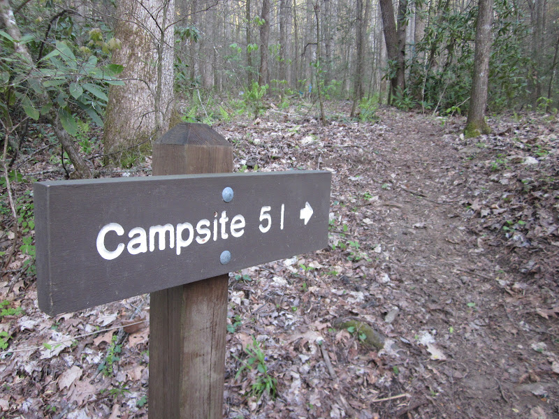

So I was at camp by 6:00 p.m., plenty of time to drop my pack and make a quick .8-mile roundtrip to the end of Deeplow Gap where it meets Indian Creek Trail.  Remember, if you are going to hike all of the Smokies 900 trails, pay attention to those loose ends. 

At my campsite, work to be done:  collect and treat water, boil some for dinner, add to dehydrated meal packet, make some hot tea. 

While all that is rehydrating and steeping, set up tent.  Campsite 51 only had two small tent sites that I could find, so I choose the one farthest from the trail.  (The best thing about Smokies backcountry sites:  cable pulley systems to hang your food away from the critters.) 

Unfortunately, my meal was pretty terrible, too spicy for me, burning my lips that were already tenderized from the windy day.  But…I ate it all because I didn’t want to carry it out the next day.  I opted not to make the chocolate pudding mix that I brought, didn’t think I could eat it all, but I had M&M’s to enjoy. 

After dinner, I read my little book in the surprisingly gradual fading of the light.  The wind had died down and a chill descended.  By 8:00 p.m. I retired to my tent to get warm and settled in.  By 8:45 p.m. it was lights out, sister.  Hope I hear some hooty-owls tonight.


Birthdays are good for you.  Statistics show that the people who have the most live the longest.  ~Larry Lorenzoni


Tuesday, May 1, 2012

I'm In Love With Sam Knob


Sam Knob & Chestnut Bald SB6K’s – 3/31/12 – 9+ Miles

Warning:  multiple photos of Sam Knob (which is a mountain, not a person) – I was a little obsessed.

Weather.com is a wonderful resource.  I had a free Saturday and the forecast for Charlotte was rain, rain, rain.  But according to weather.com’s hour-by-hour predictions, if I timed it just right in Pisgah National Forest I could dodge the raindrops.  And that’s just what I did.  In fact, I only encountered rain on the morning drive, and the rest of the day was filled with alternating sunshine and interesting clouds.

I was excited for another solo hike and this time I had new Trek hiking poles.  Lately my old ones were collapsing at unexpected moments (probably too much dirt in them and they wouldn’t tighten properly) and I was ready for some new ones, more lightweight and able to telescope down even smaller.  So near Blue Ridge Parkway milepost 420 I turned onto Forest Road 816 with new gear and an expansive feeling of anticipation in my chest – ready for Sam Knob and Chestnut Bald, two more SB6K’s. 

The purpose of FR 816 is to get hikers a mile off the BRP to access many trails in the Shining Rock and Middle Prong Wildernesses.  There is a large parking area and vault toilets at the end of the road and multiple places to pull off along the way and enough hiking to keep you busy for months.  Most of the ten SB6K’s in the Great Balsams section can be dayhiked from the FR 816 parking areas (some hikes might be longer than you like, though).  I hiked to the dual summits of Sam Knob once before, in pouring rain in July 2006, before I knew what an SB6K was, and it wasn’t a full five-mile trip so…time to do it right.

Sam Knob #1, two summits with a dip in between – love at first sight

Sam Knob #2


The trail to Sam Knob crosses open fields worthy of twirling in your Sound of Music skirt.  After about a half-mile the trail splits – turn right for the Sam Knob Summit Trail.  Very quickly I turned again, this time left, and began ascending into the trees.  The trail is very eroded going up this much-loved mountain.  In a couple of places there is a teasing view of what will be laid out to enjoy on the Pisgah buffet at the summit.
Near the top the trail splits again and either choice takes the hiker to a summit.  This is one case where two roads diverge and you should take them both!  First I went to the right.  The wind was strong and clouds were moving quickly all around. 

The prominent bump in the left background is the Devil’s Court- house, an imposing rock outcropping reachable by a short, steep trail from a parking area on the Blue Ridge Parkway – but also reachable by me from where I presently stood.  The mountain in the middle foreground is Little Sam Knob.  He looks like his hair is drooping rakishly over one eye.  The highest peak in the right background is Mount Hardy, an SB6K which I conquered a couple of months ago.  I take great pleasure in being able to orient myself by landmarks to keep track of where I am in the world. 

Where are all the people?  It was a stunning Saturday and the parking lot was full of cars.  I had the place to myself. 

Shuffling over to the other summit (the oh-so-slightly higher of the two) I had a quick snack.  This chunk of quartz is as big as a Volkswagen.  Mount Hardy is the high point in the distance.  The sky is looking quite ominous, eh?

Okay, let’s walk on over to the Devil’s Courthouse.  First I descended the Sam Knob Summit Trail, passed that first intersection and headed towards Flat Laurel Creek.  The trail was wet from recent rains and several wooden footbridges helped keep my feet dry.  I heard the creek long before I saw it and wondered if I would be getting wet after all.  But although the creek was robust, I was able to rock hop across.

And then went back to sit and savor the moment.


On the far side of the creek there is a T intersection – the Flat Laurel Creek Trail.  Turning left, I walked happily along with the creek on my left and Little Sam Knob on my right, looking for my next intersection, a right turn onto Little Sam Knob Trail.  Although this is a wilderness area, signage was very good and I was feeling full of myself.  I passed a wide-looking space on my right but there was no sign so I strode confidently on down the trail…until I got that familiar this-doesn’t-look-right-anymore-I’ve-gone-too-far feeling.  Geez, here we go again.

I backtracked to that wide-looking space, still not convinced it was legit, but it sloped gently up and around the left flank of Little Sam and certainly was a trail.  After about a mile I saw a single yellow blaze on a tree.  Well, this must be it. 

A common reminder of logging days in these mountains

A nice campsite if you don’t mind being in the middle of the trail

My next landmark was at my old friend, the Mountains-to-Sea Trail – took a right turn here towards the Devil’s Courthouse, which is a blue-blazed side trail off of the MST with no designation.  The blue blaze trail crosses over the BRP and joins the main steep trail to the summit. 

Here I encount- ered a bit of humanity on a blustery and exciting Saturday, allowing me to be included in the photo this time (Little Sam and Sam Knob in the center #3).  A full circle moment:  a photo of Sam Knob from Devil’s Courthouse to bookend the photo I had taken a couple of hours earlier. 

Sam Knob and Little Sam on the far right #4


One goal completed, one SB6K to go, the part I was most nervous about.  I back- tracked on the MST, bypassed Little Sam Knob Trail and continued on in search of Chestnut Bald.  Similar to Mount Hardy, it does not have a maintained trail but I had vague instructions to help me find the pathway, things like walk ten paces past the big rock and look over your left shoulder for the old NPS boundary sign.

And I found the break in the trees stepping off the right-hand side of the MST, but there was nothing like the trail going up Mount Hardy.  Was I good enough now at “feeling” my way to the top?  It was supposed to be short.  I tried to keep in a straight line and I saw a couple of orange tags.  I kept climbing straight up until there was no more “up” and I declared this tree the summit of Chestnut Bald.  AND I found my way back down.  Triumph!

Back on the MST eastbound, almost immediately I reached a superb lookout point that deserved a few minutes for lunch and celebration of a beautiful day and a mission accomplished.  That is Looking Glass Rock in the distance.  Can you believe I have never climbed it?  Somebody write that down on the list…

Just a couple of miles more on the MST to cross over into Shining Rock Wilderness.  Speaking of Shining, what is that glinting in the underbrush?  It was a tall beer can, looked pretty new.  Well, the least I could do was carry it out.  When I picked it up I felt sloshing, so I turned it upside down to pour out whatever was in it.  Imagine my surprise when a pink, hairless little leg popped out!  I shook the can hard and a tiny, very dead mouse slipped to the ground.  Ugh!  Yes, I shook the can some more to make sure it was truly empty and then stuffed it in a side pocket of my daypack.  Leave no trace, people.

I crossed FR 816 at its midpoint and turned onto the Art Loeb Trail towards the summit of Black Balsam.  I had already tagged this SB6K, along with Tennent Mountain and Grassy Cove Top, on an epic hike to Cold Mountain a couple of years ago, but I wanted to climb it again because it was right there and it was a beautiful day.  However, as I neared the summit I saw perhaps a dozen people on it and more on the trail, and I changed my mind.  I turned left onto the Art Loeb Spur and descended to my car at the end of FR 816 – but not before taking a few more awesome photos of my heartthrobs.

Sam Knob #5

Mount Hardy, Little Sam and Sam Knob #6


I have been fortunate to hike in some exotic locales in the past several years, but this day was as good as it gets for me:  I feel God in these mountains. 

There are many, many awesome areas along the Blue Ridge Parkway to explore and Shining Rock, Middle Prong and Pisgah NF are my favorites.  There is so much to see and the elevation gains and hiking are easy to moderate.  The MST runs like a thread all along these areas, criss-crossing the BRP.  FYI, I researched my route using DannyBernstein’s “Hiking the Carolina Mountains” and the Carolina Mountain Club’s SB6K link.

Take a day and go exploring, won’t you?

I go to nature to be soothed and healed, and to have my senses put in order.  ~John Burroughs


Monday, April 23, 2012

Graybeard Mountain


Graybeard Mountain – Montreat – 2/25/12 – Felt Like 8 Miles

Each year in late February my church, Avondale Presbyterian, offers a women’s retreat in Montreat, NC, the small community next to Black Mountain whose most famous citizen is Billy Graham.  We take over William Black Lodge, share meals, laughs, a guest speaker for the weekend, maybe some games, and experience a renewing of relationships and an injection of faith into the soul.  On Saturday afternoons some of the women go into Black Mountain for lunch and shopping, and some go hiking up to Lookout Mountain, a lovely scenic spot that isn’t too far in distance but takes some work to get to.  I’ve been to Lookout a few times so I like to go off exploring the other trails around Montreat.

This year I advertised a strenuous hike, and perhaps I didn’t sell it well because I only got one taker, our associate pastor, Jane.  In years past Jane had done a lot of hiking and backpacking, but work duties and life have not allowed room for such things in recent years.  So…what’s it like to spend the afternoon with your pastor?  A gift.

We scavenged food from the snack table and walked down Assembly Drive (aka Graybeard Trail), talking 90 miles an hour, and walked past the trailhead sign.  We ended up in someone’s driveway and turned around.  Story of my life – lost before I start.  In my defense, the roads at Montreat are small and winding, kinda like trails…

Near the trailhead we crossed Flat Creek on a very impressive bridge.  There was a definite chill in the air but a very clear blue sky.  Hats and gloves all day today and keep moving!


Very early in the hike we met a guy wearing a kilt, a bit unusual.  He was a member of the local trail club and his first question was, “Do you have a current map?”  Well, let’s see.  I pulled out my one-page map and indeed it was not the newest edition.  Kind sir produced a new map from somewhere in his pack (not his kilt, I was watching closely) and showed us that the trail had been rerouted with gentle switchbacks.  Hmmm…how much mileage does that add?    Mr. Kilt did not say.  But who cares?  We’re hiking on a spectacular winter day.


I was delighted to find that Jane is a good person to hike with.  She has an extensive knowledge of plants, identifying emerging foliage, and appreciated stopping to ponder the little things near the ground and overhead.  We were both ready for some nature time and didn’t solve any big theological questions…or did we?  More and more I think that just leaving the questions behind and getting outside in God’s world really is the answer.

The trail was in great shape, as are all the Montreat area trails that I have hiked on (thanks to Mr. Kilt and his trail maintainer friends).  There are sufficient blazes and few obstacles.  We rock hopped across the creek several times and had a good workout on the steep sections and switchbacks.  


We crossed an enormous boulder field and speculated on what it would have been like the day those big rocks tumbled to their resting places.  Huge trees were growing bravely out of narrow cracks.  This little fellow will split the rock someday. 


At Walker’s Knob Shelter we took a snack break.   Looks pretty cozy for a windy or rainy night.

Jane I hiked for several years (hours) on the supposedly 3.5-mile trail toward the summit of Graybeard Mountain, but we finally had to call it quits because of the lateness of the hour.  The compulsive completer in me was very conflicted, but there was no way to tell how far away the summit was.  It could have been 100 yards or another half-mile and we had run out of time.  Didn’t want to miss dinner, after all!  Here we are to prove that we got this far. 

 An awesome view along Graybeard Trail

On the return trip we investigated this quirky tree, a hollow middle that we could see through but lots of “outside”.  Is that a metaphor for a church retreat topic or what?

Icicles dripping along the trail – I told you it was cold

Just a few short steps from one of the switchback turns is Graybeard Falls, trickling today

The walk down was quicker, of course, and we made it back to the William Black Lodge in time for a quick shower and a hot meal.  But, come on, line dancing after dinner?  Well, if you insist...

I love to think of nature as an unlimited broadcasting station, through which God speaks to us every hour, if we will only tune in.  ~George Washington Carver

God writes the gospel not in the Bible alone, but on trees and flowers and clouds and stars.  ~Martin Luther


Thursday, April 19, 2012

Wesser Bald & Cowee Bald

Wesser Bald & Cowee Bald Lookout Towers  – 2/21/12 – 5 Miles

One more night in our cozy cabin and a half-day available for a hike.  Because of time constraints, we chose to hike on the AT to Wesser Bald lookout tower from Tellico Gap.  By trail, you can reach Tellico Gap by continuing northbound (NOBO) on the AT from Wayah Bald for about 10.5 miles.   For us, we chose a long tentative drive on unpaved roads snaking up through the mountains, always fun.

At Tellico Gap we chatted with three hikers that we had passed on our return hike from Wayah Bald yesterday – two were thru-hikers and one was a friend along for the first couple of weeks.  The friend was waiting on her ride back to civilization. 

The temperature was noticeably colder today, more wind, more clouds moving around, but still a great day to be outside – aren’t they all?  Nice trail, good switchbacks – the AT is well maintained here.  Here’s a lovely fern and galax arrangement.


The distance to the tower is listed at 1.9 miles, which we covered in about 35 minutes – can this be right?  We didn’t see anyone on the trail today. 

Wesser Bald Tower is a steel frame platform without a roof, not as solid as the stone Wayah Bald, and we could feel a little swaying going on as we climbed the stairs and marveled at the views in all directions.  The original tower was wooden and the current one once included a live-in cabin, staffed until the ‘60’s.  In the years after that a fire destroyed much of the tower.  In 1993 the wooden observation deck was added to create what we saw today.  When the tower was originally constructed, the peak was a bald but the trees have reclaimed their space.  Peter Barr’s book gives more fascinating information about this historic landmark.


West

North

East

Jim offered the alternative of me continuing on the AT down to the Nantahala Outdoor Center if he hiked back to the car and drove to meet me, a very tempting proposition, but I elected to hike back with him and go look for the Cowee Bald lookout tower from Peter’s book.  I didn’t have a detailed trail map and not a perfect memory of distance or trail conditions – plus the point of the trip was to spend time with Jim. 

I’m glad I declined, learning later that it’s 6.5 miles steeply downhill to the NOC (I was guessing 4 miles) so it would have taken way more time than we had.  A good reminder to not rely on memory alone, but always have a map. 

We took the old jeep road trail from Wesser Bald back down to Tellico Gap, only .9 miles of steepness, and then went in search of the Cowee Bald lookout tower discussed in Peter Barr’s book, cruising back roads, interpreting written directions and the North Carolina Gazateer.  Again we were exploring deep in unpaved territory.  It took more time to find it than we really had to spare, but I was determined to check this one off the list (yes, there is a fire tower “challenge").

Cowee Lookout is not glamorous, sharing a bald with lots of other towers for communi- cations, etc.  The gate was open and we could have driven right up to the foot of the tower, but we elected to walk the half-mile.  The tower has a live-in cabin similar to the one that used to be on Wesser Bald’s tower.   We could only get part way up the steel steps to a locked trap door, so no poking around in the cabin.

A nice view, but I couldn’t pick out all the peaks that Peter lists in his description.

It was a working day for two guys on one of the communication towers, climbing steel rigging like it was nothing (look near the center of the photo).  It must have been cold up there. 

The fire service road via which I intended to make a quick exit was closed, so we had to crawl back the long way down the mountain.  In Franklin we grabbed a quick late lunch at Ms. Lois’ Restaurant (delicious beef vegetable soup, worth a stop). 

Got home in time for my book club’s wine tasting party at 7:00 p.m.  Life is good to me.

"During one of my treks through Afghanistan, we lost our corkscrew. We were compelled to live on food and water for several days."  ~W.C. Fields in "My Little Chickadee"