Sunday, June 13, 2021

Carolina Thread Trail: Murray's Mill & Bunker Hill Covered Bridge

Carolina Thread Trail: Murray’s Mill & Bunker Hill Covered Bridge – Catawba, NC
7/4/20 – 4.5 Miles

Travel plans canceled left and right as the world realized that COVID-19 was not going anywhere fast. Beach trips, mountain vacations, Disney World, and visits to Grandma’s, everything seemed risky. 

Canceling the annual 4th of July Thomas family reunion of my mother’s generation (16 siblings!) and descendants was especially disappointing, as folks are scattered far across the land with just this once-a-year chance to see elders, cousins and new babies. There were so many of us, I didn’t know them all. In 2020, no reunion, no Virginia accents, no talk of farming (tobacco has been replaced by hemp!) and…oh, the food! Let’s pause a moment for the food.

Jim and I were itching to do something, wear our masks and be outside somewhere new in the 93-degree heat. He’s mentioned Murray’s Mill a few times as a day outing, so this was our chance. Even if the mill wasn’t open, there is a segment of the Carolina Thread trail to walk on. So we took a little drive to Catawba, NC. A calendar-perfect day for photographing the mill!

Murray’s Mill Lake formed by damming of Balls Creek

The David L. Stewart Trail starts beyond the mill and continues between the edge of Murray’s Mill Lake and a soybean field. Wild blackberries were bursting beside the path. The air was July-still and the mid-day sun produced a stifling heat. 


When I was a kid, the Thomas reunion was held in my own family’s big side yard. Imagine over 100 people, lots of barefoot children, lawn chairs, ice cream churns, and that same July heat. We weren’t allowed in our little house except to use the bathroom. The moms would hustle all the food out onto borrowed picnic tables when it was time to eat and hustle the leftovers back inside when the meal was over. Those who came from out of town left for the drive back home, and the locals stayed around until suppertime, when the moms brought the leftovers back out to the tables.  When I was an adult with kids of my own, our elders finally agreed to move the event to an air-conditioned church basement.

Jim and I followed the trail looking for snakes and other critters, but none were stirring. The wooded area was a respite from the direct sun. 

The trail comes to the edge of Shiloh United Methodist Church’s parking lot, turns right, then skirts the property edge out to Shiloh Road where it crosses Balls Creek. From here, the Murray’s Mill Pond Loop Trail continues to the opposite side of the pond and back to the Mill.

…but we turned back the way we came and retraced our steps to the mill.

Another section of the trail starts at the mill and goes in the other direction, but Carolina Thread Trail signs didn’t continue as far as the website suggests. The path still follows the creek, but it divides and re-divides into social trails and motorbike trails.

Trail passes under the bridge by the mill 

A footbridge crossing Balls Creek had been damaged by high water. It wasn’t broken down entirely and we treaded lightly to see what was on the other side. Many trails intersected without signage, so we headed back once again to the mill.

Inside the little general store was busy and uncomfortable as some people wore masks and some didn’t (still voluntary at this time).  But most importantly, the A/C worked and there were goodies.


Not knowing if there would be any food available anywhere, we’d brought our own sandwiches, and now our picnic was complete with a Nehi Peach and a Sun Drop. We ate lunch at a picnic table, not bad at all when you sat a spell in the shade of the old oak trees – just like at a Thomas Family Reunion.

A short drive away from Murray’s Mill, also in Catawba County, is the Bunker Hill Covered Bridge. Built in 1895, it is one of two remaining covered bridges in North Carolina.

The bridge is part of Connor Park, a nice little picnic area with a nature trail. The Bunker Hill Covered Bridge is a short walk from the parking area. We had the place to ourselves as we examined the bridge from all angles, inside and outside and below. It spans Lyle Creek.

The Carolina Thread Trail segment here follows Lyle Creek upstream for about half a mile to end at private property signs. The path was overgrown and humid and buggy…and what else would you expect on the 4th of July! 

The vision of the CTT goes beyond today and I’m glad that the organization grabs every piece of land possible to incorporate into its master plan. Who knows what this little bit of trail will connect to one day? The next generations will enjoy the benefits.

I hope that all of our 4th of July celebrations will return in 2021. I miss that fried chicken and biscuits and chocolate chess pie and butterbeans and cornbread and squash casserole and home grown tomatoes…

“Family is a link to our past,
a bridge to our future.”
~Alex Haley


Monday, May 24, 2021

Smokies 900 Round 2: Big Creek Base Camp - Day 3

Big Creek Base Camp With Carol – Walnut Bottom Campsite #37 to Big Creek Parking
5.2 Miles – 6/27/20

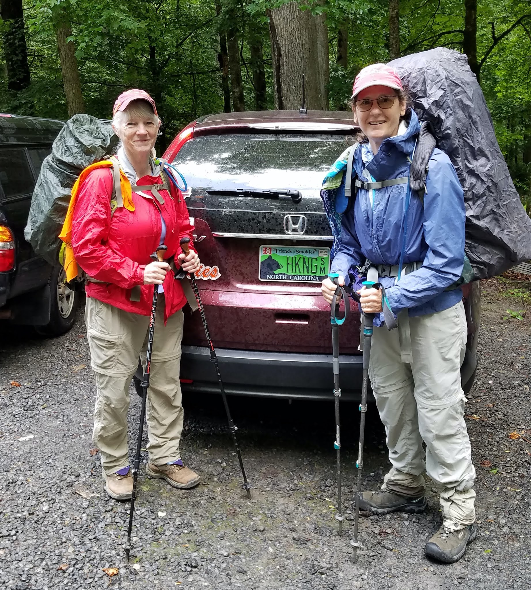
Our last day of the trip started the way our first day started, with pack covers on in a light drizzle. The Great Smoky Mountains is a rain forest. Carol and I were taking the easy way out via Big Creek Trail today anyway, so we didn’t mind.

Friday’s slight uphill was today’s slight downhill, a leisurely walk considering I had 25+ pounds on my back. I was glad I wasn’t carrying the borrowed backpack up a mountain today. Loaded or unloaded, the fit was wrong for me. This shakedown weekend was a great success in gear testing and evaluating physical capacity (or lack of it). Many tweaks and adjustments to be made, but we have more training weekends planned before our John Muir Trail hike.

We met lots of folks hiking up to the waterfalls and swimming holes. Kids were skipping along.  Cute young couples were holding hands and carrying floaties. Some parents looked a little less thrilled with the rain. Making memories.

Let's stop at Dairy Queen…

“Backpacking:  An extended form of hiking in which people carry double the amount of gear they need for half the distance they planned to go in twice the time it should take.” ~Author Unknown


Sunday, May 23, 2021

Smokies 900 Round 2: Big Creek Base Camp - Day 2

Big Creek Base Camp With Carol
 Big Creek/Gunter Fork/Balsam Mtn/Mount Sterling Ridge/Swallow Fork Loop
 14.1 Miles – 6/26/20


Morning inside my tent
The day began the same way yesterday ended: birds singing with the sunrise.

Expecting big miles up and down today, we powered up with yummy apple danish that Carol heroically hauled in for breakfast. By 7:40 a.m. we started our 14-mile loop hike [18 miles for Carol!]

We tackled the loop counterclockwise, starting up Gunter Fork Trail to get the water crossings behind us first thing. If we encountered one that looked too dangerous, we’d have a short walk back to camp. On my Smokies 900 hike of Gunter Fork, I was not that smart, but we were lucky that day and had all rock hops.  

Here we go!

Gunter Fork Trail handed us six wet crossings today. The first one was Big Creek itself, deep enough to wet the hem of my shorts. We kept our Crocs on until we crossed the next five. 

The sixth crossing was at the base of Gunter Fork Cascade, less notable for the water that flows almost imperceptibly than for the sandstone rock face itself. It’s tempting to lean over to feel the smooth surface, but it’s more important to pay attention to the slick wet rocks underfoot on the narrow trail.

Beyond the cascade, the trail’s Mr. Hyde character emerged as a rough, overgrown, narrow and washed-out track – no good adjectives! Oh, I forgot to mention STEEP. The last two miles to the junction with Balsam Mountain Trail is about a 1,500-foot gain via switchbacks, not impossible, but relentless. I told Carol to go ahead of me, as she intended to hike two extra miles on Balsam Mountain towards the AT (and two miles back) to close a gap in her 900-miler map. [Note: if you’re pursuing the Smokies 900 challenge, be sure to work remote trails like Balsam Mountain into your routes and don’t leave loose ends.] 

Going up Gunter Fork Trail


Purple flowering raspberry

Slippery slope and eroded trail grade

As we climbed higher, the hardwoods gave way to mossy alpine forest

Like yesterday, I struggled up Gunter Fork, carrying more water and feeling the weight dragging me. How can I hike the JMT? But…I arrived at the junction just seven minutes after Carol, which lifted my spirits. So much of any physical challenge is in your head.

Carol would say the challenge is also in the legs. While she hoofed it along four extra miles, I kicked back for a two-hour break, eating and dozing. Fraser firs dominated and thick green moss carpeted everything at my little rest stop. I put on my long-sleeved shirt and rain jacket against the cool, damp air of 5,500 feet elevation.

When Carol returned she was tired – of course! She ate a quick lunch and we probably should have allowed her more rest time, but we felt the miles still ahead on our loop. We turned left onto Balsam Mountain Trail for one mile to the intersection with Mount Sterling Ridge Trail.

Mount Sterling Ridge Trail is one of my favorites in the Smokies. The first three miles from Laurel Gap are flat, winding along the slopes of Big Cataloochee Mountain and Big Butt Mountain and then settling on the ridgeline of Mount Sterling. The spruce-fir forest smells like Christmas all year round and a breeze gently stirs.

Wild boar love this trail, too. Evidence of uprooting spread as far as our eyes could see in every direction, the most I have ever seen, for more than half a mile. [Note: Carol notified the ranger station after our trip. There had been no recent hog activity reports in the area. If you see something amiss in the Park, let the rangers know. Don’t assume someone else will call it in.]

We took a short break at Pretty Hollow Gap – short because the gnats were having a convention and would not let us sit in peace. 

We left the gap behind, descending Swallow Fork Trail to Big Creek, the same length and grade as Gunter Fork (four miles and 2,200 feet), only now our knees and feet were put to the test rather than our quads and lungs. (Well, our quads were still working hard.) I’ve hiked Swallow Fork Trail several times, but this was my first time going downhill. My tender toes remembered the abuse from yesterday descending Low Gap.

On the way down, Carol and I discussed our planned hike out for tomorrow (up to the AT, northbound with a side trip to Mount Cammerer lookout tower, and down Chestnut Branch Trail) and abandoned it in favor of the five-mile gentle downward glide on Big Creek Trail back to the parking lot. I felt better already!

Just two rock hop creek crossings, but at McGinty Falls I slipped and landed tailbone-first on a sharp rock. Surprisingly, it didn’t bother me the rest of the trip, but when I got back home there was a stunning bruise that lasted for weeks.

Back at camp by 5:35 p.m., a triumph for Carol’s 18-mile day and my second place 14 miles! Before we sat down and our muscles stiffened, we went about camp chores of filtering water and preparing a hot meal. 

Just as we began to eat, an unexpected rain came hard enough that we scrambled to put things away and get into our tents. The shower was over in 30 minutes, but by then exhaustion had overtaken me and I was in for the night.

Bridge over Big Creek at Campsite 37

“See I've conquered hills but I still have mountains to climb....Right now, right now,
I'm doing the best I can."
~Tracy Chapman


Monday, May 10, 2021

Smokies 900 Round 2: Big Creek Base Camp - Day 1

Smokies 900 Round 2:  Big Creek Base Camp with Carol
Big Creek/Camel Gap/AT/Low Gap I Trails – 6/25/20 - 15.4 Miles

[This trip occurred in June 2020 and this writing is in May 2021.]

Carol and I are in training for our section hike of the John Muir Trail coming at us in mid-August 2020. We have permits to access the trail via Florence Lake to hike southbound and exit through Whitney Portal after summitting Mount Whitney. COVID-19 is doing its thing and we’re adapting and moving forward with our plans.

We’re testing our gear and ourselves on an ambitious weekend in Great Smoky Mountains National Park. We’ll base camp in the Big Creek area at Lower Walnut Bottom Backcountry Campsite #37 and hike a couple of big loops. [Carol is working on completing her Smokies 900 map and I’m working on my second map. We'll both take any opportunity to hike in the Smokies!]

Bear canisters are literally our biggest challenge, filling them with food, fitting them into our backpacks, and learning how to open the darn things. Carol had a BV500 and I’m trying to get by with a BV450 (same diameter but half the height). Bear canisters are required on the JMT and our hike plan requires us to go the first 8 days without resupply.

Hmmmmm…

These canisters wouldn’t fit into my tried-and-true Osprey Aura 50, so I borrowed a slightly larger backpack from Carol for the weekend. [Verdict: not a good fit for me.]

The two of us had been COVID cautious and felt comfortable traveling together from Charlotte to Big Creek on Friday morning. The parking area was bustling with day hikers and backpackers who obviously have reconciled that outdoors is okay with awareness of social distancing.

Ten minutes in the Smokies, of course it's raining!

Funny, I’ve always thought Big Creek Trail was flat, so where did that slight-but-steady uphill come from? My borrowed backpack felt cumbersome but manageable on our first day. Wildflowers were abundant and lush green blanketed everything.

Mossy rock walls

I get excited whenever I see red bee balm – it’s such a dramatic flower 

Swimmers at Midnight Hole

Mouse Creek Falls


Campsite #37 (Lower Walnut Bottom) has several fire rings and sets of bear cables spread out over a large wooded area on both sides of the trail, with tent sites scattered throughout. Because I had checked the backcountry website the day before (imperative because it’s the only way to know for sure the latest status of anything in the park) I knew that bear activity warning signs were up but the site was not closed. (It would be closed by the following weekend).

We put up our tents, ate a quick lunch and emptied as much gear as possible from our backpacks for our 10-mile loop hike up Camel Gap Trail, along the Appalachian Trail for a couple of miles, and then down Low Gap I Trail back to our campsite near Big Creek.

Carol’s bug net 

It is not clear on a paper map, but Big Creek Trail ends and Camel Gap Trail begins at Campsite #36 (Upper Walnut Bottom). There is no indication that there ever was a junction of any kind.

Horse stalls at Campsite #36


White bee balm

Fan clubmoss, also called running cedar

Camel Gap Trail follows an old logging railroad grade upstream alongside Big Creek, crossing several feeder streams. Near the confluence of Big Creek and Yellow Creek the trail makes a significant U-turn away from the water and begins to climb a bit more aggressively (or is it just me?) to meet the AT at Camel Gap.

Although the elevation gain isn’t terribly steep on paper, I had a really difficult hike up. My pack was light and I had eaten some lunch (not enough?) but I just “bonked.” I sipped water constantly and stopped once to eat an energy bar, but still I struggled. We pushed on to the AT, where we took a real sit-down break, and that rest seemed to turn the tide.

There is something about the feel of the AT. While it certainly is not flat as it follows the ridgeline dividing NC and TN, there is psychological relief in knowing that the real climbing is done and now you’re walking in the footsteps of hundreds of hikers who have recently passed this way on their way to Katahdin. How many fewer than in other years? The ATC is discouraging thru-hikers this year so as not to spread COVID to the small trail towns. What a strange time.

Too soon we reached the intersection at Low Gap, leaving that AT buzz behind for a steep descent back down to Walnut Bottom. My toes were feeling tender, beginning to bruise, as I tried to step lightly over rocks and roots. Most times on the last mile of the day I concentrate on simply finishing the hike, but this afternoon we had a special treat: purple fringed orchids everywhere!


Whew! Back at camp after a 15.4-mile day (and a 3-hour early morning drive). We’ve both kind of jumped into the deep end of this training thing and tomorrow’s plan is a doozy too. Camp chores, filtering water, eating, and talking about gear, and then exhaustion took over.

Lying in my tent, chilly enough to get inside my silk liner and cover up with my 32-degree sleeping bag. And can I just say that I LOVE my Big Agnes sleeping pad, 25 inches wide and 3 inches thick! Forget those skinny things, I want to lie on my back and not have my arms and shoulders hyperextending to the ground below the rest of me. It’s worth the extra ounces to have a comfortable night’s sleep.

At 9:00 pm, Big Creek bubbled away in the background, birds sang as the light faded, and I drifted away.

"Going to the mountains is going home." 
~John Muir