
Smokies 900 Round 2 – 4/24/15 – Big Creek/Swallow Fork/Mt
Sterling Ridge/Mt Sterling/Baxter Creek Trails – 17.1 Miles
Hiking friend Danny Bernstein invited me to participate in a Smokies 900 discussion panel at the Smokies Life Magazine reception as part of the Spring Wildflower Pilgrimage (whew!) in Gatlinburg, TN. Danny authored a wonderful article about Smokies 900 completers for the magazine’s spring 2015 issue. I was flattered and eager to sit on the panel as an excuse to visit my happy place, Great Smoky Mountains National Park. Driving all the way to Gatlinburg from Charlotte for a 5:00 p.m. event, looks like I’ll have to spend the night…

Been a couple of years since I saw the Tennessee side of the
Smokies and I was jittery with anticipation.
Everyday life is complicated and I needed to unplug and enjoy an
infusion of outdoors. As I turned off
Highway 40 at Exit 451, Dolly Parton’s celebration of the Smokies came on the
radio: “My Mountains, My Home.” Is that a tear in my eye?

Big Creek, the only Smokies front- country camp- ground that I
haven’t spent a night in. First come, first serve, only 12 sites, I was lucky enough
to set up camp right beside the boisterous namesake.

Big Creek
After a very short time lingering by the water, I drove on twisty-turny Highway 32 to Highway 321 and Gatlinburg. I met Danny an hour before the event started, not enough time to truly catch up but we did our best as we ate Kilwin’s ice cream. The reception and panel discussion was great fun, with many audience members tallying up more Smokies miles than the panelists. (P.S. I was vindicated to hear several 900 milers agree with me that the “worst” trail in the Park is Cold Spring Gap.)

Twisty-turny again (thank goodness it was still daylight)
back to Big Creek and I met my next-campsite neighbors, a man and woman from
Louisville. They had hiked up to Mount
Sterling via Baxter Creek Trail, part of my planned route for tomorrow. They started a little campfire and produced
wine flasks and a bottle of fireball whisky.
I was compelled to swap backpacking stories for an hour before turning
in. And what a sweet treat to sleep on a
flat tent pad – my last several nights out have been on sloping backcountry
sites.
Daylight woke me at 6:00 a.m. I ate a little breakfast, packed up, moved my
car to the picnic parking area where I said hello to a backpacker getting ready
to head out at the same time: 7:05
a.m. A little morning chill. I’ve done this exact hike before but felt as
excited as if I were discovering a new country – a different season, and every day in the
Smokies is a new adventure.
Big Creek Trail is a wide old road bed following alongside Big Creek and the area is rich with history of native Americans, settlers and logging operations. The trail itself was built by the CCC in the 1930’s. The same crew constructed the Mount Sterling fire tower that I would pass later in the day. The five miles of Big Creek Trail that I walked rises about 1,500 feet, barely noticeable, and is a wildflower mecca. As I walked the broad trail I looked mostly to the right bank, stopping constantly to photograph the blooming plants, not trying to win awards, just trying to record what I saw to help in identification later. If I had tried to look at the left-hand side too, I’d still be there.
Big Creek Trail is a wide old road bed following alongside Big Creek and the area is rich with history of native Americans, settlers and logging operations. The trail itself was built by the CCC in the 1930’s. The same crew constructed the Mount Sterling fire tower that I would pass later in the day. The five miles of Big Creek Trail that I walked rises about 1,500 feet, barely noticeable, and is a wildflower mecca. As I walked the broad trail I looked mostly to the right bank, stopping constantly to photograph the blooming plants, not trying to win awards, just trying to record what I saw to help in identification later. If I had tried to look at the left-hand side too, I’d still be there.

Enough words, now let’s look at the pictures:

Stonecrop in abundance every few steps
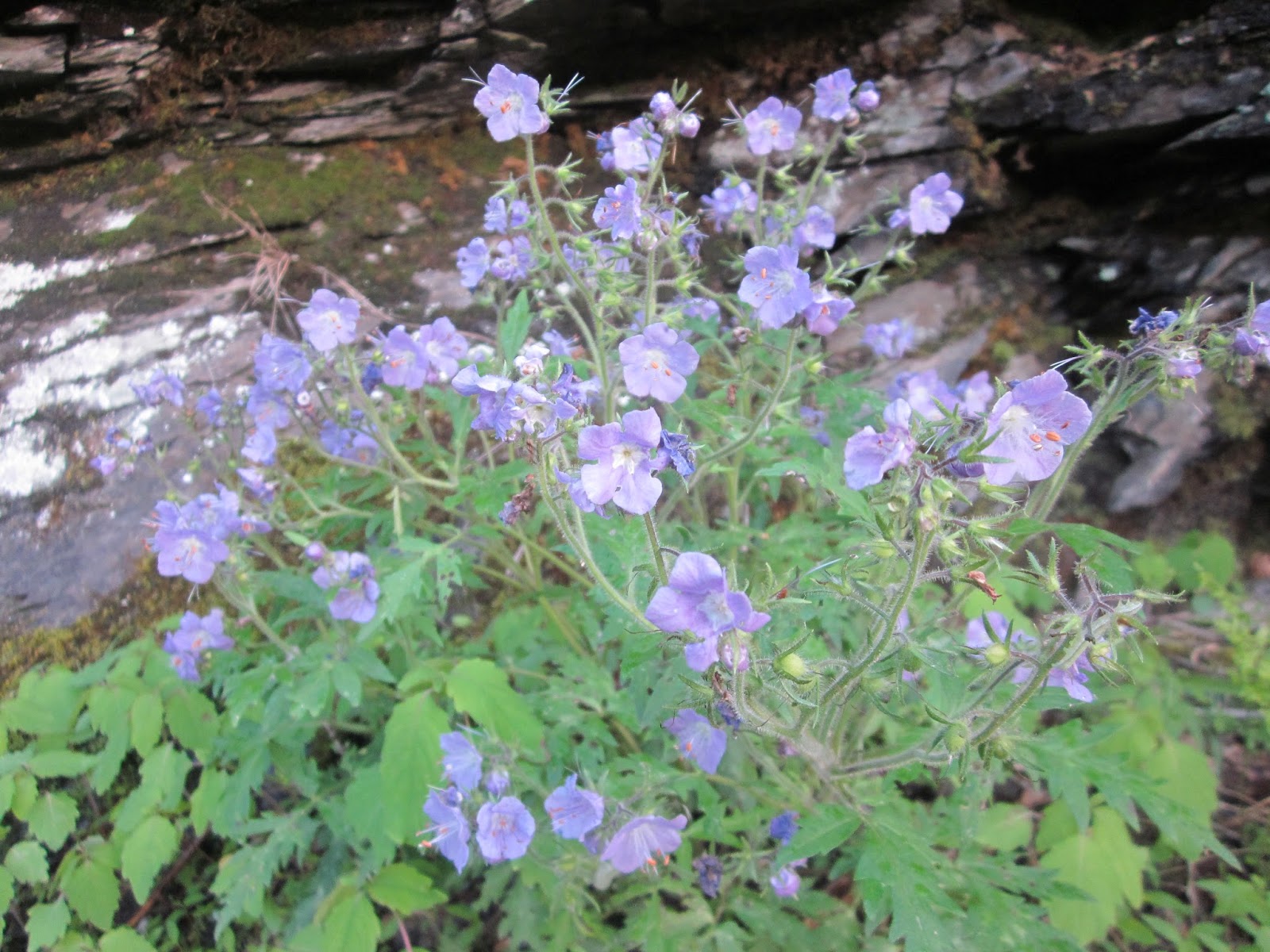
Purple phacelia

Wild geranium

Carolina vetch

Doll’s-eyes - the white flowers look pretty and benign...

... while
the fruits that appear in late summer are what gives this plant its creepy
name (this photo from a Sept 2008 Smokies hike)

Squaw-root (no chlorophyll, a parasite that grows on oak
roots)

A break in the action to check out one of Big Creek’s many cascades - looking for Midnight Hole but this wasn't it

Fifty yards to another cascade

Showy orchis, one of 30 orchids found in GSMNP

Exquisite

Found it! Midnight Hole, a six-foot plunge with a wide, deep pool

Midnight Hole - this place will be full of swimmers during the summer

Mouse Creek Falls, where the backpacker and I caught up with
each other

Dog hobble - one of my favorites

Bridge across Big Creek

Foamflower

Crested dwarf iris

Umbrella leaf - I get the name confused as elephant ear, because the leaves are as big as... well, an elephant's ear!

Umbrella leaf bloom

Meadow parsnip

Golden ragwort

Phlox and foamflower combo

Dwarf cinquefoil

Fringed phacelia
At 5.2 miles Big Creek Trail reaches Walnut Bottom and Campsite #37. This is an easy backpack- ing destina- tion, a base camp to explore more trails of the park, or a turnaround point for a respectable 10-mile wildflower dayhike (enjoy the opposite side bank on the return trip). My route turned left at 5.1 miles onto Swallow Fork Trail, nicely graded with several rock hop creek crossings as the trail climbs. The ascent felt effortless as I took my time.


Sweet white or northern white or Canadian Violet?

A jaunty sweet white trillium seems to be saying hello

Clumps of sweet white trillium

Bridge across Swallow Fork

Yellow mandarin

A sad wake robin past its prime

McGinty Creek

Peeking at Mt Guyot

At Pretty Hollow Gap I took a lunch break. This looks like a very tempting place to
camp, but backcountry camping in the Park is restricted to designated sites and shelters which must be
reserved.

Pretty Hollow Gap – spring beauties everywhere!

Spring beauties ready for their closeup
Ah, I thought, congratulating myself on getting all the
uphill done with ease. Then as I started
on the 1.4-mile section of Mount Sterling Ridge Trail I realized that my vague
recollection of it was inaccurate. More
elevation gain than I expected. But I didn’t
mind as I walked among the shady hemlocks.
Then there was that half-mile of Mount Sterling Trail that
isn’t designated on the little $1 map, more uphill. I was surprised to see hoarfrost coming up
from the ground.

Highlight of my hike:
Mount Sterling fire tower
There is a backcountry campsite at the base, an open grassy
area and some flat spots under the trees, very popular for nighttime lookouts
from the top of the tower. The six
flights of stairs seem trustworthy but the flooring inside the cab is layers of
plywood that look damp and rotten. I was
aware of being all alone as I climbed carefully up and down.

Looking north from Mount Sterling tower. I could see Max Patch, although it doesn't show up in the photo

Looking southwest from Mount Sterling tower – Mount Guyot is
the high point of the left frame and Low Gap is in the right frame
Baxter Creek Trail, the last leg of the hike, and I was feeling confident with no aches or fatigue. Only 6.1 miles! But with 4,100 feet of descent, this is the steepest stretch of trail in the Park. At the tower the chill was back, and although I had on shorts and short sleeves, I put my gloves on.


Several different types of moss, none of which I can
identify, grow among the spruce and fir trees.
Loved this moss-covered boulder.

An old sentinel

Freshly cut blowdown

Can someone please tell me what this is?

Painted trilliums were abundant along this trail. Some had dark forest
green leaves and some had bright green leaves.

Dozens of painted trilliums

Common blue violet

More white violets


Indian cucumber foliage
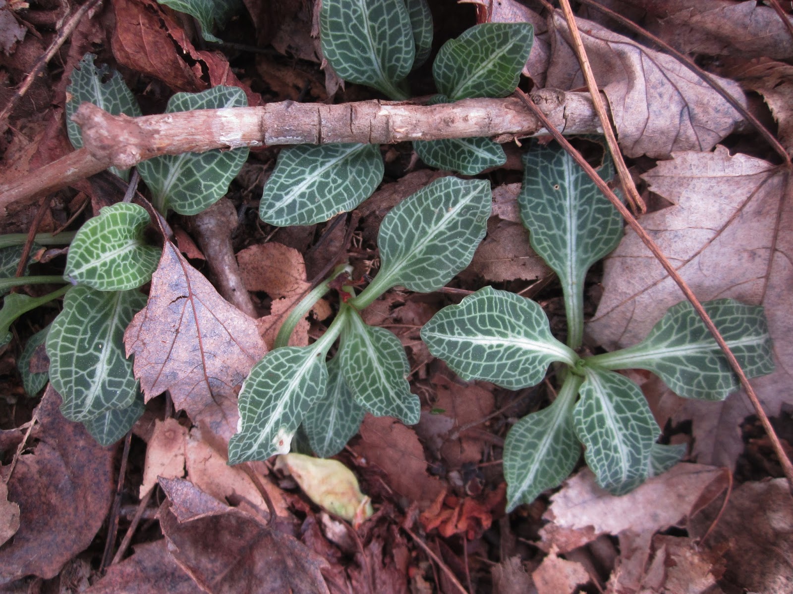
Rattlesnake plantain foliage

Mayapple foliage
Two miles on Baxter Creek Trail and I started to feel it,
knees hurting, wondering if blisters were underway. But what are you gonna do? Four more miles. Keep looking at the flowers. I could feel the temperature go up as the
trail went down.

False Solomon seal

Solomon’s seal (bad photo)

Toothwort

Brook lettuce

Yellow trillium

Purple phacelia bringing me home
All together over the course of the day I identified 43
different wildflowers. Not pictured are:
dutchman’s breeches
squirrel corn
one fire pink on Big Creek Trail
star chickweed
bishop’s cap
bluet
trout lily
wood anemone
rue anemone
round leaved violet
Halberd-leaved violet
sweet cicely
silverbell
dogwood
squirrel corn
one fire pink on Big Creek Trail
star chickweed
bishop’s cap
bluet
trout lily
wood anemone
rue anemone
round leaved violet
Halberd-leaved violet
sweet cicely
silverbell
dogwood
This was one
of the best days of my hiking life.
“I
felt my lungs inflate with the onrush of scenery – air, mountains, trees. I thought, ‘This is what it is to be
happy.’” ~Sylvia Plath


