
Wednesday, September 7, 2011

Bike Finale

MST – 8-14-11 – Day 69 – Strickland Road to US-13, Shine, NC – 43 Miles

Our hotel was packed with families in town for a big soccer tournament.  We all gathered at the breakfast bar and peered out the windows at the pouring rain.  Thank goodness for weather.com radar –  it showed the storm moving through and a window of a few hours, then rain again possibly passing north of our bike route.  This was my last day of biking on the Mountains-to-Sea Trail and nothing short of thunder and lightning would deter me.  Sure would be nice to not get drenched, though.

Jim and I got a move on, drove to the beginning point and he dropped me off.  Since today’s route was 43 miles I didn’t want to be solo the entire way, so rather than just drive slightly ahead, the plan called for Jim to drive to the halfway point and backtrack on his bike to meet me.  Together we would ride to the car and then he would drive to the end, repeat. 
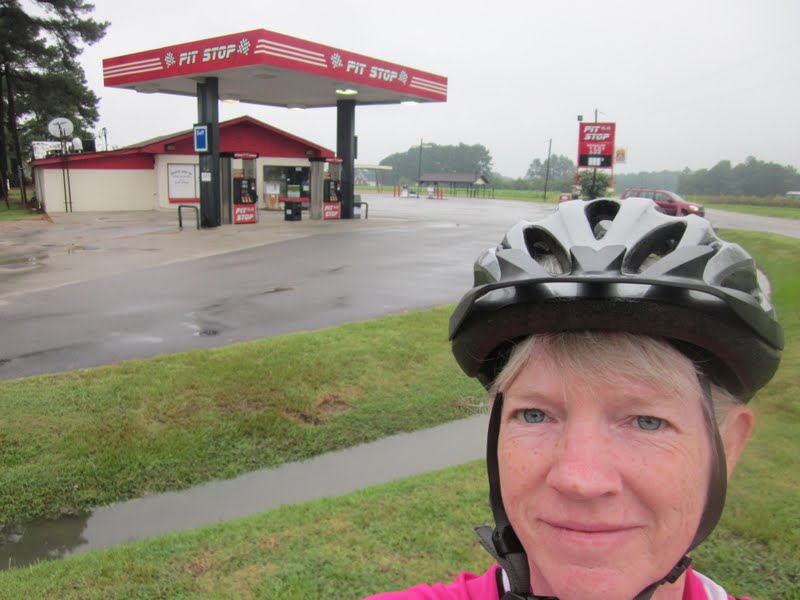
So…I got chased by a posse within the first half-mile, two dogs who also alerted the one next door – a very disconcerting way to start the day.  I do believe I could become a road cycling enthusiast if not for the dog issue.  How can they bother me so much when I’ve hiked in the woods with bears?  Well, because bears are not aggressive unless extremely provoked.  The speed of the bike seems to trigger a dog’s instinct to chase – to bite also?  Animals do what animals do and I am just not fast enough to outrun them.  So with that early burst of speed juice in my veins I was on my way, but now I didn’t trust any house possibly harboring a crazy canine.  

Part of the charm of riding on the back roads is local country stores.  Early on this Sunday morning I stopped at Hornes Church Road Convenience Mart where some good old boys were gathered for a “pre-church” conference.  The owner apparently didn’t have a no-smoking rule.  I asked them if I was late for the meeting but they didn’t seem to get the joke – maybe they were thrown off by the bike shorts and helmet.  

Beautiful stretches of morning glories in purples and pinks

What did we do before cell phones?  Jim called to say he had gotten turned around and was worried about missing me while straightening out his detour.  Even the car’s GPS plus written directions plus Map My Ride are not enough to stay updated with current conditions “on the ground”.  In this case, Highway 795 had interrupted a road.

We met up before the detour that Jim had figured out.  “Road Closed” signs for cars mean nothing to cyclists.  We watched as work vehicles passed and then crossed the RR tracks and kept on going.  


The halfway point in the town of Black Creek was sleepy on Sunday morning.  I stayed for a little break while Jim drove on to the end point to repeat step 1.  Black Creek boasts a lovely little town park with a community hall, playground, gazebo and (most important) unlocked bathrooms. 

Black Creek police station

Small town pride – the local museum

No more dog chases today and I had a very pleasant ride.  I saw different types of tobacco, burley and Bright leaf.  There were also some lovely homes out here in the country, white picket fences, huge flowerbeds in the front yards.  Most importantly, no rain appeared, just cloudy and overcast, actually great conditions although still muggy and warm.  During the last hour the sun came out and the temperature rose and I got sunburned.

Tobacco harvest – the bottom leaves from each plant in the field are pulled at one time, then the harvesters go through again and pull the next bottom set. 
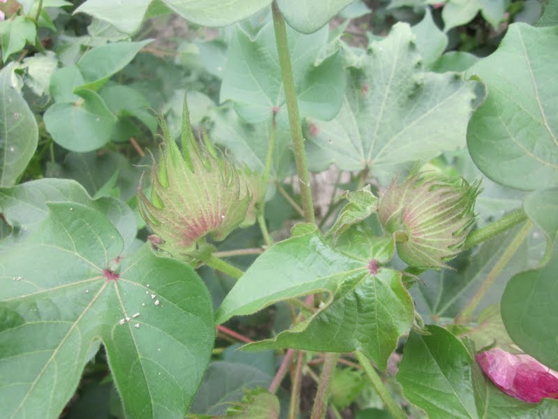
Cotton bolls

Cemetery and red barn – right after I snapped the photo here I saw a large male deer go into the woods

Once Jim caught up to me again, though, I began complaining (when I’m alone there is no one to hear me) as I was becoming tired and the heat was increasing – poor guy, don’t you know he’s glad this is the last day?   Although I knew I would make it, I appreciated having him as my coach counting down the last miles. 

What a great feeling!  My longest day (43 miles) and my last on the bike for the MST.  Just one short hike to go.

“Life is a road and I want to keep going…in the end I want to be standing at the beginning with you.”  ~Donna Lewis, At The Beginning

Adrenaline Boost


MST – Day 68 – 8-13-11 – Albritton Crossroads to Hills Grove Holiness Church – 14 Miles

All right, boys and girls, it’s time to finish up the road biking of the Mountains-to-Sea Trail.  Jim agreed to give up one last weekend to the cause.  On Saturday afternoon we drove a million miles across North Carolina once again, this time trying a different tact for fuel efficiency.  I was a little more confident of my biking abilities, so we elected to take just one car, Jim could drop me off and drive ahead and I’d bike alone a bit. 

The weather forecast was unfavorable, thunderstorms, rain and intermittent rain showers.  But if I didn’t do this now, my next chance would be months away.  I was prepared to get wet.   And we drove through a lot of rain, but for this brief ride the clouds parted and streaks of blue peeked out.

First I needed to complete the route that John J. and I had to cut short due to my flat tire.  Today Jimmy D’s Restaurant was closed so I wasn’t able to thank Jimmy again for his help on that hot day.  Now I had a repaired tire and only 14 miles to bike.  Jim agreed to drive ahead of me to each turn so I wouldn’t have to worry about directions.


All fine and dandy except for one thing:  dogs, bike chasing dogs, crazy barking bike chasing dogs.

Jim has outrun many a mutt in his cycling career and together we’ve out-maneuvered a few, mostly with me pedaling frantically and Jim putting himself between the animals and me until they give up after a brief race.  But today, when Jim was out of sight, a large dirty white mongrel from Hell with black gums, pink tongue, yellow teeth and bloodshot eyes shot out of “his” yard on the left side of the road and began the chase.  He was very persistent and there was no way I could outrun him.  He sprinted alongside me on his side of the road, yelping and foaming, and whenever he began to cross over I would yell.  He’d go back to his side but continue at my pace (which by this time was lightning speed – adrenaline is an amazing thing.)  Cerberus chased me well beyond his property lines and I’m not sure what made him give up, but I lost a couple of years off my life from the encounter.

And there was Jim, calmly waiting at the next turn.  But what could else I do?  I couldn’t have him follow behind me in the car, trying to hit every dog that came running…could I?

Lovely country house – reminds me of my mother’s birthplace down the road from where I grew up

Bike route signs are prominent and helpful.  Much of the MST on the roads follows bike routes.

Aside from the chase scene, I enjoyed the ride today.  On a deserted stretch of road a massive flock of birds came up from behind me on my right side, flew overhead and spread out, sweeping left  - a quiet, peaceful moment. 

I finished the route in about 1-1/2 hours and we headed back to Goldsboro to fuel ourselves with BBQ for tomorrow’s biking finale.

A bicycle does get you there and more...And there is always the thin edge of danger to keep you alert and comfortably apprehensive.  Dogs become dogs again and snap at your raincoat; potholes become personal.  And getting there is all the fun.  ~ Bill Emerson.


Tuesday, September 6, 2011

Croagh Patrick - Ireland

Croagh Patrick – County Mayo, Ireland – 5 miles

In celebration of our 30th wedding anniversary, Jim and I went on a 10-day trip to Ireland in July-August 2011.  Jim has visited before but this was a first-time opportunity for me.  Marathon planning sessions attempted to balance what Jim had experienced (and wanted to repeat) and what would be new to both of us.  Not only were sightseeing and Guiness-drinking on the menu, but also our outdoor interests of hiking and biking.  A plan was formulated and off we went.  I won’t overwhelm you all with the details of logistics, driving on the “wrong” side of the road, farm animals and farm machinery, lodgings and full Irish breakfasts.  Let’s talk about hiking up Croagh Patrick.

Croagh Patrick is a mountain (known locally as the “Reek”) rising 2,500 feet from the shores of County Mayo on the west coast of Ireland.  It is bare of trees and the upper portion of the slope to the summit is loose rock scree.  In the fifth century purportedly Saint Patrick fasted for 40 days at the summit (and then banned all the snakes from Ireland for good measure).  On the last Sunday of each July there is a pilgrimage to Croagh Patrick, tens of thousands of participants from around the world.  Part of that tradition is climbing the mountain barefoot.  Our journey was on Friday, July 29, two days before the 2011 event. 

First glimpse of Croagh Patrick

After a lengthy, circuitous drive to the base of Croagh Patrick (i.e. our GPS got us lost) we got a late start.  I had my trusty hiking poles and Jim “rented” a walking stick in the parking lot (6 euro, 3 returned if the stick is returned).  The weather was outstanding, light clouds but plenty of sunshine, and we were not the last people going up.  It’s 2.5 miles and 2,500 feet to the summit, a moderately serious climb, I thought to myself.  I underestimated a bit. 

Statue of Saint Patrick

The path is impossible to miss, as wide as a two-lane road at the lower portion, with plenty of boulders to step around and over, ascending beside a small stream.  Erosion is extensive and new, narrower paths are being worn past the outer edges of the main track.  No trees, plenty of grass on the mountainside, and we spotted the requisite sheep and goats in the distance.  People of every description, very young children running ahead, grandmotherly types holding onto crooked elbows of hiking companions, one man carrying a brown paper bag by its handle (what is in that?) and young couples holding hands joined the flow up the mountainside.  This first mile-and-a-half of the route goes over a smaller mountain, somewhat like a low shoulder of Croagh Patrick itself.  It grew surprisingly steep and conversation began to dwindle as hikers began to conserve (suck) wind for the climb.  The sun was warm and my low back began to tingle (could that be from my fall in the Black Mountains two weeks ago?)
Always remember to look back over your shoulder  - Clew Bay

This section of the trail topped out over- looking the next valley and this tarn, around which people apparently could not resist leaving evidence of their passage.  My hiking buddy Jeff would definitely dislike this (he disapproves of rock cairns or anything suggesting human presence). 

Jim on the ridge

For a half-mile the path moved gently enough along the ridge as the final ascent up the back side of Croagh Patrick came into view. 

What I saw was this precariously steep, rock-strewn slope unbroken by vegetation of any kind, with a worn track along one edge.  Loose rocks larger than my foot covered the mountainside.  One website I read later described the angle as 55 degrees and I believe it.  How do you keep from sliding off the mountain?  Prayer.  My nerves were rattled enough going up – coming down was going to be insane.  I’ll admit, I briefly considered turning around.

Jim on the crazy slope 

The only barefoot person I saw today

One foot in front of the other, jockeying for position as people passed going down, I climbed up to the top.  I have done some tough hikes in my life and I’ve learned to go very, very slowly on steep paths.  Fellow hikers were very social, exchanging words of encouragement and/or words of commiseration at the shared experience. 


Nearly two hours after starting, Jim and I stood on the top of Croagh Patrick.

At the summit is a small chapel built in 1905.  I can only imagine what it must be like to attend worship here on Reek Sunday, certainly very moving after so much physical exertion. 

Jim and I hung out for awhile, getting our photo taken and helping others get theirs.  We met one large family gathered to celebrate a wedding the next morning. 

At last it was time to risk life and limb going down the mountain.  This is where hiking sticks were essential, to stop yourself from sliding too far.  A huge surprise:  I found that my footing on the worn path with the tiny loose gravel was extremely slippery and walking on the big rocks was easier (the big rocks only slipped a little bit).  I “rock-surfed” most of the way down the crazy steep section. 

Past the level section, I started down the final descent a little too cocky.  Probably my legs had gotten tired and I was not as cautious as I should have been.  Anyway, on the last section down I fell solidly three times.  The last time I’m afraid the curse words in my head found their way out of my mouth because I got a few chuckles from those around me.  My sore lower back hurt with every step.  It took nearly the same amount of time to come down as it did to ascend this awesome mountain.  I was exhausted and ecstatic.

So if you’re ever in Ireland, be sure to visit Croagh Patrick.  It may not be the highest mountain you ever climb, but it is a unique experience that will only get better with the telling.

A fantastic video of hiking up Croagh Patrick is here.  You simply must see it!

“Here I am, safely returned over those peaks from a journey far more beautiful and strange than anything I had hoped for or imagined - how is it that this safe return brings such regret?”  ~Peter Matthiessen


Monday, September 5, 2011

Gimme A Sign


MST – Day 67 – 7-21-11 – Highway 13 to Highway 11 – Albrittons Crossroads – 24.2 Miles

Today’s heat index was forecast to reach 104.  John and I met at our ending point (Hills Grove Holiness Church) just as the sky was lightening, left a car, and drove to our start point about 38 miles away in Shine, NC (Hwy 13).  We hoped to finish by 11:30 a.m. to beat the heat.  I felt conflicted about whether to do the ride or not.  I had driven a very long way and spent the night, but was it safe to do this in such hot conditions?  John’s the kind of guy who will honor a commitment even if it’s unpleasant.  Should I just let him off the hook?  I needed a sign.  

Well, the morning started out reasonably cool so maybe it would be okay.  And John brought his recumbent bike, much easier on him.  So at 7:20 a.m. I started out in the lead because I had the turn-by-turn directions.  The road was flat and there were very few cars.  John was great about calling out “car back” when a car was approaching to pass us.  


I never tire of seeing these old buildings and farm equipment  - reminiscent of my growing up.  I didn’t live on a farm, but several of my uncles were farmers (mostly tobacco).  I lived just down the road and I spent a lot of time at their places.  I never was required to work in tobacco during the summer, but all my male cousins and friends and my brother did, and I can even remember my mom going to help out from time to time when I was very young.  I remember tobacco slides pulled by mules, hand-tying the leaves to the sticks, hanging them in the barns to cure.  A by-gone era. 

Flowers on a tobacco plant

Entering the town of LaGrange, I felt I was working harder than I should, and John said my rear tire appeared to be flattening.  We stopped to check it out and sure enough, it was losing air.  I had an extra tube but no pump.  John had a pump but the connection was not the right size.  Well, maybe if we speed up we can get it over with. 

We were pedaling through a pretty countryside and the air was heating up, but we didn’t feel the need to stop as often as yesterday.  On a road lined with tall corn on both sides, an enormous piece of farm equipment appeared around a bend, with wide-set tires spreading across the pavement – looked like something out of Transformers.  It could have passed over a house.  The farmer waved and chugged on by.

At Living Waters Fellowship Church we stopped to fill up water bottles from spigots at the front of the building.  We knew about this from a note in Scot Ward’s book.  He notes many water sources on the road route and this is the first time I had used one.  It’s great information to have. 

My tire was getting flatter – what to do?  We kept at it, not stopping to take photos, but after about 8 more miles I decided that I couldn’t continue.  We stopped at Jimmy D’s restaurant at Albritton’s Crossroads, a busy place on a weekday morning as they prepared their hot food bar for the lunch rush for local workers (no fast food chains out here). 

We went inside and sat in the air conditioning to determine what to do.   It was 10:00 a.m. and we were about 13 miles from our end point.  John offered to continue on alone to his vehicle, but I was concerned about him biking alone in the heat.  Looked like it was time to bum a ride.

I asked a fellow waiting on his takeout order if he would take John back to his van while I stayed behind with the bikes.  The patron couldn’t help us but suggested we talk to the owner, Jimmy.  Hitching a ride 13 miles in the country is a big request, but Jimmy stopped his work, loaded our bikes in his pickup and both of us in the front seat and took us back to Hills Grove Holiness Church – the truest kind of trail angel.  He reminded me of my cousin Sammy (one of those boys growing up on the tobacco farm), kind, friendly, willing to help out a neighbor or a stranger in any way. 

John and I called it quits - no sense in trying to pump up the tire and complete the route.  God thought it was too hot for us to be out there and I was not inclined to argue.  As John drove me back to my car, we talked about what makes people engage in outdoor adventures and, conversely, what prevents people from them.  Our conclusion:  it’s not so much in your physical ability as it is your mental attitude.  You've got to be okay with being physically uncomfortable when working towards a goal.

I turned the air on full blast and headed for home.  Along the way I passed tobacco fields and workers pulling the bottom leaves, wearing long sleeves, long pants, bandannas over noses and mouths. 

“If you want to keep going, you’ve got to keep going.” ~ John Jaskolka, age 82.

Friday, September 2, 2011

Do You Get "The" Discount?

MST – Day 66 – 7-20-11 – Hills Grove Holiness Church to Pleasant Hill AME Zion Church – 22.2 Miles

Wanted:  New biking partner for road sections of the Mountains-to-Sea Trail east of Goldsboro, NC. 

John Jaskolka, FMST board member, trail builder and maintainer, hiking and biking fool, responded to my email in spite of the fact that it was mid-July and hotter than…well, you know.  John is busier in retirement than he ever was in his career, I’ll bet.  He lives in Eastern NC and his flexibility allowed me to get some more road miles in during the week rather than encroaching on Jim’s limited weekend time.  So John and I made plans.

We met on this Wednesday afternoon at Pleasant Hill AME Zion Church about 8 miles west of New Bern, where Jim and I had started our New Bern weekend back in March.  I was surprised to see John’s car loaded with a hybrid bike.  He normally rides a recumbent bike, but he thought he’d try out the hybrid today. 
 
We drove the bikes over to Hills Grove Holiness Church off of Burkett Road and cautiously started out.  Did I mention it was hot?  At least our route wasn’t complicated - Old U.S. 70 most of the way, the flattest, straightest road yet, paralleling RR tracks on the way to New Bern.  

We soon found out that we had to share the road with trucks coming and going from the Tuscarora landfill, where an expansion is underway (so LOTS of trucks).  They were much larger than dump trucks but the drivers were very conscientious of us itty bitty cyclists. 

We also passed the Tuscarora Game Lands lookout tower, which Scot Ward’s book notes to “climb for good views.”  We didn’t stop, but John said he didn’t think climbing the tower was allowed.

Local farms were generally flourishing with corn, tobacco, soybeans and cotton.  
Healthy corn

Tobacco

Cotton

The heat was so intense, John and I had to stop every 3-5 miles to drink water and cool off.  At a convenience store in Cove City we stopped for Gatorade.  I stood in front of the air conditioner for so long I thought I’d have to start paying rent. 

I could tell John’s hybrid was uncomfortable for him because he kept shaking out his hands, not used to having them in the position of leaning on them.  My recurring thought was, “How are we going to do this for 40 miles tomorrow?”  But we paced ourselves, stopped often, and cheered when Pleasant Hill AME Zion Church came into view.  We made our plan to meet at the crack of dawn tomorrow and hopefully beat the heat.

After John and I parted ways, I drove back to the Cove City convenience store for more Gatorade (preparing for tomorrow) and chatted with the owner (also named John, and not to be confused with his son, John Paul, who was running the cash register on our first stop).  We had a nice visit and he commented on how he thinks it’s always important to say hello at a country store, because you want people to remember you if you ever are in need of help.  Good advice all the way around, I think.

I also stopped at the lookout tower and, sure enough, they don’t want you going up there.

I checked into my little hotel and blasted the AC, got cleaned up and went out for something to eat.  At the end of my meal I asked for the check and the sweet young waitress asked me if I get “the” discount.  Now, would that be the discount for being over a certain age or for being an amazing active outdoor woman?  You decide.

Cycling is like church. Many attend, but few understand. ~Jim Burlant

Some People Think Mudslide Means a Cocktail

SB6K Hike – 7-16-11 – Woody Ridge Trail/Black Mountain Crest Trail/Colbert Ridge Trail – 10.2 Miles

Another crazy Sherpa hike with the Bergs – didn’t we just do this?  Several objectives this time out:  bagging three SB6K peaks and getting in shape for hiking to the summit of Mount Whitney in September.  Yeah, yeah, that MST thing is still going but there’s so much other fun stuff to do…

Seven hikers drove through the misty morning chanting, “Please don’t pour down rain today.”  It may have been steaming hot in the Piedmont but you can count on the Black Mountains of NC to be cool and often damp.  We set up our short shuttle and started up the Woody Ridge Trail.  The woods were very wet and the breeze shook the trees and made it “rain” but no big deal. 

Steven’s duct tape gator enhancers.  He’s not taking any chances with wet feet.

The Woody Ridge Trail starts off a little steep, gets more steep, then gets ridiculous.  And still nature’s simplest offerings are amazingly beautiful: 

Turk’s cap lily (warning:  lots of these throughout the post)

Indian pipe, always a great discovery, a ghostly plant that lacks chlorophyll

Dampness highlights the spiderwebs

Rhododendron bustin' out everywhere today

About 1.7 miles up, after I realized that crawling up over boulders was not going to be unusual, we caught our breath beside this 30-foot rock wall.  David M told a story of hiking up this trail once, seeing how difficult it was, camping here overnight and then walking back down the next morning.  Then Jeff says it’s about to get steep for real.

A beautiful view, I’m told

More Turk’s cap lilies - I can't resist photo- graphing them.  Unlike most wildflowers, they are huge bright and showy.  And they have freckles like me!

How tough was this trail?  It took us 2.5 hours to climb 2.2 miles up to the intersection with the Black Mountain Crest Trail.  Normally this crowd hikes at 2+ mph.  The wet conditions made us cautious but nobody was goofing off.  It was just plain hard work getting up there. 

Which made the lunch break so satisfying, resting on a big sloping rock, whiteout views.  Everyone else had been here except me and they described what I was missing in glowing terms.  Will I hike up here again someday to see it?  Probably.

Sitting still for a little while got us chilled enough to put on the warm fuzzies – Steven and Carolyn

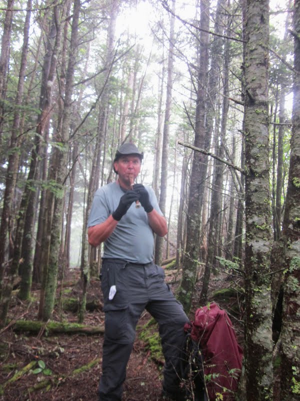
Three SB6K peaks today:  Celo Knob, Gibbes Mountain and Winter Star.  We turned right on the BMCT and hiked about a mile out to the manway to Celo Knob.  (Jamie and David M chose to continue on the route and we’d catch up with them at Deep Gap.)  The manway was faint but Jeff and his GPS got us to the summit.  In celebration, Steven played taps on his recorder and Carolyn joined in on harmonica.

 
One down, two to go.  The fun is only just beginning.

We backtracked on the Black Mountain Crest Trail, continued westward past our intersection with Woody Ridge, and reached the point for our off-trail scramble to Gibbes Mountain.  Jeff and I were going up – who else was in?  Everybody.  No manway this time, just blind faith in the almighty Jeff.  We ducked, crawled and crept our way to the top and stood on a big rock that he declared the summit.  Then we ducked, crawled and slid our way back down, dirty, muddy, covered in leaf litter.  Once you give yourself up to it, it’s kinda fun to get dirty.  This detour took over 30 minutes. 


Two down, one to go, a-quiver with anticipation. 

The Black Mountain Crest Trail is a roller coaster of ups and downs, rock scrambles, and today mud slides were on special.  Everyone slipped, some more than once, and a couple of times it was hiker bowling as one person slid into another.  I think Carolyn is the only one whose butt didn’t make contact with the ground.  Needless to say, we didn’t gain any time on this section.

During this part, for some reason I looked at my left hand and noticed all my rings were missing.  I had a sick five-minute panic attack of thinking that they had come off when I removed my gloves going up Celo Knob – a bad, bad feeling in my heart.  Poor Jeff listened as I talked to myself about what could have happened.  Finally I realized I must have removed them while working at my computer the day before and left them at home.  (PS – I was right.)  So my record of crying on Jeff’s tough hikes continues.

A muddy challenge – by foot or by butt?

A rope?  You’ve got to be kidding me.  Show us how it’s done, Carolyn.

A view, better late than never

The summit of Winter Star is an easy one, just a few steps off the trail to a U.S. Survey marker

Three down – a good day’s work.

Love vine - winds itself around other plants


Underside of Turk’s cap lilies

At Deep Gap we met back up with Jaime and David M to begin the long, steep 4-mile descent down the Colbert Ridge Trail (what goes up must go back down).  Slippery going up is one thing, but slippery going downhill calls for extra caution.  We’ve often had conversations of how difficult a rescue would be in remote areas like this.  But in one quick movement, I slipped off of a large boulder and landed solidly on my low back.  I had to catch my breath (so did everyone else, I think) and needed help to get up.  I’m lucky I didn’t crack my skull on the rock - my daypack saved me from that.  My back felt extremely sore and I gingerly walked the rest of the way.  Thank goodness the trail leveled out for the last mile.  For weeks afterwards, certain movements and postures were painful.  (Yoga classes were not fun.) 

Altogether, it took us 9 hours to do a 10-mile hike, the most technically difficult hike I’ve done (I’ll be revising that statement soon).  At least I wasn’t driving (thank you, David B) and could sit in the back seat and relax my back.  Whew!

(Note:  I moan and complain about the difficulty of these hikes sometimes, but I know that you only get better when you challenge yourself.  I feel a swelling in my chest, a sense of such accomplishment when I successfully complete one of these hikes, and I just want to go out and tackle another one.)

When you come to the end of your rope, tie a knot and hang on.  ~Franklin D. Roosevelt