Pisgah 400: Art Loeb Trail & Cold Mountain – 7/12/23 – 11.4 miles
After a comfy/chilly night’s rest (54 degrees) at Mount Pisgah Campground, Carol and I woke up to another blue sky day, looking forward to hiking to a famous summit: Cold Mountain.
Heard of it?
Yes, it’s the Cold Mountain that inspired the 1997 book by Charles Frazier (am I dating myself here?)
Yes, it’s the Cold Mountain that every Boy Scout at Camp Daniel Boone has tackled on an 11-mile round trip hike to the summit.
Yes, it’s the Cold Mountain (elevation 6,030 feet) that is part of the South Beyond 6000 Summit Challenge (SB6K).
Raising the awesomeness factor of today’s hike is the Art Loeb Trail, a challenging route traversing ridgelines of Shining Rock Wilderness and high points of Pisgah National Forest. Camp Daniel Boone is at the northern terminus of the Art Loeb Trail. The southern terminus is 30.1 miles away at Davidson River Campground in Pisgah National Forest.
I’ve hiked all of the Art Loeb Trail except the westernmost four miles starting from the camp. I summitted Cold Mountain in 2009 as part of the SB6K Challenge (that’s 14 years ago, friends). Our trek on that day was a rigorous 18 miles out-and-back from…well, you can read all about it here.
Today’s adventure is all new for Carol, so let’s go!
It’s one heck of a drive from Mount Pisgah Campground to Camp Daniel Boone, and I was taken aback when it appeared we would drive through the middle of the camp while the morning flag ceremony was being conducted. Boy Scouts young and old swarming everywhere – are we in the right place? Yep, just keep going to the gravel parking lot for Art Loeb Trail.
A young woman with a loaded backpack was studying the trailhead sign and she headed up the trail a few minutes ahead of us. We soon caught up with her and she was eager to chat. She was excited to begin a birthday challenge for herself, her first multi-day hike.
Carol and I surreptitiously raised eyebrows. We are both experienced backpacking know-it-alls and Shining Rock Wilderness is quite rugged, a myriad of unmarked animal and social trails with no signage. We suppressed the urge to grill her about gear, instead encouraging her that it was very doable. She said she had paper maps and some info from the AllTrails app, figured she would take 5 days or so. We took a group photo, and Carol and I wished her well and walked on, a little worried – yes, judging her (lack of?) preparedness.
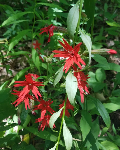
Our superiority complexes were quickly squelched as the steepness of the trail in front of us took our breath away. Let’s slow down and appreciate nature. Lush foliage and midsummer flowers were putting on a show!
At about 4 miles, we reached Deep Gap, where the Art Loeb Trail turns right and Cold Mountain Trail turns left. We took a break to assess our energy levels.
Are we having fun yet? Carol debated whether she wanted to continue to the summit. Up to this point, the Art Loeb had been challenging but not hard to follow, clear of obstacles. Looking at the head-high foliage pointing towards Cold Mountain, though, I also had doubts. This is where the “let’s start, see what it’s like, maybe turn around” philosophy applies. (Spoiler alert at the top of this post: we both made it to the summit.)
The steep grade didn’t let up. The closer we got to the top, the more rugged the trail became. The tall undergrowth persisted, broken up occasionally by boulders. No surprise I only took three photos on this section.
Several expanses of rock facing south, overlooking Shining Rock Wilderness’s green carpeted ridges. Like Goldilocks, we checked out all of them.
On the return hike, we stopped at Deep Gap again where a group of high school age Boy Scouts were setting up tents. We chatted with the woman who was guiding them on a 3-day backpack trip in Shining Rock Wilderness. We asked about the young woman on her Art Loeb birthday quest, but this group had not seen her.
where ya going?
Further down the trail, we met two men and asked if they had seen the young woman. They said yes, she was turning around, decided it was too much for her. She could have modified her plan to a one-nighter out-and-back, but at any rate, Carol and I were very happy to hear she had made a thoughtful decision.
Heck of a long drive back to Mount Pisgah Campground with plans for a simple dehydrated supper. At the neighboring campsite, two guys were cooking something that smelled delicious and they invited us to “sit a spell.” They were old friends who meet several times a year to camp together, cook a lot, smoke cigars, enjoy the peace and quiet of the outdoors. Their setup was elaborate, with a huge tent and canopies, camp cots and a large rug to keep the dirt out – and don’t forget the eternal campfire. We talked about what we’d done that day and they talked about what they might do tomorrow, after sleeping in and cooking breakfast and smoking more cigars.
"Live your life by a compass, not a clock."
~Stephen Covey


