South Dakota: Badlands National Park – 6/13/23 - 3 Miles
Nancy returned home the morning after she finished her Centennial Trail thru-hike. Busy life! I dropped her at the Rapid City Airport and headed east for a day trip to Badlands National Park.
What’s in a name?
When Badlands was first proposed as a national park in 1922, the suggested name was Wonderland National Park – thankfully that one didn’t stick! The Lakota name for this unique landscape is Mako Sica.
Weather extremes in summer and winter, few water sources, and difficulty in navigation contribute to indigenous people’s “bad” appellation, and the powers-that-be establishing the national park (finally) paid attention to Lakota wisdom.
Go deep here on the NPS website for articles of history and culture.
There are two distinct sections of Badlands NP. Ben Reifel Visitor Center is in the North Unit, open year round, easily reached via I-90. White River Visitor Center is in the Stronghold Unit to the southwest, open in summer season. This unit and Palmer Creek Unit are within Pine Ridge Indian Reservation. It’s not easy to get from one section to the other for a thorough visit in a single day. Like most visitors, I chose the road more traveled – the Loop Road through the North Unit.
Fossils of earlier life in the Badlands were uncovered by indigenous peoples long before Europeans arrived at what is called White River Badlands (Badlands NP is a small part of this area).
Present-day Badlands wildlife includes buffalo, bighorn sheep, pronghorn, prairie dogs, cute prairie dogs and serious prairie rattlesnakes. There are few established trails. You are welcome to hike “anywhere” but be prepared to help yourself get out of trouble! I stuck to a couple of short signed trails. I didn’t want to navigate solo and I sure didn’t want to count the rattlesnakes.
A short distance past the Northeast Entrance to the Loop Road, a big parking lot appears with the promise of bathrooms, information signs and an introduction to the lunar landscape. You can choose to walk on the Door Trail, the Window Trail, or the Notch Trail – or all three!
of rock. From there, you can wander on your own path or follow the yellow poles to go deeper
into the landscape.
The exciting part of the Notch Trail is climbing up to a ledge on a very unstable ladder that is not secured to the slope. This is not as easy as it looks (notice the people using hands and feet near the top).
There were groups of people negotiating this ladder with no regard for taking turns or safety of others. I was by myself and had to squeeze myself into the queue to get back down, then had to holler at others to stop ascending as I was trying to descend. (&#%*!)
The Ben Reifel VC was buzzing with activity. They have a very cool working fossil prep lab where volunteers demonstrate and explain their work. Kids were being sworn in as Junior Rangers.
Leaving the crowded VC, I realized it was way past time I should have stopped for my packed lunch. The sun was strong and the temperature was high - I didn’t want to eat in my car. At the next picnic area there were somewhat shaded picnic tables, all occupied. What to do? Be friendly! I introduced myself and asked a couple if I could share their space. We had a great conversation about their RV travels and retirement life.
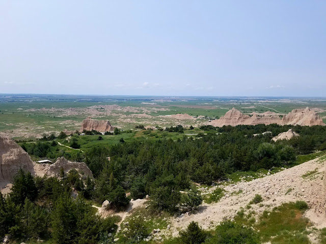
The rest of the Loop Road offers viewpoints on both sides and I stopped at every one. What really knocked my socks off was Yellow Mounds Overlook, a palette of colors I did not expect. From a big pull-out area, I scrambled up on a ridge to get the full impact.
Reflection: the United States’ diversity of geography, geology, climate, wildlife, and human life often leaves me speechless. I am so grateful for my country’s commitment to preservation and celebration of public lands.
The paved Loop Road ends at the Pinnacles Entrance, where the unpaved Sage Creek Rim Road beckons. With more precise planning and a travel partner, this looks like an intriguing and worthwhile extension of a visit to include the southwestern portions of Badlands NP. Another time!
Had to do it: on the way back to Rapid City, I stopped at Wall Drug to see what all the fuss was about. I wandered around, bought a doughnut and a souvenir, and got outta there.
“Only when the last tree has been cut down
and the last river has been poisoned
and the last fish has been caught
will you realize you cannot eat money.”
~Cree Prophecy

.jpg)


.1.jpg)