Tuesday, April 29, 2014

AT Project in VA: Great Valley to Rich Valley


Appalachian Trail in VA Project – 2/22/14 – US 11 to VA 42 – 11.8 Miles

The back roads of southwest Virginia continue to incentivize Jim to help me with my AT hiking.  Thank goodness he likes biking in the cold since so far Winter 2014 has been relentless.

A brief two-day window of a precipitation-free forecast was all it took to coax us out once again.  At the end of 2013 I had completed roughly the middle third of the AT from Shenandoah NP southward to Burke’s Garden, south of I-77.  For this outing I planned to cover the section from Burke’s Garden to I-81 – backwards, sort of.  To maximize my daylight, I started from I-81 to hike northbound to the Trail’s crossing at VA 42.  This 12-mile section goes from Great Valley up over Gullion Mountain, down into Crawfish Valley, then back up again over Big Walker Mountain and down into Rich Valley.  Jim planned to bike all over creation and end up at the same spot on VA 42.

Technically I started from the parking lot of The Barn Restaurant on VA 11 and walked underneath I-81.  Clear blue skies, but colder than I expected.  The AT entered an open field with a gentle climb.  I had been walking less than five minutes when I heard a lot of barking and howling and, looking far across the field, I saw a pack of hunting dogs and two hunters in blaze orange.  Suddenly a deer jumped in front of me and ran into the brush.  Welcome to hunting season – again.  I took out my red rain jacket and tied it on the outside of my pack.  [Later on I described this scene to someone who reasoned that the hunters were probably bear hunting and would only shoot up into a tree after the dogs had trapped one.  If anyone wants to weigh in on this theory, let me know.]

Part of the land now owned by the Forest Service that includes the AT corridor was donated by the Davis family, descendants of James Davis, who purchased the land in 1748.  About one mile into my hike I took the short side trail to visit the Davis Cemetery, fenced in at the edge of an open hilltop meadow.

Headstone for Lizzie M. Davis, wife of F.G. Davis, died at age 34.  The inscription reads:  “I shall be satisfied when I awake with Thy likeness.”

After crossing VA 617 I found myself again in open pastureland.  In contrast to the deep green of midsummer, it is still beautiful in winter, straw-colored grass, bare gray branches of an old sentinel tree, deep blue sky minus summer’s haze.

Winter light

I negotiated nine fence stiles today, only half of which were noted in my guidebook, crossing barbed wire fences that separate land ownership.

At a spot called Davis Path Camp- site, the remains of a shelter taken down in 2008 “because of misuse."  Camping is still allowed. 

And the privy is still open for business.

A very pleasant gentle climb up Big Walker Mountain to Tilson Gap, 900 feet elevation gain in 1.7 miles.  Got to put some footprints in a little bit of snow.  Then what goes up must come down, a little more steeply on the north side. 

Walking a narrow stretch of the trail between two barbed wire fences


At VA 610 I clambered over fence stiles on either side of the road and noted this friendly reminder to behave and be grateful as hikers are now entering a narrow corridor on private land.  Instead of going straight up the hill, the trail meandered through the meadow before entering the woods again.

After one last small downhill I encountered yet another stile at the North Branch of the Holston RIver, which was flowing at its fullest capacity.  Fast moving water is mesmerizing, don’t you think?   In a few hundred yards I came to VA 742 and the low-water Holston River Bridge, a concrete crossing level with the pavement.  The water was lapping onto the bridge, threatening to spill over. 

From the bridge I got an eyeful of Tilson’s Mill, built before the Civil War.  The building is massive and deteriorating and spooky.  I’ve read that trail volunteers are working to stabilize the structure and document its history and I look forward to learning more about it.  Right now there isn’t much information on the web.

Tilson’s Mill

According to the map, one more mile to go, but I question that it is longer, through another pasture, a few ups-and-downs, and at long last I stepped out onto VA 42 where reliable Jim was waiting.  I am so happy that we have found a way to share these adventures.

On our way back to our hotel room in Marion, VA, we stopped to check out Hungry Mother State Park, nice little cabins, lakefront with swimming, a conference center, picnic areas and an extensive trail system.  If the temps ever get out of the 20’s at night I would like to camp there, perhaps as a base camp when I can help the next hiker complete this section of the AT. 

How did the park get its name?  The traditional story that park rangers tell is that the hungry mother is Molly Marley, a victim of a Native American raid on a Virginia settlement. Marley and her child were taken captive, but they escaped into the woods, surviving for many days by eating berries. Ultimately Molly collapsed and died. Her child was found, crying "Hungry mother." The child led them to Molly's body.

“We tend to forget that happiness doesn't come as a result of getting something we don't have, but rather of recognizing and appreciating what we do have.” ~Frederick Keonig


Tuesday, April 22, 2014

Saluda Waterfalls: Stopping By Woods On a Snowy Day


Snowy Saluda Waterfalls – 2/16/14 – 4 miles

Snow on Friday in the NC mountains sparked a spontaneous decision for Jim and me to spend Saturday gallivanting around the Columbus-Saluda-Hendersonville area, have a little outdoor fun at some waterfalls and leave time for microbrewery research and a good meal.  Just hope the roads are clear. 

Ken Adams’ book North Carolina Waterfalls is the quintessential source for waterfall hunting.  Some are simply drive-bys, some are reached by short hikes and some require bushwhacking with confidence.  Today we stuck to the first two types.

First, Shunkawauken Falls spills down a steep cliff and passes under a small bridge on White Oak Mountain Road near Columbus, NC.  This curvy climbing two-lane is quite narrow but there are small pull-off areas both before and after the waterfall so you can get out of the car and walk to it.  Just be mindful of the occasional vehicle that might be coming around the mountain. 

Well, that was easy.

Next up, Little Bradley Falls.  The book’s directions for a “shortcut” include looking for the correct pullout on Holbert Cove Road.  Snow plowing had piled up white stuff and the landscape was a bit different than the author probably encountered.  Is that a pull-out?  Is there rip-rap under that snow?  Will the car slide off the road?  We made a guess, then interpreted further instructions from that point  – and we were wrong.

After skidding down an embankment we began looking for the “obvious trail” following Cove Creek upstream, which was not at all obvious.  Eventually we hit an impassable wall, so we knew we had not started from the right place – but go up or go down?  Do we need to cross the creek?  Most important clue:  there were no other footprints in the snow.  

I abandoned my hiking poles (regretted that later) and we shimmied across Cove Creek on a big snow-covered log and walked upstream on the far side, eventually encountering footprints.  So is this the “obvious trail?”  In ten minutes the footprints crossed the creek to put us on the side on which we had begun - now we could trust that we were on the right path.  Rock hopped successfully, but I had less confidence in my balance without my hiking poles.  

Snow creates a hush, no rustling leaves, no sticks breaking underfoot, and voices are muffled.  Even the bubbling creek is muted. 

The footprints took us to Little Bradley Falls, 50 feet tall, quite robust and showing off, and no one there but us.  Looks like a great swimming hole in the hot summertime. 

A stacked stone chimney beside the trail

Retracing our snowy steps, we found the rip-rap scramble up to the road that should have been our original entry point.  We climbed up, but it was very difficult, lots of loose rock, and I would not recommend it.  Next time I would start this trail from the bridge crossing farther down on Holbert Cove Road, much safer and still a short hike.

At that same bridge is the obvious trailhead for Bradley Falls – hey, wait a minute.  Does that look like we have a flat tire?  Pressure is low.  Go home?  No, let’s hike and then worry about it.

We knew that on this hike we had to cross Cove Creek and probably would get wet.  Jim managed to hop the big boulders, but I was too nervous with slippery ice.  I could see the creek bottom, maybe six inches deep, smooth bottom, no rocks, so I ran across.  Wet feet for sure.

Again we followed footprints in the snow.  The guidebook says ignore the first three left side trails.  After the third one, the footprints stopped – we were going too far?  The trail was still quite wide and obvious and we continued to the fourth left side trail, a steep scramble even on a dry day down to a rocky outcropping overlook to look across Cove Creek Gorge at 100-foot Bradley Falls.  Again, we were alone.  I can imagine the crowd in the summertime.

Stunning viewpoint, felt very remote.  We picked a poor time of daylight so photos are terrible.  Slippery slushy walk back as the snow continued to melt. 

Back at the creek crossing I again ran across, Jim got a good video.  Somehow my feet got even wetter. 

The tire was no worse, only about 3:00 p.m., so we went into Hendersonville and discovered Southern Appalachian Brewery.  Knowing we couldn’t make it all the way back to Charlotte without solid food, we stopped for pizza in Columbus.  Aahhh, making good memories.

“When snow falls, nature listens.”  ~Antoinette van Kleeff

Wednesday, April 9, 2014

Pilot Mountain State Park On A Tuesday


Pilot Mountain State Park – 2/4/14 – 9 miles

Every week of January 2014 I attempted to hike on the AT in Virginia…and each plan was foiled by weather, too much snow, too cold, too windy to go alone.  So in early February I saw a one-day window of opportunity and made a run for it – not to Virginia, but to Pilot Mountain State Park in NC.  Three reasons to go:  One, a shorter trip than going to VA on a weekday; two, I hadn’t been there since the kids were small; and three, the Mountains-To-Sea Trail has been rerouted to pass through the park. 

Called the most recognizable mountain in North Carolina, Pilot Mountain is actually two quartzite pinnacles connected by a narrow saddle, the most prominent remainder of the time-worn Sauratown Mountain range.  Big Pinnacle rises to 2,421 feet.  From the website:  “To the native Saura Indians, the earliest known inhabitants of the region, Pilot Mountain was known as Jomeokee, the "Great Guide" or "Pilot." It guided both Native Americans and early European hunters along a north-south path through the area.”


In addition to the Mountain section, the park stretches to include a section of the Yadkin River, connected by a 6.5-mile narrow corridor.  The Mountains-To-Sea Trail follows the corridor up from the River portion, along the eastern edge of the mountain section, then turns eastward towards Hanging Rock State Park.  This reroute occurred after I completed the MST in 2011. 

I was chomping at the bit for a challenging hike to test my knees and I found one. 

The Park was nearly deserted on this cold but clear Tuesday morning.  During my nine-mile hike I saw two dayhikers, two trail runners and a guy walking his dog.  On a warmer Saturday visitors can number in the hundreds.

A little Zen on the Grindstone Trail, which begins at the park office and passes by the camp- ground  
loop, making easy access for campers to hike to the main attraction summit.

Past the campground, the Grindstone Trail climbs moderately and at 2.5 miles it forks; the right option is a connector to the Ledge Spring Trail.  I took the left option (a Ledge Spring/Grindstone Trail section running concurrently) and climbed .8 miles more to the summit area parking area, which was enormous and deserted except for two people who had stepped five yards from their car to look at the view.

And the view is this

A short path from the parking lot leads to the summit of Little Pinnacle and the prime viewing spot for what you came for:  Big Pinnacle

Of course the next thing to do is follow the Jomeokee Trail as it crosses the saddle and encircles Big Pinnacle.  I was thrilled at my great good fortune to be there totally alone. 

Looking straight up the rock, see trees growing out of crevices

Looks like a climber’s nirvana, doesn’t it?  But climbing is prohibited on Big Pinnacle for several ecological and practical safety reasons.  For instance, making it safe for climbers on top would require building extensive railings and stairs which would greatly detract from the natural view.  Some (most) things are better just left alone.  However, climbing is permitted on the back side of Little Pinnacle along the Ledge Spring Trail, the next section of my hike.


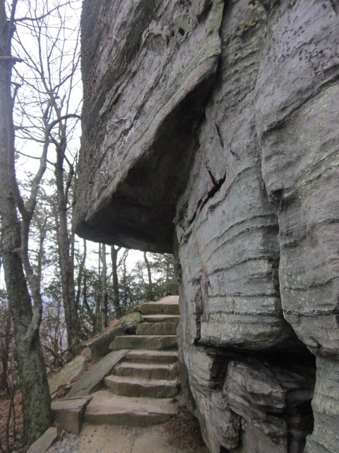
Ah, Ledge Spring Trail, strenuous – yes!  I imagine that tackling this baby uphill is quite a workout.  Nearly a mile of continuous stone steps going downhill was strenuous as well and my knees began to talk aggressively to me the way they did back in November.  The key on this section is to go very slowly and enjoy the towering rock features with climbing route names like Pool Hall, Nuts & Bolts, Three Bears and Devil in the White House.  The up side of my day (no people) was also the down side (no climbers).

I turned left onto Mountain Trail, which continues a winding descent for 2.5 miles to Pinnacle Hotel Road and the entrance to the Corridor Trail connecting to the river portion of the Park.  Along this section I saw the devastation of last year’s controlled burn that, well, got out of control.  I remember it well because Jim and I hiked at Hanging Rock State Park that day and could see the smoke from 22 miles away.

But look what’s coming back – mountain laurel.  Nature will always win.

At the end of Mountain Trail I took the very short road walk to Grassy Ridge Trail and began to climb what I had just descended.  By now my knees were officially hurting and I took it easy for the last 1.5 miles.  I was glad to see the park office and the end of my loop. 

There you have it, the mountain section of Pilot Mountain State Park.  I skipped the .6-mile Sassafrass Trail that is accessed from the summit parking area; otherwise, I walked all the trails in the section.  I admit to my prejudice against visiting this park on a weekend day.  In my opinion, there are not enough trails to spread out the crowd unless you are willing to venture past the summit and hike the larger loop.  Otherwise, I recommend Tuesday mornings. 

“My favorite weather is bird-chirping weather.”  ~Loire Hartwould