Monday, June 24, 2013

Joshua Tree NP - North View & Maze Loop Trails


Joshua Tree NP – Day Five – 3/23/13 - North View Trail & Maze Loop Trail - 6 Miles

Soon after we hit the sleeping bags last night a couple of Spanish-speaking guys fired up their camp stove on the site beside ours and enjoyed a good long loud chat with their late night snack.  Despite the delayed sleep, we woke up and started packing up before 7:00 a.m.  Today was our last day in Joshua Tree and I know I was ready to move on.  As we broke camp we noticed a couple of cars driving around the loop.  One car stopped and the occupants asked us if we were leaving and could they have our site.  Seems that every single campsite in Joshua Tree NP was full and these two had slept in their car the night before.  We said sure, and they had their tent pitched the moment ours were pulled down.  Then they left to buy provisions in town as we finished packing the car. 

David had prepared a hot breakfast every morning but yesterday he ran out of fuel, so today he faced a cold start.  He tried to sell the idea of a quick jaunt into town for breakfast before our last hike.  I was used to eating granola bars and Jeff said he had everything he needed already, but this was supposed to be a fun vacation, not an endurance contest, so we drove into town for a cup of coffee (and a bacon-and-egg sandwich).  Thus fortified, we hit the trailhead for our last hike.

The beginning of our finale hike is just a couple of miles from the West Entrance on Park Boulevard.  Multiple trailheads come together in a tangle here and we were careful in looking at the signs, reviewing our map and using proper squinting and head-scratching techniques to get us going in the right direction.  And we weren’t even looking for the Maze Loop yet.

All week I had been praising the National Park Service folks for their wise placement of nature trails in Joshua Tree NP, sweet little loop hikes with interpretive signs that lure the average Park visitor who wants to see some desert stuff but is not necessarily well equipped for desert hiking.  The short loops ensure that the visitor gets a good dose of the environment with minimal chance of getting lost.  the snarl of trailheads today so close to the Park entrance, literally one of the first pull-offs the casual visitor will encounter, kind of set that praise back a little bit.  However, from what I’ve read online since returning home, it’s a lot better than what it used to be.

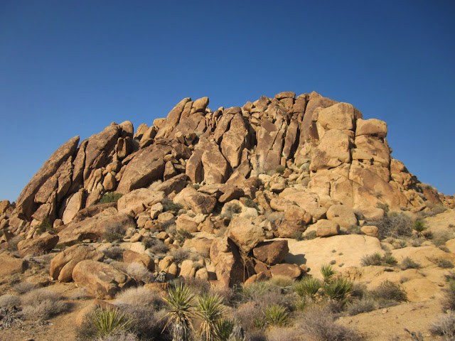
Anyhoo, our brave trio set out on North View Trail and we were not disappointed.  Although the total assent is just a few hundred feet, the ups and downs of the first two miles were enough to make us feel like we had done something. 

In between the stacked boulders we could see down into the town of Joshua Tree spread out in the valley.  Jeff and David took the side trail up to a viewpoint of Copper Mountain while I chilled out with a view of my own.  (When I turned on my phone to take a photo here, it surprised me by ringing!  It was the tech at the computer repair store in Charlotte with the sad news that my laptop could not be resurrected.)

From the high points of the bare rocks the trail descended down a wide ridge and dropped into a gulch and our not-so-favorite thing: a series of sandy washes.  Trail signs were few and far between here and following footprints were not always a good clue, as many people have taken detours as the washes split apart.  Just keep following David. 


At last the Maze Loop, which also has a loop on either side of it, so check your map!  We opted to skip the Window Loop since it goes around one big pile of rocks with a hole in it and we could spot it from the Maze Loop.  See it in the upper left?


A closer look at the Window

 The Maze was not very maze-like, rather a flat walk along the valley floor.  I had a little fun with my Liberty hat along the way.

As we walked along in the sand with the boulder mountains surrounding us, I experienced that feeling of being in a place that I will probably not see again.  I realized that I should slow down and savor the last mile back to the trailhead, the car, the road and the exit from Joshua Tree National Park.  I told David that I felt like I was rushing.  He looked at me very soberly and said, “You look more Czechoslovakian to me.”  Priceless.  Still makes me laugh when I think about it.

I did slow down, the guys passed me, and I enjoyed my last opportunity to find that perfect Joshua tree.  If you are looking for a peaceful escape from the East Coast with an other-worldly landscape and serenity everywhere you look, take a slow stroll in Joshua Tree National Park.

Civilization was just a few miles away via the California interstate system and a hotel room in Los Angeles was ready for us.  The restaurant next door had an excellent bar with massive margaritas.  How had I gone so long without one? 


Anybody who says the scenery gets old is not paying attention.”  ~ Cecil Rowe, oldest person to complete Smokies 900 (age 78)


Wednesday, June 19, 2013

Joshua Tree NP - Carey's Castle and Mastodon Peak


Joshua Tree NP- Day Four – 3/23/13 – Carey’s Castle and Mastodon Peak – 11 Miles

Yesterday’s off-trail hike didn’t interest me, but today’s off-the-map adventure sounded intriguing.  Jeff found a GPS track for this one on the internet, and we all know that everything on the internet is accurate and trustworthy, right?  But…who can resist searching for Carey’s Castle? 

As I mentioned previously, abandoned mines are spread all around Joshua Tree NP and the origins of many are lost to time. This web page summarizes that in the late 1930’s Arthur Cary staked several mining claims in the area, including one called the “Welcome Stranger” claim, and moved into a nearby shelter formed by several huge boulders leaning against each other.  There is evidence (drawings on the rock ceiling) that this cave-like space was once used by Native Americans.  Cary added rock and mortar walls, three windows and a door, and it became his Castle.  Once upon a time there was a rough road that passed near the Castle (we saw a rusted old truck bumper) but nowadays there is no road and no trail.  Crossed fingers and Jeff’s GPS are the way to go.

We drove through the Park and out the southern entrance, took a couple of back roads, and parked in some obscure spot to start our hike back inside the boundary line.  Mental bread crumbs for later:  picture a piece of paper with a horizontal line across the bottom – the road.  At the top of the paper, treeless mountains of rocks.  Squiggly lines of sand rising vertically from the road up to the mountains.  There’s your map. 

Walking in deep sand again, following many footsteps up a wide wash, seemingly flat but with a slight and steady elevation gain.  Another day for interesting cacti and flowers.

Barrel cactus and teddy bear Cholla cactus

Jeff photographing a blooming Engelmann’s hedgehog cactus

Englemann’s hedgehog cactus blooms

Perky yellow flowers in the middle of the wash

Looks impassable

But there is a way

Blooming beavertail cactus

Jeff directed us left or right as the canyons split and we began a pattern of climbing over boulders, walking up a small wash, climbing over more boulders, another wash.  We were all going so slowly that I didn’t get out of breath, but a couple of times I needed David to pull me up.  Hiking poles seem useless in boulders.  After 2.5 hours and about 4 miles of what felt like an easy walk in between the scrambling, we stumbled upon... 

Carey’s Castle

Let’s take a look inside, shall we?

Remains of rusted bed springs.  Notice the windows.

Rough shelving and old tin cans

The area around the dwelling is littered with rusty barrels

While Jeff sauntered off to bag yet another peak (3468), David and I found the faint trail to Carey’s “Welcome Stranger” mine. Peering through the grate we could see a ladder going straight down into pitch black. Interesting that it is barricaded when so many mine openings in the Park are not.  This is supposed to be a hard-to-find location, but I suspect plenty of people have checked out Carey’s Castle and mine.

Heading back the way we came – sort of

Ocotillo cactus

Ocotillo bloom close up

We retraced our steps with Jeff’s guidance back down out of the narrow canyons to the wide valley floor.  Jeff did his usual disappearing and reappearing act from time to time, taking photos and enjoying some solitude, and I kept a close eye on David.  Jumping off rocks makes me nervous and I wanted a helper if I broke a leg. 

Remember that mental map I described earlier?  The road is several miles going across the bottom of the “page”, but whereabouts along that line did we leave the car?  We have to hit the road at some point.  Do we go straight, bear left or bear right?  Straight is relative.  David seemed to be trending right, and my memory leaned left, so I stuck with my intuition and trudged on.  Just as I was beginning to tire, a glint of light got my attention and I walked right up to the car.  Jeff was a couple of minutes behind.  We drove back along the road and picked up David as he was approaching the road bed about a half mile away.

Time for one more?  Of course.  On the way back to camp we had to pass right by Cottonwood Spring Oasis, a vital water source for miners back in the day.  Records indicate that the palm trees are native.  Awesome, aren’t they? 

We hiked the easy three-mile loop that includes Mastodon Peak.  (We skipped the 3.6-mile trail further out to Lost Palms Oasis.)  The summit of Mastodon Peak is a short but steep rock scramble that my body said “no” to, so I waited at the bottom while the guys made the summit, a few minutes of introspection.  Just standing and looking out across miles and miles of desert was very calming, a few deep breaths in, burning a memory into the brain because we may never pass this way again.

How is it that we have been in California this long and have not had a Mexican meal?  Tonight we found one in 29 Palms.

“We may never pass this way again.” ~ Seals & Crofts


Friday, June 14, 2013

Joshua Tree NP - A Zero Day


Joshua Tree NP – Day Three – 3/21/13 – Zero Miles

When Jeff sent me the itinerary for the Joshua Tree trip he included a description:  hike to the summit of Quail Mountain, the high point of the Park, mostly off trail (out and back, 10.5 miles).   I immediately knew that this would be my town day.  Too many miles in the hot desert, no trail so I would have to keep the guys in my sights, and I just wasn’t feeling it.  So I dropped them off and…

Went to Coyote Corner for my hot shower.   As I walked from the parking lot, a small woman walked alongside me, didn’t say hi, sped up a little bit to get in the door ahead of me.  At the counter she paid for two showers (her and her husband who was somewhere close by), meaning I had to wait because there are only two units.  Took the hubby nearly 25 minutes to be done – Lord only knows what the wife was doing. 

Checked out the Park’s Visitor Center, watched their excellent video, learned that the rock piles in Joshua Tree are the result of slow erosion, not a big flood or rocks tumbling from great heights.  The VC was extremely crowded so I didn’t hang around. 

Returned to Crossroads Café for a little brunch.  I had a food deficit to make up for:  yogurt and granola with fresh fruit, plus French toast.  Reading my guidebook, drinking a second cup of coffee, sitting on a soft chair – yeah, roughing it makes you appreciate the “soft” parts more.  As I paid for my meal at the counter, a male customer behind me said, “I don’t normally say things like this but…”  Hhmmm, what’s coming?  He continued,” But your hair looks beautiful.”  He should have seen me an hour ago!  Haha!

Drove around a bit to uncover the town of Joshua Tree but, to my mild surprise, there really wasn’t much going on.  It was mid-week, but this is supposed to be their busy time, right?  Art gallery closed, a couple of stores closed, but a couple of vegan restaurants were open.  Is it too soon to eat again? 

By 1:00 p.m. I returned to the trailhead to meet Jeff and David and settled in to read my book, “Tortilla Curtain”, a fantastic story for the setting we were in.  They were due back at 2:00 p.m. but didn’t show up until 4:30 p.m.  They chose to return a different way, adding unforeseen mileage (yeah, that possibility is one reason why I didn’t go.)  It sounded like a rewarding but tough hike and Jeff acknowledged that I made a wise choice to opt out.  Good for him, too, so he didn’t have to drag me back.

Watched rock climbers at the parking lot while I was waiting 

Back to Coyote Corner for the guys to get hot showers, too, then dinner at the Joshua Tree Saloon.  I had to settle for a burger without mushrooms because they ran out.  What, no grocery store to run to for such a simple thing?


 Saw this gem as we were leaving the Saloon, by that time it was closed.  How did I miss this???

We cruised a few streets in town, stopped to fill up on water at the VC’s outside spigots, then back to Ryan Campground.  The sky was very clear with a two-thirds moon and the stars were very vibrant.  The usual noisy campers were nearby but earplugs can fix that.

I finished my book (wow!) and lights out.

“If you can spend a perfectly useless afternoon in a perfectly useless manner, you have learned how to live.”  ~Lin Yutang