Thursday, September 29, 2011

Test Driving an Osprey Sirrus 24 Daypack

I am in the market for a new daypack.  My current one is small and has served me well, but it only holds the essentials for an average hike day.  If the weather calls for an extra layer or two, I end up tying a micro fleece onto an outside strap.  The side pockets are not adequate for holding an extra water bottle.  Most of all, there is no hip belt, just a thin strap around my waist to keep it from falling off.  My weekend backpack is an Osprey Aura 50, made for women, and I absolutely love it, so I’m test driving an Osprey daypack designed for women, the Sirrus 24.  I’ve used it on a couple of hikes here in North Carolina and for all my dayhiking on my recent trip to Death Valley National Park in California.

Pros:
The airspeed suspension system featuring a tensioned stretch mesh back panel kept my back the coolest possible in 110-degree heat in Death Valley.   I like this feature very, very much.

The alloy frame and hip belt serve their purpose to support weight on my hips.  My old daypack simply hung from my shoulders.  

Like my Aura 50, the hip belt has dual zippered pockets for quick access to camera, keys, maps, small snacks without stopping. 

The right side harness has a zippered pocket just the right size and handy access for a cell phone (come on, you know you all carry one everywhere).  

The size is right for winter dayhiking or carrying lots of water for super-hot summer dayhiking.  Everything fits inside rather and no more snagging extra clothing on branches.  The side mesh pockets are wide and deep enough to hold large water bottles.  

A pack cover is included, so no extra cash for this essential piece of gear.  Fortunately I have not had to use it yet.

There are lots of straps to tighten down your load top to bottom

Cons:
My main criticism is with the hydration sleeve: (1) The fabric is pulled so tightly over the top edge of the alloy frame that I find it a little difficult to insert a full hydration bladder into the sewn-in hydration sleeve.    (2)  The hydration sleeve can only be accessed from inside the main compartment, not top loading from the outside.  (3) The top slash pocket is an additional obstacle.  Any gear that I have stowed in the top slash pocket has to be removed so that I can flip the mesh pocket out of the way to access the hydration sleeve.  I’d rather do without the slash pocket and be able to top load my hydration reservoir via its own zippered pocket.  

Although I use trekking poles 95% of the time, the Stow on the Go trekking pole attachment (to carry your poles but have them accessible without taking off your pack) is not something I would use.  On some of the desert hikes I chose not to carry poles at all, and with my arms hanging by my side as opposed to bent elbows with poles, the attachment rubbed against the inner part of my left upper arm quite a bit.  If wearing a sleeveless shirt, this would have been intolerable. The literature calls this an attachment but it is sewn in permanently. I see where this feature would be attractive to some, but I would like some way to detach it short of cutting it off.  

The pocket for the integrated rain cover is accessed by a zipper at the bottom of the pack and is actually quite large.  Lots more can go in this pocket than the rain cover.  However, since it is zippered at the bottom, I have to take the pack off and lay it flat to get at whatever is stowed there.  If my hiking buddy unzipped it while I’m wearing it, everything would fall out.  So I’ve put stuff in here that I hopefully don’t need often, like my first aid kit.  The pack diagram explaining the features looks different than my pack, making me wonder if mine is an anomaly, if this pocket should be small and the pocket above it (accessed from a top zipper) should be larger.   Sure would be nice if that were the case.

Bottom line:  I’m keeping my new Osprey Sirrus 24 pack.  I can adjust to the cons as matters of convenience.  Most important to me is this pack is extremely comfortable to wear all day long and can hold more of what I need to carry.    Maybe I’ll repurpose the top slash pocket for chocolate storage.  That way at the end of the day it will always be empty.


I purchased this pack through www.appoutdoors.com.  

Sunday, September 25, 2011

The Spiders Are Winning

SB6K Hike – 9/1/11 – Waterrock Knob/Lyn Lowry/Plott Balsam Mountains – 8.3 Miles

Jeff has hiked to the top of all of the SB6K’s, but for some reason (boredom? nice guy syndrome?) he offered to help me with a hike that I wouldn’t try solo, and of course I said yes.   As a review, the SB6K Challenge is summiting a list of 40 mountains in the Southern Appalachians that are over 6,000 feet high.  Today on our out-and-back trek we tried to tag Waterrock Knob, Lyn Lowry, Plott Balsam and Yellow Face Mountains, scored three out of four.  

I left my cozy campsite in the Smokies and met Jeff at the Waterrock Knob Visitor Center parking lot on the Blue Ridge Parkway.  Our hike began about 10:30 a.m. on this hot and hazy day.  


The half-mile trail to Waterrock Knob’s summit is paved for a short distance and then a well-worn trough, a popular stop for BRP motorists stretching their legs.  I climbed Waterrock Knob in 2009 when my husband Jim biked the BRP, but it doesn’t count as a SB6K summit unless it’s part of a five-mile hike.  Challenges are challenges, rules are rules, and hikers are honest.

We spent just a few minutes at Waterrock Knob where the maintained trail ends and then we stepped off into manway territory.  This is where my life fell into Jeff’s hands because I’m leery of navigating unmaintained trails.  This one was tagged with orange and/or pink plastic tape at frequent intervals and I paid close attention because the trail was faint, especially in the dense vegetation of late summer.  Trail tagging is technically a no-no but I’ll never complain.


Jeff found himself an efficient spiderweb catcher (also called a big branch.)  He was so specific about the requirements for a good one that I made a video of his explanation and put it on YouTube - kind of a public service announcement.   I’ve learned to accept spiderwebs in the face, but this hike turned out to have the most spiderwebs I’ve ever encountered so I was glad Jeff was willing to carry his weapon in front of me…I mean him.


Browning Knob was the next bump in the chain of mountains on our route, named for R. Getty Browning, a North Carolina engineer who convinced the powers-that-be to extend the southern end of the Blue Ridge Parkway through NC, not TN (thanks, R.G.).  Browning Knob is also higher than 6,000 feet but isn’t part of the SB6K challenge (those rules again).  Anyway, been there, tagged that.


The trail was extremely overgrown, crisscrossed with blackberry briers as tall as me, and we often couldn’t see the ground, just going by feel.  Jeff expended some effort breaking back branches to make the return trip back easier.  Me, I just slogged through.  Three summits, three steep ups and downs (four if you count Browning Knob, which I guess I do), and fighting through the overgrowth much of the way – we call that a party.

One of nature’s puzzles:  when this tree blew over did the roots make the rock move?

We walked through a grassy open area, passing close by someone’s home, a reminder that many of the SB6K’s are on private property and we hikers must behave so as not to spoil the fun for others. 


Hmmm - a viewing platform with a no trespassing sign and a box to hold information fliers

The second SB6K summit was Mount Lyn Lowry, named for a woman who died of leukemia.  In her memory, her family installed an enormous lighted cross on the summit.  (I read that the Reverend Billy Graham “presided over the dedication ceremony” in 1962.)  I thought I knew what a big cross looked like but I certainly didn’t expect this.  

A good place for a lunch break – I was past hungry by now.  Jeff’s idea of peanut butter and crackers is different than mine.

The descent from Lyn Lowry was steep but I didn’t take much notice – it would be a shock on the return trip.  Next up, the trail morphed into an old road bed with several intersections, no markings, but Jeff knew the combination of right, left, left.  (See why I hike with him?)  Along the road were muddy spots with animal prints, including this bear paw.


Our last summit, Plott Balsam Mountain, had a denser canopy and thus less dense undergrowth, but the manway was barely discernible.  There were still orange tags to follow but they weren’t consistent.  The simple rule to reach the summit is to just keep going up until Jeff’s GPS says we’re there. 

And here I am at the nondescript summit, no view, just a small rock to stand on.  Yay for me!

On the descent of Plott Balsam we played the “let’s see if Sharon can find her way back” game and I struggled a little looking for the faint trail and scattered orange tags.  Jeff had to remind me that “descend” means “walk down.”  Good practice for me.

As I said, that climb back up Lyn Lowry was very tough, no switchbacks, and the same going back up and over Browning Knob.  And the industrious spiders and their offspring hatched since the morning were busily reconstructing their webs that we had destroyed on the first pass.  I thought we’d never get back.  The last couple of miles of the return were just pushing through briers, arms and legs scratched and bleeding.  I like to call it combat hiking.  Not only are you walking on uneven ground, you’re crouching to push through weeds or duckwalking under fallen trees or crawling up over rocks.  What – you don’t think this is fun??

The Lyn Lowry cross from a distance

All total, 8.3 miles, nearly 3,000 feet ascent, 6.5 hours – we decided not to try summiting Yellow Face Mountain (on the opposite side of the Parkway from Waterrock Knob) today.  Much more important was finding supper before my long drive home.  You know you’ve had a tough hike when you have to wash the blood off your arms and legs before ordering a meal in a restaurant.  I recommend Maggie Valley Restaurant (great grilled mountain trout and blackberry cobbler.)

I see my path, but I don't know where it leads. Not knowing where I'm going is what inspires me to travel it.” ~Rosalia de Castro


Friday, September 23, 2011

To Everything There Is A Season

8/31/11 - Clingmans Dome Bypass Trail/AT – 1.5 miles 

Sshhhh…Smoky Scout has snuck away for an overnight in the Smokies. 

My friend Jeff offered to hike with me to some hard-to-reach SB6K peaks, and it’s such a long drive that it only made sense to make it a two-day trip.  Where else but my beloved Great Smoky Mountains?  It was a perfect time to check out the new visitor centers and try out a new daypack.  Packing up was simple and the drive felt like going home.

The new Oconaluftee Visitor Center is outstanding with a mini-museum of interactive and kid-friendly displays about history and wildlife. 

Next stop:  the new Clingman's Dome Visitor Center, formerly known as the bathrooms (pit toilets have been added).  

I was more than a little excited to be back on a Smokies trail, even if it was the Bypass Trail.  I had a new Osprey daypack to test drive, too. 

Forney Ridge Trail:  recent work by Trails Forever

Hiking seemed like no effort:  Was it the new pack?  My increased strength?  The bone dry trail conditions?  Or was it this magic butterfly that flew alongside me for far longer than I expected, to the point that I began talking to it as I walked?


At the top of the Bypass Trail I turned right and followed the AT back to the paved Clingman’s Dome trail.  At about 6:00 p.m. on a weekday, not much of a crowd.  At the top I met a young couple from Michigan with a very nice dog (on a leash).  They were staying in Cades Cove and were very excited about the Smokies.  I mentioned that they might want to check about where dogs can go in the park; they said they were aware of the dog rules and had cleared it with the staff person in the VC. 

A hazy late afternoon at Clingman’s

On the drive back down to camp I stopped at an overlook that I have always bypassed.  In one corner of the parking area I spied one of those “Quiet Walkway” signs that I also usually ignore, so I decided to take a stroll.  Apparently “Quiet Walkway” means “leave toilet paper here”.

I set up my little tent near the ranger station at Smokemont.  The campground was mostly empty, perhaps 20 sites out of 142 sites occupied.  The site next to mine was occupied by a loaded backpack and a hammock, no car, no other setup.  As I staked out my tent, the occupant of the hammock gingerly stepped down and limped to the bathroom.  On his way back he said hello, which I took as an invitation to ask what the heck happened to him.  Turns out he was hiking the Benton MacKaye Trail with some friends and his knee gave out, so he was waiting for his wife to pick him up while his friends hiked on.  Sometimes stuff happens.

In the excitement of packing to leave home I forgot to eat lunch and the only food I had with me was trail food, so I drove into Cherokee hoping for a decent supper.  Cruising through town, I noticed that improvements had been made in many businesses and the place had a vibrant feeling.  At Paul’s Restaurant I enjoyed a fantastic Indian taco (Indian fry bread with chili, cheese, tomatoes, onions) and the owner said that the town has spiffed up, replaced the elementary school, and things were going well.  Oh, and I got an enormous slice of homemade coconut cake to go for breakfast (...but I ate it before I went to sleep.)

Back at Smokemont, there was still some daylight so I walked around the loops and inspected the sites I have reserved to bring back the Wild Women for more adventures in October.  Sites look different in real life than they do on the websites – I decided to change them when I got back home.

I popped open my little camp chair, strapped on my head lamp and chilled in my campsite kingdom.  The night air cooled down, the crickets tuned up and I could hear the calm, peaceful Oconaluftee River nearby.  I read my daily devotion, which was Ecclesiastes 3:1-15, a time for everything, very appropriate.  As the light faded I could see the outline of the mountains, never-changing and ever-changing, majestic, mysterious, comforting, a sanctuary.  


Climb the mountains and get their good tidings. Nature’s peace will flow into you as sunshine flows into trees. The winds will blow their own freshness into you, and the storms their energy, while cares drop off like autumn leaves. ~John Muir


Thursday, September 22, 2011

Mountains-To-Sea Trail Finale

MST – Day 70 – 8-18-11 – FINALE – Cable Lands Access Eno River State Park to West Point of the Eno City Park – 8Miles


Funny how things that are a big focus of your life for a long time seem to end so suddenly:  romances, beach vacations, high school, college, the Harry Potter series.  You dream about them, you talk about them with everyone who will listen, you plan for them, you live them - and then they're over. 

The Mountains-to-Sea Trail certainly did not turn out the way I envisioned when Danny Bernstein proposed our adventure two years ago.  Starting at the westernmost point, hiking in consecutive sections towards the coast, sunny days, step by step…well, we did manage to hold to the hiking west to east part.  Very soon after starting we abandoned the idea of hiking consecutive miles.  Mother Nature in the form of a bad winter interfered and we didn’t want to wait, so we just planned around her.  And although we walked all the trail miles together, Danny and I did not complete the trail at the same time as I imagined at the outset.  She walked her last mile in May and I walked mine in August.  Really, I feel like I “finished” the MST three times.  The first time was when Danny and I walked to the top of Jockey’s Ridge, the eastern terminus of the trail at the Outer Banks, a very significant moment as our journey together ended.  The second time was completing the biking miles with Jim.  And the third was eight miles walking along the Eno River, a return to walking in the woods.

Joe Miller, whom I met in the backcountry of theSmokies nearly two years ago, is an outdoor writer based near Raleigh.  Joe kindly agreed to hike the last section with me, and I could not have dreamed of a better partner, as he is thoroughly familiar with the miles along the Eno, including some not yet on my radar.

I met Joe and his friend Robert at West Point on the Eno Park in Durham, where we left two cars, and Joe drove to the newest 3.3-mile section between the Cabe Lands and Pump Station accesses (see Joe’s description here.)  The guys were in training for an Ultimate Hike event and said they were comfortable with a 3-mph pace.  Hmmm…I’m not sure I can keep that up, but here goes.  Soon we were rocking and rolling up short but surprisingly steep climbs and I wondered aloud who had ordered the importation of small mountains to Durham.  The conversation was as fast-paced as the walking (happens often when hikers get together with stories to swap) and the miles melted away.  Very soon we reached Cole Mill Road and swung onto the MST section I had expected to hike. 

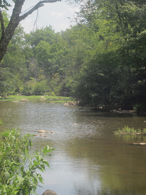
Lots to see on the MST as it follows meandering Eno River, including reminders of human impact

Joe on footbridge

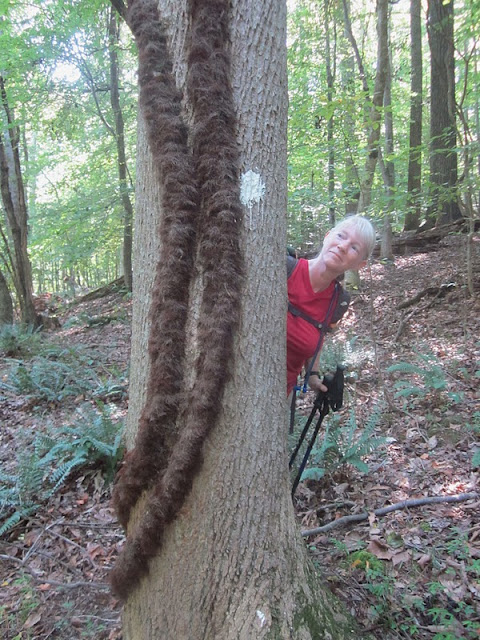
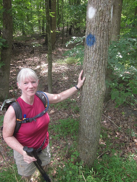
Another MST blaze with some ferocious poison ivy vines

A wall of rock – part of an old dam?

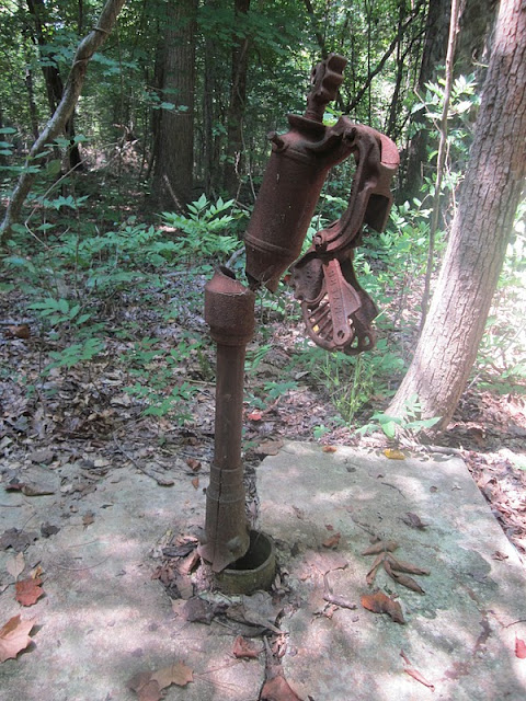
A pump on Pump Station Trail

A slow backpacker

Mill wheel

We crossed Guess Road and ducked back into the woods as part of West Point of the Eno Park.  The trail split in several directions without a clear direction, and Joe’s intuition said to go right.  Robert and I said left and were promptly proven wrong when we passed a guy’s driveway and walked out onto a road.  Rather than backtrack, we cut cross-country and soon reconnected with our trail.  (Joe never said I-told-you-so.)

The Eno River broadens into several wonderful swimming holes and on this weekday a fellow and his dog were playing hooky, splashing and kicking across a tiny pond.  I paused to stick a hand in, thought about taking off my shoes, but we moved on.  

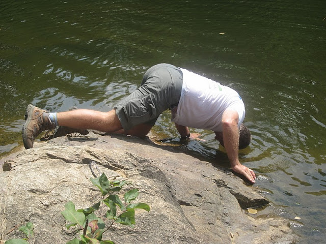
Joe cools off

The eight miles went as quickly as any I’ve ever experienced, just a couple of quick pauses at intersections and no food breaks (but a 3-mph pace, thank you very much)…and then we were looking at the last MST white circle.  How many have I passed?  I’ve photographed quite a few.


And I have now completed the Mountains-to-Sea Trail, nearly 1,000 miles across North Carolina, #25 in a list of distinguished outdoor lovers.  What a magnificent, challenging, unique adventure!  Thank you to Danny and my husband, Jim, and to all the friends and FMST folks and trail builders and maintainers who made it possible.  

Read Joe's story of my last hike here.  

“Begin at the beginning and go on till you come to the end: then stop.” ~ Lewis Carroll, Alice in Wonderland

“Another turning point, 
a fork stuck in the road
Time grabs you by the wrist, 
directs you where to go…
It’s something unpredictable, 
but then again is right
I hope you had the time of your life.”  
~Green Day


Wednesday, September 7, 2011

Bike Finale

MST – 8-14-11 – Day 69 – Strickland Road to US-13, Shine, NC – 43 Miles

Our hotel was packed with families in town for a big soccer tournament.  We all gathered at the breakfast bar and peered out the windows at the pouring rain.  Thank goodness for weather.com radar –  it showed the storm moving through and a window of a few hours, then rain again possibly passing north of our bike route.  This was my last day of biking on the Mountains-to-Sea Trail and nothing short of thunder and lightning would deter me.  Sure would be nice to not get drenched, though.

Jim and I got a move on, drove to the beginning point and he dropped me off.  Since today’s route was 43 miles I didn’t want to be solo the entire way, so rather than just drive slightly ahead, the plan called for Jim to drive to the halfway point and backtrack on his bike to meet me.  Together we would ride to the car and then he would drive to the end, repeat. 

So…I got chased by a posse within the first half-mile, two dogs who also alerted the one next door – a very disconcerting way to start the day.  I do believe I could become a road cycling enthusiast if not for the dog issue.  How can they bother me so much when I’ve hiked in the woods with bears?  Well, because bears are not aggressive unless extremely provoked.  The speed of the bike seems to trigger a dog’s instinct to chase – to bite also?  Animals do what animals do and I am just not fast enough to outrun them.  So with that early burst of speed juice in my veins I was on my way, but now I didn’t trust any house possibly harboring a crazy canine.  

Part of the charm of riding on the back roads is local country stores.  Early on this Sunday morning I stopped at Hornes Church Road Convenience Mart where some good old boys were gathered for a “pre-church” conference.  The owner apparently didn’t have a no-smoking rule.  I asked them if I was late for the meeting but they didn’t seem to get the joke – maybe they were thrown off by the bike shorts and helmet.  

Beautiful stretches of morning glories in purples and pinks

What did we do before cell phones?  Jim called to say he had gotten turned around and was worried about missing me while straightening out his detour.  Even the car’s GPS plus written directions plus Map My Ride are not enough to stay updated with current conditions “on the ground”.  In this case, Highway 795 had interrupted a road.

We met up before the detour that Jim had figured out.  “Road Closed” signs for cars mean nothing to cyclists.  We watched as work vehicles passed and then crossed the RR tracks and kept on going.  


The halfway point in the town of Black Creek was sleepy on Sunday morning.  I stayed for a little break while Jim drove on to the end point to repeat step 1.  Black Creek boasts a lovely little town park with a community hall, playground, gazebo and (most important) unlocked bathrooms. 

Black Creek police station

Small town pride – the local museum

No more dog chases today and I had a very pleasant ride.  I saw different types of tobacco, burley and Bright leaf.  There were also some lovely homes out here in the country, white picket fences, huge flowerbeds in the front yards.  Most importantly, no rain appeared, just cloudy and overcast, actually great conditions although still muggy and warm.  During the last hour the sun came out and the temperature rose and I got sunburned.

Tobacco harvest – the bottom leaves from each plant in the field are pulled at one time, then the harvesters go through again and pull the next bottom set. 

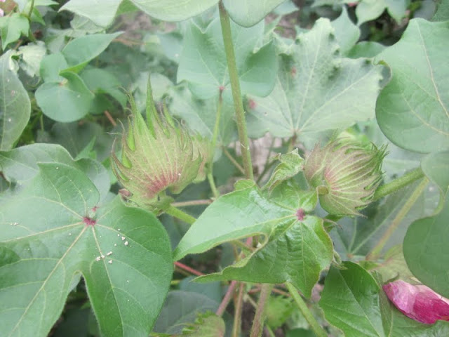
Cotton bolls

Cemetery and red barn – right after I snapped the photo here I saw a large male deer go into the woods

Once Jim caught up to me again, though, I began complaining (when I’m alone there is no one to hear me) as I was becoming tired and the heat was increasing – poor guy, don’t you know he’s glad this is the last day?   Although I knew I would make it, I appreciated having him as my coach counting down the last miles. 

What a great feeling!  My longest day (43 miles) and my last on the bike for the MST.  Just one short hike to go.

“Life is a road and I want to keep going…in the end I want to be standing at the beginning with you.”  ~Donna Lewis, At The Beginning

Adrenaline Boost


MST – Day 68 – 8-13-11 – Albritton Crossroads to Hills Grove Holiness Church – 14 Miles

All right, boys and girls, it’s time to finish up the road biking of the Mountains-to-Sea Trail.  Jim agreed to give up one last weekend to the cause.  On Saturday afternoon we drove a million miles across North Carolina once again, this time trying a different tact for fuel efficiency.  I was a little more confident of my biking abilities, so we elected to take just one car, Jim could drop me off and drive ahead and I’d bike alone a bit. 

The weather forecast was unfavorable, thunderstorms, rain and intermittent rain showers.  But if I didn’t do this now, my next chance would be months away.  I was prepared to get wet.   And we drove through a lot of rain, but for this brief ride the clouds parted and streaks of blue peeked out.

First I needed to complete the route that John J. and I had to cut short due to my flat tire.  Today Jimmy D’s Restaurant was closed so I wasn’t able to thank Jimmy again for his help on that hot day.  Now I had a repaired tire and only 14 miles to bike.  Jim agreed to drive ahead of me to each turn so I wouldn’t have to worry about directions.


All fine and dandy except for one thing:  dogs, bike chasing dogs, crazy barking bike chasing dogs.

Jim has outrun many a mutt in his cycling career and together we’ve out-maneuvered a few, mostly with me pedaling frantically and Jim putting himself between the animals and me until they give up after a brief race.  But today, when Jim was out of sight, a large dirty white mongrel from Hell with black gums, pink tongue, yellow teeth and bloodshot eyes shot out of “his” yard on the left side of the road and began the chase.  He was very persistent and there was no way I could outrun him.  He sprinted alongside me on his side of the road, yelping and foaming, and whenever he began to cross over I would yell.  He’d go back to his side but continue at my pace (which by this time was lightning speed – adrenaline is an amazing thing.)  Cerberus chased me well beyond his property lines and I’m not sure what made him give up, but I lost a couple of years off my life from the encounter.

And there was Jim, calmly waiting at the next turn.  But what could else I do?  I couldn’t have him follow behind me in the car, trying to hit every dog that came running…could I?

Lovely country house – reminds me of my mother’s birthplace down the road from where I grew up

Bike route signs are prominent and helpful.  Much of the MST on the roads follows bike routes.

Aside from the chase scene, I enjoyed the ride today.  On a deserted stretch of road a massive flock of birds came up from behind me on my right side, flew overhead and spread out, sweeping left  - a quiet, peaceful moment. 

I finished the route in about 1-1/2 hours and we headed back to Goldsboro to fuel ourselves with BBQ for tomorrow’s biking finale.

A bicycle does get you there and more...And there is always the thin edge of danger to keep you alert and comfortably apprehensive.  Dogs become dogs again and snap at your raincoat; potholes become personal.  And getting there is all the fun.  ~ Bill Emerson.


Tuesday, September 6, 2011

Croagh Patrick - Ireland

Croagh Patrick – County Mayo, Ireland – 5 miles

In celebration of our 30th wedding anniversary, Jim and I went on a 10-day trip to Ireland in July-August 2011.  Jim has visited before but this was a first-time opportunity for me.  Marathon planning sessions attempted to balance what Jim had experienced (and wanted to repeat) and what would be new to both of us.  Not only were sightseeing and Guiness-drinking on the menu, but also our outdoor interests of hiking and biking.  A plan was formulated and off we went.  I won’t overwhelm you all with the details of logistics, driving on the “wrong” side of the road, farm animals and farm machinery, lodgings and full Irish breakfasts.  Let’s talk about hiking up Croagh Patrick.

Croagh Patrick is a mountain (known locally as the “Reek”) rising 2,500 feet from the shores of County Mayo on the west coast of Ireland.  It is bare of trees and the upper portion of the slope to the summit is loose rock scree.  In the fifth century purportedly Saint Patrick fasted for 40 days at the summit (and then banned all the snakes from Ireland for good measure).  On the last Sunday of each July there is a pilgrimage to Croagh Patrick, tens of thousands of participants from around the world.  Part of that tradition is climbing the mountain barefoot.  Our journey was on Friday, July 29, two days before the 2011 event. 

First glimpse of Croagh Patrick

After a lengthy, circuitous drive to the base of Croagh Patrick (i.e. our GPS got us lost) we got a late start.  I had my trusty hiking poles and Jim “rented” a walking stick in the parking lot (6 euro, 3 returned if the stick is returned).  The weather was outstanding, light clouds but plenty of sunshine, and we were not the last people going up.  It’s 2.5 miles and 2,500 feet to the summit, a moderately serious climb, I thought to myself.  I underestimated a bit. 

Statue of Saint Patrick

The path is impossible to miss, as wide as a two-lane road at the lower portion, with plenty of boulders to step around and over, ascending beside a small stream.  Erosion is extensive and new, narrower paths are being worn past the outer edges of the main track.  No trees, plenty of grass on the mountainside, and we spotted the requisite sheep and goats in the distance.  People of every description, very young children running ahead, grandmotherly types holding onto crooked elbows of hiking companions, one man carrying a brown paper bag by its handle (what is in that?) and young couples holding hands joined the flow up the mountainside.  This first mile-and-a-half of the route goes over a smaller mountain, somewhat like a low shoulder of Croagh Patrick itself.  It grew surprisingly steep and conversation began to dwindle as hikers began to conserve (suck) wind for the climb.  The sun was warm and my low back began to tingle (could that be from my fall in the Black Mountains two weeks ago?)

Always remember to look back over your shoulder  - Clew Bay

This section of the trail topped out over- looking the next valley and this tarn, around which people apparently could not resist leaving evidence of their passage.  My hiking buddy Jeff would definitely dislike this (he disapproves of rock cairns or anything suggesting human presence). 

Jim on the ridge

For a half-mile the path moved gently enough along the ridge as the final ascent up the back side of Croagh Patrick came into view. 

What I saw was this precariously steep, rock-strewn slope unbroken by vegetation of any kind, with a worn track along one edge.  Loose rocks larger than my foot covered the mountainside.  One website I read later described the angle as 55 degrees and I believe it.  How do you keep from sliding off the mountain?  Prayer.  My nerves were rattled enough going up – coming down was going to be insane.  I’ll admit, I briefly considered turning around.

Jim on the crazy slope 

The only barefoot person I saw today

One foot in front of the other, jockeying for position as people passed going down, I climbed up to the top.  I have done some tough hikes in my life and I’ve learned to go very, very slowly on steep paths.  Fellow hikers were very social, exchanging words of encouragement and/or words of commiseration at the shared experience. 


Nearly two hours after starting, Jim and I stood on the top of Croagh Patrick.

At the summit is a small chapel built in 1905.  I can only imagine what it must be like to attend worship here on Reek Sunday, certainly very moving after so much physical exertion. 

Jim and I hung out for awhile, getting our photo taken and helping others get theirs.  We met one large family gathered to celebrate a wedding the next morning. 

At last it was time to risk life and limb going down the mountain.  This is where hiking sticks were essential, to stop yourself from sliding too far.  A huge surprise:  I found that my footing on the worn path with the tiny loose gravel was extremely slippery and walking on the big rocks was easier (the big rocks only slipped a little bit).  I “rock-surfed” most of the way down the crazy steep section. 

Past the level section, I started down the final descent a little too cocky.  Probably my legs had gotten tired and I was not as cautious as I should have been.  Anyway, on the last section down I fell solidly three times.  The last time I’m afraid the curse words in my head found their way out of my mouth because I got a few chuckles from those around me.  My sore lower back hurt with every step.  It took nearly the same amount of time to come down as it did to ascend this awesome mountain.  I was exhausted and ecstatic.

So if you’re ever in Ireland, be sure to visit Croagh Patrick.  It may not be the highest mountain you ever climb, but it is a unique experience that will only get better with the telling.

A fantastic video of hiking up Croagh Patrick is here.  You simply must see it!

“Here I am, safely returned over those peaks from a journey far more beautiful and strange than anything I had hoped for or imagined - how is it that this safe return brings such regret?”  ~Peter Matthiessen