Maine 2021: Acadia National Park – Ocean Path/Bowl Trail/Beehive Trail/
Gorham Mountain Trail/Cadillac Cliffs Trail/Otter Cove Trail
7/12/21 – 5.6 Miles
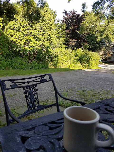
Daylight in our little basement grotto woke us at 5:00 a.m. It was a luxury to drift in and out for an hour before getting started on the day. First things first: an al fresco cup of coffee to remind us we’re on vacation.
What, you thought we were done with MDI after only one hike? Nope. I found a popular hike route that hits some highlights [kinda like those once-in-a-lifetime Smokies visitors] and we happily joined the human flow on a scenic, varied, heart-stopping trek.
[Note: we didn’t follow this exact plan but it was a good base. We followed recommendations from our Airbnb host to alter/add to it.]
From the Fabbri Picnic Area, we followed a path alongside Park Loop Road to Otter Point, where Otter Cove opens to the Atlantic Ocean. The overcast skies lent a feeling of seriousness to the landscape like, hey, y’all, this might look like fun under a blue sky, but the rocks mean business so watch your step!

 The dark peninsula in the middle horizon is Great Head; the faint stretch of land on
the far horizon is Schoodic Head, where we’ll be exploring tomorrow.
As we drew closer to Thunder Hole, the throngs, masses, droves of people appeared in every shape and size and age, many of them children. We passed on by with just a cursory look because of the line of people queuing to peer down into the narrow inlet carved into the rocks. Steps and railings serve the purpose of protecting people from themselves, (i.e. slipping into the chasm and drowning as waves crash and “thunder” in the narrow space), but seeing the infrastructure made me lose interest.
[Hypocritical of me, I admit, because I was right there in line to climb stairs to see Niagara Falls and Yellowstone Falls back in the day, and about an hour from now I would be hanging onto infrastructure for dear life as we climbed the Beehive with lots of company.]
The Ocean Path took us through a large parking area (restrooms!) and down a set of wooden stairs to Sand Beach. The setting brought to mind the coast of Wales with sandy stretches between rocky cliffs rising on either end. We were not tempted to wade in the water, but kids were romping in the surf as kids do, living in the moment rather than worrying about the temperature.
[Here is another description of the Ocean Path in reverse, from Sand Beach to Otter Point.]
Here comes the heart-stopping part [Note: if you don’t like iron rung ladders and handrails, don’t do this hike – read a great description here.] At .3 miles, we turned right onto the Beehive Trail and the strength and endurance challenge commenced. Jim and I scrambled our way through an obstacle course like this one on the Tour du Mont Blanc in 2016, but I was now five years older and a teensy bit less confident with heights and balance.
Hiking poles were useless so we strapped them to our daypacks.
Although the climb was very steep, we really didn’t get out of breath making our way up the rocks. In fact, much of the challenge was waiting in vulnerable, precarious spaces as the ant-people ahead of us crept upward handhold by handhold. I was in no hurry to pass any of my ant-friends.
[Note: While patience is required to follow fellow hikers going up the Beehive, going down the Beehive against this flow would be even slower and no fun AT ALL.]
Up close to the rocks (I mean 6 inches from my face) it took all my concentration not to think about the narrowness of the ledge I was standing on.
The real summit of the Beehive is further along on a broad rock facing towards Frenchman’s Bay (there are no easily distinguished pointy summits in Acadia NP). Several large groups of people were spread out there so Jim and I kept moving.
We continued on the Beehive Trail as it parallels the Bowl Trail up to its namesake lake. There are a few connector trails between the two (be careful or you’ll get off track) so we decided to skip the lake and head to Gorham Mountain. We descended about half a mile further down the Bowl Trail back towards the Loop Road, then turned right onto Gorham Mountain Trail and climbed half a mile right back up.
Many trail guides follow Gorham Mountain Trail along the ridge all the way down to the Loop Road, but we took our host’s advice to take Cadillac Cliffs Trail as it drops steeply below the ridge and rejoins Gorham Mountain Trail after .3 miles. If you haven’t had enough rock scrambling fun yet, this is your trail.
We rejoined Gorham Mountain Trail, then turned right onto Otter Cove Trail to make our way back to the parking area at Fabbri Picnic Area.
Whew! This hike affirmed what we learned yesterday, that Acadia National Park is small but mighty, challenging and unique.
It’s only noon. What’s the plan for the rest of the day? Jim rented a bike to cruise the Park Loop Road while I rode the shuttle bus from Acadia Visitor Center into Bar Harbor and played tourist.
With Mount Desert Island in the rearview mirror, we moved on to our next Airbnb on Jones Cove near the Schoodic Peninsula area of Acadia National Park. A cute guest cottage on a private estate, an engaging host sharing a wealth of information about her part of the world, a walk on the private path down to the cove at sunset – what will tomorrow bring?
“Enjoy the beauty of a sunset,
nature’s farewell kiss for the night.”
~Sharon Rene


No comments:
Post a Comment