Pisgah 400 - Vineyard Gap Trail/Riverside Trail/Bradley Creek
Trail – 6/15/19 – 9.2 Miles
Okay, I’m ready for another try at GAIA. I’ve uploaded the
NatGeo map for Pisgah Ranger District. I’m headed to the Turkeypen trailhead.
I’m planning a loop of 9 miles, but it’s not deep in the backcountry. Jim has
my hike plan and a copy of the map. I’m goin’ in.
I’ll tell you up front that my hike was successful! I
followed my planned route and didn’t get lost – though I may have been confused
once or twice. The GPS boosted my confidence 1000% and I had a grand time. My
counterclockwise loop route included a little out-and-back side trip to connect
some dots. [I guess this was actually a lollipop hike starting at the top of
the lollipop.] Here’s how the day played out.
Great day for a horseback ride. I wonder how many of
these I’ll meet today.
Starting from Turkeypen Gap, I took the 2.3-mile Vineyard
Gap Trail, a quick climb up and then a meander along Forge Mountain.
Pipsissewa: One of my top 100 favorite wildflowers
because of the delicacy of the tiny flowers and the name is funny to say three
times fast (did you do it?)
The last half-mile of Vineyard Gap plunges with no
apology straight down to South Mills River. The track is muddy and horse trough deep.
At the water’s edge I confirmed that we had indeed had a lot
of rain lately. This was potentially the
biggest crossing of the day, so I took the time to remove socks and shoes (my
Salomons today, no boots) and waded through in bare feet. The water was above my knees and incredibly
refreshing. No, really!
On the far side, shoes and socks back on, and I realized I
was in a spread-out campsite with little trails running everywhere. After a bit of back-and-forth, I decided I’d
found the Riverside Trail near the point where Bradley Creek flows into South
Mills River. I turned right for a “quick” 3-mile out-and-back to its junction
with Bradley Creek Trail. Through fern
fields and grassy wildflower meadows, with hardly any trail blazes to distract
me, I followed upstream alongside Bradley Creek at a quick pace…until I hit another
wet crossing.
Rhododendron
Robin’s plantain
Yarrow
I realized that all my care at that first crossing was for
naught – I should keep my shoes on and barrel through, faster and ultimately
safer than bare feet. Now I didn’t have to worry about wet shoes because I had ‘em.
Embracing the
flow
There were two more wet crossings of Bradley Creek on the
way to the junction – and that meant repeating the THREE crossings on the
return. So far I’m up to SEVEN crossings,
all of them mid-calf or above the knees, but who’s counting? (ME.) The horses and
riders I met along this trail were having a great time, by the way.
Okay, backtrack on Riverside Trail and now I’m cruising alongside South Mills River. The trail is pretty flat, my GPS is awesome, and who cares
if the track is not exactly following the dotted lines? Fortunately the water
felt quite refreshing, because I crossed the river SIX more times. Two of them
were pretty darn wide and crotch-deep. By now I’d figured out that I was taking
the criss-crossing horse route rather than the new-ish footpath that stuck to
the right riverbank, but I was happy to keep splashing.
My first
time seeing this plant: little brown jug or wild ginger – or are they the same?
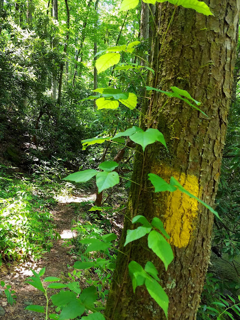
Poison ivy and a yellow blaze
At the intersection of Bradley Creek Trail and South Mills
River Trail, I was in familiar territory and strolled back to Turkeypen Gap. I was
really pleased to hone my GPS skills and I relished the water challenges on a
hot day. No slip-ups! No snakes! Success
all the way round!
"You cannot step into the same river twice." ~Heraclitus


No comments:
Post a Comment