
Appalachian Trail Project in VA – Grayson Highlands Backpack
– 3-31-14 – Old Orchard Shelter to Deep Gap South of Mount Rogers Plus Mount
Rogers Summit – 16 Miles

Up at sunrise, I ate a Clif bar breakfast and got going on
my 16-mile day, leaving Mike at camp. He
likes a more leisurely morning routine and would be taking a shorter route via the
Pine Mountain Trail, so no hurry. We
planned to reconvene, perhaps at Thomas Knob Shelter for an afternoon break, but
definitely at our camping spot a couple of miles past it near Deep Gap where
Mike had camped on an earlier trip. My
plan was to follow the AT through the Scales, up and over Wilburn Ridge, past
Thomas Knob and then,for bonus points, take
the side trail out-and-back to summit Mount Rogers, the high point of Virginia,
before ending at Deep Gap. (Picture the letter “U”. My route
was the letter part and Mike’s was a dotted line across the top.)
A bit of background:
All three days of this adventure the AT wandered in and out of the George
Washington Jefferson National Forest and particularly the Mount Rogers National
Recreation Area, which includes more than 20,000 acres of southwest Virginia
high country. The NRA is further broken
down into designations of Lewis Fork Wilderness, the Little Wilson Creek
Wilderness and the Crest Zone. The Crest Zone encompasses the open areas on
the ridges such as Wilburn Ridge, Pine Mountain, Stone Mountain, and more. (Will there be a test at the end of this blog
post?)
One thing (among many) that I really appreciate about Mike is
his attention to Plan B. We would be
separated all day and accidents can happen.
We discussed what each would do if the other didn’t show up by a
prescribed time at a prescribed place. We
knew each other’s routes. For example,
if we missed each other at Thomas Knob Shelter, we would hike on to Deep
Gap. If the other person didn’t show up
at Deep Gap that night, the first one would wait until noon the next day before
backtracking to look. (One, i.e. me,
might get too tired and decide to stop at Thomas Knob Shelter for the night.) We each had a set of keys to both vehicles
set up for the shuttle in the event something happened that either of us needed
to bail out and get to a car (hike out, hitch a ride, whatever). We would leave notes at a shelter or any
obvious place if we needed to bail out.
And of course, there were hikers everywhere so it might be feasible
to leave word with a person too.

My first order of business was climbing Pine Mountain, 1,000
feet elevation gain in 1.7 miles, a much needed warm-up on a cold morning. Uphill and plenty of snow made me slow down
and look closely at this snow-covered, lichen-covered dead tree.
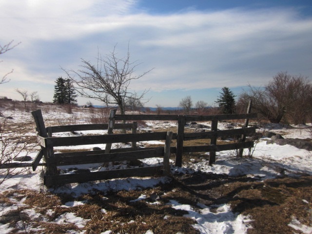
Fence stile at the top of Pine Mountain. These are the type places that require some
thought and real map consulting (not just the elevation guide), because the AT
turned sharply left and followed the fence before dipping back into the trees,
but footprints continued straight across the meadow. (This was the Pine Mountain Trail that Mike
would take across the high country.)

A mile further the Trail goes through the Scales livestock
corral, once upon a time used to weigh cattle that grazed in the high meadows
before they were taken to market. (The tiny building is a composting toilet, hurray!) Several
horse trails intersect there, including the Scales Trail, the First Peak Trail
and the Virginia Highlands HorseTrail, and cattle are still grazed in the area
to help keep the Crest Zone open areas bald.
The other bald mowers are a herd of wild ponies that are very
friendly, as they associate humans with food.
They eagerly greet hikers and can be petted, but be aware that they may
lick you because you’re salty. And
PLEASE don’t feed them.

A second herd of wild ponies lives in Grayson Highlands State
Park, which I also passed through on today’s hike.

Ponies at the Scales

A pony has noticed me

Walking along Stone Mountain

Looking at Wilburn Ridge – Mike is on the other side

Icy Big Wilson Creek

Crossing the boundary into Grayson Highlands State Park,
there are signs that no tent camping is allowed at Wise Shelter. Backpackers can go back onto NRA land at Big
Wilson Creek to camp or figure out how to get to the campground inside the
park. Many of the thru-hikers I met
during the day were heading for this shelter to spend the night. I paused there to eat my second breakfast and
check out the privies (yes, there were two!)

After crossing Quebec Branch a couple of times on
footbridges I passed the Backpackers Spur Trail, which leads .8 miles to an
overnight parking lot. Another place to
pay close attention to blazes on rocks as the AT takes a very sharp turn
here.

It's ooh-and-ahh time. I walked through Massie Gap, an expansive
series of open meadows (okay, and a boring red-mud-and-gravel road bed) with wonderful
views of the rock outcroppings I was going to climb over. I’ve
hiked this section two times before and was pumped up to be here on such a
clear day.

Let the boulder fest begin


Going through the Fat Man Squeeze, a tunnel between rocks so
narrow that I had to bend my knees to get my pack through, and yeah, that’s
solid ice that was several inches thick.
I considered crawling but made it by just sliding my feet inch by
inch. No witnesses. There is an alternate route around this but what’s
the fun in that?

The trail continues up and down over the rock piles, passing
near the summit of Wilburn Ridge. This
is the highest point of the AT in Virginia and is higher than Katahdin in Maine
at the Trail’s end. My initial
enthusiasm was tempered as I slowly went over each bump to Rhododendron Gap
where the Pine Mountain Trail comes in. During
the rhododendron bloom in mid-June this is one of the most wondrous places on
earth.
At the gap the AT turns left and levels out through a rhodo
tunnel with campsites scattered among the trees. The trail gently slopes down to Thomas Knob
Shelter. As I approach through an open field,
who do I see sitting on the rocks behind the shelter gazing out at nature’s
majesty? My faithful buddy Mike.


I took a load off, refilled and treated some more water, and
took a break. There were several thru-hikers
also hanging out and one opportunistic pregnant pony mama. One of the hikers was feeding her, but I kept
my mouth shut. The pony licked my hand,
then my arm, and was going for my face – I was a salty treat!

Mike and our four-legged friend
Although quite large with an upstairs loft, Thomas Knob
Shelter wasn’t very appealing to me. It
is right at the trail in a wide open area that was flooded from the recent rain
and now-melting snow. I was very happy
to continue on. Mike and I checked our Plan
B once more (he was continuing straight to camp but I was still planning my
side hike up to Mount Rogers) and he left ahead of me. Soon I hefted my backpack and moved on
southbound another half mile.

What can I say about the one-mile round trip to Mount Rogers
(elev. 5,729 feet)? I have now been
there and done that. I hid my pack in
some trees and hustled up the trail, noting the change from hardwoods to Fraser
fir and a 10-degree drop in temperature.

There is no view at all from the summit, just a couple of
piles of boulders and a little search for the marker.
Late in the day now, as I made the steady, slushy, slippery,
wet descent (plus a little uphill over Brier Ridge) I met about a dozen
thru-hikers slogging their way up. Some
asked me how far it was to Wise Shelter (about 7 miles). I told each of them about camping spots just
a mile past Thomas Knob Shelter and encouraged them to stop so they could enjoy
going through the openness of Wilburn Ridge the next morning. But thru-hiker mentality is to push the miles
and I doubt that any of them took my suggestion.
Deep Gap was a sharp turn in the trail with no open space or
flat area that I could see. I kept
walking another mile until the land leveled out and I glimpsed Mike’s tent far
off in the trees. Well, my pink tent was
going to stand out! We did our
housekeeping chores, got water, set up a bear line, cooked and ate supper and
discussed tomorrow’s plan. It wasn’t
quite as cold at night and I slept very comfortably.
Good night, John Boy.
Good night, Mary Ellen…
“You can't own a mountain any more than you can own an ocean
or a piece of the sky. You hold it in trust. You live on it, you take life from
it, and once you're dead, you rest in it.”
~Grandpa, Walton’s Mountain
No comments:
Post a Comment