Appalachian Trail in VA Project – 5/24/13 – James River to BRP
Punchbowl Mountain Crossing – 10.9 Miles
My husband Jim and I are getting pretty good at combining
hiking and biking adventures. In 2009
Jim biked the entire Blue Ridge Parkway with me driving the support
vehicle. Each day I dropped him at the
start of a section, I would do some short hikes in the area, and picked him up
at the end of his section. A nice dinner,
a B&B for a good night’s sleep, repeat.
It was a memorable vacation. And
now I have a hiking project that rubs up close to the BRP…
Memorial Day weekend, fantastic weather forecast. Jim and I headed to Lexington, VA with a plan
for me to cover 38 miles of the AT northbound from the James River to connect
to Spy Rock Road, where Cathy and I started what I fondly refer to as the “brutal
backpack” just a few weeks ago.
The AT crosses the James River and US 501/130. At the parking lot I was unnerved by two roaming dogs barking at our car. Will they follow me into the woods?
The AT crosses the James River and US 501/130. At the parking lot I was unnerved by two roaming dogs barking at our car. Will they follow me into the woods?
No, the dogs were too lazy to cross the road as I headed
trail north. Within two minutes, the
world was left behind as the woods enveloped me and I knew it was going to be a
great day.
Memorial plaque on a footbridge
I hereby declare this Mountain Laurel Appreciation Day
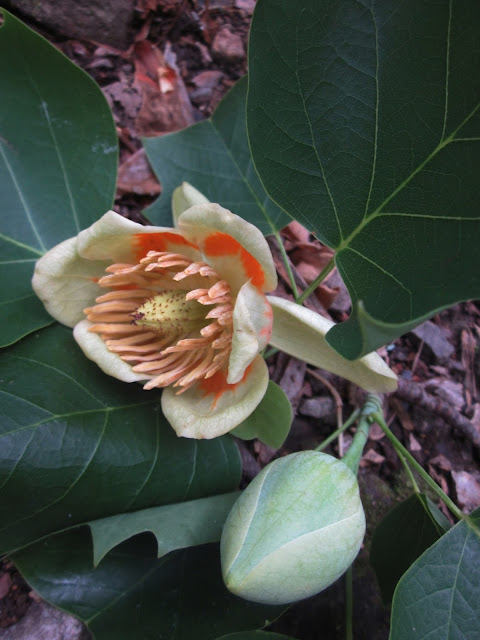
Okay, tulip magnolia blooms are pretty, too
The climb up from the James River is a serious one, gaining 2,000
feet in 3 miles. Going up I caught
glimpses of the James River below.
The reward at the top – lunch with a view
I was not alone at the summit. A couple of college
students hiked up and strung up their hammocks for a unique afternoon of
reading and relaxing. A big reward for a
big effort!
Flowers, flowers, flowers all day long. Did you know that spiderwort comes in many
colors?
Carolina vetch
Solomon’s seal
Rhodies again
Flame azalea
There were strong winds and I had more than one moment of
concern from cracking limbs. Forget
about snakes and lions and tigers and bears in the woods – I am much more
spooked at the idea of a tree limb coming down on my head. I kept moving at a steady pace with a
heightened awareness of what was happening around me.
View from the summit of Bluff Mountain, site of a former
fire tower and where the body of a little boy was found after going missing for
five months in 1891. A reminder that people lived and died in the Virginia mountains.
The story of Emmett (Ottie) Cline Powell as told in the ATC’s Appalachian Trail Guide for Central Virginia goes like this: “Little Ottie was not with the other boys as
they returned to Tower Hill School with wood for the stove. A dragged stick in the path suggested he had
turned the wrong way. The weather was
cold. The search party grew to hundreds
over many weeks. His father, a country
preacher, ran a newspaper notice that described his son: ‘not very tall for his
age, light hair, blue eyes, a fair complexion, and is very intelligent.’ Five months later, four young men were using ‘the
old Bear Trail’ to cross from Amherst County to Rockbridge County, when their
dog began barking on the top of Bluff Mountain.
Little Ollie’s remains had been found, his hat still on his head.”
I am learning that there are many waypoints on the AT in Virginia, gravel road crossings, intersecting trails and gaps (how many Salt Log Gaps are there? More than one). About every 5 or 10 miles there is a shelter. Using David “Awol” Miller’s A.T. Guide, it’s easy to track progress and stay oriented to where I am and where I’m going on the trail. And of course, the elevation profiles let me know when to eat a power bar in preparation for getting myself up those steep climbs.
Almost before I knew it, I was at the Parkway where Jim
waited for me. He had been happily
riding his bike up and down like a little kid.
Outdoor therapy is the best.


No comments:
Post a Comment