
MST - Day 59 – 4-22-11 – Hatteras Ferry to Buxton – 13.75 miles

I loved our little home-away-from-home at Cape Pines Motel – a two-room efficiency so Danny and I both had space to spread out computers, stuff, and some privacy. She’s an early riser and I’m a stay-in-bed-until-the-last-possible-moment riser, so she had the kitchen to turn on lights, eat breakfast, read, compute, etc.

Our hike began with an early morning stroll through the town of Hatteras, sleepy now but busy later in the day.

Land Shark (remember SNL?)

Cemetery in town
On the beach again, less windy than yesterday, hard packed sand and easy walking. Because of a sunburn on the backs of my legs, it was long pants for me for the next few days. (You would think I would have learned that lesson after all these years.) And I felt like most of the time I would just be carrying my hiking poles on the level terrain, so I left them behind. I missed them a time or two, but for the most part it was liberating to swing my arms as I walked.

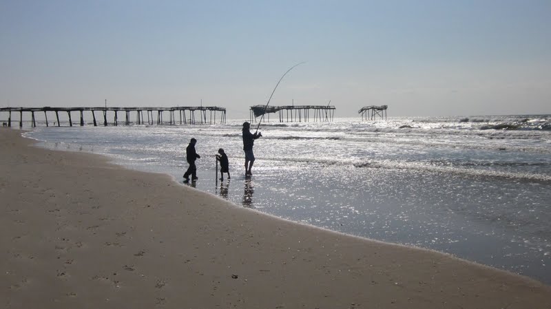

Under the pier
At NPS Frisco Campground we got off the beach and meandered along the paved drive – MST white circle blazes here! We followed the blazes through onto the Open Ponds Trail, 4.4 miles of maritime forest. The trail started off as a soft pine needle walk and then transitioned to soft sand, hard to negotiate without my poles. We passed a beautiful pond, scrub pines, two deer – I did not expect this type of trail at this point, another one of the delights of the MST.


Best white blaze yet (do you recognize poison ivy?)

At Buxton Woods picnic area the trail changed to pavement and a short walk to the Cape Hatteras Lighthouse – goosebumps!
The lighthouse was closed at the moment because of the wind. We
inquired about advance tickets and learned they were not necessary, so
we decided to come back after we completed the day’s hike. We
continued on, walking along the track on which the lighthouse was moved
back in 1999 from its original site. Can you see the lighthouse in the
distance?


We browsed through the exhibits on the grounds and watched a fascinating video of the monumental endeavor to move the lighthouse, something I remember watching often in the news as it was taking place. Read about the move here.
Over the course of our Mountains-To-Sea adventure Danny and I have seen some impressive natural icons of North Carolina: the Great Smoky Mountains from Clingmans Dome, Grandfather Mountain, Pilot Mountain, to name a few. Although the Cape Hatteras Lighthouse is manmade, seeing it from the context of the MST was definitely a highlight for me.
Danny’s story of our Hatteras day is here.
In every outthrust headland, in every curving beach, in every grain of sand there is the story of the earth. ~ Rachel Carson
No comments:
Post a Comment