Friday, August 23, 2024

South Dakota: Bear Lodge (Devil's Tower National Monument) in Wyoming

South Dakota: Bear Lodge (Devil’s Tower National Monument) in Wyoming
6/11/23 – 3.3 Miles


What’s in a name? 

Devil’s Tower National Monument is a name most of us recognize, thanks to a white explorer’s incorrect interpretation of a Native American word in an 1875 book about the Black Hills. The book was popular and the name stuck, despite the fact that most prior maps and documents recorded the more accurate interpretation as Bear Lodge. This is one of many geologic features in the U.S. with Native American names that have been overwritten by European settlers.

Names matter. This sacred mountain rising from the plains of Wyoming is Bear Lodge (Mato Tipila). Go deep into the National Park Service website, click here and here, to read origin stories from Native American tribes throughout the region, including Arapaho, Cheyenne, Crow, Kiowa, Lakota, and Shoshone.

Continuing with my own story: After a luxurious night’s sleep (momentarily disrupted by a fire alarm) I woke to sunshine streaming through the windows and choices of how to spend the day. That Ford Expedition in the parking lot winked at me and we took off on I-90 towards Wyoming. Blue skies, near-empty roads, cruising at 80 mph…Thank you, Spirit, for this gift of time.

I had to pull over when I first saw Bear Lodge, imposing from many miles away. I was totally unprepared for this colossal monolith rising up out of the prairie.

Driving along the Main Park Road to the Visitor Center searching for a parking spot, I realized my sense of time was a little skewed – oh, this is a Sunday! I joined the throngs to walk the 1.8-mile Tower Trail loop around the base of Bear Lodge, observing that the National Park Service has put a lot of infrastructure in place to manage gobsmacked humans, including fences, directional signs and info signs about what you’re looking at.

As I noticed most people going counterclockwise, I intuitively chose the clockwise direction to avoid pacing myself with the crowd. (A tactic I learned at flea markets and Christmas fairs - you’re welcome!)

Whew! I took over 100 photos of the same subject, the sheer walls, the steep slope, the piles of boulders at the base. Here are a few:

Do you see "the window?"

Colorful bundles or strips of cloth were tied to trees all around the monument. They represent prayer offerings as a private, personal connection to the site. It is considered inappropriate to take photos.

June Voluntary Climbing Closure
(some people either ignored the request or didn’t read the sign…)

It's possible to escape the swarm around the tower’s base and hike along several trails to view Bear Lodge from a distance as part of the landscape. I walked the Joyner Ridge Trail, a 1.5-mile loop, enjoying solitude as I climbed up a small rocky ridgeline and descended into a shady ravine and then an open valley of flowers. 

View from the high point of Joyner Ridge Trail

Mariposa Lily

I sat down in a field and pondered this mysterious natural formation. Its energy drew me in like
nothing else I’ve ever experienced. I think I’ll be back.

Driving out of the park, I had to stop at Prairie Dog Town

A small disappointment today long the scenic route back to Rapid City…
the store in Aladdin was closed (because Sunday, y’all)


Just one more!

May the positive energy of the Universe
Surround you, flow through you
Bring Peace to your mind,
Love to your heart,
and Calm to your spirit


Monday, July 22, 2024

South Dakota: Centennial Trail Day 5 - Rapid Creek To Whispering Pines Campground

South Dakota:  Centennial Trail Day 5 – Rapid Creek to Whispering Pines Campground
6/9/23 – 7 Miles

I woke up unburdened, still resolute in my decision to end my Centennial Trail hike today. Nancy and I ate quickly, packed up, and stepped off quite early to beat stormy weather due this afternoon. Gratifying to see long shadows as we shouldered our packs, but don’t be fooled – we know rain is a-comin’!

Lest we think that we’ve put all the hard work behind us, early on the trail warmed us up climbing above Pactola Lake. Still in deep shadows.


Pactola Lake is the largest and deepest reservoir in the Black Hills. Read a little more here.

Boat launch at Pactola Lake

In a small, sweet meadow we took a break to enjoy the view

Cactus?

Nancy moving on

Following the now-familiar pattern of old logging roads and single track, the trail led us through open forest and meadows, showing off flowers and ponderosa pines.

Black henbane

Yellow salsify aka yellow goatsbeard

Nancy convinced me to sniff a ponderosa pine tree to see if it smells like vanilla

We’d heard tell of an unusual object on the trail, no signage or particular landmark to indicate its presence…if you’re looking at your feet you’ll miss it…

Yes, it’s a DISCO BALL! You know what to do now!

A good belly laugh in the middle of the woods

It’s easy to miss the turn-off to Deer Creek Trailhead even if there’s no disco ball distraction 

Here I said goodbye to the CT, silently promising myself that I can someday return
to pick up where I left off

Hello, Whispering Pines Campground!

Yesterday (just before the lightning storm) Nancy called and scored a last-minute cancellation for a cabin, so no pitching tents tonight. Check out their Facebook page for up-to-date info. 

Today we were greeted by Harley, the owner, and collected our resupply boxes, no longer necessary for me but imperative for Nancy. What was of utmost importance to me was a monster Mountain Dew from the icebox that I guzzled down immediately. 

Rushmore Cabin – hallelujah! A long walk to the bathhouse, but hot showers, laundry facilities,
a dry roof over our heads and a porch swing!

At the bathhouse I showered, put on clean clothes and started a load of laundry. A thunderstorm came through as I transferred my clothes to the dryer. I stood under the breezeway roof, safe and dry, listening to the rumble and watching the downpour flood the gravel drive alongside the RVs. How many more affirmations do I need that this is my stopping point?

What storm clouds?

Summer staffer Paula and her furry friend Maisy (because she is amazing) drove us to the Sugar Shack for takeout food. This iconic local joint is a much-anticipated stop for thru-hikers on the CT and a hub for the locals. [In December 2023 Sugar Shack was completely destroyed by fire, devastating to this rural community where neighbors support one another. They are now operating out of the Merritt General Grill. Plans for rebuilding are in the works.]

Nancy and I sat at our little picnic table by our cabin and enjoyed a wide-ranging conversation with our food and adult beverages. It was sad that our time on trail was ended but (no surprise) Nancy made a friend at the showers (Lynne) and they decided to hike on together to complete the trail. I felt very happy that she made this new connection, for companionship, speed, safety and fun. (She’ll finish the trail in 2 days, where I had estimated another 4 days for me.) We made plans to meet on Monday at Bear Butte State Park, the northern terminus of the trail, and we’ll summit together.

Nancy organized her gear to continue her hike while I contacted Roam’N Around for a shuttle pickup tomorrow morning. I also booked a room at Comfort Inn in Rapid City and rearranged my rental car that I had reserved for later in the week.

In the very early morning rain Nancy shouldered her pack and slipped out the cabin door. Bridget from Roam’n Around arrived mid-morning to pick me up - so happy to see her! (Read about our shuttle ride with Bridget to start the trail here.) She was transporting another solo woman (Dani) who was taking a day off for the rain, going back to stay at Bridget’s. The SUV was filled with chatter as we compared experiences on and off-trail.

Bridget and Dani dropped me at the Rapid City airport with all my stuff plus Nancy’s big duffel bag, which I wrangled into a massive Ford Expedition, very nice indeed for little ol’ me. At the Comfort Inn, I holed up with more sodas and candy bars and my resupply box, clean towels, a king size bed, more big fluffy pillows than anyone needs.

The hotel was full (Saturday night) with middle school age soccer teams in town for a tournament. At 2:00 am someone set off a fire alarm and we had to wait outside for the fire department to come and clear it.

BUT after that I was inside and warm and dry.

Instead of my planned 4 days post-hike, ahead of me now is 7 days of fun “roamin’ around” South Dakota before my return flight. What shall I do? Stay tuned.

“Another turning point, a fork stuck in the road
Time grabs you by the wrist, directs you where to go
So make the best of this test and don’t ask why
It’s not a question but a lesson learned in time

It’s something unpredictable, but then again is right
I hope you had the time of your life”

~ Green Day


Saturday, July 13, 2024

South Dakota: Centennial Trail Day 4 - Sheridan Lake to Rapid Creek

 South Dakota: Centennial Trail Day 4 – Sheridan Lake to Rapid Creek
 6/8/23 – 14.5 Miles

Good morning from Sheridan Lake Campground

After yesterday’s ugly finish, I packed up with determination to push through our plan for the next 2 days: hike 14.5 miles today to Rapid Creek Trailhead and camp nearby, then a half-day hike (6-ish miles) the next day to Deer Creek and detour to Whispering Pines Campground where we’ve sent our resupply boxes. We'll clean up, rest up, chug lots of sugary soft drinks, and camp there. Yes, I can do this!

By the shores of Sheridan Lake

At a trail junction, Flume Trail loop goes right and the CT turns left to cross the dam 

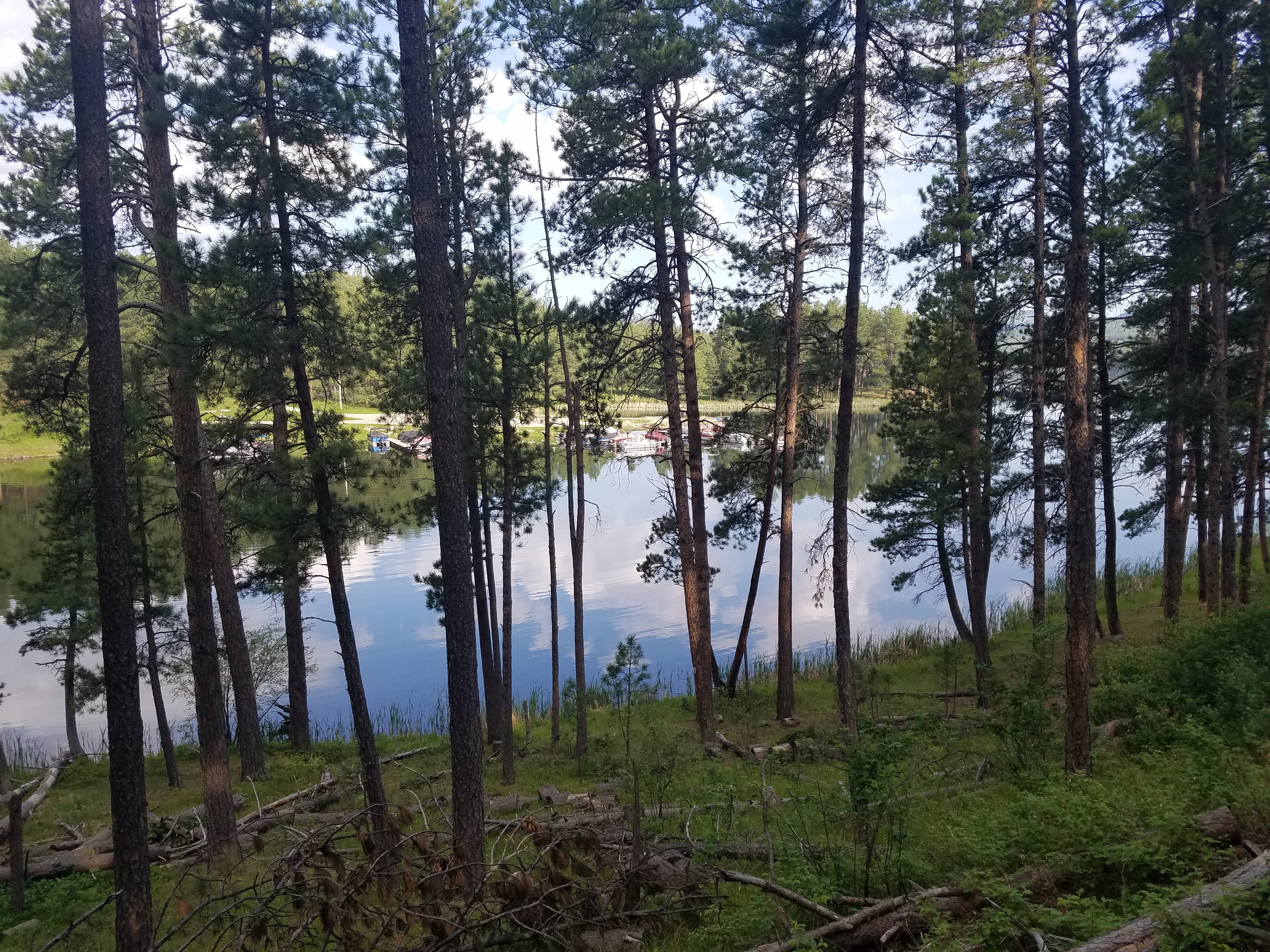
A fancy wooden bridge crosses the lake’s outlet to Spring Creek 

Looking at Sheridan Lake from the bridge

Looking at Spring Creek from the bridge

This bit of trail was an old road bumping along up and down to Dakota Point Trailhead. The popular picnic area is .8 miles away, but we didn’t bother entertaining the idea of checking it out.

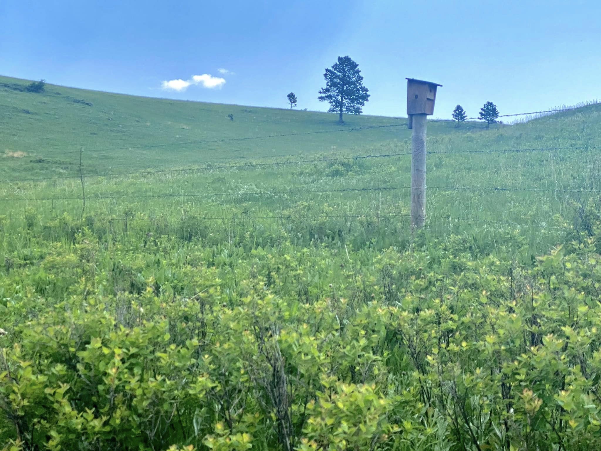
After crossing Sheridan Lake Road (Highway 228) we walked along several miles of old roadbeds and cattle trails, taking in the expansive rolling hills and open grasslands. CT 89 trail markers were few and far between.

What storm clouds?

Water reservoirs for cattle – in very dry conditions CT hikers have filtered water here
 (fortunately we didn’t have to)

We stopped for a brief break in prairie paradise, melting into the idyllic scenery, and discovered we both had cell service (don’t judge). As I texted with Jim, Nancy checked the weather and suddenly jumped up: “We’d better get out of here and into some trees.”

Oh, THOSE storm clouds…

Nancy’s lightning tracker app showed a LOT of activity coming towards us. Her serious expression sobered me up as we walked quickly, then sprinted, turning off the exposed trail to run down to lower ground. We looked for a grove of trees of similar height so we could sit apart from each other to reduce the risk of us both getting zapped. (Don't think about it don't think about it don't think about it)

We sat and listened to thunder booming as a light rain fell around us, followed by glimmers of sunshine. Nancy’s app indicated more storms were forming, so we got back on trail, keeping a quick pace as we continued descending. This was definitely NOT FUN.

We moved away from the storms as the trail crisscrossed gravel Brush Creek Road and more single track, passing through brief stretches of pine stands, open fields, and gates to keep cattle in/out.

Dandelions along Brush Creek Road

As I walked the miles between Brush Creek and Rapid Creek, I pondered yesterday’s degree of difficulty, my extreme tiredness, my ill-fitting backpack, and the unnerving dangers of quickly developing lightning storms. What adjustments could I make to do this for 5 more days? Can I just suck it up? Tomorrow this time we’ll be at Whispering Pines. Will a shower and real food be enough to reset?

I felt hotspots on my feet and called a timeout to take a look. Sure enough, several blisters were forming, which hasn't happened to me in years. Hmmm.

Nancy continued to monitor the weather forecast, indicating that rain was coming starting tomorrow afternoon with a total washout the day after. My pondering increased to serious deliberation. I strongly dislike (hate) setting up a tent in the rain. How many adverse conditions add up to discontinuing my hike? Did I just not train enough? Is it failure or is it wise to stop before I do more damage to my body? Do I care if I am judged? If these conditions discourage me, what does that mean? Am I declaring an end to my backpacking life?

Another consideration: Nancy has been incredibly supportive, but she isn’t here just to help me. She is hiking for herself as well. If I decide to stop, she can continue to “hike her own hike,” certainly faster. The sooner I tell Nancy what I’m thinking, the sooner she can make her own plan.

A ray of clarity: being outside fills my soul, but not with a 27-pound backpack in thunderstorms. The inclination to end my hike became a decision and then a resolution. It’s okay to let go of completion goals. Waves of peace and relief came over me and feelings of doubt dissipated. I shared my decision with Nancy and we talked over the logistics going forward.

Ahhhhhh…my load felt lighter already.

Rapid Creek Trailhead at Pactola Basin Road was a welcome sight (hello pit toilets – yay!) but not a good place to camp because of easy accessibility for party people. We scouted around for a protected hidden spot. There was a stand of mature Ponderosa pines right beside the creek, but this didn’t look appealing in the event of another lightning storm.

We crossed Pactola Basin Road in search of a place to pitch tents closer to the water, but there wasn’t enough vegetation to screen us from the road.

Ultimately we decided to camp tucked in under the small grove of Ponderosa Pines, secluded and close by the creek. A curious person would have to walk right up in there to see us. (The pit toilets were still close enough for convenience.)

Nancy boiling water on her backpacking stove

We ate supper relaxing by the creek, entertained by Nature’s show. We watched two trout in a pool, facing upstream and holding steady, as though they were taking a rest. A pair of Canada geese and their brood of six goslings paddled merrily with the flow.


Sure enough, a thunderstorm rolled through around 1:30 a.m. There wasn’t much we could do underneath those majestic tall pines except wait for it to pass and go back to sleep. 

“Thunder on a hot summer day reminds me
 that change happens when we least expect it.”
~Anonymous