
Tour du Mont Blanc: Refuge
La Flégère to Les Houches – 7/20/16 – 11.8 Miles

After 9 days of hiking, Jim and I thought we’d experienced the gamut of the TMB’s tricks – hot sun, cold rain, slippery snow, lung-busting climbs, knee-knocking descents, brief tree tunnels, wide open spaces, meandering balcony walks, vertiginous ladder climbs. All this and the fellow hikers with whom we shared the trail, a meal, a beer and a laugh made memories that are still part of our daily conversation a year later. Our last day on the TMB was by no means anticlimactic. In fact, it was a “final exam” encompassing every one of those features.
We ignored our assigned late breakfast time and were waiting
in the dining hall before 7:00 a.m. for the tables and the buffet to be set up.
The meager fare was a disappointment for our farewell – breads, jam, butter,
yogurt – but the croissants, as usual, were heavenly. We lingered a bit to
catch up with familiar faces before starting out. Some, like us, were hiking
all the way to Les Houches, but Cassie and Niki, Toby and Abby were skipping
the last kilometers by taking the cablecar from Le Brévent down to Chamonix.
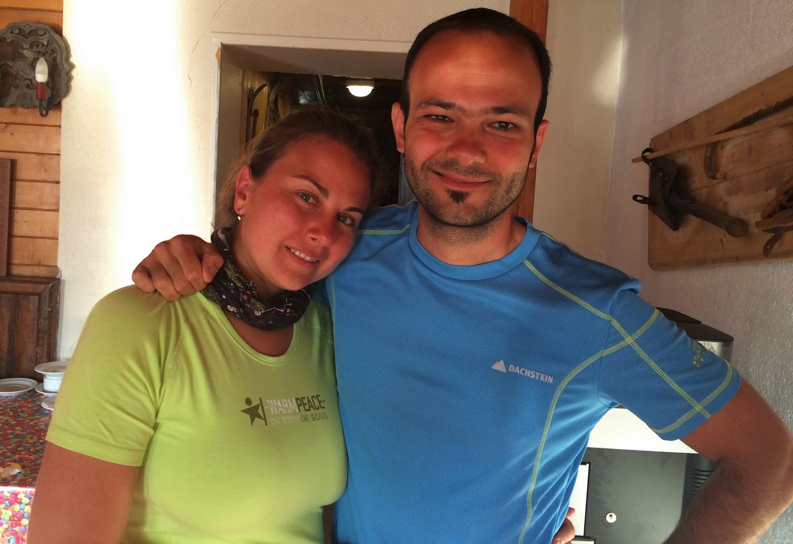
Our Bulgarian friends

The German couple

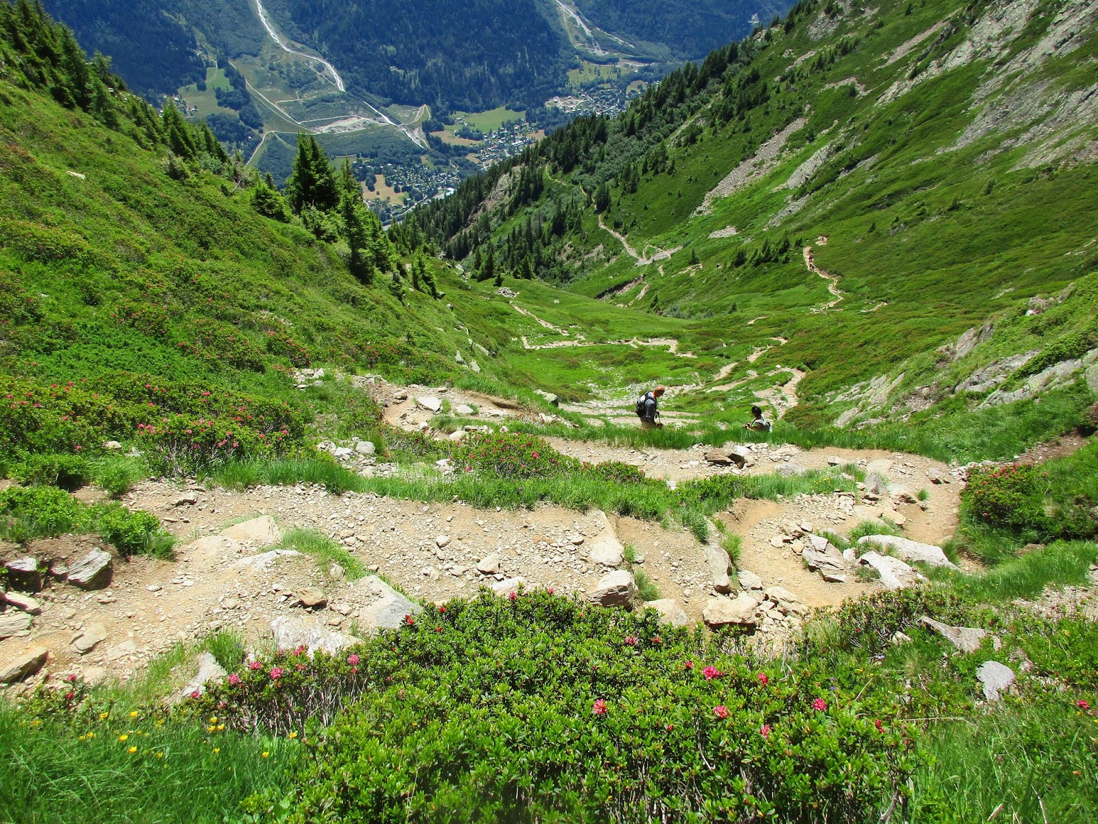
The TMB continued along the flanks of the Aiguilles Rouges (Red
Peaks) massif, which parallels the Mont Blanc massif with the Vallée de l’Arve separating
the two. The trail was mostly level with
a slight upgrade for the first several kilometers, following the curving
contours over grassy slopes and rocky sections. As the rising sun crested the
Mont Blanc massif, we passed from deep shadow to perfect blue sky.


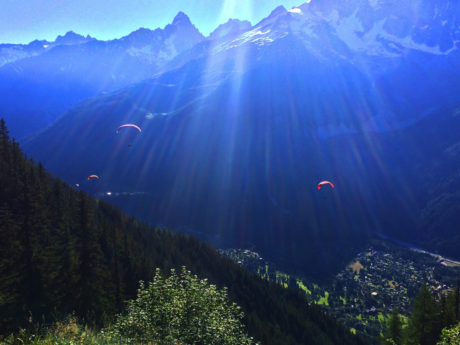
After two hours we reached the cablecar station at Plan Praz
(photo below, the building on the green slope at the upper right) where the paragliders
were launching to drift down to Chamonix. Note: next time we’re going to paraglide for our grand finale!

Plan Praz is the staging grounds for a massive downhill
skiing area, not intended to be a scenic summer playground. I imagine the
snow-covered scene of ski runs is impressive, but we were not enticed to linger
under the pylons and chairlifts. (Besides, the lift station didn’t open until
11:00 so no bathrooms.) Construction equipment blocking the intersection confused
the main trail route, but we soon figured out that it takes a sharp right turn
and goes up… WAY up… to the Col du Brévent.

Hey, if this gal can do it, so can we. [Truth: she
and her human rode up on the Le Brévent cablecar and walked a level trail
before turning around at this point.]

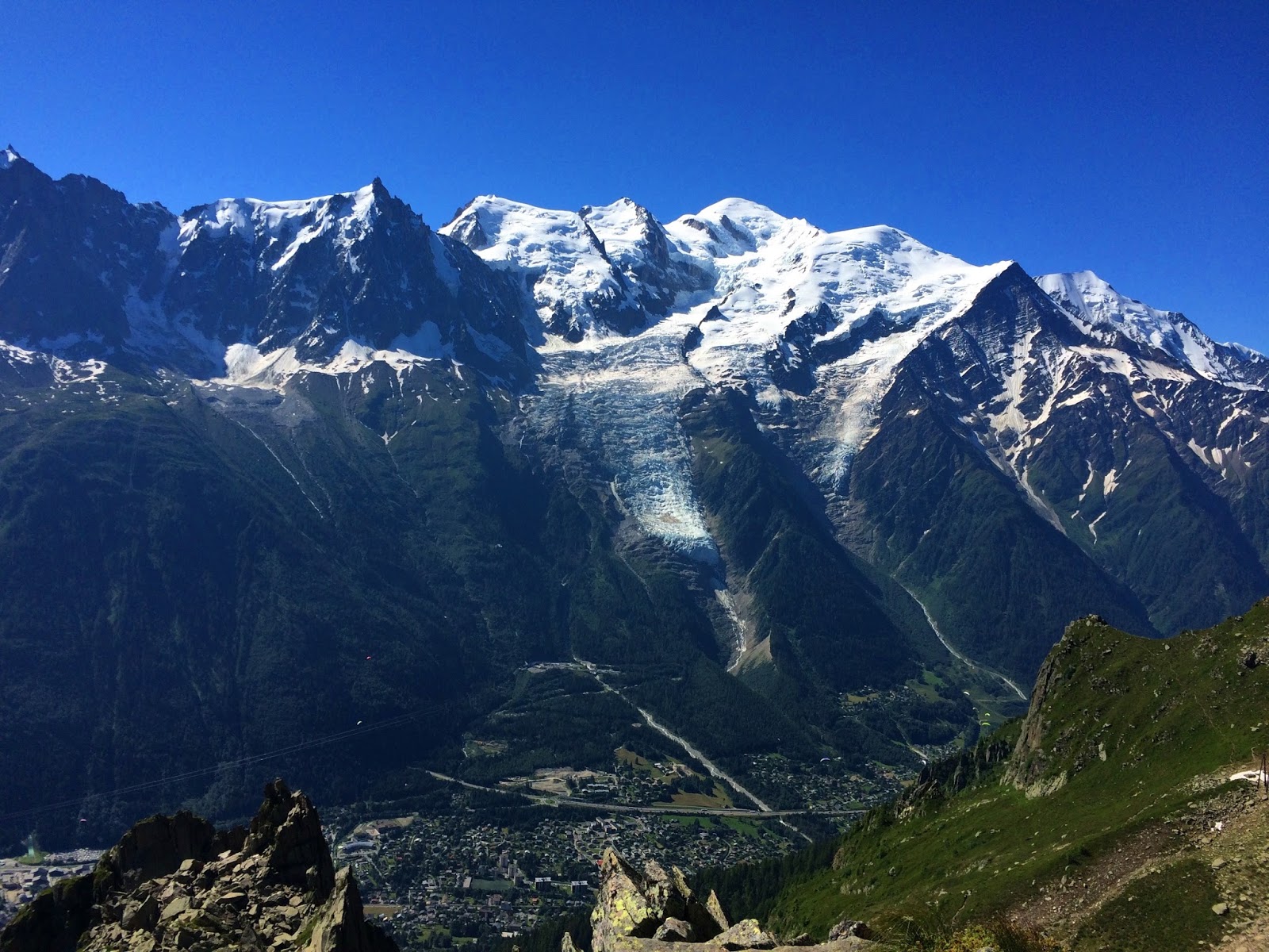
Mont Blanc towering over Chamonix and the Vallée de
l’Arve

Mont Blanc full frontal,
Glacier des Bossons (left) and Glacier de Tzoumaz
(right)
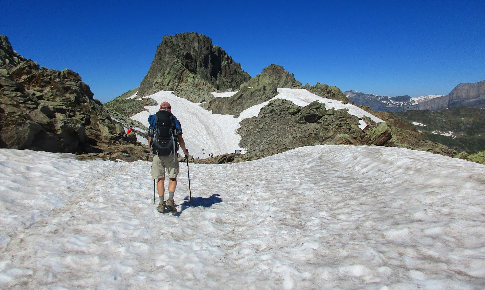
Twists and turns led us up to the Col du Brévent,
where I was dismayed to see snow fields – again.


Looks like we are going where they’re going. For me, slushy
slip-and-slide snow slopes are the most intimidating challenge of the TMB. Give me ladders and boulders any day. I’ll
let Jim go first.


My turn
Here Mont Blanc was hidden from view as the trail wound
around the back side of Le Brévent, passing through hollows holding pockets of
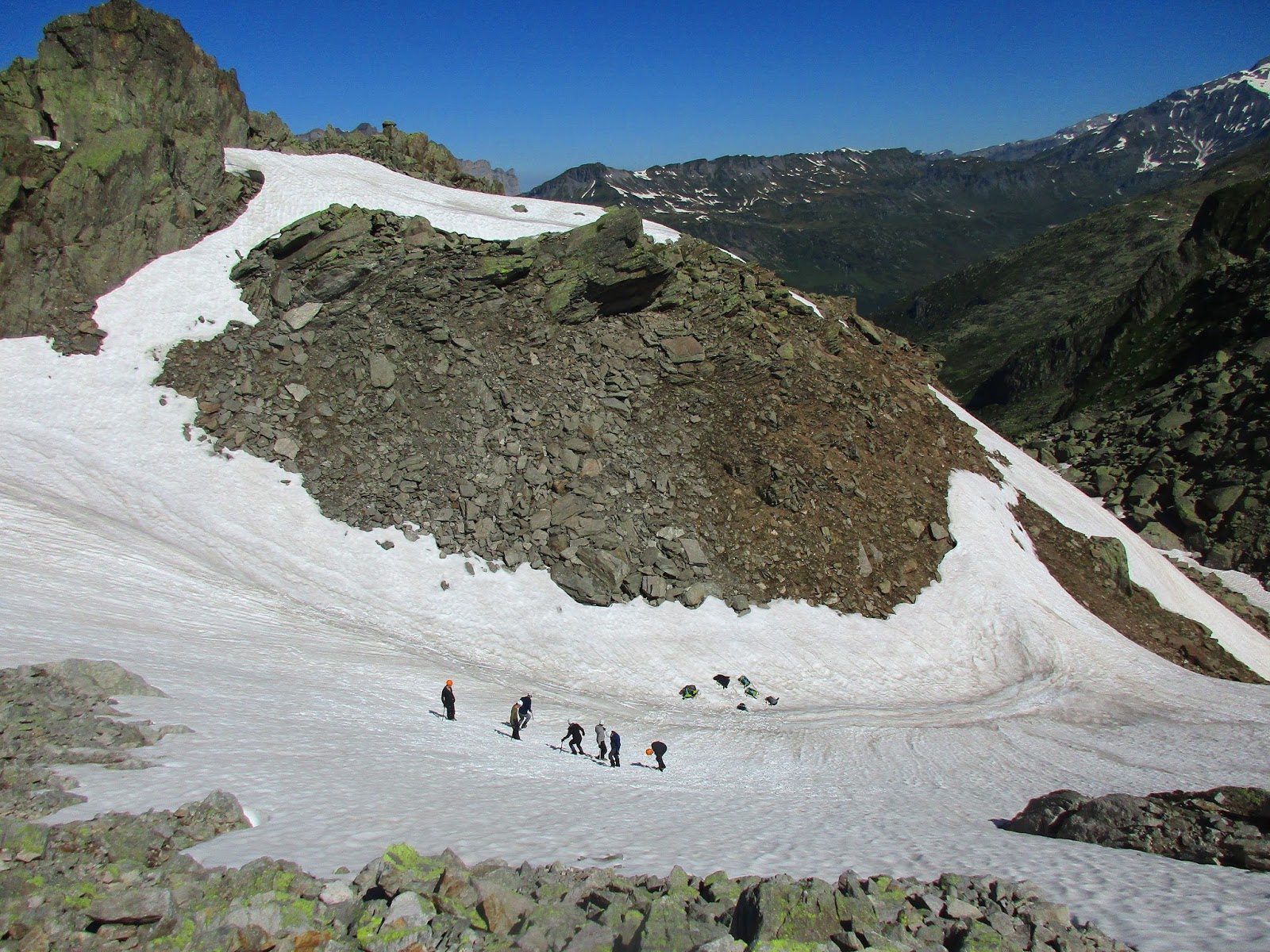
snow. In one large basin we caught a
skills lesson for a group of mountaineers.
The guy in red is the instructor. We watched as the participants lined
up, and on the go signal they ran as fast as possible across the snow-covered
slope. If they slipped, they self-arrested with ice axes. If that didn’t work,
they skidded to the bottom of the basin. The goal was for every person to make
it all the way across without falling. As I watched I was reminded that, as
most things, practice increases confidence. Maybe I need a snow skills class.


Looking down to the right into the Vallée de la Diosaz,
on the opposite side of the Aiguilles Rouges from the Vallée de l’Arve

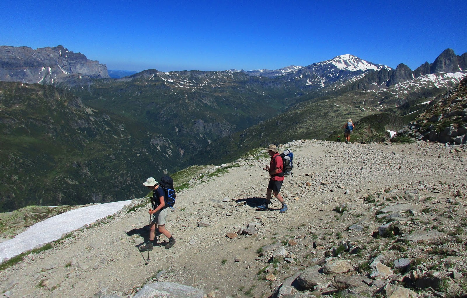
Once again, in a blink the terrain changed to rugged
rocks and boulders and a little guesswork about where to step
My wish was granted - metal handrails and two more
ladders!
Somewhere in this section Jim and I got caught behind a
group of four women, chatty and loud and apparently clueless that other people
were also negotiating this technical terrain. We asked politely if we could pass
them and they stepped aside without missing a beat in their conversation.
American accents – ensuring the stereotype?

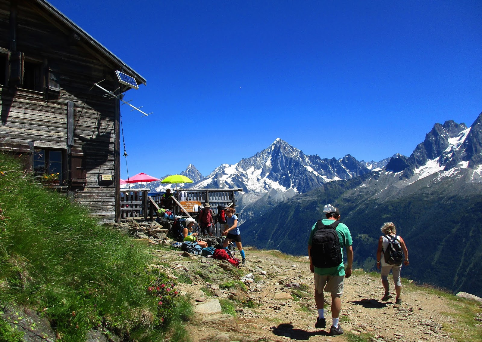
Climbing up over the shoulder near the summit of Le
Brévent
The lift station was swarming with people of all ages (and
footwear of all types) on this perfect summer day. We bought two sodas from the refreshment
stand and collapsed at a picnic table for a break. Hmmm…I hear voices rising
above the din…here come the four ladies and, yes, of course there is room at
our table. We began the usual trail small talk, learned that they were from
Vancouver, Canada (whew!) and this was their first day on the TMB (Jim said
they smelled like soap.) The group’s leader (aka the loudest woman) seemed very
cocky and know-it-all, explaining facts about the trail to us as though we just
fell off the cablecar. We made a quick
retreat, and nicknamed her “Miss Van-Cougar.”

Le Brévent faces the ultimate panorama of majestic
Mont Blanc

Glacier des Bossons (left) and Glacier de Tzoumaz
(right)

Closeup of Glacier des Bossons
The guidebook describes the rest of today’s hike: “From [Le
Brévent] the seemingly never-ending descent to Les Houches is among the
steepest and most tiring of the whole circuit.” As Jim says, there’s no
back-slapping until it’s all done! So
down we go, right behind our German friends.


Looking up at Le Brévent station


The TMB follows the ridge line

Lac du Brévent looks heart-shaped from this vantage
point. Perhaps next time we will take the detour to visit it?

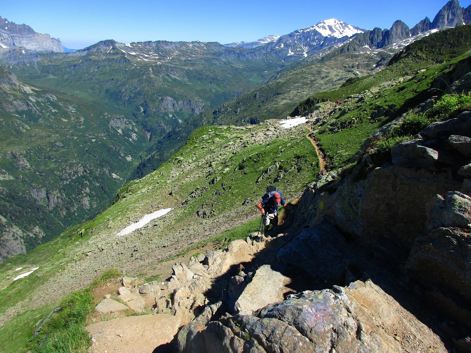
Eventually the trail veers left off the ridge in a series of
zigzags down through grassy slopes that looks simple enough, but there are
hundreds of irregular steps both shallow and deep, a serious thigh workout.
Refuge de Bellachat is our last chance for an overpriced
beverage and a bathroom break. Another great place to stay overnight, although
at this point I’m not sure I would choose to since Les Houches and a private room
and showers are within reach.


I am delighted to see the last of these
Below Bellachat the path continued its ruthless descent
through patches of forest and the Vouillards ravine which involved several
sketchy stream crossings. This follows the pattern we’d come to expect as the
TMB descends to towns, leading hikers down as expediently as possible and good
luck!


Les Houches
We began to meet dayhikers as the trail signs led us through
a maze of intersecting paths. We even followed a fence edge alongside the Parc
Merlet mountain zoo. Soon after that we passed Le Christ Roi (Christ the King),
a concrete statue 75 feet tall (the second highest in France). It can be seen prominently in the valley,
although we never had a vantage point from which to check it out. Luckily,
though, at the base of the monument we caught up with the British family and
shared hugs and farewells. They were headed to the train station, while Jim and
I were set to walk through town.
Now I understood why some hikers took the cablecar to Chamonix;
during the last few kilometers to and through Les Houches it was a challenge to
stay enthusiastic. What was a convenient start on the far side of the village
was now, of course, a long finish. But the sun was still shining as we crossed
the last flower-covered bridge to end our circuit of the Tour de Mont Blanc.


At Hotel Slalom, Tracey greeted us with congratulations
and an end suite twice the size of our former room, including an enormous
bathroom, windows on the back and side walls, and a lovely front balcony. Such
luxury! What first? Showers? Food? Naps?
Yes yes yes!


A celebratory supper at La Basilic, adult beverages, fresh salad and
soft bread, vegetable lasagna stuffed with cheese and smothered in cream sauce,
and espresso. Très délicieux!
So many thoughts and emotions to process – we will certainly
struggle to describe our experiences to family and friends back home and to
keep the details straight in our own memories. Each day of our hike we recorded
our journey in a little black notebook, hoping to capture the big moments and
the little stuff, weather, food, people. Combined with our photos, we hope to read
about this adventure of a lifetime as we age and feel the awe again and again.
We have six more days ahead chasing adventures of a different sort...

Miles hiked: 11.8 Elevation
gain: 2,848 feet Elevation loss: 5,502 feet
“It’s
all still there in heart and soul. The walk, the hills, the sky, the solitary
pain and pleasure–they will grow larger, sweeter, lovelier in the days and
years to come.” ~Edward Abbey
"I
do not bring back from a journey quite the same self that I took." ~W.
Somerset Maugham
3 comments:
Beautiful country
What a great journey. I appreciated your truthfulness. My wife and I are planning to hike the TMB next summer for our 25th anniversary.
Greg, I hope my writings have given you some information to help plan your adventure. When planning ours, I relied heavily on several blogs for estimating distances, where to stay (and not stay). When we got boots on the ground, of course, we found that there were even more options for accomodations, and I've tried to name some of those options for the next travelers (like you) to check out. My husband jokes that I go on a "trip of a lifetime" about once a year, and I am a lucky traveler, but the TMB experience is in a class by itself. Enjoy!
Post a Comment